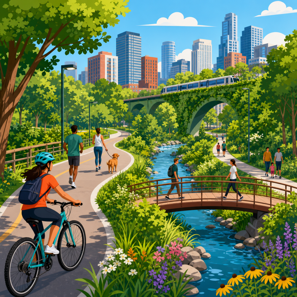
Urban trails and green loops feel connected when they function as a continuous system rather than a set of isolated paths. In sustainable urban development, that distinction matters because a connected walking and cycling network changes daily behavior: people choose active travel more often, parks become easier to reach, and neighborhoods that once felt divided begin to share public space. I have worked on trail audits, wayfinding reviews, and public realm plans where a route looked complete on paper but failed on the ground because crossings were unsafe, signage was inconsistent, or the path simply stopped at a busy road. Connectivity is the quality that turns infrastructure into a lived network.
Urban trails are linear routes designed for walking, wheeling, running, or cycling within built environments. Green loops are circular or linked route systems that connect parks, waterfronts, streets, plazas, and ecological corridors into an easy-to-follow circuit. The key term is not just access but legibility: users must understand where the route goes, how to stay on it, and what destinations it links. A connected system also needs continuity, comfort, safety, and usefulness. If a parent pushing a stroller, an older adult using a mobility aid, and a commuter on a bike can all move through it without confusion or repeated barriers, the network is doing its job.
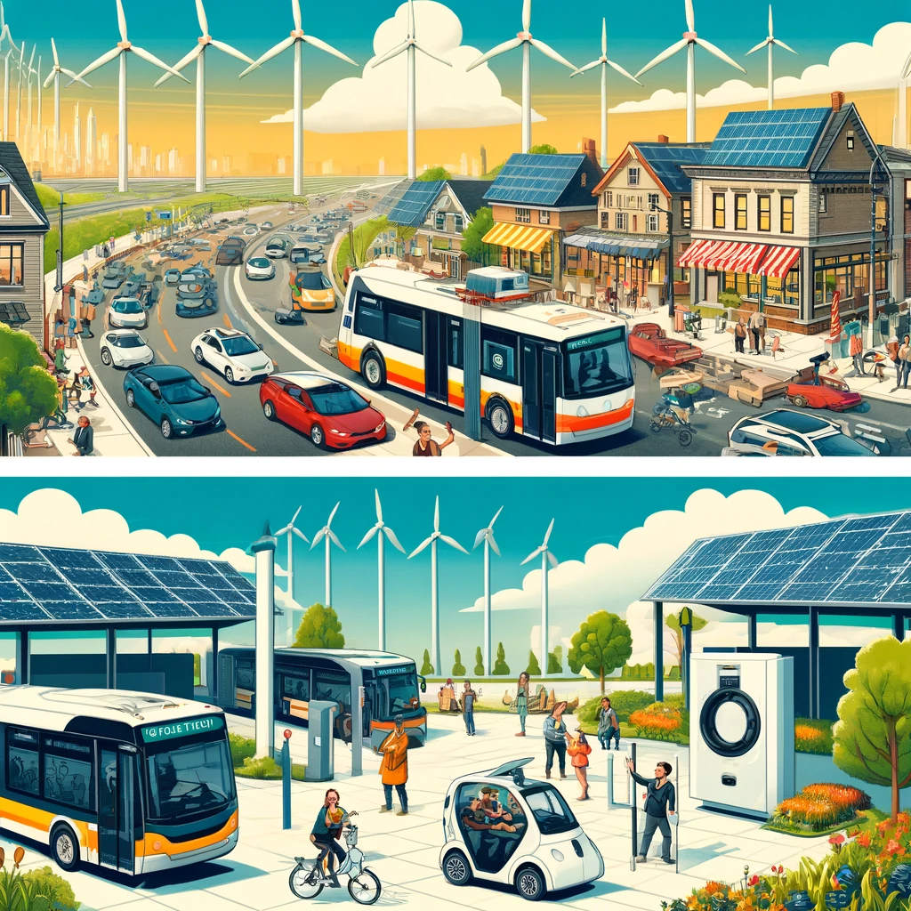
This hub article explains what makes urban trails and green loops feel connected, why that perception is measurable, and how cities can improve it. The subject sits at the center of sustainable urban development because connected green mobility networks support lower transport emissions, better public health, stormwater-sensitive landscapes, and more equitable access to amenities. Research from cities including Copenhagen, Melbourne, Portland, and Singapore consistently shows that direct routes, frequent access points, visible landmarks, and protected crossings increase both use and perceived safety. Connectivity is therefore not a design flourish. It is the operating principle behind successful urban trail systems, and it shapes every related topic in this sub-pillar.
Physical continuity: the route must actually hold together
The first requirement is uninterrupted movement. A trail feels connected when users can keep going without sudden dead ends, awkward detours, or quality drops that force them into conflict with traffic. In project reviews, the biggest failures are usually mundane: a shared-use path narrows at a bridge, paving changes from smooth asphalt to broken pavers, a curb cut is missing, or a crossing phase is too short for slower walkers. Each break tells users the route was not designed as one system. People experience that instantly, even if planning maps show a complete corridor.
Directness matters as much as continuity. A connected green loop does not need to be perfectly straight, but it should move people efficiently between real destinations such as schools, transit stations, markets, waterfronts, and sports fields. The best networks use desire lines as evidence. If residents repeatedly create informal shortcuts across grass, that usually signals the formal path is misaligned with actual travel patterns. Good design responds by formalizing those links, improving crossings, and reducing unnecessary grade changes. In dense districts, a small intervention like opening a mid-block passage can dramatically improve perceived connectivity because it saves time and simplifies navigation.
Surface quality and width also shape connection. Shared paths that are too narrow create friction between walkers and riders, especially near entrances and scenic points where people stop unexpectedly. Guidance from organizations such as NACTO and AASHTO has reinforced the need to size facilities for expected volumes, directional flow, and accessibility needs. A route that technically exists but feels cramped, uneven, or flooded after rain will not be used as a dependable connector. Maintenance is part of continuity. Leaf buildup, poor drainage, root heave, and winter ice can sever a trail as effectively as a missing segment.
Wayfinding and mental mapping: people need to know where they are
A connected route is easy to read. Users should understand where the trail begins, how to remain on it, what destinations are ahead, and how far away they are. This is where wayfinding, landmarks, and spatial hierarchy matter. Consistent names, route markers, pavement cues, and decision-point signs reduce cognitive load. If signs call the same route three different names, or if district branding changes at each neighborhood boundary, the system feels fragmented even when the pavement is continuous. Good wayfinding acts like a conversation with the user: you are here, this is the route, these are your choices, and this is how long it will take.
Landmarks strengthen memory and confidence. Waterfront edges, historic bridges, tree allees, public art, transit stations, and civic buildings all help people orient themselves. On successful green loops, planners often sequence memorable features so the route becomes intuitive after one or two uses. I have seen underperforming paths improve substantially after a city added simple orientation maps at entrances and clear blade signs at every fork. Usage did not rise because the geometry changed. It rose because uncertainty dropped. People are more likely to choose a route when they believe they can complete it without stopping to interpret ambiguous space.
Digital navigation now influences perceived connectivity too. If a trail is accurately mapped in municipal GIS, OpenStreetMap, Google Maps, and cycling apps, users discover it sooner and trust it more. The opposite is also true: when online maps show gaps, wrong access points, or missing entrances, people assume the route is incomplete. Cities that maintain open geospatial data improve not only planning but everyday usability. For a hub topic like urban trails and green loops, digital legibility is no longer optional. It is part of the network itself because many trips now begin with a phone search rather than a paper map or local knowledge.
Safety, comfort, and inclusion: connection is emotional as well as physical
People describe a trail as connected when it feels safe enough to use consistently. That includes traffic safety, personal security, lighting, sightlines, and social comfort. A route may join multiple parks, but if it requires crossing six lanes of fast traffic without refuge islands or protected signal timing, most users will not experience it as connected. The same applies to isolated underpasses with poor visibility, entrances hidden behind parking lots, or segments with no passive surveillance from nearby homes or businesses. Safety interventions are not secondary amenities. They are the conditions that allow connection to be perceived and trusted.
Inclusion expands this idea. The route must work for children, older adults, disabled users, new cyclists, and people traveling at different speeds and for different reasons. Universal design principles are essential here: smooth surfaces, manageable slopes, tactile warnings, frequent seating, shade, accessible crossings, and clear widths all support a broader range of users. When cities test routes only with confident adults moving quickly, they routinely overestimate connectivity. The more reliable question is whether a user with limited stamina, a parent with two children, or a wheelchair user can complete the loop with dignity and without special effort.
Comfort influences repeat use. Shade trees, water access, toilets, noise buffering, wind protection, and places to pause all matter, especially on longer loops. Public life research has shown that people evaluate routes not just as transport channels but as environments. If a path offers varied scenery, social activity, and moments of rest, it feels shorter and more coherent. That is why successful urban green loops often mix ecological spaces with active edges such as cafes, playgrounds, libraries, and markets. The route becomes part of civic life rather than leftover infrastructure, and that strengthens both use and identity.
Nodes, crossings, and destinations: strong links make a strong network
Connection happens at nodes: trailheads, transit stops, park gates, plazas, bridges, and intersections where people decide whether to continue. The design of these places often determines whether the wider route feels seamless. A green loop that meets a rail station through a direct, visible, step-free entrance will function as part of the everyday transport system. If the same station requires users to detour through parking access roads, stairways, or unsigned service lanes, the practical link is weak. In network planning, these small transition points deserve as much attention as the long path segments between them.
Crossings deserve special emphasis because they are where many urban trails fail. Best practice is well established: reduce crossing distance, slow turning vehicles, provide median refuges where needed, align crossings with desire lines, ensure signal timing supports slower users, and maintain strong visual priority. Raised crossings, protected intersections, curb extensions, and bicycle-specific signal phases are not cosmetic upgrades. They communicate continuity across streets. When trail materials, markings, and sightlines carry through the junction, users understand that the route still exists and that they are expected in that space.
Destinations give purpose to the loop. People rarely use urban trails only for recreation; they use them to get somewhere. Schools, employment centers, neighborhood retail, community gardens, hospitals, cultural venues, and transit hubs should sit within the mental map of the network. The strongest systems combine everyday utility with leisure value. That is why loops around rivers, former rail corridors, and connected park chains often outperform isolated scenic paths. They support exercise, commuting, social trips, and tourism at the same time. Mixed purpose increases resilience because usage remains high across seasons, times of day, and demographic groups.
| Connectivity factor | What users notice | Typical design response |
|---|---|---|
| Missing links | Sudden detours or dead ends | Close gaps, add bridges, open mid-block passages |
| Poor crossings | Stress at busy roads | Protected signals, refuges, raised crossings |
| Weak wayfinding | Confusion at turns | Consistent signage, maps, pavement markers |
| Low comfort | Fatigue, heat, or conflict | Shade, seating, wider paths, separate zones |
| Limited destinations | Route feels recreational only | Link transit, schools, shops, and civic places |
Ecology, identity, and governance: why connected systems last
Green loops feel more connected when ecological structure reinforces movement. Tree canopy, waterways, habitat corridors, bioswales, and continuous planting create a recognizable spatial language that helps users perceive the route as one landscape. This has environmental value beyond aesthetics. Continuous green infrastructure reduces urban heat, supports biodiversity movement, improves infiltration, and can lower runoff loads entering drainage systems. In several waterfront and river restoration projects, I have seen ecological repair become the organizing spine for public access, making the route easier to fund and easier for residents to understand.
Local identity matters as well. A successful urban trail reflects the neighborhoods it passes through without losing overall coherence. Materials, interpretive signs, public art, and programming can acknowledge industrial history, Indigenous knowledge, local ecology, or community culture. The balance is important. If every segment is branded differently, the loop breaks apart mentally. If everything is standardized too rigidly, the route feels placeless. The best systems use a common family of signs, lighting, and pavement cues while allowing distinctive nodes and stories along the way. Users then experience both continuity and local character.
Long-term connectivity depends on governance. Fragmented ownership and maintenance regimes are common reasons trails feel disconnected over time. Parks departments, transport agencies, water authorities, private developers, and business improvement districts may each control pieces of the same corridor. Without shared standards for paving, lighting, snow clearance, vegetation management, and data updates, quality becomes inconsistent. Durable networks usually have a lead coordinating body, adopted design standards, and a capital plan for filling gaps. Performance should be measured with counts, intercept surveys, accessibility audits, collision data, and maintenance response times. If cities want connected urban trails and green loops, they must manage them as networks, not projects.
The core lesson is simple: urban trails and green loops feel connected when people can move through them continuously, safely, comfortably, and with clear purpose. Physical links, readable wayfinding, protected crossings, inclusive design, everyday destinations, ecological continuity, and coordinated governance all contribute to that experience. Remove any one of those elements and the network weakens; combine them well and the route becomes part of daily life rather than an occasional amenity. That is why connectivity sits at the heart of sustainable urban development. It supports lower-carbon travel, healthier routines, stronger neighborhood access, and public spaces people actually use.
As a hub for this subtopic, this article frames the questions every related piece should answer in more detail: where gaps occur, how crossings should work, what wayfinding standards matter, how green infrastructure supports mobility, and how cities can measure success. The practical benefit is clear. When trails and loops feel connected, more residents use them more often, for more types of trips, across more seasons. That produces better returns on public investment and more equitable access to urban green space.
If you are planning, designing, managing, or advocating for urban trails and green loops, start with the user journey from end to end. Walk it, ride it, map every friction point, and fix the small breaks that make the whole system feel uncertain. Connected networks are built one gap closure, one safer crossing, and one clearer decision point at a time. Use that standard to evaluate every corridor in your city.
Frequently Asked Questions
What does it mean for urban trails and green loops to feel connected?
A connected trail or green loop does not just exist as a line on a plan; it works as a continuous, understandable, and comfortable system in real life. People experience connection through what happens between destinations, not just at the destinations themselves. If a route repeatedly forces users to guess where to go, cross wide roads without protection, step onto narrow sidewalks, or navigate abrupt changes in surface and signage, it may technically exist but still feel fragmented. In practice, connectedness comes from continuity of movement, clarity of direction, and consistency of design.
That feeling is shaped by several factors working together. Physical continuity matters first: paths need to link parks, schools, shops, transit stops, housing, and civic spaces without awkward breaks. Functional continuity matters just as much: users should be able to keep walking, rolling, or cycling without frequent conflict points, dead ends, or inaccessible sections. Visual continuity also plays a major role. Repeated landscape cues, legible wayfinding, recognizable path materials, lighting, and sightlines all help people understand that they are still on the same network.
When urban trails and green loops feel connected, people trust them. They begin to use them for everyday trips rather than occasional recreation. That is the key distinction in sustainable urban development. A route that feels whole supports active travel, broadens access to public space, and helps neighborhoods relate to one another as part of a shared urban system instead of isolated pockets divided by roads, rail lines, or fragmented public realm design.
Why is perceived connectivity just as important as physical connectivity?
Perceived connectivity is critical because people make travel decisions based on comfort, confidence, and simplicity, not only on whether a path technically exists. A map may show a complete corridor, but if users encounter unclear transitions, poor lighting, hostile intersections, missing curb ramps, or confusing entrances, the route can feel unreliable. Once that reliability is in doubt, many people will avoid it, especially children, older adults, infrequent cyclists, and anyone unfamiliar with the area. In other words, a network that is physically connected but psychologically disconnected will underperform.
This is especially important in urban settings where small barriers have outsized effects. A single unsafe crossing can sever an otherwise valuable green loop. A trail that disappears at the edge of a park and resumes half a block later without clear cues may be enough to make people feel lost. Similarly, if one segment feels inviting and the next feels exposed, noisy, or inaccessible, users perceive a break in the system. These moments matter because connectivity is experienced sequentially. People remember friction more vividly than planners often expect.
From a policy and design standpoint, perceived connectivity affects mode shift, public health outcomes, and equity. If networks are only legible to confident users, they are not truly serving the broader population. Well-connected urban trails succeed when they reduce mental effort as well as physical obstacles. They should be easy to read, easy to trust, and easy to use repeatedly. That is what turns infrastructure into a daily habit rather than an occasional amenity.
What design features make a trail network feel seamless instead of fragmented?
Seamlessness usually comes from a combination of consistent design standards and careful attention to transitions. The most effective networks minimize moments where users have to stop and reinterpret the route. Clear path alignment, continuous paving or surface treatment, visible entrances and exits, and well-placed wayfinding all help users understand where the route goes next. Consistency is powerful. When signage, markings, lighting, planting, seating, and edge conditions repeat in a recognizable way, people intuitively understand that separate segments belong to one larger system.
Intersections are often the decisive factor. A network may look strong in linear segments but fail where trails meet roads, bridges, underpasses, or commercial frontages. Seamless systems provide direct crossings, short waiting times, protective design for walkers and cyclists, and clear continuation on the opposite side. Grade changes, curb details, and accessibility features should feel integrated rather than improvised. If users have to dismount, detour, or search for a legal route through traffic, the sense of continuity is lost immediately.
Good connected networks also balance movement and place. They are not simply corridors; they link a sequence of useful and welcoming destinations. Access points into parks, neighborhoods, schools, waterfronts, and transit nodes should be frequent and obvious. Supporting amenities such as lighting, benches, trees, drinking fountains, maps, and bike parking reinforce the idea that the route is intentionally designed for regular public use. In strong urban trail systems, every segment feels like part of the same public realm story, even when neighborhood character changes along the way.
How do gaps in wayfinding and public realm design weaken urban trail connectivity?
Wayfinding and public realm design are often underestimated because they can appear secondary to the path itself, yet they strongly influence whether a route feels complete. When signage is inconsistent, poorly located, or overly technical, users lose confidence. They may not know whether they are still on the loop, whether a crossing leads to the next segment, or how far key destinations are. That uncertainty interrupts movement and discourages return trips. A connected network should reduce doubt at every decision point, especially where routes intersect with streets, plazas, transit stations, and park entrances.
Public realm design has a similar effect because it provides the context that makes movement feel coherent. If one trail segment is shaded, generous, and clearly defined, but the next spills into a parking lot edge, a service road, or an unmarked sidewalk zone, the user experiences a break even without a literal gap. Materials, edges, lighting, planting, and frontage conditions all communicate whether people walking and cycling are expected and supported. Spaces that feel neglected, overdesigned for vehicles, or visually cluttered can sever continuity just as effectively as a missing path link.
In trail audits and route reviews, these are often the issues that explain why a “complete” corridor still underperforms. The line exists, but the experience does not hold together. Strong wayfinding and coherent public realm design turn a set of segments into a readable network. They help users orient themselves, understand the next move, and feel that the route belongs to the city as a continuous civic asset rather than a patchwork of unrelated projects.
How can cities evaluate whether their green loops truly function as a connected system?
Cities should evaluate connectedness by combining plan review with real user experience testing. A network may appear complete in GIS or concept drawings, but the true test is whether someone can move through it easily, safely, and intuitively at street level. That means auditing entire journeys, not just individual segments. Evaluators should trace common trips between homes, parks, schools, transit, retail areas, and community facilities to see where the route breaks down. The most useful reviews look closely at transitions, crossings, entrances, visibility, accessibility, and decision points.
Fieldwork is essential. Walking and cycling the route at different times of day often reveals issues that are invisible in diagrams: poor lighting, unclear path hierarchy, hidden entrances, uncomfortable traffic exposure, drainage problems, maintenance failures, or conflicts with loading and parking. User diversity also matters. A route should be assessed from the perspective of children, older adults, wheelchair users, less confident cyclists, and first-time visitors. If only experienced users can navigate it smoothly, the system is not as connected as it seems.
Cities should also use performance indicators tied to real outcomes. Useful measures include the number and severity of route gaps, crossing delay, continuity of accessible design, wayfinding clarity, proximity to destinations, and changes in walking and cycling uptake. Public feedback can help identify where people feel the network “drops.” Ultimately, a connected green loop is one that works as everyday infrastructure: it is easy to follow, easy to enter, safe to use, and meaningfully linked to the places people actually need to go. That is the benchmark cities should design and evaluate against.