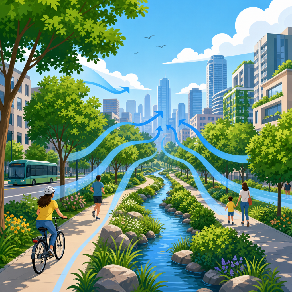
Urban cooling corridors are connected streets, parks, waterways, tree canopies, and open spaces designed to move cooler air through dense neighborhoods and reduce dangerous heat buildup. In practical terms, they are the city-scale version of shade plus ventilation: a deliberate network that lowers surface temperatures, improves pedestrian comfort, and helps buildings shed heat after sunset. As cities warm under climate change and expand with more asphalt, concrete, and dark roofs, these corridors have become a core strategy within sustainable urban development. They matter because urban heat is not just uncomfortable; it raises energy demand, worsens air quality, increases heat illness, and amplifies inequality in districts with fewer trees and less access to open space.
The key idea behind an urban cooling corridor is simple. Heat accumulates where surfaces absorb solar radiation during the day and rerelease it slowly at night, a pattern known as the urban heat island effect. Airflow can disrupt that pattern, especially when it is paired with shade, vegetation, moisture, and reflective materials. I have worked on site reviews where two blocks with similar density felt completely different: one had mature trees, setbacks that allowed breezes to pass, and a shaded median; the other was a sealed canyon of paving and glass. The difference was measurable in surface readings and obvious to anyone walking there. Cooling corridors formalize those lessons into planning, design, and operations.
For a hub article, the most useful approach is to answer the big questions directly: what counts as a cooling corridor, how these systems reduce heat, what physical elements make them effective, where they work best, and how cities can evaluate success. The concept spans urban climatology, landscape architecture, transportation planning, public health, and infrastructure management. That breadth is exactly why the topic deserves a central overview. When designed well, urban cooling corridors do more than lower temperature. They support safer walking and cycling, strengthen biodiversity links, improve stormwater performance, and make climate adaptation visible in everyday streets.
What urban cooling corridors include
An urban cooling corridor is not a single park or a row of street trees. It is a connected pathway of cooler microclimates that allows air, people, and ecological processes to move through the city with less heat stress. Corridors can follow riverbanks, greenways, rail easements, waterfronts, boulevard systems, school grounds, utility rights-of-way, and shaded complete streets. In compact districts, even a sequence of pocket parks, courtyards, arcades, and planted sidewalks can function as a corridor if the spaces are linked and the design avoids major heat traps.
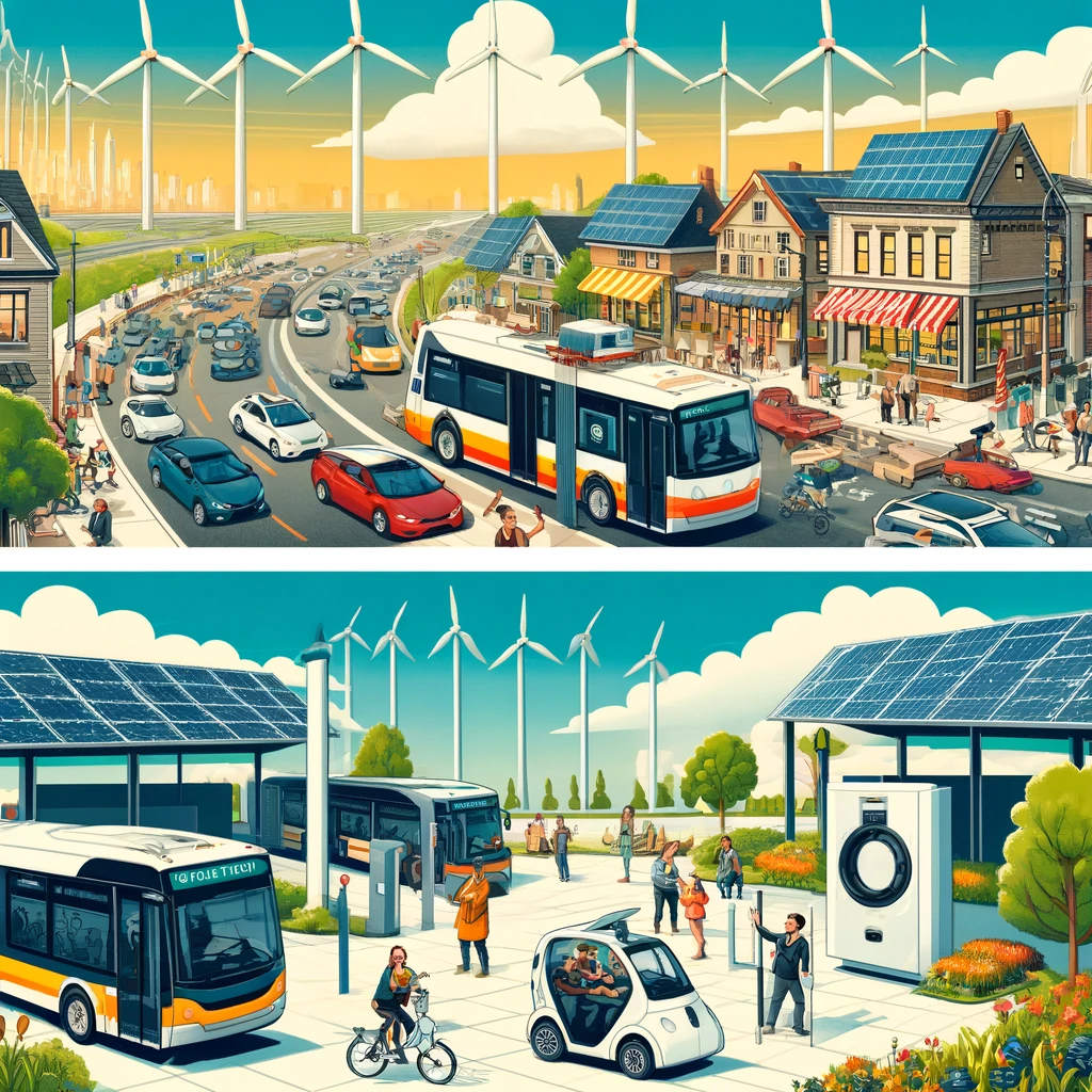
The most effective corridors combine horizontal continuity with vertical openness. Horizontal continuity means cool elements are linked rather than isolated. Vertical openness means wind can move through the corridor instead of being blocked by poorly spaced towers, blank podiums, or dense walls of roadside development. Cities such as Stuttgart, Germany, have long mapped ventilation paths that channel cooler night air from surrounding landscapes into the urban core. Singapore uses park connectors, water-sensitive landscapes, and dense tree planting to moderate pedestrian conditions in humid heat. Medellín’s Green Corridors program expanded vegetation along roads and waterways and reported notable local temperature reductions, while also improving public space quality.
Corridors can be natural, engineered, or hybrid. Natural corridors rely on topography, prevailing winds, and existing blue-green assets such as streams and tree cover. Engineered corridors use targeted design choices, including high-albedo paving, permeable surfaces, bioswales, shaded transit stops, and building massing rules that preserve ventilation. Hybrid corridors are the norm in established cities because they retrofit existing streets and open spaces instead of starting from a blank site. The common requirement is connectivity. A cooling corridor should carry benefits across multiple blocks, not end at the boundary of a single project.
How cooling corridors reduce urban heat
Cooling corridors work through four main mechanisms: shading, evapotranspiration, ventilation, and reduced heat storage. Shading blocks shortwave solar radiation from reaching pavement, walls, transit platforms, and people. A mature tree canopy can lower surface temperatures dramatically compared with exposed asphalt, especially during peak afternoon sun. Evapotranspiration cools air as plants release water vapor; this effect is strongest when vegetation is healthy, soil moisture is adequate, and the planting design matches the local climate. Ventilation moves accumulated warm air out of urban canyons and replaces it with cooler air from parks, waterfronts, or less built-up areas. Reduced heat storage comes from using materials and forms that absorb less energy and release it faster after sunset.
These mechanisms interact. Shade lowers leaf and soil stress, which helps plants maintain evapotranspiration. Cooler surfaces reduce the sensible heat transferred to surrounding air. Better airflow keeps humidity and stagnant air from accumulating around building clusters. In field assessments, I have seen corridor segments fail when one mechanism was emphasized and the others were ignored. For example, a bright pavement treatment can reduce surface temperature, but if the street remains fully exposed and tree pits are too small to support canopy growth, the pedestrian experience still feels harsh. Likewise, dense planting without airflow planning can create comfort problems in very humid climates.
Time of day also matters. Midday comfort depends heavily on direct shade and radiant temperature reduction. Nighttime recovery depends more on how much heat surfaces stored during the day and whether breezes can flush it out. This is why corridor design should be based on local heat profiles rather than generic greening targets. Metrics commonly used include land surface temperature from thermal imagery, mean radiant temperature, air temperature at pedestrian height, sky view factor, and wind speed. For public health, cities often pair these with heat vulnerability mapping to prioritize neighborhoods where exposure and social risk overlap.
Core design elements and where they fit best
Successful corridors are assembled from repeatable components that can be adapted block by block. Street trees are usually the backbone because they cool pavements, buffer solar exposure, and make walking viable in summer. Species selection matters. Large-canopy, drought-tolerant trees with high leaf area and proven urban resilience generally outperform ornamental species that provide limited shade or fail early in compacted soils. Soil volume is equally critical. Standards used by many urban foresters call for substantial uncompacted rooting space, often supported with structural soils or suspended pavement systems.
Water features can support cooling, but they are not universally beneficial. Flowing water and vegetated edges often improve local comfort more reliably than shallow decorative basins that add humidity without meaningful temperature reduction. In dry climates, blue-green corridors that capture stormwater for irrigation can sustain evapotranspiration during hot periods. In humid climates, the design should avoid creating stagnant conditions. Surface materials also play a large role. Cool pavements and high-albedo finishes can reduce heat absorption, although glare, maintenance, and winter performance must be evaluated. Permeable paving helps where it supports soil moisture and stormwater infiltration, but it is not a substitute for shade.
| Element | Main cooling function | Best use case | Key limitation |
|---|---|---|---|
| Large-canopy street trees | Shade and evapotranspiration | Pedestrian streets, school routes, transit corridors | Needs soil volume, irrigation, maintenance |
| Park and greenway links | Cool air source and connected shade | District-scale networks, river corridors | Requires land continuity and safe access |
| Cool pavements | Reduced heat storage | Wide sidewalks, plazas, low-shade streets | Can create glare; limited pedestrian benefit without shade |
| Bioswales and rain gardens | Soil moisture and plant cooling | Retrofit streets with drainage upgrades | Performance depends on maintenance and rainfall patterns |
| Ventilation-preserving massing | Air movement | Redevelopment zones and waterfront districts | May constrain buildable area or tower placement |
Building form can either reinforce or undermine the corridor. Continuous street walls, deep podiums, and poorly aligned towers can trap heat and suppress wind. By contrast, varied setbacks, breezeways, porous ground floors, and step-down forms near open spaces can preserve ventilation. The right solution depends on local climate. Hot-arid cities often benefit from compact shade with carefully managed airflow, while hot-humid cities need more ventilation to prevent oppressive conditions. A good cooling corridor is therefore not a fixed recipe. It is climate-responsive urban design backed by thermal analysis.
Planning, measurement, and common implementation mistakes
Planning an urban cooling corridor starts with mapping. Cities should identify heat hotspots, vulnerable populations, prevailing winds, topography, existing canopy, impermeable cover, transit routes, schools, healthcare facilities, and public open space gaps. Geographic information systems, satellite-derived land surface temperature, mobile heat surveys, and on-the-ground thermal audits are standard tools. The National Integrated Heat Health Information System in the United States has helped many local governments combine climate data with public health indicators. ENVI-met, SOLWEIG, and similar microclimate models are commonly used to test design scenarios before construction.
Once a city understands where heat risk concentrates, corridor planning should align with capital projects already on the schedule. The most durable cooling networks are often built through street reconstruction, drainage upgrades, transit improvements, schoolyard redesigns, and park renewals rather than as standalone beautification efforts. This matters because irrigation sleeves, soil cells, curb adjustments, and utility coordination are much easier to install when the street is already open. Governance matters too. Transportation departments, parks agencies, water utilities, housing authorities, and public health teams must share performance goals. If one agency values traffic throughput while another values canopy spread, the corridor can be compromised in design review.
The most common mistakes are predictable. First, cities overcount green area and undercount usable shade. Grass alone does little for midday pedestrian comfort compared with canopy over sidewalks and waiting areas. Second, planners treat connectivity as optional. A cool park separated by four overheated intersections is not an effective corridor. Third, maintenance is undervalued. Dead trees, clogged bioswales, failing irrigation, and compacted soils erase thermal gains quickly. Fourth, projects rely on average citywide temperature changes, which are often too coarse to reflect neighborhood benefits. Success should be measured at the human scale: shaded route continuity, reduced mean radiant temperature, lower surface temperatures, safer school walks, and fewer dangerous waiting conditions at transit stops.
Urban cooling corridors are one of the clearest examples of climate adaptation improving daily life immediately, not decades later. They reduce exposure on the walk to work, make public spaces usable in hotter months, and support lower-emission travel by making walking, cycling, and transit more comfortable. For city leaders, the lesson is straightforward: cooling is not a single product to install but a connected system to plan, build, and maintain. Start with hotspot mapping, protect ventilation paths, prioritize shade where people actually move and wait, and tie corridor delivery to routine infrastructure investment. Done well, urban cooling corridors turn heat resilience into visible, measurable public value. If your city is updating streets, parks, or zoning now, make cooling corridors part of the brief from day one.
Frequently Asked Questions
What is an urban cooling corridor, and why does it matter in hot cities?
An urban cooling corridor is a connected network of streets, parks, waterways, shaded sidewalks, tree canopies, medians, plazas, and other open spaces planned to help cooler air move through dense urban neighborhoods. You can think of it as the city-scale version of combining shade and ventilation. Instead of relying on a single park or a few isolated trees, a cooling corridor links multiple cooler landscape elements together so they work as a system. That system can reduce surface temperatures, lessen heat trapped by pavement and buildings, and create more comfortable conditions for walking, biking, waiting for transit, and spending time outdoors.
These corridors matter because cities tend to absorb and hold heat much more than surrounding rural areas, a phenomenon often called the urban heat island effect. Dark roofs, asphalt, concrete, limited vegetation, and tightly packed buildings all contribute to dangerous heat buildup, especially during heat waves and at night. When neighborhoods cannot cool down after sunset, health risks rise sharply, particularly for older adults, children, outdoor workers, and households without reliable air conditioning. Urban cooling corridors help address that problem by improving airflow, increasing shade, and reducing the amount of heat stored in urban surfaces throughout the day.
They also matter for equity and resilience. In many cities, the hottest neighborhoods are often those with fewer trees, less park access, heavier traffic, and more impervious surfaces. Well-designed cooling corridors can target those areas to improve public health, comfort, and safety. Beyond temperature reduction, they can support cleaner air, better stormwater management, improved biodiversity, and more attractive public spaces. In short, urban cooling corridors are not just a landscaping idea; they are a practical climate adaptation strategy that helps cities function better as temperatures continue to rise.
How do urban cooling corridors actually work?
Urban cooling corridors work through a combination of physical processes that lower heat exposure and improve urban airflow. The first is shade. Trees, pergolas, and other overhead elements block incoming solar radiation from hitting sidewalks, roads, walls, and building roofs. When surfaces receive less direct sunlight, they stay cooler and release less stored heat back into the air. This is one of the most immediate and noticeable benefits for people moving through the city on foot or by bike.
The second process is evapotranspiration, which is the cooling effect produced when plants release water vapor. Trees, shrubs, planted medians, rain gardens, and green spaces can help cool surrounding air as moisture evaporates from leaves and soil. Water bodies such as rivers, canals, ponds, and restored streams can also contribute to local cooling when integrated carefully into the urban fabric. These natural systems do not just beautify a corridor; they actively influence the microclimate.
The third process is ventilation. Cities often contain blocks, towers, and street layouts that either trap heat or channel breezes. A cooling corridor is designed to preserve or enhance pathways where air can move more freely, especially from cooler sources such as waterfronts, shaded parks, or less developed edges of the city. Street orientation, building spacing, setbacks, vegetation placement, and the width of open spaces all affect whether cooler air can travel into overheated districts. When these elements are aligned well, they can help flush out stagnant warm air and support nighttime cooling.
Materials also play a role. Cool pavements, reflective surfaces, permeable materials, and lighter-colored finishes can reduce how much heat streets and public spaces absorb during the day. When these material choices are combined with canopy cover and open-air pathways, the overall cooling effect becomes stronger. In practice, the best corridors are not dependent on one intervention alone. They work because shade, airflow, planting, water-sensitive design, and lower-heat materials are coordinated across an entire route or network rather than applied in isolated patches.
What features are usually included in a successful urban cooling corridor?
Successful urban cooling corridors typically combine natural, built, and planning features into one connected system. Tree canopy is often the most visible element because mature shade trees can significantly lower sidewalk and street temperatures while also improving comfort for pedestrians. But canopy alone is not enough. Corridors usually include linked green spaces such as pocket parks, linear parks, planted boulevards, schoolyards, and vegetated medians that extend cooling benefits across multiple blocks instead of concentrating them in one place.
Street design is another major component. Wider sidewalks, reduced pavement where possible, permeable surfaces, bioswales, and traffic-calmed corridors can all support cooler conditions. In some cases, cities redesign overly wide roadways to create more room for planting, stormwater capture, and protected pedestrian routes. Building design can contribute too. Setbacks, breezeways, arcades, green roofs, cool roofs, and thoughtful orientation can help reduce heat storage and allow air to move through urban districts more effectively. In dense areas, even small design changes repeated consistently can produce meaningful results.
Water-related features may also be included, especially where cities have rivers, canals, restored streams, retention basins, or fountains designed with sustainability in mind. These need to be planned carefully for water use, maintenance, and local climate conditions, but when integrated appropriately they can reinforce cooling performance. Equally important is connectivity. A successful cooling corridor is not just a collection of pleasant places. It is a route or network that links cooler nodes together so people and air can move through the city more comfortably and efficiently.
Good corridors are also measured and managed. Cities often use thermal mapping, shade analysis, wind studies, land surface temperature data, and community feedback to determine where the hottest areas are and which interventions will have the greatest effect. Maintenance is critical as well. Trees need watering and pruning, permeable surfaces need upkeep, and public spaces must remain safe and inviting. The most successful corridors are those treated as long-term infrastructure rather than one-time beautification projects.
Do urban cooling corridors really reduce heat, or are they mostly a planning concept?
Urban cooling corridors can produce real, measurable heat reduction when they are designed and implemented well. They are not just a conceptual planning tool. Research on urban forestry, shaded streets, cool materials, green infrastructure, and airflow-sensitive urban design consistently shows that connected cooling interventions can lower surface temperatures and improve thermal comfort. The exact amount of cooling varies by climate, urban form, vegetation type, maintenance quality, and time of day, but the underlying mechanisms are well established.
One important distinction is the difference between surface temperature and air temperature. A shaded sidewalk may be dramatically cooler than a nearby sun-exposed one, and that can make a major difference in pedestrian comfort even if the broader neighborhood air temperature drops by a smaller amount. In other words, people experience heat not just through the air around them, but through sun exposure, radiant heat from hot surfaces, humidity, and wind. Cooling corridors can improve several of these factors at once, which is why they can feel noticeably better on the ground even when citywide air temperature changes seem modest.
These corridors are especially valuable during extreme heat events and in neighborhoods with limited tree cover. By reducing daytime heat gain and supporting better nighttime release of stored heat, they can lower cumulative heat stress over the course of a day. They can also reduce the energy burden on buildings by limiting heat absorbed through walls, pavements, and surrounding surfaces. While no corridor can eliminate dangerous heat on its own, a connected network of cooling spaces can meaningfully reduce exposure and complement other heat resilience measures such as cooling centers, building retrofits, emergency alerts, and equitable access to air conditioning.
So yes, urban cooling corridors are grounded in practical science and real urban design strategies. Their effectiveness depends on execution. A disconnected line of small trees in heavily paved surroundings will not perform like a fully planned corridor that combines canopy, ventilation, reflective materials, stormwater-sensitive planting, and access across multiple neighborhoods. The stronger the network and the better the maintenance, the more credible and durable the cooling benefits tend to be.
How can cities create urban cooling corridors in existing neighborhoods?
Creating urban cooling corridors in existing neighborhoods usually starts with identifying where heat risk is highest and where connected interventions are most feasible. Cities often begin by mapping land surface temperatures, tree canopy gaps, public health vulnerability, pedestrian routes, transit access, flood-prone areas, and public land ownership. This helps planners see where residents are most exposed and which streets, parks, school grounds, utility corridors, river edges, or underused public spaces could be linked into a coherent cooling network. The goal is not simply to add greenery wherever there is space, but to create continuous pathways that spread cooling benefits into the areas that need them most.
In built-up districts, retrofitting can happen incrementally. A city might narrow oversized traffic lanes, replace excess asphalt with planted medians or bioswales, install street trees with adequate soil volume, add shade structures at transit stops, convert vacant lots into mini-parks, and require cool roofs or greener setbacks during redevelopment. Schoolyards, libraries, public housing campuses, and municipal properties can serve as anchor points in the network. Waterways and drainage corridors can also be restored or redesigned to provide both cooling and stormwater benefits. Over time, these separate projects can be stitched together into a corridor that functions across neighborhood boundaries.
Community involvement is essential. Residents often know which blocks feel unbearable in the afternoon, where shade is missing, which walking routes are unavoidable,