Urban mobility shapes how people reach jobs, schools, markets, clinics, parks, and one another, making it one of the strongest forces in connecting communities across a city. In practice, urban mobility means the systems, services, and street designs that move people and goods through urban areas: public transit, walking, cycling, shared mobility, roads, curb management, and digital trip planning. Transportation connectivity refers to how easily residents can access essential destinations safely, affordably, and reliably, regardless of age, income, disability, or neighborhood. I have worked on mobility planning projects where a ten-minute bus frequency increase changed job access more than a costly road widening, and that experience makes one point clear: connection is not just about speed; it is about opportunity.
This matters because mobility determines whether cities feel integrated or fragmented. A neighborhood can sit three miles from a hospital or community college and still be effectively isolated if bus service is infrequent, sidewalks are broken, crossings are unsafe, or fares consume too much household income. The World Bank, OECD, and UN-Habitat consistently link transport access to economic participation, social inclusion, and public health. Cities with better integrated transport networks tend to support stronger labor markets, higher foot traffic for local businesses, and lower household transportation burdens. Poorly connected areas, by contrast, often face longer commutes, fewer social ties, and reduced access to services. Urban mobility is therefore not a narrow transport issue; it is basic civic infrastructure that affects equity, resilience, and neighborhood cohesion.
For a hub article under urban mobility and transportation, the key is to treat mobility as a connected ecosystem rather than a collection of isolated modes. Buses depend on sidewalks. Rail depends on first-mile and last-mile access. Delivery traffic affects bus lanes and bike safety. Parking policy influences housing costs and street design. Mobility technology can simplify travel, but only if data standards, payment systems, and service design work together. When cities align these pieces, residents gain practical freedom: more destinations reachable within reasonable time and cost. That is the real role of urban mobility in connecting communities, and it is why the topic deserves a broad, grounded look across infrastructure, policy, technology, and everyday use.
Access, equity, and the geography of opportunity
The first job of urban mobility is to connect people to opportunity. Access is a more useful measure than movement alone because it asks a direct question: how many jobs, schools, grocery stores, parks, and health services can a resident reach within a realistic time? Transit agencies and planning teams increasingly use accessibility analysis with tools such as OpenTripPlanner, ArcGIS Network Analyst, and General Transit Feed Specification data to map these outcomes. In cities I have studied, the biggest mobility gains often came not from glamorous megaprojects but from redesigning local bus routes, improving transfers, and fixing dangerous walking links to stations. A resident who can reliably reach thirty percent more jobs within forty-five minutes experiences a tangible expansion of life choices.
Equity sits at the center of this discussion because transport disadvantage is unevenly distributed. Lower-income households often spend a higher share of income on transportation and are more likely to depend on public transit, walking, and informal shared rides. Older adults, children, and people with disabilities face additional design barriers when stops lack seating, audible signals, ramps, or safe crossings. Redlining, highway construction, and uneven public investment have left many communities physically divided by infrastructure that prioritizes through traffic over local access. A connected city reverses that pattern by focusing investments where the gap between need and service is greatest. Fare capping, reduced-fare programs, all-door boarding, and station accessibility upgrades are not peripheral measures; they are essential mobility tools.
Community connection also depends on perceived dignity. Riders are more likely to use transit when service is frequent, vehicles are clean, information is clear, and waiting areas feel safe. Transport planning too often treats vulnerable users as an afterthought, yet the strongest networks are designed around the widest range of needs from the start. Universal design principles, Vision Zero street safety policies, and complete streets frameworks provide practical guidance. When a city improves sidewalks near schools, installs protected bike lanes to commercial corridors, and synchronizes bus schedules with shift work hours, it is doing more than moving people. It is making participation in city life materially easier.
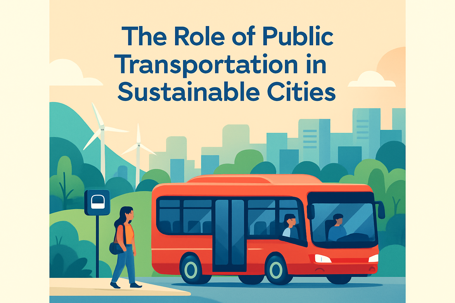
Public transit as the backbone of community connection
Public transit remains the backbone of urban mobility because no other mode moves large numbers of people as efficiently through dense corridors while supporting inclusive access. High-capacity rail matters in major metros, but buses are the workhorse in most cities. Bus rapid transit, frequent local service, and timed transfers often deliver broader community benefits than capital-intensive systems with fewer stations. Cleveland’s HealthLine, Bogotá’s TransMilenio, and Guangzhou’s bus rapid transit show how dedicated lanes, off-board fare payment, and platform-level boarding can improve reliability and reduce travel time when supported by strong operations. The lesson is straightforward: riders value consistency and useful coverage as much as prestige.
Frequency is the hidden architecture of connection. A route that comes every ten minutes effectively allows spontaneous travel; a route that comes every thirty minutes demands rigid planning and punishes missed connections. Transit planners use metrics such as on-time performance, headway adherence, passenger loads, and transfer wait times because community access depends on the complete trip, not a single vehicle movement. Integrated fares also matter. Systems using smart cards or open-loop payment reduce friction across buses, metro, commuter rail, and bike share. London’s Oyster and contactless model, for example, showed how fare integration and capping can simplify travel across modes and encourage use without riders mastering a maze of ticket products.
Transit’s community role extends beyond commuting. It supports elder independence, youth access to education and recreation, attendance at cultural events, and routine health care visits. In neighborhood engagement sessions, I repeatedly hear one practical truth: people judge a transport network by whether it works for everyday errands, not just peak-hour office trips. That is why weekend frequency, evening safety, stroller access, and intuitive wayfinding deserve the same attention as downtown peak service. A community-connected transit network is one that serves actual daily life across income levels and trip purposes.
Walking, cycling, and the first-mile last-mile link
The most important trip in urban mobility is often the one taken on foot. Every transit journey begins or ends with walking, which makes sidewalk quality, crossing safety, lighting, shade, and wayfinding foundational to community connection. The Federal Highway Administration and National Association of City Transportation Officials have documented how shorter crossing distances, leading pedestrian intervals, raised crosswalks, and curb extensions can reduce conflicts and improve comfort. In commercial districts, wider sidewalks and slower turning movements increase foot traffic and strengthen social interaction. A station with poor pedestrian access is not truly accessible, even if trains run every few minutes.
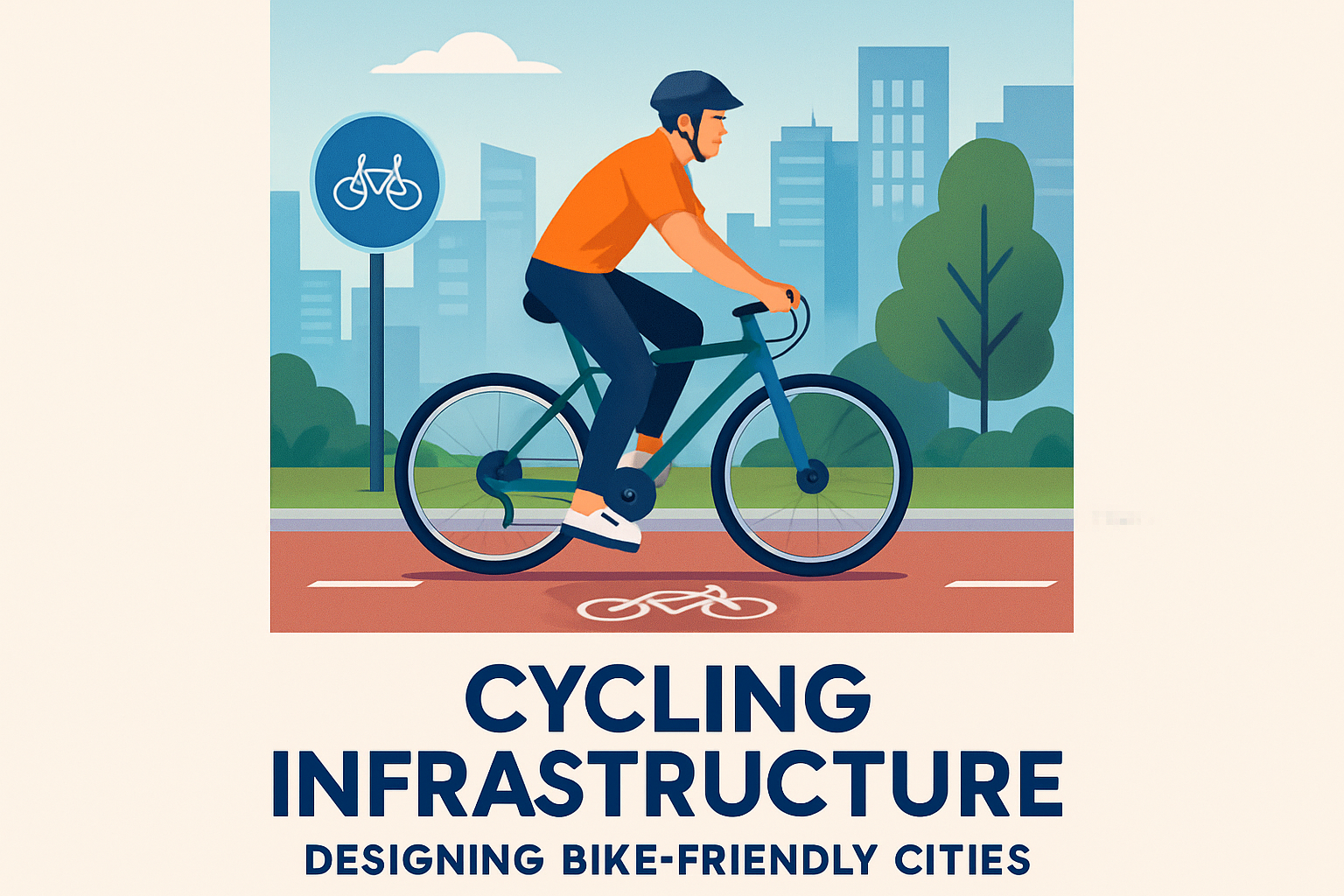
Cycling expands the practical reach of neighborhoods by making short and medium trips faster than walking and often more reliable than driving in congested areas. Protected bike lanes, secure parking, and low-stress neighborhood greenways matter because most people will not ride next to high-speed traffic. Cities such as Copenhagen, Paris, and Seville increased bicycle mode share by building connected networks rather than isolated segments. The key word is connected. A single high-quality lane that ends at a dangerous intersection fails as a mobility system. Bike share adds another layer when stations are placed near transit, campuses, and retail streets, giving residents flexible access without the cost of car ownership.
First-mile and last-mile planning is where many community-oriented mobility strategies succeed or fail. If a commuter rail station is surrounded by wide arterials, missing sidewalks, and expensive parking, nearby residents may still struggle to use it. Better solutions include micromobility docks, safe crossings, pickup zones for paratransit and community shuttles, and zoning that supports mixed-use development near stations. These measures are highly practical. They reduce transfer penalties, broaden the station catchment area, and make mobility systems feel coherent rather than fragmented.
Shared mobility, digital platforms, and integrated trip planning
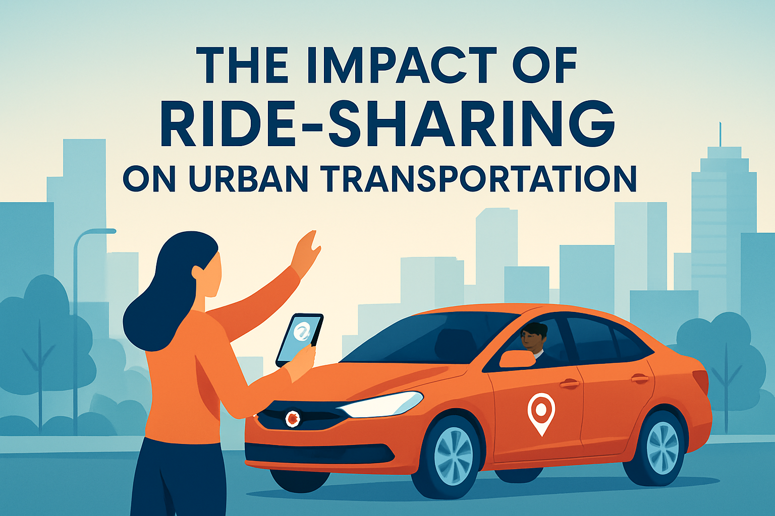
Shared mobility has diversified urban transportation, but its community value depends on integration and governance. Ride-hailing, car share, bike share, scooter share, demand-responsive shuttles, and vanpools can fill service gaps, especially for late-night travel, dispersed employment areas, or neighborhoods with limited fixed-route transit. Yet these services are not automatic substitutes for public transport. In many cities, ride-hailing has increased vehicle miles traveled in busy districts and contributed to curb congestion. The right question is not whether shared mobility is good or bad; it is where and how it complements the network.
Integrated trip planning is one of the most effective ways to connect communities because travelers experience mobility as one journey, not separate agencies and apps. Mobility-as-a-service platforms, real-time passenger information, and multimodal payment systems can reduce uncertainty and improve uptake when they are designed around public needs. The underlying standards matter. GTFS and GTFS-Realtime allow trip planners to combine schedules and live updates across operators, while account-based ticketing can support fare capping and interagency transfers. In my experience, riders forgive many constraints if information is accurate and payment is simple. They lose trust quickly when a transfer is technically possible on paper but impossible in real time.
| Mobility element | How it connects communities | Main limitation if poorly managed |
|---|---|---|
| Frequent bus service | Links housing to jobs, schools, and services across many neighborhoods | Unreliable headways weaken access and trust |
| Protected bike network | Extends short-trip reach and improves station access | Disconnected segments deter most riders |
| Ride-hailing and shuttles | Fills gaps for late-night, low-density, or special-needs trips | Can increase congestion and cost without policy controls |
| Integrated payment | Simplifies transfers across modes and reduces friction | Fragmented fares create hidden penalties |
| Accessible sidewalks and crossings | Enable safe first-mile and last-mile travel for all users | Missing links can isolate stations and corridors |
Digital tools also raise inclusion questions. Not every rider has a smartphone, banking access, or consistent data service. Cash options, kiosks, call centers, multilingual information, and privacy safeguards remain essential. A connected community mobility system must be technologically capable without becoming digitally exclusionary. Good transport technology reduces barriers; it does not create new ones.
Street design, land use, and the public realm
Urban mobility connects communities most effectively when transportation and land use reinforce each other. Dense, mixed-use areas support frequent transit because more destinations sit within walking distance of stops. In turn, reliable transit makes it easier to live with fewer cars, which frees land from parking and allows more housing, retail, and public space. This reciprocal relationship is visible in transit-oriented development, but the concept only works when affordability and pedestrian design are addressed at the same time. Otherwise, station-area investment can raise land values while displacing the very communities meant to benefit from better access.
Street design is where policy becomes visible. A corridor with dedicated bus lanes, safe crossings, street trees, curb management, and active storefronts invites movement and interaction. A corridor dominated by fast traffic, blank walls, and long crossing distances does the opposite. NACTO guidance, complete streets policies, and safe system design principles have pushed cities to think beyond vehicle throughput toward person throughput and injury prevention. That shift matters because communities do not thrive on speed alone. They thrive on streets where people can meet, shop, linger, and travel without fear.
Curb management has become especially important as e-commerce, deliveries, ride-hailing, and food pickup compete for limited street space. Without clear loading zones and enforcement, buses get blocked, bike lanes become pickup areas, and sidewalks are obstructed. Seemingly small operational details can determine whether a street works as a connector or a barrier. Mobility planning at its best pays attention to those details because the everyday user experiences the network at curb level, one block and one transfer at a time.
Resilience, measurement, and what cities should do next
Connected communities need mobility systems that keep working under stress. Heat waves, flooding, power outages, fuel price spikes, and public health emergencies all test whether residents can still reach essentials. Resilient urban mobility means redundant options, accessible information, and infrastructure designed for disruption. Bus networks often recover faster than rail after localized incidents because service can be rerouted, while protected bike networks provide low-cost continuity when transit is strained. During recent crises, many cities used open streets, temporary bike lanes, and bus priority measures to preserve access. The strongest responses were not improvised from nothing; they built on existing networks and institutional coordination.
Measurement should focus on outcomes communities feel. Useful indicators include jobs reachable within forty-five minutes, percentage of residents near frequent transit, sidewalk completeness, serious injury rates, fare burden, transfer success, and access for wheelchair users. Traditional traffic counts alone cannot show whether a city is becoming more connected. Planners should combine ridership data, origin-destination analysis, household travel surveys, and direct community feedback. When numbers and lived experience disagree, field observation matters. I have walked station areas that looked compliant in spreadsheets yet remained effectively inaccessible because crossings were indirect, elevators unreliable, or signage unclear.
The central takeaway is simple: urban mobility connects communities when it expands access, not merely movement. The best systems combine reliable public transit, safe walking and cycling, thoughtful street design, fair pricing, and technology that simplifies rather than fragments travel. They also recognize tradeoffs. Not every corridor needs the same treatment, and not every innovation improves equity or efficiency. Cities should start with the daily trips people already need to make, identify the barriers they face, and invest where access gains are greatest. If you are building or evaluating an urban mobility strategy, begin with one question: can residents of every neighborhood reach opportunity safely, affordably, and with dignity? Answer that well, and stronger community connection follows.
Frequently Asked Questions
What does urban mobility mean, and why is it so important for connecting communities?
Urban mobility refers to the full network of systems, services, and street designs that help people and goods move through a city. That includes public transit, walking routes, bike lanes, roads, shared mobility services, curb management, and digital tools that help residents plan trips in real time. Its importance goes far beyond transportation itself. Urban mobility shapes whether people can reliably get to work, reach schools on time, attend medical appointments, shop for daily needs, visit parks, and stay socially connected with family, neighbors, and community institutions.
When mobility works well, communities become more connected in practical and social ways. Residents can access more opportunities without needing to live directly next to them. Employers can reach a larger workforce. Students can attend schools, training centers, and libraries more easily. Older adults, people with disabilities, and lower-income households are less likely to be isolated when streets and transit systems are designed for broad accessibility. In that sense, urban mobility is not just about movement; it is about participation in city life. The stronger the mobility network, the more likely a city is to support equity, economic activity, public health, and community cohesion.
How does transportation connectivity affect access to jobs, schools, healthcare, and everyday services?
Transportation connectivity describes how easily and safely people can reach essential destinations. A city may have many jobs, clinics, grocery stores, and public services, but if residents cannot access them efficiently, those opportunities remain limited in practice. Good connectivity reduces travel time, lowers transportation costs, improves reliability, and expands the number of destinations a person can reach within a reasonable trip. This matters especially in urban areas where many households rely on public transit, walking, or cycling rather than private cars.
For employment, strong connectivity can increase access to a wider range of jobs across different neighborhoods and business districts. Workers benefit when buses and trains run frequently, routes are direct, and first-mile and last-mile connections are safe. For education, children and college students need dependable ways to reach schools, campuses, childcare centers, and after-school programs. In healthcare, connectivity can directly influence outcomes by making it easier for patients to attend appointments, access pharmacies, and receive urgent or preventive care. Everyday services such as markets, government offices, parks, and community centers also become more usable when trips are affordable, intuitive, and safe. In short, transportation connectivity turns urban services from being theoretically available into being truly reachable.
What role do walking, cycling, and public transit play in building stronger communities?
Walking, cycling, and public transit are foundational to community connection because they move large numbers of people while supporting safer, more inclusive, and more active urban environments. Walking is the most basic form of mobility and the starting point for nearly every trip. Sidewalk quality, crossings, lighting, shade, and traffic calming all influence whether residents can comfortably move through their neighborhoods. When streets are designed for pedestrians, they become social spaces as well as transportation corridors, encouraging local interaction and supporting nearby businesses.
Cycling adds another affordable and efficient travel option, especially for short and medium-distance trips. Protected bike lanes, secure parking, and connections to transit stations can make cycling practical for a wider range of users, not just confident riders. Public transit, meanwhile, provides the backbone for equitable urban access because it connects many neighborhoods to employment centers, schools, medical districts, and civic destinations at scale. Frequent, reliable transit can reduce car dependence, lower congestion, and serve residents who cannot drive or choose not to. Together, these modes create a more balanced transportation system. They help cities function more efficiently while also making public space more human-centered, which strengthens everyday interaction between communities.
How can cities make urban mobility more equitable and accessible for all residents?
Creating equitable and accessible urban mobility requires cities to focus on who is currently underserved and why. In many places, mobility gaps affect lower-income neighborhoods, peripheral districts, older adults, people with disabilities, women, shift workers, and residents without access to a private vehicle. A truly inclusive approach starts with affordable fares, dependable service, and safe infrastructure in the places where need is greatest, not only where demand is already strongest. That means improving transit frequency, reducing long wait times, filling sidewalk gaps, adding protected crossings, and making stations and vehicles accessible for people using wheelchairs, strollers, or mobility aids.
Equity also depends on design and policy details that are easy to overlook. Lighting, visibility, maintenance, wayfinding, multilingual information, and safe transfer points all affect whether a trip feels possible and dignified. Digital trip planning tools can help, but cities must also account for residents with limited internet access or lower digital literacy. Community engagement is essential because residents often understand daily barriers better than any map or performance dashboard. When cities listen to local users and invest accordingly, mobility systems become more responsive to real-life travel patterns. The result is not just a fairer transportation network, but a city where more people can fully participate in work, education, health, and civic life.
What strategies help improve urban mobility and strengthen connections between neighborhoods?
Improving urban mobility requires a coordinated strategy rather than a single project. One of the most effective steps is building a connected, multimodal network where walking, cycling, public transit, and shared mobility complement one another. Instead of treating each mode separately, cities can design smoother transfers, safer station access, and clearer trip information so residents can move between neighborhoods with less friction. Transit priority measures such as dedicated bus lanes, signal priority, and streamlined boarding can improve speed and reliability, while complete streets policies can make corridors safer for pedestrians and cyclists at the same time.
Land use and transportation planning also need to work together. Mixed-use development near transit, schools, clinics, and retail can shorten trip distances and make neighborhoods more self-sufficient while still staying connected to the larger city. Better curb management can reduce conflicts between buses, delivery vehicles, ride-hailing, cyclists, and pedestrians. Data and digital tools can support smarter planning, but long-term success depends on public trust, maintenance, and consistent investment. Most importantly, cities should measure outcomes that matter to residents: how safely people travel, how long trips take, what destinations are reachable, and whether mobility improvements are reaching underserved communities. When those goals guide decision-making, urban mobility becomes a powerful tool for linking neighborhoods, expanding opportunity, and building a more connected city.