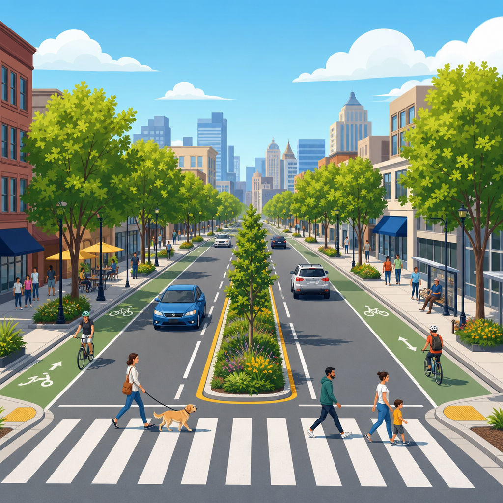
Road diets on urban arterials are one of the most practical, evidence-backed ways to make city streets safer, calmer, and more productive without rebuilding the entire corridor. In transportation planning, a road diet usually means reallocating space on a multi-lane street, most often converting four undivided travel lanes into three lanes with one lane in each direction and a center two-way left-turn lane. On wider corridors, the concept can also include adding bus lanes, protected bike lanes, pedestrian refuge islands, curb extensions, or wider sidewalks while reducing excess motor vehicle capacity. The core idea is not anti-car. It is to match street design to actual demand, reduce conflict points, and support the full range of uses that urban arterials are expected to serve.
I have worked on corridor studies where a road diet was first treated as politically impossible, then became the preferred option once crash patterns, signal delay, and frontage business access were mapped in detail. That pattern is common because many urban arterials were designed for speed and throughput during a period when engineering practice prioritized peak-hour vehicle movement over safety, street life, and multimodal access. Yet these same corridors often cut through dense neighborhoods, serve transit stops every few blocks, front schools and small businesses, and generate turning movements that a high-speed four-lane layout handles poorly. When a street is functioning as both a traffic conduit and a local main street, overbuilt geometry creates avoidable harm.
The case for road diets matters because urban arterials are disproportionately dangerous. The National Association of City Transportation Officials, the Federal Highway Administration, and Vision Zero programs in major cities have repeatedly shown that severe crashes cluster on wide, fast, multi-lane roads. Speed is the decisive factor. A small increase in operating speed sharply raises stopping distance and the probability that a pedestrian or cyclist dies in a collision. Lane changes, weaving, and left-turn conflicts add another layer of risk. A road diet addresses these mechanics directly by reducing crossing distance, organizing turning traffic, and lowering the speed cues embedded in the street cross section.
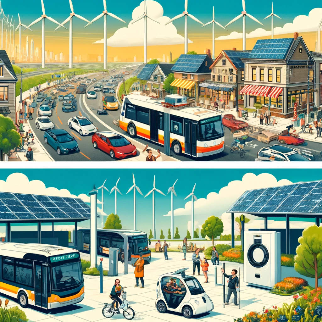
Road diets also matter for fiscal reasons. In many cities, a full street reconstruction is years away, but restriping can happen during routine resurfacing at a fraction of the cost. That makes road diets unusually powerful as a capital-light intervention. They can improve safety, create space for transit priority, and support economic development without waiting for a mega-project. For a sustainable urban development agenda, that combination is compelling: better safety outcomes, lower implementation cost, reduced emissions from smoother traffic flow and mode shift, and better access for people who do not drive. The strongest argument is simple. Urban arterials should move people efficiently while protecting the neighborhoods they run through, and road diets help streets do both.
How road diets improve safety on urban arterials
The safety case starts with conflict reduction. A conventional four-lane undivided arterial allows through traffic in both lanes while turning vehicles slow unpredictably in the inside lane. Drivers swerve around left-turning cars, sight lines are blocked, and pedestrians must judge multiple streams of traffic at once. In a three-lane configuration, turning vehicles move into a dedicated center lane, which removes the need for sudden lane changes and reduces rear-end and sideswipe crashes. Pedestrians cross one moving lane at a time in each direction instead of two, and median islands can create a protected pause point. The design is simpler, and simpler streets are safer streets.
Federal Highway Administration evaluations have found crash reductions in the range commonly cited around 19 to 47 percent after road diet conversions, with especially strong performance on corridors carrying about 20,000 vehicles per day or less, though context always matters. Those numbers are not magic and should not be copied without local analysis, but the trend is durable across many studies. I have seen corridor before-and-after reviews where the biggest gains came not from one dramatic fix but from many small geometry improvements working together: lower lane-change pressure, shorter crossing distances, better turn management, and clearer driver expectation. Injury severity also tends to fall because lower operating speeds reduce kinetic energy at impact.
Safety benefits extend beyond crashes captured in police reports. Near misses, illegal passing, and risky turning maneuvers shape how comfortable people feel using a street. Parents decide whether children can walk to school. Older adults decide whether crossing to a pharmacy feels possible. Transit riders decide whether reaching a bus stop on the far side of an arterial is worth the stress. When agencies evaluate road diets only by vehicle delay and reported crashes, they miss these practical access outcomes. A successful urban arterial is not merely one with acceptable peak-hour level of service; it is one people can cross, enter, and use without fear.
Why traffic operations often work better than critics expect
The most common objection is that removing a travel lane will inevitably create gridlock. Sometimes capacity is a legitimate concern, but in practice many urban arterials are carrying traffic volumes and turning patterns that a three-lane section can handle well, especially when signals are coordinated and access management is improved. Four-lane undivided roads often look higher capacity on paper than they perform in reality because turning vehicles and friction from driveways disrupt flow. A center turn lane can recover some of that lost efficiency. Travel speeds become more uniform, platoons move more predictably, and erratic passing declines.
Analysis should focus on corridor performance, not the instinctive reaction that fewer lanes must mean less function. Planners typically review average daily traffic, peak-hour directional split, intersection turning counts, queue lengths, bus stop locations, driveway density, and crash history. Tools such as Synchro, VISSIM, or Highway Capacity Manual methods can test whether the corridor still operates acceptably after reallocation. In built-up environments, the target is rarely free-flow speed. It is reliable movement at an urban-appropriate pace. A corridor that moves slightly fewer cars at a lower speed but carries more people safely by foot, bike, and bus can be a net operational improvement.
Real-world results support that view. New York City used road diet strategies on corridors including parts of Manhattan and Queens while pairing them with pedestrian islands and bike facilities, producing safety gains without the systemic paralysis opponents predicted. Seattle, San Francisco, and Minneapolis have reported similar patterns on selected arterials. Results vary by block and by peak direction, but the broader lesson is consistent: when a road is overbuilt relative to demand, reallocating space can organize traffic rather than simply constrain it. The key is disciplined corridor selection and honest monitoring after implementation.
Economic, environmental, and community benefits
Urban arterials are not abstract traffic pipes. They are addresses, storefronts, bus stop environments, and neighborhood edges. Road diets can improve local economies because slower, steadier traffic and safer crossings increase visibility and access for ground-floor businesses. Merchants often fear that fewer lanes mean fewer customers, yet on many urban commercial streets the larger challenge is not regional access but whether people feel comfortable stopping, parking, walking, and crossing. Adding curbside parking, loading management, wider sidewalks, or bike access can expand the customer base. Retail districts depend on friction, not just speed.
Environmental benefits are also substantial, though they should be stated carefully. A road diet does not automatically cut emissions on every corridor. If a design creates persistent stop-and-go congestion, emissions can rise locally. But when it smooths traffic flow, supports bus reliability, and enables short trips by walking or cycling, the overall transportation system becomes less carbon intensive. Sustainable urban development is fundamentally about reducing forced car dependence. Urban arterials with hostile crossings and no dedicated space for active travel push even short errands into automobiles. Reallocating street space can reverse that dynamic by making non-driving modes practical for everyday trips.
Community outcomes are equally important. Wide, fast arterials divide neighborhoods by race, income, age, and disability status because the burden of dangerous crossings falls hardest on people with the fewest alternatives. On several corridor projects I have worked on, the strongest testimony came from residents who did not frame the issue as transportation at all. They talked about getting to school, church, parks, and jobs. Road diets can function as public health and equity interventions because they improve access to daily destinations, reduce noise and stress, and support transit users who already sustain the corridor’s person-throughput.
| Corridor issue | Typical four-lane problem | Road diet response | Expected benefit |
|---|---|---|---|
| Left turns | Turning vehicles block through lane | Center turn lane | Fewer rear-end and sideswipe crashes |
| Pedestrian crossings | Long crossing distance with multiple threat lanes | Fewer travel lanes and refuge islands | Safer, easier crossings |
| Transit delays | Buses merge repeatedly in unstable traffic | Calmer flow or dedicated curb space | More reliable bus service |
| Commercial access | High-speed traffic discourages stopping | Lower speeds and better curb management | Improved storefront visibility and access |
| Cycling access | No comfortable operating space | Protected or buffered bike lanes | More short trips without cars |
When road diets are appropriate and how to implement them well
Road diets are not universal prescriptions. The best candidates are urban arterials with a documented safety problem, moderate traffic volumes, frequent turning activity, closely spaced signals, adjacent land uses that generate walking and transit demand, and a cross section wider than necessary for current function. They are often especially effective where posted speeds exceed the surrounding urban context, where there is a history of multiple-threat pedestrian crashes, or where a corridor is due for resurfacing and can be restriped cheaply. Context-sensitive design is critical. A freight corridor with heavy truck percentages, a route with unusual directional peaking, or a constrained bridge segment may need a different treatment or partial application.
Implementation quality determines whether the concept succeeds. Agencies should start with data, but not stop there. Good practice includes before-and-after counts, speed studies, emergency response review, curb use inventories, transit operator input, and direct engagement with corridor businesses and residents. Signal timing may need adjustment. Turn pockets should be designed carefully. Loading zones, school drop-off activity, and bus stop placement should be mapped block by block. On some corridors, quick-build materials such as posts, paint, and modular islands are the right first move because they allow agencies to test the design, collect results, and refine details before permanent construction.
Clear communication is part of engineering, not an afterthought. Opposition often comes from fear of traffic spillover, parking loss, or emergency delay. The most credible response is transparent analysis paired with measurable commitments: publish travel-time changes, crash trends, bus performance, and business access plans. If a project underperforms, adjust it. That willingness to monitor and refine builds trust. The deeper point is that urban arterials should be evaluated by how well they serve city life. A road diet is appropriate when it transforms an overbuilt road into a street that moves people safely, supports local commerce, and reconnects neighborhoods rather than slicing through them.
The case for road diets on urban arterials is ultimately a case for better matching design to purpose. Streets in cities must do more than move vehicles quickly for a short peak period. They must safely carry people of different ages and abilities, support transit, enable commerce, and fit the neighborhoods they pass through. Road diets achieve that by reducing conflict points, lowering speed cues, and reallocating space from surplus capacity to functions the corridor actually needs. They are not a cure-all, and they require careful corridor analysis, but where the fit is right they are among the highest-value interventions available to transportation agencies.
For city leaders, engineers, and community advocates working on sustainable urban development, the practical takeaway is straightforward. Start with the arterials that have recurring crashes, uncomfortable crossings, and more pavement than performance demands. Review traffic volumes honestly, engage corridor users early, and use resurfacing cycles to pilot change at low cost. The evidence is strong that many urban arterials can become safer and more useful through a road diet, with benefits that extend from injury prevention to bus reliability, local business access, and reduced car dependence. If your city wants streets that support both mobility and neighborhood life, road diets deserve a place at the center of the conversation.
Frequently Asked Questions
What is a road diet on an urban arterial, and what changes does it typically include?
A road diet is a street redesign strategy that reallocates existing roadway space to better match how a corridor actually functions. On urban arterials, the classic example is converting a four-lane undivided street into three lanes: one travel lane in each direction plus a center two-way left-turn lane. That center lane removes turning vehicles from through traffic, which reduces sudden stopping, weaving, and rear-end crash risk. The extra space created by the conversion can then be used for other purposes that improve safety, comfort, and corridor performance.
Depending on the street’s width, land use context, and transportation goals, a road diet may also include protected bike lanes, buffered bike lanes, bus lanes, wider sidewalks, pedestrian refuge islands, curb extensions, transit boarding islands, parking lanes, landscaped medians, or safer crossing treatments at intersections. On some corridors, the redesign also creates room for loading zones, short-term parking, or green infrastructure such as stormwater planters. The key idea is not simply “removing lanes,” but reassigning public right-of-way to support safer and more efficient movement for everyone who uses the street.
Urban arterials are often good candidates because many were designed primarily to move cars quickly, even as surrounding neighborhoods became more walkable, transit-oriented, or commercially active. In those settings, the original cross-section can create excessive speeding, difficult pedestrian crossings, and frequent conflicts between turning and through vehicles. A road diet helps align the street’s design with current city goals, which often include safety, access to businesses, transit reliability, and a better public realm.
Do road diets actually improve safety, or do they just slow traffic down?
Road diets are widely supported by transportation safety research because they address several common crash patterns at once. When a four-lane undivided arterial is converted to one through lane in each direction plus a center turn lane, the design reduces the number of conflict points between drivers, pedestrians, and cyclists. Left-turning vehicles no longer stop in a through lane, which lowers the chance of rear-end collisions. The simpler lane arrangement also reduces side-swipe and lane-change conflicts because drivers are not weaving around slower vehicles as often.
For pedestrians, the safety benefits can be substantial. Crossing three lanes with a center refuge or turn lane is generally less stressful and less exposure-intensive than crossing four undivided lanes. The reduced crossing distance, fewer moving lanes to monitor at once, and lower prevailing speeds all contribute to a safer environment. If the project also adds median islands, curb extensions, high-visibility crosswalks, or pedestrian signal improvements, those benefits become even stronger.
It is true that road diets often calm traffic, but that is not a drawback when the goal is a safer, more urban street. In many urban contexts, excessive speed is itself a major safety problem. A modest reduction in speed can dramatically improve a driver’s ability to react and can lower the severity of crashes that do occur. Slower, steadier traffic flow is often preferable to a corridor that feels fast but is unpredictable and conflict-heavy. In other words, road diets are not just about slowing vehicles; they are about creating a safer operating environment with fewer dangerous interactions and more consistent traffic behavior.
Will a road diet create congestion or make traffic worse on a busy arterial?
This is one of the most common concerns, and the answer depends on the corridor’s actual traffic volumes, intersection performance, and surrounding street network. In many cases, road diets work well on arterials because the existing four-lane configuration is inefficient rather than necessary. On streets with moderate daily traffic, the inside lane is often disrupted by frequent turning movements, driveway access, bus stops, and signal operations. That means the apparent capacity of four lanes may not translate into smooth traffic flow. A three-lane configuration with a dedicated center turn lane can sometimes improve operations by making movements more orderly and reducing blockages.
Transportation agencies typically evaluate road diet candidates using traffic counts, turning movement data, signal timing, crash history, and corridor-specific conditions. Intersections usually matter more than midblock lane count, so a successful road diet often includes signal retiming, turn-pocket adjustments, access management, or other operational changes. If transit priority, parking management, and pedestrian improvements are part of the redesign, the corridor may function better overall even if vehicle speeds become slightly lower. The more relevant question is often not whether one car can drive faster at off-peak times, but whether the street moves people safely and reliably throughout the day.
It is also important to distinguish between “more congestion” and “different traffic behavior.” A road diet may reduce speeding and discourage risky passing, which can make travel feel slower even when overall delay remains acceptable. In many urban settings, that tradeoff is worthwhile because the corridor becomes safer, easier to cross, and more supportive of local businesses and transit. Where traffic volumes are too high for a standard conversion, planners may use a modified approach, such as peak-hour lane management, targeted turn lanes, bus priority treatments, or segment-by-segment redesign rather than a one-size-fits-all template.
How do road diets affect transit, bicycling, walking, and local businesses?
One of the strongest arguments for road diets is that they can make an arterial more productive for multiple users, not just private vehicles. For transit, reallocating street space can create dedicated bus lanes, queue jumps, transit islands, or stop designs that reduce delay and improve reliability. Even where a full bus lane is not feasible, a calmer and more organized street can help buses re-enter traffic more predictably and reduce conflicts caused by turning vehicles and erratic lane changes.
For bicycling, road diets often create the space needed for facilities that are far safer and more attractive than a painted lane next to fast-moving traffic. Protected bike lanes, buffered lanes, or wider outside lanes can significantly increase rider comfort and broaden who feels able to bike on the corridor. That matters because a street that is technically legal to bike on is not necessarily one that feels usable for most people. Reallocation gives cities a practical way to add bicycle infrastructure without expensive right-of-way acquisition.
Walking benefits are equally important. Narrower crossings, refuge islands, better visibility, slower turning movements, and improved sidewalk conditions make it easier for people to reach bus stops, schools, shops, and housing on both sides of the street. These are not cosmetic upgrades; they directly affect whether an arterial functions as a barrier or as a connector within the neighborhood.
For local businesses, the impact is often positive when the redesign improves access and comfort. A calmer street can increase foot traffic, make storefronts more visible, and create space for parking, loading, outdoor seating, or landscaping. While some merchants initially worry about lane reductions, business districts often benefit when the corridor becomes a place people are willing to visit and spend time in, rather than simply drive through quickly. The economic value of a street depends not only on vehicle throughput, but on how well it supports access, visibility, and a pleasant customer experience.
Are road diets expensive to implement, and how do cities know whether one is the right fit?
Compared with full corridor reconstruction, road diets are often a relatively cost-effective intervention because many can be implemented primarily through restriping, signage, signal adjustments, and targeted curb or median work. That makes them especially appealing to cities that want meaningful safety improvements without waiting years for a major capital project. In some cases, agencies start with a quick-build or pilot version using paint, posts, temporary materials, and revised pavement markings. This allows staff to test the concept, gather data, and make adjustments before committing to more permanent construction.
Determining whether a road diet is appropriate requires a corridor-level analysis rather than a generic assumption. Planners and engineers usually look at average daily traffic, directional peak demand, crash patterns, transit activity, driveway frequency, turning volumes, pedestrian demand, adjacent land uses, and the street’s role in the larger network. They also consider whether the corridor is serving a downtown, neighborhood main street, school area, commercial strip, or mixed-use district, because the right design should reflect the street’s context and purpose.
Community engagement is another essential part of the process. Residents, business owners, transit riders, emergency responders, and accessibility advocates often provide insights that traffic models alone cannot capture. A well-run planning process explains the goals clearly, shares before-and-after expectations honestly, and uses measured results such as speeds, crashes, crossing conditions, travel times, and business access to evaluate success. When cities choose the right corridor and pair the redesign with good analysis and communication, road diets can deliver outsized benefits in safety, livability, and multimodal performance for a modest investment.