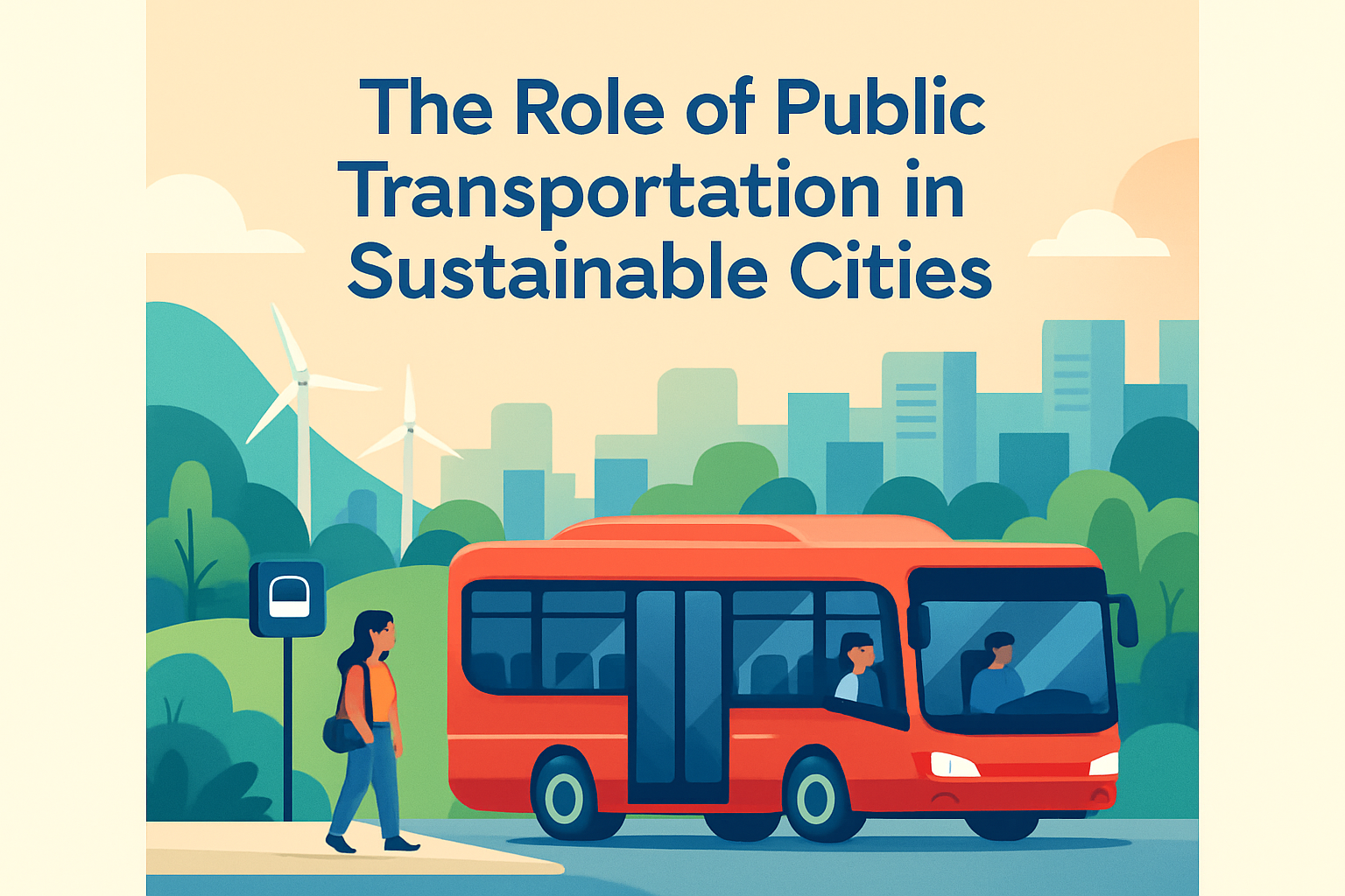
Smart traffic management systems are reshaping how cities move people, goods, and emergency services through crowded streets. In practice, these systems combine sensors, connected signals, analytics software, and communication networks to monitor road conditions in real time and adjust operations faster than any fixed-timing plan can. The core idea is simple: use live data to reduce congestion, shorten travel times, improve safety, and cut emissions. For city leaders, transit agencies, and logistics operators, that makes smart traffic management a transportation strategy and a public service investment. I have worked on digital mobility projects where a single poorly timed corridor created delays across several neighborhoods, and the lesson was consistent: traffic flow is not a static engineering problem. It is a dynamic system influenced by weather, events, construction, crashes, school schedules, freight deliveries, and pedestrian activity. A smart traffic management system responds to those variables continuously rather than relying on assumptions made during an old signal study.
The term covers several technologies. Adaptive traffic signal control changes signal timing based on vehicle demand detected at intersections. Intelligent transportation systems, often shortened to ITS, connect field devices such as cameras, radar, loop detectors, variable message signs, and transit priority equipment to a central platform. Some cities also use artificial intelligence and machine learning to forecast queues, identify incidents, and optimize green time allocation. Vehicle-to-infrastructure communication is an emerging layer that allows equipped vehicles and roadside units to exchange information about signal phase, speed recommendations, and hazards. These capabilities matter because urbanization keeps increasing pressure on roads that cannot simply be widened. According to widely cited transportation studies from agencies such as the U.S. Department of Transportation and the European Commission, congestion imposes measurable economic costs through wasted fuel, lost labor time, and unreliable delivery windows. A smart traffic management system addresses that problem by turning fragmented traffic assets into a coordinated network.
How Smart Traffic Management Systems Work in Real Time
A modern system begins with data collection. At the street level, intersections may use inductive loops embedded in pavement, video detection cameras, microwave radar, Bluetooth or Wi-Fi travel time sensors, and connected pedestrian push buttons. Each device captures a different aspect of movement. Radar works well in poor visibility and measures speed reliably. Video analytics can estimate turning movements, classify vehicles, and detect near misses involving cyclists or pedestrians. Bluetooth readers infer corridor travel times by matching anonymized device signatures between checkpoints. The data flows through fiber, cellular, or dedicated municipal networks to a traffic management center, where software aggregates conditions on dashboards and decision engines recommend or execute control actions.
The most visible action is adaptive signal timing. Instead of running fixed cycle lengths and splits all day, the system recalculates timing plans based on demand. If a sports event releases traffic onto one arterial, green time can be extended for the dominant movement while side street delay is kept within acceptable thresholds. If a bus is running behind schedule, transit signal priority can either extend a green phase or shorten a red phase to help it recover. Emergency vehicle preemption goes further by interrupting normal timing to create a safer path for fire trucks or ambulances. In deployments I have reviewed, the difference between “connected” and “smart” was decisive: connected devices merely report conditions, while smart systems close the loop by using that information to influence field operations automatically.
Integration is what turns separate tools into a traffic management system rather than a collection of gadgets. The software layer often connects signal controllers, incident management tools, public transit feeds, weather services, and traveler information platforms. Operators can see lane closures, CCTV footage, parking occupancy, and bus arrival data in one interface. Standards such as NTCIP in North America help devices from different vendors communicate, which matters when cities are upgrading older cabinets in phases rather than replacing everything at once. Well-designed systems also maintain audit logs, fallback timing plans, cybersecurity controls, and performance dashboards. Those features are not glamorous, but they are essential because traffic operations must remain reliable during network outages, cyber incidents, and equipment failures.
Key Benefits for Urban Mobility, Safety, and Sustainability
The first and most immediate benefit is reduced delay. When signal timing reflects actual demand, intersections waste less green time on empty approaches and move more vehicles per cycle. That can improve corridor progression, reduce stop-and-go driving, and increase travel time reliability. Reliability matters as much as speed. Commuters can tolerate a 25-minute trip more easily than a trip that varies unpredictably between 20 and 45 minutes. Freight operators value the same thing because delivery planning depends on dependable arrival windows. For municipal governments, more reliable movement supports local business activity and public satisfaction without major road expansion.
Safety gains are equally important. Smart traffic management systems can detect red-light running, wrong-way entries, queue spillback, and stalled vehicles, allowing operators to respond sooner. At intersections with heavy pedestrian demand, adaptive systems can lengthen crossing time or trigger leading pedestrian intervals based on actual conditions. Some cities pair analytics with Vision Zero policies by identifying crash-prone approaches and adjusting timings, signage, and enforcement accordingly. This is where intelligent traffic management becomes more than congestion relief. It becomes a risk reduction program grounded in data. I have seen agencies gain public trust when they could show before-and-after metrics on severe crashes, not just average speed improvements.
Environmental performance is another strong argument. Idling and repeated acceleration increase fuel consumption and tailpipe emissions. Smoother progression reduces both, especially on congested arterials with many signals. The exact savings depend on fleet mix, corridor geometry, and baseline delay, but the direction is consistent: fewer stops generally mean lower emissions per trip. Smart systems also support broader sustainability goals by improving bus service regularity and making multimodal travel safer. If buses arrive more predictably and crossings feel safer, some travelers shift away from private vehicles. That indirect effect can be more valuable over time than the signal optimization itself, because the cleanest congestion reduction is often a mode shift rather than simply pushing more cars through the same network.
Core Technologies Cities Use Today
City deployments vary, but most successful programs rely on a common technology stack. The field layer includes signal controllers, roadside sensors, CCTV cameras, weather stations, and dynamic message signs. The communications layer moves data between cabinets and central systems using fiber backbones, secure wireless links, or hybrid networks. The application layer handles analytics, decision support, simulation, and operator workflows. Well-known platforms in the market support adaptive control, advanced traffic management systems, and integrated corridor management, but technology selection should follow operational goals rather than marketing claims. A downtown grid with heavy pedestrian volumes needs different tools than a suburban freight corridor.
| Technology | Primary Function | Typical Urban Use Case |
|---|---|---|
| Adaptive signal control | Adjusts cycle, split, and offset using live demand | Peak-hour congestion on arterial corridors |
| Video analytics | Detects vehicles, pedestrians, queues, and incidents | Complex intersections and safety monitoring |
| Transit signal priority | Gives buses or trams conditional priority | Improving schedule adherence on busy routes |
| Variable message signs | Communicates incidents, detours, and travel advice | Event traffic and freeway-to-arterial diversion |
| Digital twin simulation | Tests timing changes before field deployment | Planning construction detours and special events |
Artificial intelligence is useful, but only when it is built on clean operational data. Cities are increasingly using machine learning for short-term traffic prediction, anomaly detection, and signal optimization recommendations. However, I advise agencies to be practical. A radar detector with good maintenance often creates more value than an “AI” pilot with poor data governance. The strongest programs start by fixing detector health, communications uptime, time synchronization, and controller inventories. Then they add forecasting and automation where those capabilities can be verified against real outcomes. In transportation operations, elegant models never compensate for missing field discipline.
Digital twins and microsimulation tools are also becoming standard in mature programs. Engineers can model corridor behavior under construction phases, weather disruptions, and event surges before changing real signals. Tools such as PTV Vissim, Aimsun, and TransModeler are widely used for this purpose. Simulation does not replace field observation, but it reduces risk by showing likely bottlenecks, queue lengths, and diversion patterns in advance. That is especially valuable when city streets serve many functions at once, including transit access, pedestrian movement, deliveries, and curbside pickup.
Implementation Challenges and What Successful Cities Do Differently
The hardest part of smart traffic management is rarely the hardware. It is governance, maintenance, and cross-agency coordination. Traffic departments, police, transit operators, emergency services, and public works often own different assets and use different data systems. If they do not share operating procedures, the city ends up with disconnected technology and inconsistent responses. Successful cities establish clear governance early: who owns the platform, who maintains detectors, who can change timing plans, how incidents are escalated, and which metrics define success. Without those rules, even a well-funded deployment can drift into reactive troubleshooting.
Maintenance discipline is another differentiator. Cameras get dirty, loops fail, firmware ages, and communications links degrade. When detector health falls, adaptive control loses accuracy and operators lose confidence. The best agencies treat maintenance as a performance function, not a back-office chore. They monitor device uptime, mean time to repair, and data quality daily. They also train technicians and operators together so field realities inform control room decisions. In projects I have supported, this operational alignment consistently outperformed flashy pilot programs that ignored long-term asset management.
Privacy, cybersecurity, and equity also require serious attention. Video and Bluetooth sensing can raise legitimate public concerns if data handling is opaque. Cities need clear policies on anonymization, retention, access control, and procurement standards. Cybersecurity frameworks from organizations such as NIST provide a strong baseline for segmentation, authentication, patching, and incident response. Equity matters because optimization can unintentionally favor commuter traffic over transit riders, pedestrians, or neighborhoods with less political influence. Good programs test outcomes across user groups and include multimodal performance measures, not just vehicle throughput. A system that speeds suburban inbound traffic while making crossings less safe is not smart by any serious standard.
Future Trends in Intelligent Urban Traffic Control
The next phase of urban traffic management will be more predictive, multimodal, and cooperative. Connected vehicle data is already improving visibility between fixed sensors, especially on corridors where roadside coverage is incomplete. As more vehicles broadcast speed and location data, operators can detect slowdowns and travel time changes with greater spatial detail. Over time, signal phase and timing messages will help equipped vehicles approach intersections more smoothly, reducing unnecessary braking and improving safety. Cities are also integrating curb management, parking guidance, and freight loading data into traffic platforms because congestion increasingly comes from curbside friction, not just intersection capacity.
Another trend is performance-based operations. Agencies are moving away from one-time timing studies toward continuous measurement of travel time, person throughput, bus reliability, and safety indicators. That shift supports stronger capital planning because leaders can tie technology investments to measurable outcomes. The most credible smart traffic management systems will not be the ones with the most sensors. They will be the ones that prove, month after month, that they reduce delay, protect vulnerable road users, and make the network more resilient during disruptions.
Smart traffic management systems improve urban flow by turning transportation networks into responsive, measurable, and coordinated systems rather than static infrastructure. The essential components are clear: reliable detection, integrated communications, adaptive control, strong maintenance, and governance that aligns traffic operations with safety, transit, freight, and equity goals. Cities that implement these systems well see more dependable travel times, faster incident response, safer intersections, and lower emissions from reduced idling. They also gain something less visible but equally valuable: the ability to manage streets based on evidence instead of assumptions.
The main benefit is not simply moving more cars. It is improving how the entire city functions. Workers arrive more predictably, buses stay closer to schedule, emergency vehicles lose less time at intersections, and pedestrians cross streets designed with current conditions in mind. There are tradeoffs to manage, especially around maintenance budgets, cybersecurity, privacy, and equitable service, but those are operational challenges, not reasons to avoid modernization. If your city is evaluating intelligent transportation systems, start with a corridor audit, define measurable objectives, and build a phased plan that prioritizes detector health, signal integration, and multimodal performance reporting. That is how smart traffic management delivers lasting urban mobility improvements.
Frequently Asked Questions
What is a smart traffic management system, and how does it work in a city?
A smart traffic management system is a technology-driven approach to running urban roads more efficiently by using real-time data instead of relying only on fixed signal schedules or manual observation. These systems typically combine road sensors, traffic cameras, GPS data, connected traffic lights, communication networks, and analytics software to monitor conditions continuously across an entire corridor or city. When congestion builds, a crash occurs, or traffic demand shifts unexpectedly, the system can respond by adjusting signal timing, changing lane priorities, improving route coordination, or alerting operators immediately.
In practical terms, the system acts like a citywide traffic intelligence layer. It gathers information from multiple sources, such as vehicle counts, speeds, queue lengths, pedestrian activity, transit movements, and emergency vehicle locations. Software then analyzes that information and recommends or automatically applies operational changes. For example, if one direction of travel becomes heavily congested during a special event or weather disruption, signals can be re-timed to move more vehicles through that corridor. This dynamic approach helps cities improve flow, reduce delays, and manage streets more proactively than traditional traffic systems.
How do smart traffic management systems reduce congestion and improve travel times?
Smart traffic management systems reduce congestion by responding to what is actually happening on the road rather than following a fixed timing plan that may no longer match real demand. Traditional traffic signals often operate on preset schedules based on average conditions, but traffic is rarely average throughout the day. A smart system can detect changes in volume, speed, turning movements, and lane occupancy in real time, then optimize signal timing to reduce unnecessary stops and shorten queues. This is especially valuable during rush hours, incidents, road construction, or large public events, when traffic patterns shift quickly.
These systems also improve travel times by coordinating intersections along major corridors so vehicles encounter fewer red lights and move more smoothly between blocks. In many cities, this is done through adaptive signal control, which updates green time allocation based on current conditions. Some systems also integrate public transit priority, freight routing support, and incident response tools, all of which help keep the broader network functioning efficiently. The result is not just faster trips for drivers, but more reliable travel times for buses, delivery fleets, and emergency responders. Over time, those improvements can strengthen economic productivity, reduce fuel waste, and improve the day-to-day travel experience for residents.
What technologies are commonly used in smart traffic management systems?
Smart traffic management systems rely on a mix of field hardware, communications infrastructure, and software platforms. Common technologies include inductive loop detectors embedded in roads, radar sensors, video analytics cameras, Bluetooth or Wi-Fi travel-time monitoring tools, and GPS-based data from connected vehicles or fleet systems. These devices collect information on traffic volumes, vehicle speeds, queue lengths, lane usage, and intersection performance. Traffic signal controllers and connected signal cabinets then use this information to execute timing adjustments or communicate with a central management platform.
On the software side, cities often use analytics dashboards, traffic management centers, predictive modeling tools, and artificial intelligence applications to identify patterns and guide decisions. Communication networks such as fiber, wireless backhaul, and cloud-connected platforms allow agencies to move data quickly between intersections and control centers. In more advanced deployments, systems may also integrate transit data, weather feeds, parking information, incident reports, and emergency vehicle preemption. Together, these technologies give transportation agencies a more complete, real-time picture of road conditions and the operational tools needed to respond effectively.
How do smart traffic systems improve safety and support emergency response?
Safety is one of the strongest arguments for investing in smart traffic management. By detecting abnormal conditions quickly, these systems help cities respond faster to crashes, stalled vehicles, hazardous weather, and sudden congestion buildups that can lead to secondary collisions. Real-time monitoring allows traffic operators to identify risks earlier and take action, such as changing signal timing, posting alerts, activating detour plans, or dispatching field personnel. Some systems also analyze near-miss patterns, red-light running, pedestrian conflicts, or speeding behavior, helping agencies identify dangerous intersections before severe crashes occur.
Emergency response is another major benefit. Smart traffic systems can give priority to ambulances, fire trucks, and police vehicles by adjusting signals along their route to reduce delays at intersections. This capability can save critical minutes during medical emergencies or disaster response. In addition, traffic management centers can coordinate more effectively with public safety departments by sharing live road conditions, camera views, and incident data. For cities, that means better situational awareness, quicker clearance of blocked lanes, and safer movement for both responders and the public. Over time, these improvements contribute to a more resilient transportation network that can handle both everyday traffic and high-pressure emergency events more effectively.
What are the main benefits and challenges for cities adopting smart traffic management systems?
The benefits are broad and measurable. Cities that implement smart traffic management systems often see reduced congestion, shorter and more predictable travel times, lower vehicle emissions, improved transit reliability, and better use of existing road infrastructure. Because these systems optimize flow dynamically, they can help delay or reduce the need for expensive road expansion projects. They also support better decision-making by giving transportation agencies access to detailed performance data, which can be used to evaluate intersections, prioritize capital improvements, and communicate results to elected officials and the public. For freight operators, emergency services, and transit agencies, the gains in reliability can be especially valuable.
At the same time, adoption comes with challenges that city leaders need to plan for carefully. Upfront costs for equipment, communications networks, software integration, and system maintenance can be significant. Agencies may also face issues related to legacy infrastructure, cybersecurity, interoperability between vendors, staff training, and long-term data management. Public concerns about privacy and surveillance must be addressed with clear governance policies and transparent communication. The most successful implementations usually begin with defined operational goals, strong interagency coordination, and a phased deployment strategy that allows cities to build capacity over time. When planned well, smart traffic management can deliver lasting improvements in urban mobility, safety, and sustainability.