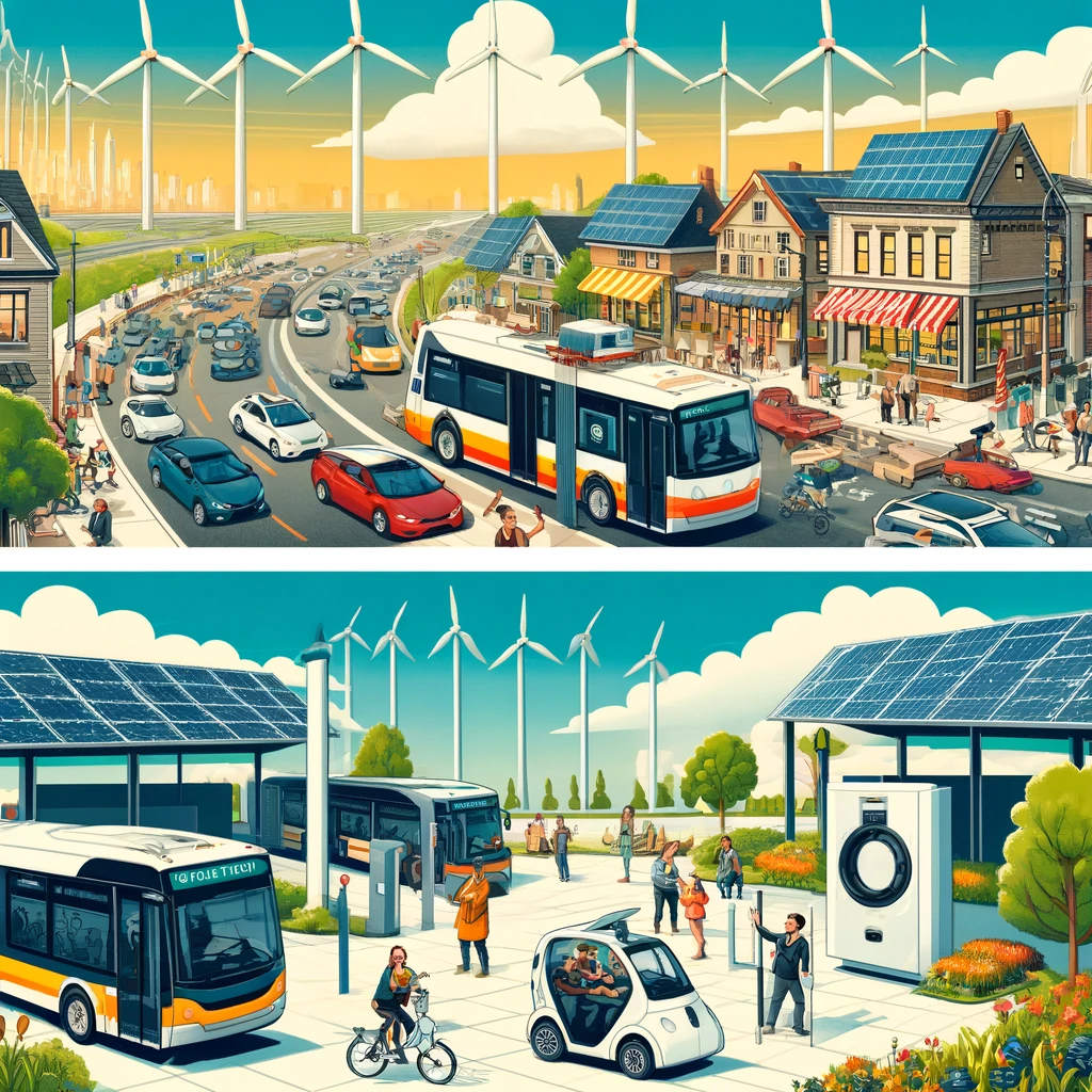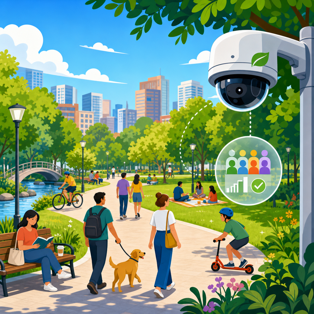
Monitoring public space use with respect for privacy is now a core challenge in sustainable urban development because cities need reliable data about how parks, streets, plazas, transit hubs, and civic buildings are used without turning everyday life into constant surveillance. Public space monitoring means collecting information about occupancy, movement, dwell time, congestion, safety conditions, and patterns of access in shared environments. Privacy, in this context, means limiting the collection of personally identifiable information, reducing the risk of reidentification, setting clear rules for data handling, and ensuring that people can use public places without being individually tracked. When I have worked with municipalities on pedestrian counting and curb management projects, the first issue was never the sensor specification. It was trust. Residents wanted proof that the city was measuring activity to improve services, not building a database of individuals.
That distinction matters because public-space data directly shapes budgeting, accessibility upgrades, traffic calming, transit service, park maintenance, event planning, emergency response, and climate adaptation. A city that understands footfall can place benches where older adults actually rest, adjust lighting on routes used after sunset, redesign crossings near schools, and direct cleaning crews to high-use areas. A city that gathers data carelessly can trigger backlash, legal exposure, procurement delays, and inequitable outcomes. The practical question is not whether to monitor public space use, but how to do it proportionately. Good practice starts with a simple rule: collect the minimum data needed for a defined civic purpose, process it as close to the sensor as possible, retain it for the shortest useful period, and publish enough information about methods that the public can evaluate the program.
This hub article explains the main methods cities use, the privacy risks each method creates, the governance standards that reduce those risks, and the design choices that make monitoring both useful and legitimate.
Why cities monitor public space use
Cities monitor public space use to answer operational questions that observation alone cannot answer at scale. How many people use a plaza by hour and season? Which entrances to a station create crowding? Are new bike lanes increasing activity on adjacent commercial streets? Does a cooling intervention such as tree canopy or misting infrastructure increase summer park use? These are measurable questions, and better answers lead to better spending decisions. During pilot work on downtown street redesigns, I have seen hourly pedestrian counts overturn assumptions held for years. A block thought to be underused during weekdays turned out to be heavily used by shift workers between 5 a.m. and 7 a.m., changing lighting and sanitation schedules.
Monitoring also supports equity. Aggregate use data can reveal whether investments are concentrated in already successful places while lower-income neighborhoods receive less maintenance or fewer amenities. It can show whether wheelchair-accessible routes are actually being used, whether women avoid certain corridors after dark, or whether playgrounds are crowded in areas with limited open space. None of those questions requires identifying individuals. In fact, the strongest public-space programs separate pattern detection from personal identity. The goal is to understand flows and conditions, not names and faces.
Common monitoring methods and their privacy implications
The best monitoring method depends on the question being asked. Manual counts are often the least intrusive and can be highly accurate for short studies, but they are labor intensive and do not scale well. Infrared beam counters and thermal sensors can estimate entries and exits with very low privacy risk because they do not capture identifying imagery. Computer vision systems can provide richer insights such as direction of travel, queue length, and mode split, yet they create higher risk if raw video is stored or faces can be reconstructed. Wi-Fi and Bluetooth sensing can estimate devices in range and repeat visits, but because device identifiers can be persistent, these systems demand strong hashing, rotation handling, and retention limits. Mobile location data from third-party aggregators can reveal broad movement patterns across districts, though representativeness and consent are recurring concerns.
There is no universally “safe” technology. Privacy depends on system design. A camera that converts video to anonymous counts at the edge and deletes frames immediately may be less invasive than a Wi-Fi system that keeps pseudonymous identifiers for months. The right comparison is not sensor versus sensor in the abstract; it is data collected, processing location, retention period, access controls, and the likelihood that a person could be singled out.
| Method | Typical use | Main privacy risk | Lower-risk practice |
|---|---|---|---|
| Manual counts | Short-term footfall and behavior studies | Observer notes becoming overly detailed | Use standardized tally sheets without personal descriptors |
| Infrared or thermal sensors | Entrances, trail counters, room occupancy | Misclassification in dense conditions | Calibrate regularly and publish accuracy ranges |
| Computer vision | Queues, mode detection, congestion analysis | Capture of identifiable imagery | Process on device, avoid storage of raw video, mask by design |
| Wi-Fi or Bluetooth sensing | Dwell time and repeat visitation estimates | Persistent identifiers enabling tracking | Use salted hashing, rapid deletion, and aggregate reporting only |
| Third-party mobility data | District-level origin-destination trends | Opaque consent and sample bias | Validate against local counts and document limitations |
Privacy by design in public-space monitoring
Respect for privacy is achieved through design choices made before procurement, not by adding a disclaimer after deployment. The first control is purpose specification. If the objective is to measure park occupancy by hour, the system should not collect identifiers, audio, or detailed trajectories. The second control is data minimization. Capture counts, not footage; zones, not exact paths; time bands, not second-by-second histories. The third control is edge processing. Modern sensors can classify objects and output counts directly on the device, which sharply reduces the need to transmit or store sensitive material. The fourth control is retention discipline. If raw data is temporarily needed for calibration, set deletion schedules measured in hours or days, not indefinite periods.
Strong privacy by design also includes governance around access and vendors. Procurement documents should prohibit secondary use, training of unrelated models on municipal data, and unrestricted subcontractor access. Contracts should specify encryption, incident reporting, audit rights, and data return or destruction at project end. For higher-risk projects, a formal privacy impact assessment is essential. Good assessments map data flows, identify legal basis, test whether less intrusive options could achieve the same result, and define mitigation measures. Cities that complete this work early move faster later because they avoid redesigns after public objections or legal review.
Legal standards, public expectations, and accountability
Privacy rules vary by jurisdiction, but several standards are widely relevant. The European Union’s General Data Protection Regulation sets a high benchmark for lawful basis, necessity, proportionality, and rights related to personal data. In the United States, the legal landscape is more fragmented, with state privacy laws, biometric statutes in some jurisdictions, constitutional considerations, and public-records obligations intersecting in complex ways. Even where a particular dataset is argued to be anonymous, cities should assume that public acceptance depends on more than legal defensibility. A system can be lawful and still unacceptable if residents feel deceived or excluded from decision-making.
That is why accountability mechanisms matter. Publish plain-language notices that explain what is being collected, why, for how long, by whom, and with what safeguards. Mark monitored spaces clearly unless doing so would compromise a narrowly defined safety function. Create oversight through a privacy office, ethics board, or cross-department review committee. Release technical summaries, accuracy testing results, vendor names, and retention schedules. Offer contact points for questions and complaints. In public meetings I have found that residents often respond positively when officials explain why an anonymous pedestrian counter is being installed at a dangerous crossing and show exactly what the sensor does not collect. Specificity lowers fear more effectively than generic assurances.
Choosing metrics that improve places without profiling people
The most useful public-space metrics are usually aggregate. Footfall by hour, mode share, average queue length, seat occupancy, near-miss counts at intersections, path choice, and duration of use can all inform design and operations without linking data to identified individuals. Environmental conditions such as shade coverage, surface temperature, air quality, and noise levels become even more valuable when paired with aggregate use data. For example, a city can compare summer use of two similar playgrounds and learn that the shaded site holds visitors 40 percent longer in the afternoon. That result supports heat-resilience investments while respecting privacy.
Bias and representativeness still require attention. Computer vision may undercount in low light or dense crowds. Device-based methods may underrepresent children, older adults, or people who disable wireless signals. Third-party mobility datasets can skew toward specific income groups or app users. The remedy is methodological transparency and triangulation. Validate one source against another, report confidence intervals, and avoid claiming precision that the system cannot deliver. When a metric could shape major capital spending, cities should combine automated sensing with field observation, community input, and accessibility audits. Better evidence comes from mixed methods, not blind faith in dashboards.
Building public trust through communication and participation
Public trust is not a communications afterthought; it is part of project performance. When people believe monitoring is fair, limited, and useful, cities face fewer delays and collect better data because vandalism, rumor, and political resistance decline. Effective engagement starts before installation. Explain the civic problem in concrete terms, such as unsafe crowding at a bus interchange or underused green space during extreme heat. Show the alternatives considered and why the selected approach is the least intrusive option that can still answer the question. Invite civil liberties groups, disability advocates, neighborhood organizations, and local businesses into the review process early.
Participation should also shape success criteria. Residents may care less about total counts than about whether monitoring leads to tangible improvements: shorter crossing distances, more toilets, better lighting, safer night access, cleaner sidewalks, or more shade. Cities should commit to reporting not just data outputs but decisions made from that data. A quarterly update that says sensor counts led to retimed signals, reallocated maintenance crews, and expanded seating demonstrates purpose limitation in practice. It shows that information was collected to improve public space use, then converted into visible benefits. That feedback loop is one of the strongest privacy protections because it discourages mission creep and keeps programs tied to defined urban outcomes.
From pilot to long-term program
A responsible monitoring program usually begins with a pilot, but pilots need discipline. Define the hypothesis, target locations, baseline conditions, privacy controls, and evaluation plan before any hardware is installed. Use short procurement terms, independent testing, and sunset clauses. If the pilot fails to improve decision-making, end it. If it succeeds, scale gradually with standardized policies so each department is not reinventing rules on retention, signage, vendor review, and publication formats. In mature programs, transportation, parks, planning, and public works share a common governance model even when they use different sensors.
For sustainable urban development, the payoff is substantial. Cities can manage public space as critical infrastructure while preserving the anonymity that democratic urban life depends on. The key lessons are consistent: start with a specific public purpose, choose the least intrusive method that can answer it, process data locally whenever possible, retain little, validate results, and explain the system in plain language. Monitoring public space use with respect for privacy is not a contradiction. It is the standard cities should adopt if they want data-informed streets and parks without normalizing surveillance. If you are building a program now, begin with a privacy impact assessment, a clear metrics plan, and a public commitment to collect less while learning more.
Frequently Asked Questions
What does monitoring public space use with respect for privacy actually mean?
Monitoring public space use with respect for privacy means gathering useful information about how shared environments function without identifying, tracking, or profiling individual people. In practice, cities and organizations want to understand whether parks are busy at certain times, where sidewalks become congested, how transit hubs handle peak demand, how long people typically stay in plazas, or whether civic spaces are accessible and safe. The privacy-respecting part is what separates responsible monitoring from intrusive surveillance. Instead of collecting names, faces, precise identities, or full movement histories tied to specific people, the focus is on aggregated patterns, anonymous counts, short-term trends, and environmental conditions.
This approach often relies on privacy-by-design methods. That can include using sensors that count movement without capturing recognizable imagery, processing data at the device level so raw footage never leaves the camera, blurring or discarding personal details immediately, minimizing how much data is collected, and setting strict retention limits. The goal is not to know who a person is, but to understand how a public space performs. For example, a city may want to know that a plaza is overcrowded between 5 p.m. and 7 p.m. on weekdays, not that a particular individual visits it every Tuesday.
At its core, this kind of monitoring supports better urban planning, safer infrastructure, cleaner operations, and more equitable access while still respecting civil liberties. When done correctly, it helps planners make evidence-based decisions about lighting, seating, maintenance, mobility, accessibility, and emergency response without normalizing constant personal observation. That balance is what makes privacy-conscious public space monitoring such an important issue in sustainable urban development.
Why do cities need to monitor parks, streets, plazas, and transit hubs in the first place?
Cities monitor public spaces because they need dependable evidence about how those spaces are actually used, not just how they were intended to be used. A park may look adequately designed on paper but still have underused areas, inaccessible entrances, or overcrowded pathways. A transit station may appear efficient until real-world flow data reveals recurring bottlenecks, unsafe platform crowding, or uneven service demand. Monitoring gives urban planners, transportation agencies, facilities managers, and public officials a clearer picture of occupancy, circulation, dwell time, and patterns of access so they can improve design and operations.
There are also strong sustainability reasons for doing this. Better data can help cities allocate cleaning crews more effectively, reduce energy use in civic buildings, plan infrastructure upgrades based on actual demand, and make public investments where they will have the greatest social benefit. Monitoring can reveal whether a new street design improves walkability, whether a public square supports community life throughout the day, or whether certain groups are being unintentionally excluded by poor layout, lack of shade, or inadequate accessibility features. In that sense, public space data is not just about efficiency; it is also about equity, resilience, and quality of life.
At the same time, the need for monitoring does not justify unrestricted data collection. That is why responsible cities define clear public-interest purposes before deploying any system. They ask specific questions such as: Are we trying to reduce dangerous overcrowding? Improve accessibility? Measure the success of a redesign? Support emergency planning? When the purpose is narrow and legitimate, data collection can be tailored to meet that need without becoming invasive. The best monitoring programs are mission-driven, proportionate, and transparent about why they exist and how the information will be used.
What technologies can be used to monitor public space use without invading privacy?
A wide range of technologies can support privacy-conscious public space monitoring if they are selected and configured carefully. One common option is anonymous people-counting sensors that detect presence, entries, exits, or directional movement without storing identifiable images. Thermal sensors, lidar, infrared beam counters, radar-based systems, Wi-Fi or Bluetooth sampling with strong anonymization, and computer vision tools configured for edge processing can all be part of a privacy-first approach. The important distinction is not just the hardware itself, but whether the system is designed to avoid collecting personal data in the first place.
For example, camera-based systems can be especially sensitive because they may capture faces, clothing, and other identifying details. However, they can be made more privacy protective if image analysis happens directly on the device and only statistical outputs, such as counts or occupancy levels, are transmitted. Raw video can be deleted instantly or never stored at all. Similarly, mobile signal data can help estimate foot traffic trends, but it should be aggregated, salted, hashed, or otherwise anonymized in ways that prevent re-identification and long-term tracking. Technologies that produce useful planning metrics without generating individual-level records are generally the most appropriate for public settings.
Low-tech methods also matter. Manual observation, periodic audits, anonymous surveys, and temporary studies can sometimes answer planning questions without introducing continuous monitoring infrastructure. In many cases, the most privacy-respecting solution is not the most advanced one, but the one that collects the least data needed to solve a real problem. A responsible city or operator evaluates each technology based on necessity, proportionality, transparency, accuracy, security, and the risk of function creep. If a simpler tool can answer the question, it is often the better choice.
How can public space monitoring be designed to protect privacy from the start?
Protecting privacy from the start requires privacy by design, which means privacy is built into the system before deployment rather than added after concerns arise. The first step is purpose definition. Cities should state exactly what they need to measure, such as crowding at a transit entrance, park occupancy by time of day, or pedestrian flow through an intersection. Once the purpose is defined, they should collect only the minimum data necessary to achieve it. If simple counts are enough, there is no justification for capturing facial images, device-level identifiers, or continuous individual trajectories.
Strong governance is equally important. A privacy-protective program should include data minimization rules, short retention periods, access controls, encryption, independent oversight, and clear internal limits on data use. Information collected for facility management should not quietly be repurposed for unrelated enforcement, commercial advertising, or behavioral profiling. Public notices should explain what is being monitored, what data is collected, how long it is retained, and who is responsible for the system. In higher-risk situations, organizations should conduct privacy impact assessments and, where appropriate, consult the public before implementation.
Good design also means accounting for fairness and trust. Even anonymized systems can create concern if they are deployed secretly, concentrated in certain neighborhoods, or used in ways that disproportionately affect vulnerable populations. The most credible programs are transparent, independently reviewable, and open to adjustment if harms emerge. They use technical safeguards, legal safeguards, and operational safeguards together. In short, protecting privacy from the start means limiting collection, preventing misuse, securing data, being honest with the public, and designing systems to serve communities rather than monitor them by default.
What are the biggest risks of public space monitoring, and how can cities reduce them?
The biggest risks include over-collection of personal data, re-identification of supposedly anonymous information, function creep, discriminatory impacts, weak security, and erosion of public trust. Function creep is especially important because a system introduced for a narrow goal, such as measuring crowd density, can gradually expand into law enforcement surveillance, commercial targeting, or long-term behavioral tracking if safeguards are weak. Even data that seems harmless in isolation can become sensitive when combined with other sources. Location patterns, timestamps, and repeated observations may reveal routines, affiliations, or vulnerabilities if not properly protected.
There is also the risk of unequal impact. Monitoring tools may be deployed more heavily in some communities than others, or they may produce biased interpretations if the technology performs differently across environments or populations. Poorly governed systems can chill normal public life by making people feel watched, even when the stated purpose is operational. That matters because public spaces are meant to support movement, assembly, recreation, expression, and civic participation. If monitoring undermines those freedoms, the social cost may outweigh the operational benefits.
Cities can reduce these risks through a combination of technical restraint and strong accountability. They should choose low-intrusion tools, anonymize data at the earliest possible stage, avoid storing raw personal data unless absolutely necessary, and establish strict limits on sharing and retention. They should publish policies, conduct audits, test for bias and accuracy, involve independent reviewers, and create mechanisms for public feedback and complaint. Most importantly, they should continuously ask whether a monitoring system still serves a legitimate public purpose in a proportionate way. Responsible monitoring is not just about collecting data carefully; it is about knowing when not to collect it at all.