Intercity rail and regional housing growth are usually planned in separate rooms, funded through separate programs, and measured with separate metrics, yet they shape the same map. Intercity rail refers to passenger train service connecting cities across a region, typically faster and less stop-intensive than local transit. Regional housing growth describes where new homes are built across metropolitan areas, secondary cities, and smaller towns over time. The missing planning link is the failure to align these systems so that housing supply, station access, job markets, and infrastructure capacity reinforce one another instead of competing.
I have worked on corridor studies where transport teams focused on ridership forecasts while housing teams debated zoning capacity with little reference to rail timetables, station catchments, or trip patterns. That disconnect produces predictable outcomes: expensive rail stations surrounded by weak land use, fast-growing towns with congested highways but poor rail access, and core cities under pressure because demand is not distributed along regional corridors. When intercity rail and housing strategy are coordinated, regions can absorb growth more efficiently, reduce car dependence, widen labor markets, and support climate targets without relying on a single dominant city to carry all demand.
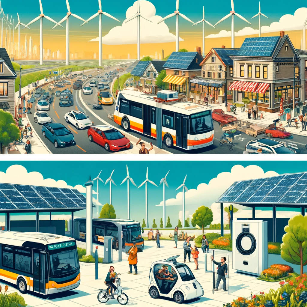
This matters now because many regions face a double constraint. Housing affordability has deteriorated as population growth outpaces supply in productive urban areas, while transport emissions and road congestion continue rising. National infrastructure programs often support rail modernization, and local governments often set housing targets, but the governance gap between them remains wide. A sustainable urban development strategy needs a regional frame: not only how many homes to build, but where they should go relative to stations, travel times, utilities, schools, and employment centers. Intercity rail can turn a disconnected set of places into a networked housing market, but only if planning treats the rail corridor as a growth structure rather than just a transport asset.
Why intercity rail changes housing geography
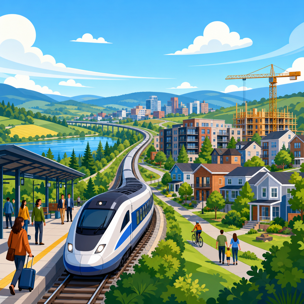
Intercity rail changes housing geography by altering effective distance, not just physical distance. A town eighty kilometers from a major employment center may feel remote if the trip by road is unreliable and parking costs are high. The same town becomes part of a practical commuter shed if trains run every thirty minutes, travel times are competitive, and stations connect to local buses, cycling, and walkable neighborhoods. In planning terms, rail expands labor market access while reducing the generalized cost of travel, a concept that combines time, money, comfort, and reliability.
This effect is visible in multiple countries. In Japan, rail-linked regional cities have long supported housing and economic activity beyond the largest metropolitan cores because service frequency and station-area development were treated as integrated decisions. In France, TGV and conventional rail corridors have influenced growth in secondary cities, though outcomes vary depending on local housing policy and station placement. In the United Kingdom, towns on strong mainline routes often command housing premiums, but places with weak local planning around stations frequently underperform. The lesson is consistent: rail accessibility creates potential value, yet housing growth follows only when local land use rules, infrastructure delivery, and station environments allow that value to be realized.
Planners should be careful, however, not to assume any rail investment automatically improves housing outcomes. A single flagship service with low frequency will not reshape development patterns in the same way as all-day, clockface service. A peripheral parkway station surrounded by surface parking may capture riders without creating a mixed-use district. Rail can support regional housing growth, but the mechanism is specific: dependable service, coordinated land supply, and last-mile access must work together.
What coordinated planning looks like in practice
Coordinated planning begins with a shared corridor vision. Instead of asking whether a rail line deserves funding and separately asking where local governments can assign housing numbers, the region should identify station-based growth areas, target housing typologies, service levels, and enabling infrastructure in one process. I have seen the strongest results when transport agencies, municipalities, and utilities work from the same geospatial evidence base: station catchments, parcel constraints, flood risk, school capacity, employment trends, and travel-time thresholds.
A practical framework usually includes four linked questions. First, which stations can accommodate substantial housing growth within a ten- to fifteen-minute walk, not just within the municipal boundary? Second, what service pattern is required to make those homes genuinely rail-oriented, including off-peak frequency, weekend service, and reliability standards? Third, what local interventions unlock development, such as upzoning, land assembly, street redesign, wastewater upgrades, or affordable housing requirements? Fourth, how will value created by better connectivity be captured or recycled into infrastructure and housing delivery?
Timing matters as much as policy. If a region rezones station areas years before rail improvements, speculative land pricing can raise costs without producing homes. If rail is upgraded before planning approvals and utility capacity are in place, early momentum is lost and opponents argue the investment failed. The most effective sequencing ties rail service commitments to phased housing delivery, with clear triggers for schools, utilities, and public realm improvements. This is how corridor planning moves from aspiration to implementation.
Common reasons the link is missed
The link between intercity rail and regional housing growth is often missed because institutions are organized by mode, jurisdiction, and funding silo. National rail operators focus on timetable performance, asset condition, and major capital programs. Local governments control zoning and development approvals. Regional planning bodies, where they exist, may set broad growth strategies but lack binding authority. The result is fragmented decision-making. A town may seek housing growth near its station, yet have no influence over service frequency. A rail agency may rebuild a station, yet have no mandate to shape adjacent land use.
Metrics can also distort priorities. Transport appraisal has traditionally emphasized travel-time savings, benefit-cost ratios, and passenger volumes. Housing policy often emphasizes unit counts, affordability percentages, or short-term delivery pipelines. Neither lens alone captures the wider value of linking rail and housing: reduced household transport costs, broader job matching, lower per-capita infrastructure costs in station-served areas, and stronger resilience across a region rather than one overheated core. Once regions begin measuring accessibility to jobs and homes together, the case for integrated planning becomes much clearer.
Political cycles add another obstacle. Rail projects unfold over a decade or more, while housing targets and municipal leadership can change every few years. That mismatch encourages short-term decisions, such as approving housing where land is easiest to entitle rather than where long-term transport capacity is strongest. It also creates the temptation to promise rail-led growth without making difficult local choices on density, parking reform, and street design. Honest planning requires acknowledging that corridor success depends on both infrastructure and land use reform.
Station areas are not all equal
Not every station should absorb the same kind or scale of housing growth. Corridor planning works best when stations are categorized according to function, market strength, and infrastructure capacity. In practice, I group them into metropolitan anchor stations, secondary city hubs, growth-town stations, interchange nodes, and constrained heritage or environmental locations. Each type supports a different development response.
Metropolitan anchor stations can take high-density mixed-use growth because they already have strong labor markets, utilities, and connecting transit. Secondary city hubs are ideal for medium- to high-density housing paired with office, education, and healthcare uses. Growth-town stations often need moderate density, family housing, and town-center services within walking distance. Interchange nodes require careful design because large parking fields and road geometry can suppress urban form. Constrained stations may be better suited to limited infill and public realm improvement rather than large housing allocations.
| Station type | Typical housing role | Key planning priority | Main risk if unmanaged |
|---|---|---|---|
| Metropolitan anchor | High-density apartments and mixed use | Transit capacity and affordability requirements | Displacement and inflated land values |
| Secondary city hub | Mid- to high-density housing near jobs and services | Station district regeneration | Office-only growth with weak residential delivery |
| Growth-town station | Townhouse, apartment, and family housing mix | Walkable street network and utility upgrades | Car-dependent edge expansion |
| Interchange node | Targeted infill around multimodal access | Redevelop parking and improve place quality | Station remains a traffic island |
This differentiation matters because blanket density policy can backfire. Assigning very high housing targets to stations with poor local services or constrained wastewater systems delays delivery and undermines public trust. Conversely, under-planning around strong stations wastes scarce accessibility. Good regional housing strategy matches place type to realistic capacity, then invests to increase that capacity over time.
Housing affordability, access, and displacement
One reason to link intercity rail and regional housing growth is affordability, but the relationship is not automatic. Better rail service can open lower-cost towns to wider job markets, giving households more options and reducing pressure on expensive urban cores. Yet the same improvement can raise land values around stations, especially where supply is constrained. Without deliberate policy, accessibility gains can be capitalized into prices rather than translated into more homes.
That is why station-area planning should combine increased development capacity with affordability tools. Inclusionary zoning, public land disposition rules, land value capture, and partnerships with housing associations or mission-driven developers can secure mixed-income outcomes. In some corridors, employer-assisted housing near rail has also helped essential workers remain close to reliable transport. Parking reform is another underrated lever. Excessive parking minimums near intercity stations consume land, increase construction costs, and weaken walkable urban form. Reducing or eliminating those minimums often improves project feasibility while supporting lower-car households.
Displacement risk must also be addressed directly. In lower-income station districts, rail investment and rezoning can trigger speculative acquisition and rent escalation before any community benefits are delivered. Anti-displacement strategies should include tenant protections, right-to-return policies where redevelopment occurs, preservation funding for existing affordable stock, and support for small businesses affected by station-area change. Regions that ignore these issues often face justified opposition, slowing both housing and transport improvements. Linking rail and housing successfully means expanding opportunity without simply moving vulnerable residents farther from it.
Governance, funding, and delivery tools
Integrated corridor planning depends on institutions that can connect plans to budgets. The strongest models use a regional authority or formal corridor partnership to align transport investment, housing targets, and infrastructure phasing. That does not require removing local control, but it does require binding agreements on growth distribution, station-area expectations, and service standards. Memoranda of understanding are not enough if funding can still flow without delivery.
Several tools help close the implementation gap. Joint development agreements can coordinate station redevelopment with housing and commercial uses. Tax increment financing, special assessment districts, and development charges can help fund public realm and utility upgrades where legally permitted. Public development corporations can assemble fragmented land around stations that private markets struggle to coordinate. Value capture should be used carefully and transparently; if it extracts too much too early, it can suppress housing production rather than support it.
Data governance matters too. Shared dashboards should track not only ridership and housing starts, but also accessibility gains, affordability outcomes, mode share, vacancy, delivery by tenure, and infrastructure readiness. When everyone uses the same evidence, corridor decisions become less ideological and more operational. In my experience, this is where many programs improve: once agencies see that a station with mediocre ridership also has poor pedestrian access and delayed zoning, the problem becomes solvable rather than abstract.
How regions can build the missing link now
Regions do not need to wait for a megaproject to connect intercity rail and housing growth. They can start by mapping every station by travel time to major job centers, then identifying where zoning, infrastructure, and service upgrades would unlock the most homes within existing corridors. A ten-station improvement program tied to realistic housing delivery can outperform a single iconic investment with weak land use follow-through. Frequent all-day service, integrated fares, bus connections, station access improvements, and clear local zoning changes usually matter more than branding.
Second, adopt corridor-level housing targets that are station specific, not municipality specific alone. This shifts debate from administrative boundaries to functional geography. Third, prioritize publicly owned land near stations for mixed-income development and community facilities. Fourth, standardize station-area planning guidance so local governments are not reinventing basic tools for every site. Fifth, communicate tradeoffs honestly: some growth should move to rail-served towns, but those towns must accept more compact form, reduced parking dominance, and stronger tenant protections.
The missing planning link is not conceptual anymore; the evidence is already strong. Regional housing growth works better when intercity rail is treated as a settlement framework, and intercity rail performs better when homes, services, and jobs are concentrated where the network can serve them efficiently. For sustainable urban development, that alignment is no longer optional. It is the difference between growth that compounds public value and growth that deepens congestion, exclusion, and infrastructure strain. The next step is simple: plan your housing map and your rail map together, station by station, before the next cycle of growth locks in another generation of avoidable problems.
Frequently Asked Questions
What is the missing planning link between intercity rail and regional housing growth?
The missing planning link is the failure to treat transportation access and housing location as parts of the same regional system. In many places, intercity rail is planned around mobility goals such as travel time, ridership, station upgrades, and service frequency, while housing growth is planned through separate zoning decisions, local development approvals, infrastructure sequencing, and affordability programs. That separation creates a disconnect: rail investments can improve access to secondary cities and smaller towns, but if those communities do not plan for enough homes near stations or along connecting corridors, the full value of that investment is lost. The reverse is also true. Regions may encourage housing growth in outlying areas without aligning it to reliable intercity rail service, which increases car dependence, road congestion, and household transportation costs.
At a practical level, the missing link shows up in different funding streams, different agencies, and different performance measures. Rail agencies often measure success through on-time performance, farebox recovery, and passenger volumes. Housing agencies and local governments tend to focus on unit production, affordability targets, land supply, and local tax impacts. Those metrics matter, but they do not by themselves answer the bigger regional question: where should growth occur so that residents can access jobs, education, healthcare, and other cities efficiently without every new household depending on long car trips? A stronger planning link means coordinating service patterns, station-area land use, housing targets, utility investment, and local approvals so that rail and housing reinforce each other rather than evolve in isolation.
Why does intercity rail matter for housing growth beyond the biggest metropolitan core?
Intercity rail can significantly reshape the geography of housing demand because it expands the practical distance people can travel between home, work, school, and family connections. When passenger rail reliably connects a major metro with secondary cities and smaller regional centers, those places become more viable locations for new housing. Residents may choose to live in communities with lower housing costs, different lifestyles, or more available land while still maintaining access to larger labor markets and essential services. That does not mean everyone will commute daily by rail, but improved regional connectivity changes how households and developers evaluate location choices.
This matters especially in regions where the core city has severe affordability pressures, limited land supply, or political resistance to enough new housing. Without strong alternatives, housing demand spills outward in a fragmented way, often to places that are only realistically accessible by car. Intercity rail offers a way to distribute growth more strategically. It can support compact development in regional centers, strengthen downtowns in smaller cities, and make station districts attractive for mixed-income housing, not just office or retail uses. In that sense, rail is not merely a transport project; it is a regional growth-shaping tool. But for that potential to materialize, communities served by rail need planning frameworks that allow housing production at the right scale, with supportive local infrastructure and protections against displacement.
How can planners better coordinate intercity rail investments with regional housing strategy?
Better coordination starts with shared regional objectives instead of isolated project pipelines. Planners should identify which cities, towns, and station areas are intended to absorb future housing growth and then align rail service plans, land use policy, and infrastructure funding around that map. That means asking a more integrated set of questions early in the process: which stations have the strongest potential for new homes, what service frequency is needed to make those locations attractive, what zoning changes are required, what utility and school capacity must be added, and how affordability can be preserved as accessibility improves. When those questions are answered together, rail and housing decisions become mutually reinforcing rather than sequential and reactive.
Institutionally, coordination often requires formal mechanisms because goodwill alone is not enough. Regions can use joint planning bodies, station-area housing targets, corridor-wide development agreements, and linked funding criteria that reward communities for permitting housing near rail access. State and regional governments can also require housing and transportation plans to use compatible geographic assumptions and time horizons. Equally important is the use of better metrics. Instead of measuring rail only by ridership and housing only by units produced, agencies can track combined outcomes such as homes added within reach of intercity stations, reduced household transportation costs, access to jobs across the corridor, and the share of new growth captured in connected regional centers. Those metrics create accountability for the actual regional outcomes that residents experience.
What are the risks of planning rail and housing separately?
When rail and housing are planned separately, regions often end up with expensive infrastructure that does not generate its full economic or social return, alongside housing patterns that deepen inequality and car dependence. A new or improved rail corridor may serve places that preserve low-density zoning near stations, limit multifamily housing, or fail to invest in last-mile connections. In that scenario, the rail line may attract fewer riders than expected because the surrounding land use does not support enough people living within practical reach of the service. At the same time, housing growth may continue in auto-oriented fringe locations that are cheaper to build in but harder and more costly to serve efficiently over the long term.
There are also fairness and affordability risks. If improved rail access raises land values in regional centers without a parallel housing strategy, lower-income households may be priced out of the very places that are becoming best connected. That can turn accessibility gains into displacement pressures. On the other hand, if regions push housing growth into disconnected locations, households may find lower rents or purchase prices but face higher transportation costs, longer trips, and reduced access to opportunity. Separate planning can therefore produce a lose-lose pattern: underperforming rail, inefficient growth, and households forced to trade housing affordability against mobility. Integrated planning reduces those risks by ensuring that accessibility gains are matched with realistic housing capacity, affordability tools, and local public investment.
What does a successful intercity rail and housing growth strategy look like in practice?
A successful strategy treats rail corridors as development frameworks, not just transportation alignments. In practice, that means identifying a network of major cities, secondary cities, and smaller towns where growth should be concentrated; improving intercity rail service among them; and pairing those investments with clear housing production goals near stations and in connected urban areas. The strongest examples usually include frequent and reliable service, predictable long-term capital planning, zoning that allows a substantial range of housing types, public investment in streets and utilities, and policies that support affordability so new accessibility does not simply translate into higher prices. Success also depends on local connectivity. A station does not create broad access on its own if residents cannot easily walk, bike, bus, or safely drive short distances to and from it.
Just as important, successful strategies are measured by regional outcomes over time. The question is not only whether more trains run or more homes are approved, but whether the region is producing enough housing in well-connected places, broadening access to opportunity, and reducing pressure for scattered sprawl. A good strategy will show that households in multiple communities can reach jobs and services more efficiently, that smaller cities gain population and investment without losing affordability entirely, and that infrastructure spending supports a more coherent growth pattern. In short, success looks like a region where transportation and housing policy are finally working from the same map, with intercity rail helping shape sustainable, inclusive regional growth instead of operating as a standalone mobility project.