Land use reform improves transit ridership by putting more homes, jobs, shops, schools, and services within easy reach of frequent buses and trains, reducing the time and distance that make transit inconvenient. In planning practice, land use refers to how cities allocate space for housing, commerce, industry, public facilities, and streets. Reform means changing rules such as zoning, parking mandates, minimum lot sizes, height limits, and approval processes so urban form supports efficient movement rather than forcing car dependence. Transit ridership is the number of passenger boardings or trips taken on public transportation. These three ideas are tightly linked: where destinations are located, how intensely land can be used, and how streets are designed largely determine whether people ride transit regularly or only as a last resort.
I have worked on corridor plans where a transit agency invested millions in faster service yet saw only modest gains because local zoning still reserved most nearby parcels for low-density uses and required abundant parking. I have also seen the opposite: a city legalized mixed-use apartments near stations, reduced parking minimums, improved sidewalks, and suddenly the same bus route carried more riders all day, not just at rush hour. That pattern is not anecdotal. Research from the Transit Cooperative Research Program, the Institute of Transportation Engineers, and major metropolitan planning organizations consistently shows that density, diversity of uses, destination accessibility, and walkability are core predictors of transit use. Land use reform matters because it changes these predictors at the source.
The policy relevance is broader than transportation alone. Higher ridership helps justify more frequent service, and better frequency makes transit useful for more trips, creating a reinforcing cycle. Stronger ridership also supports climate goals by lowering vehicle miles traveled, improves household affordability by reducing the need to own multiple cars, and expands access to jobs for residents who cannot or prefer not to drive. In fast-growing regions, reform can prevent congestion from worsening simply by adding more lanes. In slower-growth cities, it can focus limited public investment where it has the highest return. A transit line performs best when the surrounding land use supplies riders throughout the day and in both directions.
To understand how land use reform improves transit ridership, it helps to focus on a practical question planners ask constantly: how many useful destinations can a person reach safely and quickly without a car? When reforms increase that number, transit becomes competitive. When rules isolate homes from daily needs, separate jobs from housing, and spread activity thinly across vast areas, transit struggles even if vehicles are modern and stations are attractive. Ridership is not driven by infrastructure alone. It is driven by the relationship between service and the places that service connects.
Why density, mix, and proximity drive ridership
The most important mechanism is simple: transit needs a critical mass of people and destinations near stops. Low-density development means fewer potential riders within walking distance, usually defined as roughly a quarter mile for local bus and a half mile for rail, though actual willingness depends on safety, weather, topography, and street design. If only a small number of residents live near a stop, service must either be infrequent or heavily subsidized. Neither condition is ideal for sustained ridership growth. By contrast, reform that allows more homes per acre near high-frequency routes increases the pool of riders who can access service without driving to it.
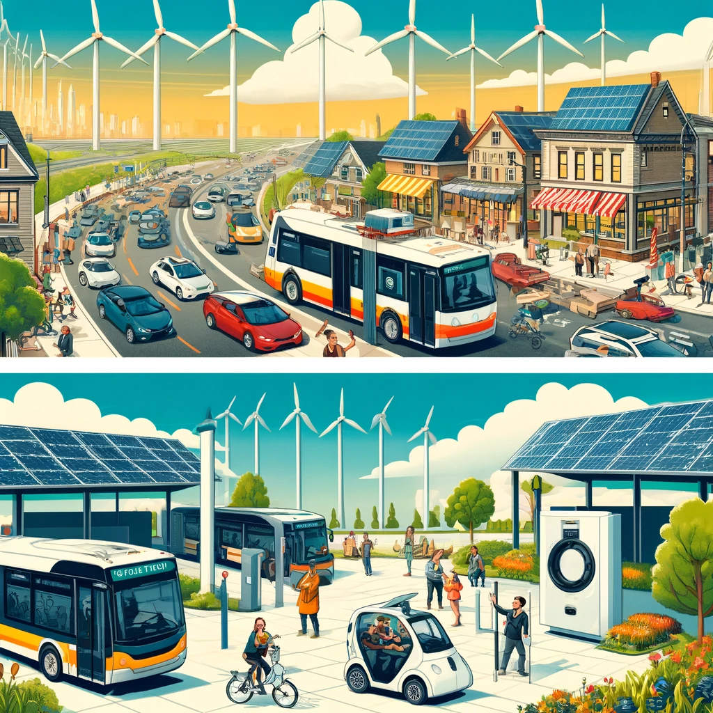
Density alone is not enough. A district filled only with apartments may produce strong morning boardings but weak reverse commuting and limited midday demand. A district with only offices may empty out after work. Transit performs better when zoning permits a mix of residential, retail, employment, civic, and recreational uses. That mix creates trips in multiple directions at different times, supporting all-day frequency. In Arlington, Virginia, the Rosslyn-Ballston corridor is a widely cited example: concentrated mixed-use development around Metrorail stations generated far higher ridership and tax value than dispersed growth would have, while preserving nearby single-family neighborhoods through targeted upzoning rather than blanket change.
Proximity also matters. Even moderate density can support ridership when buildings are close to stops, blocks are short, and walking routes are direct. I have reviewed station areas where nominal residential density looked adequate on paper, but superblocks, cul-de-sacs, and parking lots forced pedestrians to walk twice the straight-line distance. Ridership lagged because the actual experience was inconvenient. Land use reform therefore includes urban design standards, not just unit counts. Requiring active frontages, limiting setbacks, allowing corner stores, and improving parcel connectivity can raise the effective catchment area of a stop without changing the route itself.
Which zoning reforms have the biggest effect
Several zoning changes consistently improve transit outcomes. First, upzoning near frequent transit permits more housing and employment where accessibility is already highest. This can take the form of transit-oriented development overlays, form-based codes, increased floor area ratios, taller height limits, or by-right multifamily permissions within station areas. Second, mixed-use legalization allows everyday destinations to cluster around stops, shortening trips and increasing nonwork travel demand. Third, accessory dwelling units, duplexes, fourplexes, and small apartment buildings expand ridership incrementally across bus corridors, not just at major rail stations.
Parking reform is equally important. Minimum parking requirements raise development costs, consume land near stops, and encourage driving by making car storage abundant. Removing or reducing these mandates often leads to more compact projects and lower rents per unit because developers can build fewer structured spaces, which are expensive. In many markets, one underground parking stall can add tens of thousands of dollars to project cost. When parking is unbundled from rent and priced separately, some households choose fewer cars and rely more on transit. This is one of the fastest ways land use policy can influence travel behavior.
Approval reform also matters. If every multifamily or mixed-use project near transit requires lengthy discretionary review, the nominal zoning capacity will not translate into actual buildings or riders. Predictable by-right approvals, clear design standards, and coordinated infrastructure planning reduce delay and uncertainty. Cities such as Minneapolis and Portland have paired broader housing permissions with corridor planning and parking changes, making it easier for incremental infill to occur where transit already exists. The result is not instant transformation, but over time the service market becomes denser, more walkable, and more supportive of frequent routes.
| Reform | What it changes | How it improves transit ridership |
|---|---|---|
| Upzoning near stations | Allows more homes and jobs within walking distance | Creates a larger all-day rider base and supports higher frequency |
| Mixed-use zoning | Permits shops, offices, housing, and services together | Generates trips in both directions and beyond commute hours |
| Parking minimum reduction | Frees land and lowers development cost | Reduces car dependence and makes compact projects feasible |
| Missing-middle housing legalization | Adds duplexes, fourplexes, and small apartments on corridors | Builds corridor ridership gradually without waiting for mega-projects |
| By-right approvals | Shortens timelines and cuts entitlement risk | Turns zoning capacity into actual development near transit |
How station area design and street networks shape demand
People do not ride transit because a station exists on a map; they ride when the entire trip chain works. That starts with the first and last mile. Land use reform is often discussed as zoning text, but the physical arrangement of streets and public space is just as decisive. Fine-grained street grids, safe crossings, street trees, lighting, weather protection, and ground-floor activity all increase the number of people willing to walk to transit. Wide curb cuts, blank walls, fast turning traffic, and large parking lots have the opposite effect, even in dense districts.
Station area planning works best when it aligns parcelization and frontage with pedestrian movement. Small to midsize blocks create more route choices and storefront opportunities. Buildings that front the sidewalk, rather than hiding behind parking, make walking shorter and more comfortable. Bus stop placement matters too. A stop next to a long inactive edge or a difficult arterial crossing will underperform compared with one integrated into a visible, active main street. In my experience, modest design fixes such as relocating driveways, narrowing curb radii, or opening midblock passages can noticeably increase stop activity because they remove friction from daily trips.
Street hierarchy should also support transit priority. If zoning permits substantial growth but buses remain trapped in mixed traffic with no signal priority, ridership gains will be smaller than they could be. Conversely, when land use reform is paired with bus lanes, queue jumps, and reliable schedules, each investment amplifies the other. This is why the most successful corridors are planned as systems. Land use generates demand, street design makes access easy, and transit operations convert potential demand into actual ridership.
Why reform must align with housing affordability and jobs access
Transit-oriented growth raises an obvious concern: if neighborhoods near high-quality service become too expensive, the households most likely to rely on transit may be displaced farther away. That weakens ridership and undermines equity. Effective land use reform therefore includes affordability tools such as inclusionary housing, public land disposition policies, community land trusts, preservation funds for older apartment buildings, and tenant protections where legally available. The goal is not only to add units, but to keep a range of incomes near frequent service.
Jobs access is the other half of the equation. Many cities still zone large employment areas in ways that favor office parks, warehousing isolated from housing, or campuses surrounded by surface parking. These patterns are difficult to serve efficiently by transit because origins and destinations are spread out. Reform can cluster employment around stations, permit mixed commercial intensities, and retrofit underused commercial strips into walkable job centers. When residents can reach major employment districts without a car, ridership becomes durable because transit serves economically essential trips.
Real-world examples illustrate the point. Seattle’s urban villages and light-rail station planning have combined growth concentration with significant transit usage, though affordability pressures remain a challenge. In contrast, many suburban employment centers with abundant free parking and separated land uses continue to generate low transit mode share despite nearby regional rail, because the final leg from station to workplace is too dispersed or unpleasant. Ridership follows access. Reform succeeds when it improves who can live near transit, where jobs locate, and how easily the two connect.
How cities can measure whether land use reform is working
Good policy needs metrics. The most useful indicators are not just total boardings, but boardings per service hour, stop-level access, housing and job growth within transit catchments, parking utilization, and the share of residents living within a short walk of frequent service. Many agencies also track farebox recovery, but that number can be distorted by pricing policy and should not be the sole measure of success. Accessibility metrics are stronger because they show how many destinations transit can realistically reach within a defined time window.
Modern tools make this analysis much better than it was a decade ago. General Transit Feed Specification data can be combined with parcel information, census data, and software such as Remix, Conveyal, ArcGIS, or UrbanFootprint to model how zoning changes affect ridership potential. Before-and-after comparisons are especially valuable. If a city reduces parking minimums on a bus corridor, legalizes apartments near stops, and improves sidewalks, analysts can track permit activity, car ownership rates, stop boardings, and travel times over several years. That evidence helps separate symbolic reform from changes that actually increase transit use.
Patience is necessary. Land use change unfolds more slowly than service adjustments. A bus route can be redesigned in months, but redevelopment near stations may take years because parcels turn over gradually and financing cycles matter. Still, the long-term payoff is substantial. Once a corridor has enough residents and destinations to support frequent service all day, transit becomes structurally stronger. The city no longer has to fight land use patterns that suppress demand. If your goal is a more sustainable urban development strategy, prioritize reforms that let more people live, work, shop, and learn near reliable transit, then measure outcomes rigorously and adjust based on results.
Land use reform improves transit ridership because it changes the built environment that determines whether transit is practical for daily life. More homes near stops, a better mix of destinations, lower parking requirements, safer walking routes, and faster approvals create the rider base that frequent service needs. When those reforms are paired with affordability tools and access to jobs, ridership gains are stronger and more durable. Cities that treat transportation and land use as separate systems usually underperform. Cities that align them create a reinforcing loop of higher access, lower car dependence, and better return on public investment.
The central lesson is straightforward. Transit succeeds where urban form supports short walks, concentrated activity, and many trip purposes throughout the day. Reform is not one policy but a package: zoning capacity, mixed use, parking change, street design, and implementation discipline. The exact mix will vary by market, but the direction is consistent across successful examples. If you are building a sustainable urban development agenda, start with the areas around frequent transit and reshape the rules that govern what can be built there. Then connect those reforms to housing, jobs, and public realm improvements so ridership can grow for the long term.
Use this article as your hub for evaluating station areas, corridor zoning, parking policy, and walkability standards across your city or region. Identify where current rules block compact mixed-use growth, map those barriers against existing transit service, and prioritize reforms where service is already frequent or can become frequent soon. Done well, land use reform does more than raise boardings. It makes transit useful to more people, more often, for more kinds of trips.
Frequently Asked Questions
What does land use reform mean, and why does it affect transit ridership?
Land use reform refers to changing the rules that shape how cities grow and how property can be used. In practice, that often means updating zoning codes, reducing or removing parking minimums, allowing more homes and businesses near transit, revising minimum lot size requirements, permitting taller buildings in appropriate areas, and simplifying approval processes that slow down needed housing and mixed-use development. These policies matter because transit ridership depends heavily on whether people actually live, work, shop, study, and access services close enough to bus stops and rail stations for transit to be practical in everyday life.
When land uses are spread too far apart, even good transit service struggles to attract riders. A bus or train becomes less convenient if residents have to travel long distances just to reach a stop, or if their destinations are located in low-density areas with limited service. By contrast, land use reform concentrates more daily activity within easy reach of frequent transit. That means more potential riders are located near stations and corridors, and more trips can be completed without needing a car. In simple terms, reform improves the physical pattern of the city so transit can serve more people more efficiently, more often, and for more types of trips.
How do more homes and mixed-use development near transit increase ridership?
Transit works best when many people are located near reliable service and when their destinations are also nearby. Allowing more housing near transit stations and along frequent bus routes increases the number of residents who can realistically choose transit for commuting, errands, school, medical appointments, and social activities. If reform also allows mixed-use development, meaning homes are located alongside shops, offices, restaurants, schools, and services, transit becomes even more useful because people can make multiple short trips in one area without driving.
This kind of development pattern supports ridership in several ways. First, it boosts the number of potential boardings within walking distance of a stop. Second, it creates two-way and all-day demand, not just peak-hour commuting, because people are traveling for many purposes at different times. Third, mixed-use areas make walking to and from transit more interesting, direct, and practical, which improves the overall rider experience. A station surrounded by apartments, grocery stores, childcare, clinics, and jobs will generally generate more consistent ridership than a station surrounded by parking lots, single-use buildings, or low-density development. The key idea is that transit needs a supportive environment around it, and land use reform helps create that environment.
Why are parking mandates, lot size rules, and height limits so important to transit use?
These rules may sound technical, but they have a major effect on whether transit can compete with driving. Parking mandates require developers to provide a set number of off-street parking spaces, even in places well served by buses or trains. That increases construction costs, uses valuable land for car storage, and spreads buildings farther apart, which makes walking less comfortable and destinations less accessible by transit. Removing or reducing parking mandates near frequent transit can lower costs, support more housing and commercial space, and create neighborhoods designed around people rather than parked cars.
Minimum lot sizes and restrictive height limits can also suppress transit ridership by limiting the amount of housing and economic activity allowed in transit-rich areas. If a city requires large lots or caps building height too aggressively, fewer people and businesses can locate near transit, even where infrastructure already exists. That means the city underuses valuable station areas and major corridors that could otherwise support strong ridership. Reforming these rules does not mean allowing unlimited development everywhere. It means aligning land use standards with transportation goals so places with good transit can accommodate enough residents and destinations to sustain frequent service. In many cases, better ridership begins with simply allowing the urban form that transit has always needed.
Can land use reform improve transit ridership even if transit service is not perfect yet?
Yes, although the strongest results usually come when land use reform and transit service improvements happen together. Reform can still make a meaningful difference by increasing the number of people and activities located near existing routes, which raises the baseline demand for service. Even if service is currently infrequent, more homes, jobs, and services near stops can lead to more riders over time and strengthen the case for agencies to invest in better frequency, longer hours, and improved reliability. In that sense, land use reform can help create the conditions that justify better transit.
That said, land use and transit are most effective as a coordinated strategy rather than separate policy tracks. Residents are more likely to ride when the service is frequent and dependable, and agencies are more likely to provide that service when enough people live and work in the right places. Reform helps solve one side of the equation by reducing the distance between people and transit and by increasing destination density along the network. If cities combine zoning changes, streamlined approvals, and reduced parking requirements with bus priority, better sidewalks, safer crossings, and frequent service, ridership gains tend to be stronger and more durable.
What broader benefits come from land use reform that supports transit ridership?
Higher transit ridership is one important result, but it is not the only benefit. Land use reform that places more housing, jobs, schools, shops, and public services near frequent transit can improve affordability, reduce household transportation costs, lower traffic congestion, and support environmental goals. When people can meet daily needs without driving everywhere, they spend less on fuel, parking, vehicle ownership, and maintenance. Businesses can benefit from better access to workers and customers, and cities can make more efficient use of infrastructure that is already in place instead of extending roads and utilities farther outward.
There are also quality-of-life and public policy advantages. Walkable, transit-supportive neighborhoods can give more people access to opportunity, including those who cannot or prefer not to drive, such as seniors, students, lower-income households, and people with disabilities. They can also support more vibrant commercial districts and more resilient local economies by bringing steady foot traffic to neighborhood businesses. From a planning perspective, land use reform helps align transportation investment with urban development patterns, ensuring that public transit operates in places where it can perform well. That is why many planners view reform not as a narrow zoning issue, but as a foundational strategy for creating more connected, efficient, and accessible communities.