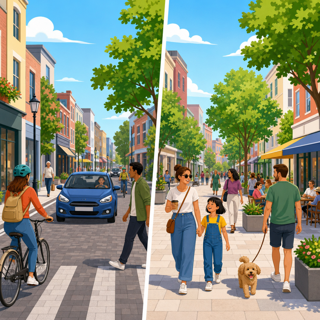
Shared streets and pedestrianized streets are often discussed as if they are interchangeable, yet they represent different design philosophies, operating rules, and policy goals within sustainable urban development. A shared street is a public right-of-way where pedestrians, cyclists, delivery vehicles, emergency access, and sometimes private cars use the same surface with low speeds and minimal separation. A pedestrianized street, by contrast, is a corridor where general motor traffic is restricted or removed, making walking the primary mode and allowing only limited access for servicing, transit, or emergency response. That distinction matters because the choice affects safety, business activity, accessibility, maintenance, traffic circulation, and the social life of a place.
In practice, I have seen projects fail when cities selected a street type based on appearance rather than function. A paving scheme with flush curbs and decorative bollards does not automatically create a successful shared street. Likewise, closing a street to cars does not guarantee a thriving pedestrian district. The underlying questions are operational: who is allowed to enter, at what speed, during which hours, under what enforcement system, and with what accommodations for people with disabilities, freight, and emergency services. Those details determine whether a street supports sustainability goals or simply shifts problems to nearby blocks.
For planners, designers, merchants, and residents, understanding the difference is important because both models can reduce car dependence and improve public realm quality, but they work best under different conditions. Shared streets are typically suitable where low vehicle volumes can be maintained and users can negotiate movement through eye contact, geometry, and slow speeds. Pedestrianized streets are usually better where footfall is high enough that mixing with cars would create conflict, noise, and safety concerns. Both can support climate goals by encouraging walking, cycling, and transit use, yet each requires different governance, design standards, and performance metrics.
Definitions also vary by country, which creates confusion. In the United Kingdom, designers often use the term shared space for schemes that reduce conventional traffic controls. In the Netherlands, the woonerf tradition established legally defined low-speed residential environments where drivers are guests. In many North American cities, pedestrian mall, car-free street, open street, and slow street are used inconsistently. For this hub article, shared streets means mixed-use corridors with intentional low-speed coexistence, while pedestrianized streets means corridors where ordinary through-traffic by private motor vehicles is prohibited full-time or for substantial periods.
What shared streets are and how they work
A shared street is designed to communicate caution and negotiation instead of segregation. Rather than relying on standard curbs, lane markings, and signalized priority, it uses a level surface, short sightlines, tight turning radii, textured paving, street furniture, planting, and frequent pedestrian activity to keep vehicle speeds very low, typically around 10 to 20 kilometers per hour. The concept depends on uncertainty in a controlled way: drivers feel they are entering a people-oriented environment, so they proceed slowly and yield more often.
Successful shared streets have strict operating conditions. Vehicle volumes must remain low, because informal negotiation breaks down when too many cars enter. Land uses should generate active frontages and a steady presence of people, giving motorists visual cues that the street is not a traffic corridor. Access is usually retained for residents, deliveries, sanitation, and emergency services, but through-routing is discouraged using modal filters, one-way access, timed restrictions, or parking removal. Without those controls, drivers treat the street like any other shortcut.
One of the clearest precedents is the Dutch woonerf, developed from the late 1960s and codified with legal rules requiring walking pace and pedestrian priority. Many later projects borrowed the aesthetic without the legal framework, which is why outcomes vary. Exhibition Road in London is often cited as a modern shared surface example. Its single-surface granite design improved the public realm dramatically, but it also required careful detailing, extensive management, and ongoing debate about accessibility for blind and partially sighted users. That debate is essential, because a shared street must be readable for everyone, not just confident pedestrians.
What pedestrianized streets are and how they work
A pedestrianized street removes the central conflict by excluding general car traffic, either permanently or during defined hours. The result is simpler to understand operationally: pedestrians have clear priority because the corridor is fundamentally for walking, social activity, outdoor dining, retail spillout, events, and sometimes cycling or transit, depending on local rules. Delivery windows may be permitted early in the morning, and emergency access remains necessary, but private through-traffic is not part of the normal street function.
Pedestrianization can take several forms. A full-time pedestrian street excludes ordinary vehicles at all times. A timed pedestrian zone may allow servicing before shops open and then convert to a walking-focused environment during trading hours. A transit mall combines pedestrian priority with buses or trams. Seasonal pedestrianization is common in tourism districts, where streets close on weekends or summer evenings. The key point is that motor vehicle access is controlled as an exception, not treated as a coequal mode.
Well-known examples show the range of outcomes. Strøget in Copenhagen, pedestrianized beginning in 1962, is one of the most studied retail streets in the world and demonstrated that removing cars can increase public life and commercial vitality when supported by dense urban fabric and transit access. Madrid’s central street transformations, many Italian historic centers, and numerous German city centers use pedestrianization to protect heritage, improve air quality, and strengthen local commerce. In North America, some mid-century pedestrian malls struggled because they were implemented in weak downtowns without enough residents, destinations, or transit, leading later planners to wrongly conclude that pedestrianization itself was the problem.
Key differences in design, access, and performance
The simplest difference is this: shared streets manage coexistence, while pedestrianized streets manage exclusion. That leads directly to different design choices and performance expectations. On a shared street, every design element must slow vehicles and clarify human priority without relying entirely on barriers. On a pedestrianized street, the primary challenge is controlling access points, maintaining servicing, and programming the space so it remains active throughout the day and year.
| Factor | Shared Street | Pedestrianized Street |
|---|---|---|
| General car access | Usually allowed in limited form | Usually prohibited |
| Target vehicle speed | Very low, often 10–20 km/h | Near zero except service or emergency vehicles |
| Main design goal | Low-speed mixing and place quality | Walking priority and car-free public space |
| Best context | Low traffic volumes, fine-grained access needs | High footfall, retail cores, historic centers |
| Primary risk | Too many vehicles undermine safety and comfort | Poor servicing, weak activation, displaced traffic |
| Accessibility challenge | Wayfinding and edge definition on level surfaces | Managing cyclists, deliveries, and crowding |
From a transportation perspective, shared streets can preserve a degree of permeability for local access, which makes them attractive where complete closures would be politically difficult or operationally disruptive. Pedestrianized streets usually deliver larger gains in comfort, noise reduction, and dwell time because people are not continuously negotiating with moving vehicles. If the goal is maximizing café seating, children’s play, outdoor events, and strolling, pedestrianization generally outperforms shared access. If the goal is balancing access on a constrained local street where some vehicles must remain, a true shared street may be the more realistic tool.
Safety evidence requires nuance. Very low-speed environments can reduce severe injury risk, but only if speeds and volumes remain low in reality, not just on plan drawings. Pedestrianized streets remove many conflict points altogether, which can improve perceived safety substantially. However, both models need universal design considerations. Tactile guidance, detectable edges, seating placement, lighting, drainage, and clear management of cycling are critical. Accessibility organizations have rightly challenged schemes where visual ambiguity was celebrated by designers but created navigation difficulties for disabled users.
When each approach makes sense in sustainable urban development
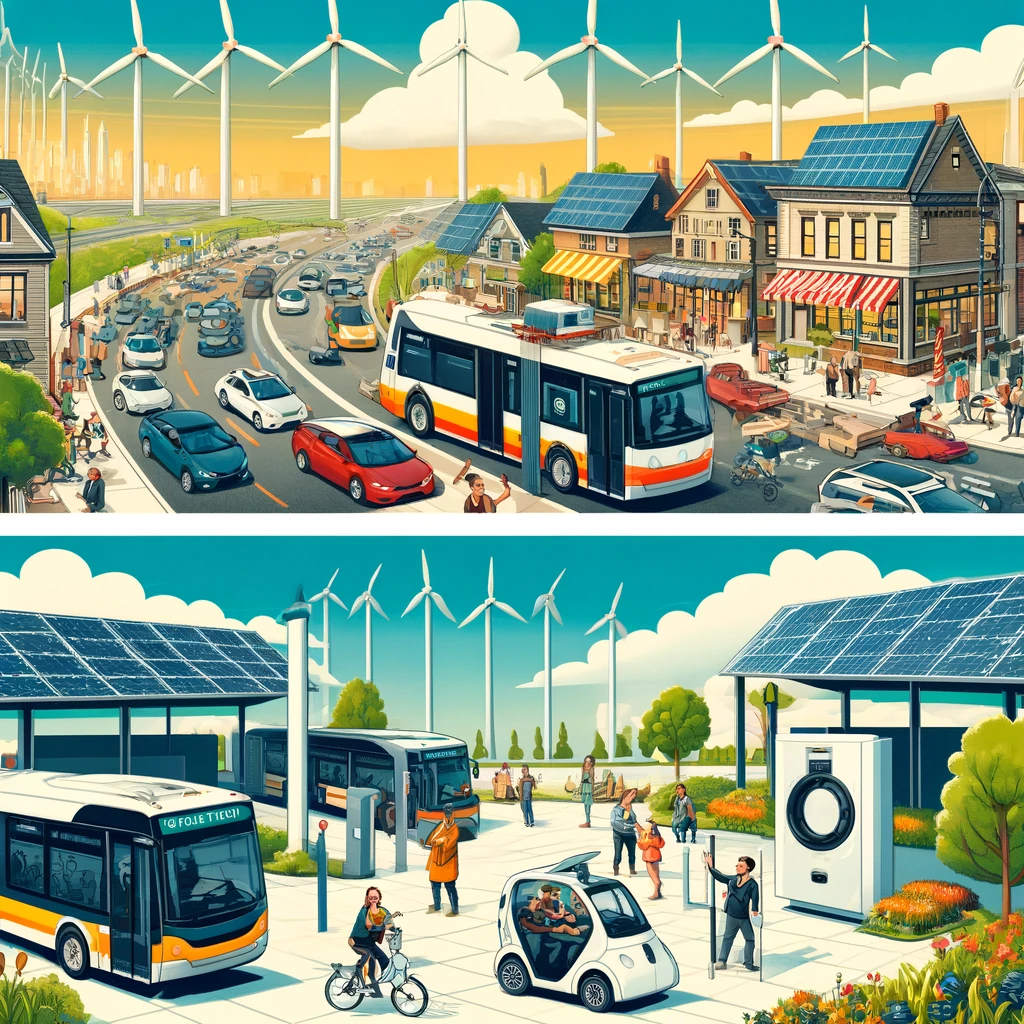
Within sustainable urban development, the right choice depends on context, not ideology. Shared streets are strongest on local commercial streets, residential mews, campus environments, waterfront lanes, and heritage streets where service access must be retained and traffic can be tightly managed. They can support lower embodied carbon than full roadway reconstruction if the project reuses existing alignments and utilities, although high-end paving materials may offset some savings. Their sustainability value comes from reducing dominance by cars while preserving necessary access.
Pedestrianized streets make the most sense in dense mixed-use districts with strong transit, a connected surrounding street network, and enough destination intensity to fill the space with people for long periods. These projects often support mode shift more directly because they create unmistakable priority for walking and transit. They also tend to produce clearer air quality and noise benefits along the corridor itself. In tourism-heavy centers, pedestrianization can protect fragile historic environments from vibration, emissions, and curbside clutter.
Economic impacts depend on implementation quality. Studies across Europe and many recent city center projects show that merchants often overestimate how many customers arrive by private car and underestimate the spending power of pedestrians, cyclists, and transit riders. Still, retail gains are not automatic. A pedestrianized street without shade, seating, programming, or convenient access can feel empty. A shared street without strict traffic management can feel stressful. The sustainable outcome is not the label; it is the combination of design, land use, access policy, and management.
Common mistakes, policy tradeoffs, and how cities should decide
The most common mistake is treating either model as a surface treatment instead of an operating system. Cities spend heavily on stone paving, trees, and furniture, then leave vehicle rules vague or unenforced. The result is predictable: delivery vans stop anywhere, ride-hailing vehicles creep through crowds, cyclists and pedestrians conflict, and nearby streets absorb unmanaged spillover. Good projects start with governance. That means legal designation, access permits, loading plans, emergency protocols, maintenance responsibilities, and measurable targets for speed, footfall, injuries, dwell time, and business performance.
Another mistake is ignoring network effects. A pedestrianized street can succeed brilliantly on its own frontage while creating congestion or illegal loading on adjacent streets if the freight plan is weak. A shared street can calm one block but fail if upstream intersections continue feeding too much traffic into it. Cities should model circulation, test timed deliveries, coordinate waste collection, and monitor curb demand before finalizing design. Tools such as traffic evaporation analysis, pedestrian level of service observations, and before-and-after counts are more useful than assumptions.
Decision-makers should also be honest about tradeoffs. Shared streets may appear flexible, but flexibility can become ambiguity, especially for vulnerable users. Pedestrianized streets create clearer priority, but they require alternative access arrangements and stronger political commitment. In my experience, the best decisions come from a simple sequence: identify the corridor’s dominant purpose, measure current and desired footfall, define necessary vehicle access, test disability inclusion early, and choose the street type that matches those conditions rather than forcing a fashionable template.
For cities building better public realms, the difference between shared streets and pedestrianized streets is not semantic; it is strategic. Shared streets are mixed environments that only work when speeds and volumes are kept very low through design and regulation. Pedestrianized streets are people-first corridors where general car access is removed so walking, social life, and commerce can flourish with fewer conflicts. Both can advance sustainable urban development by supporting lower car dependence, stronger local economies, and healthier public spaces, but they solve different problems.
The clearest takeaway is to match the tool to the context. If a street must retain limited local vehicle access and can realistically operate at walking pace, a shared street may be appropriate. If pedestrian activity is high and vehicle presence undermines comfort, safety, or place quality, pedestrianization is usually the stronger option. In either case, success depends on more than design drawings. It requires enforceable access rules, inclusive detailing, freight planning, maintenance, and ongoing measurement.
Use this article as the starting point for evaluating street transformation projects across your city or organization. Define the street’s purpose first, then align design, policy, and operations around that purpose. When those pieces work together, streets stop being traffic conduits and become durable public assets.
Frequently Asked Questions
1. What is the main difference between a shared street and a pedestrianized street?
The core difference is how each street type treats motor vehicles. A shared street is designed for multiple users to occupy the same public space at very low speeds, typically without the conventional separation of sidewalks, curbs, lane markings, or signal-heavy traffic controls. Pedestrians, cyclists, deliveries, emergency vehicles, and in some cases private cars all move through the same corridor, but the design intentionally signals that drivers are guests and must proceed cautiously. The goal is not to eliminate all vehicle access, but to create a low-speed, people-priority environment where movement is negotiated socially as much as mechanically.
A pedestrianized street, by contrast, is defined primarily by restricting or removing general motor traffic. In a pedestrianized corridor, the street is reserved mainly for walking, gathering, shopping, dining, public life, and sometimes cycling, depending on local rules. Vehicles may be prohibited entirely or allowed only under limited conditions, such as delivery windows, emergency access, transit operation, or maintenance. In other words, a shared street still accommodates some degree of mixed access, while a pedestrianized street is much more explicit about prioritizing people on foot by limiting motorized entry.
2. Are shared streets and pedestrianized streets designed for different urban goals?
Yes. Although both approaches support more sustainable, people-centered cities, they usually serve different policy and planning objectives. Shared streets are often used where a city wants to calm traffic, reduce the dominance of cars, improve safety, and support flexible access without fully closing the street to vehicles. They are especially useful in places where some vehicle presence is still necessary, such as historic centers, mixed-use neighborhoods, woonerf-style residential streets, commercial lanes with frequent deliveries, or streets that must remain accessible to service and emergency vehicles. Their design philosophy focuses on coexistence, low speeds, and spatial negotiation among users.
Pedestrianized streets are typically chosen when the city’s primary goal is to create a high-quality public realm with minimal interference from motor traffic. These projects often support retail vitality, tourism, placemaking, public health, climate action, and stronger street-level social activity. Because they sharply reduce vehicle presence, pedestrianized streets can offer a calmer, cleaner, and often more comfortable environment for walking, sitting, events, and outdoor commerce. In practice, cities may use shared streets as transitional interventions or context-sensitive compromises, while pedestrianization is often pursued when policymakers want a stronger shift away from car access and toward public life.
3. How do the operating rules differ between shared streets and pedestrianized streets?
The operating rules are one of the clearest distinctions. On a shared street, vehicles are generally allowed, but their behavior is heavily constrained. Speed limits are typically very low, driver yielding expectations are much stronger, and the physical design reinforces caution. Instead of relying solely on signs, the street itself communicates that drivers should move slowly, watch for people everywhere, and avoid treating the corridor like a normal through-route. There may also be restrictions on vehicle type, time of access, loading activity, or turning movements. The legal framework varies by jurisdiction, but the principle is consistent: vehicles may enter, yet they must do so in a way that clearly prioritizes vulnerable users.
On a pedestrianized street, the rules usually begin with exclusion rather than accommodation. General motor traffic is restricted, banned, or tightly controlled. Depending on the specific street, access may be limited to emergency vehicles, sanitation, deliveries during designated hours, mobility assistance vehicles, or transit. This means the operating logic is simpler from a user perspective: the space is intended first and foremost for pedestrians. However, successful pedestrianized streets still require detailed management, including enforcement, loading plans, bollard systems, access permits, event scheduling, and accessibility accommodations. So while both street types need clear rules, shared streets regulate coexistence, whereas pedestrianized streets regulate exceptions to an otherwise pedestrian-first environment.
4. Which street type is safer and better for walkability?
Neither model is automatically better in every setting; safety and walkability depend on design quality, enforcement, context, and user expectations. Shared streets can improve safety significantly when they are truly designed for low-speed, low-volume movement. Features such as flush surfaces, tight geometries, minimal visual priority for cars, street furniture, planting, and short sight lines can reduce speeds and make drivers more attentive. When successful, shared streets create a comfortable, human-scaled environment that encourages walking and lingering while still allowing essential access. However, if traffic volumes remain too high or speeds are not effectively controlled, the “shared” concept can become confusing or uncomfortable, especially for children, older adults, or people with disabilities.
Pedestrianized streets often deliver stronger walkability benefits because they remove the primary source of conflict: general motor traffic. That usually makes the environment quieter, cleaner, easier to navigate, and more inviting for retail activity and public life. For many users, especially in busy commercial areas, pedestrianization offers a more intuitive and comfortable experience. Still, safety and accessibility are not guaranteed simply by banning cars. Good pedestrianized streets need careful surface design, clear routes for people with vision impairments, appropriate seating and shade, well-managed cycling rules, and workable service access. In short, pedestrianized streets often provide the highest pedestrian comfort, while shared streets can offer strong walkability when vehicle access must be retained but tightly controlled.
5. When should a city choose a shared street instead of a pedestrianized street?
A city should consider a shared street when the corridor still needs some regular vehicle access, but leaders want to reduce speed, improve public space quality, and rebalance priority toward pedestrians and cyclists. This often applies in mixed-use districts, heritage areas, local main streets, residential zones, waterfronts, campus environments, or streets where deliveries and emergency access are essential and complete closure is politically or operationally difficult. Shared streets can also be effective where the urban fabric is narrow or irregular and where a conventional curb-and-lane layout undermines the character or functionality of the place. In those cases, a shared street offers a way to calm traffic and reshape behavior without fully banning vehicles.
A pedestrianized street is usually the better choice when through-traffic is not necessary, surrounding networks can absorb vehicle rerouting, and the city’s main objective is to maximize walking, public life, and place-based economic activity. It is particularly appropriate in dense commercial centers, tourism districts, civic streets, and corridors with very high pedestrian demand. The decision ultimately depends on local conditions: traffic volumes, land use, business needs, emergency operations, accessibility considerations, transit integration, and community support. Many cities also use pilots to test both models before committing to permanent redesign. The best choice is not the one with the strongest label, but the one whose rules, geometry, and management align with how the street actually needs to function.