Heat-ready neighborhood design for extreme summer temperatures is now a core requirement of sustainable urban development, not a niche planning exercise. A heat-ready neighborhood is a district intentionally shaped to reduce heat exposure, lower surface and air temperatures, protect public health, and keep daily life functioning during prolonged hot weather. Extreme summer temperatures refer not only to high daytime highs, but also to dangerous nighttime heat, humidity, solar radiation, and multi-day heat waves that prevent buildings and people from recovering. I have worked on climate-responsive planning reviews where the most expensive mistake was treating heat as a building issue alone. In practice, neighborhood form, street materials, tree canopy, housing quality, public space, transit access, and emergency planning determine whether a community remains livable when temperatures spike. This matters because heat already causes more weather-related deaths than most other hazards in many countries, and the risk is distributed unevenly. Dense low-income blocks with little shade and high pavement coverage can be several degrees hotter than greener areas nearby. Good design reduces illness, energy demand, infrastructure strain, and social disruption at the same time.
Why neighborhoods overheat and who faces the greatest risk
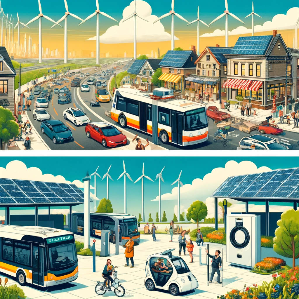
Neighborhoods overheat because cities store and re-radiate solar energy. Dark roofs, asphalt streets, parking lots, and masonry walls absorb heat during the day and release it slowly after sunset, creating the urban heat island effect. Limited vegetation compounds the problem by reducing evapotranspiration, the cooling process through which plants release water vapor. Street geometry also matters. In wide, treeless corridors, pavement can reach temperatures well above surrounding air temperature. In enclosed street canyons with poor airflow, heat lingers even when direct sun is blocked. Waste heat from vehicles, air conditioners, industry, and power systems adds another layer, especially in dense districts.
The greatest risk falls on older adults, infants, outdoor workers, people with cardiovascular or respiratory disease, and residents without reliable cooling. Poor housing quality magnifies exposure. Upper-floor apartments with low insulation, west-facing windows, and no exterior shading can remain dangerously hot overnight. I have seen building assessments where indoor temperatures stayed above 30 degrees Celsius long after sunset, even when the daily maximum had passed. Social conditions matter just as much. If residents cannot safely walk to shade, a cooled library, a transit stop, or a clinic, neighborhood heat becomes a public health emergency rather than a comfort issue. That is why heat-ready neighborhood design begins with exposure mapping and vulnerability mapping together, not separately.
Street layout, shade, and surface materials that reduce heat at the source
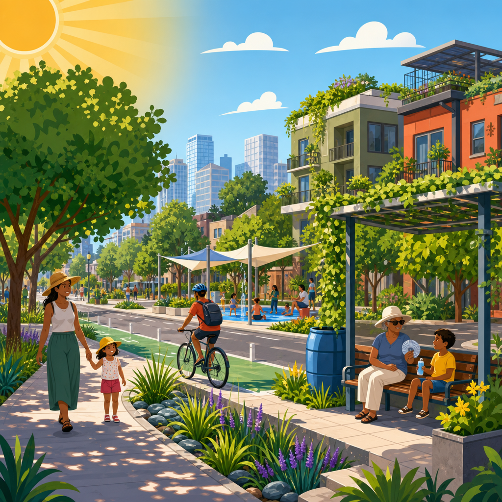
The fastest way to improve outdoor thermal comfort is to reduce how much solar energy streets and public spaces absorb. In neighborhood planning, that means prioritizing tree canopy, high-albedo materials where appropriate, and street dimensions that balance shade, airflow, and access. Mature trees are often the most effective visible intervention because they lower mean radiant temperature, cool surfaces, and make walking possible during peak afternoon hours. Species selection matters. Urban foresters typically favor drought-tolerant, site-appropriate trees with broad canopies, strong branch structure, and root systems compatible with sidewalks and utilities. Planting plans should include soil volume targets, irrigation strategies during establishment, and maintenance funding, because survival rates determine whether promised canopy becomes real canopy.
Surface materials require more nuance than simply choosing the lightest option. Cool pavements can lower surface temperatures, but some materials increase glare or reflected radiation for pedestrians if deployed without shade. Cool roofs perform better on buildings than highly reflective paving does in pedestrian-heavy public spaces. Permeable pavements can help manage stormwater and sometimes reduce sensible heat, yet their performance depends on local climate, maintenance, and subbase design. In hot neighborhoods, I recommend treating streets as layered systems: continuous shade over sidewalks, reduced exposed asphalt width where traffic volumes permit, traffic calming to cut vehicle heat and emissions, and pocket spaces with seating under canopy every short walking interval. A shaded five-minute walk changes behavior; an unshaded one often deters it completely.
Parks, blue-green infrastructure, and the cooling network approach
Single parks help, but isolated green spaces do not create citywide resilience. Heat-ready neighborhood design works best as a connected cooling network linking parks, schoolyards, courtyards, bioswales, greenways, and shaded sidewalks. This network gives residents repeated access to lower-temperature spaces throughout daily routines. Blue-green infrastructure adds cooling through shade, evapotranspiration, and in some cases water presence, but planners need to be precise. Large lawns with intensive irrigation are rarely the best answer in water-stressed regions. More effective solutions often combine drought-resilient trees, understory planting, rain gardens, permeable surfaces, and targeted water features that are safe, maintainable, and designed for local conditions.
Schoolyards are especially valuable because they can function as daytime cooling assets and community refuges. Several cities have converted asphalt-heavy campuses into shaded, planted grounds with cooler play surfaces and stormwater capture. That type of retrofit improves child health, reduces runoff, and creates neighborhood cooling in one capital project. Green roofs and green walls can also contribute, especially where land is limited, though they should not be treated as substitutes for street trees at pedestrian level. Their strongest value is often building-scale insulation, habitat support, and stormwater retention. The practical planning lesson is simple: cooling infrastructure should be distributed, connected, and accessible, not concentrated in showcase projects that look good on a map but fail the everyday walking test.
Housing, buildings, and passive cooling standards that protect residents
Neighborhood heat resilience fails if housing traps heat indoors. Passive cooling should therefore be a baseline design principle for new development and retrofits. The most reliable measures include exterior shading, high-performance insulation, airtightness with controlled ventilation, reflective or vegetated roofs, operable windows positioned for cross-ventilation, and layouts that limit west-facing solar gain in the hottest climates. Thermal mass can help or hurt depending on diurnal temperature swing; in locations where nights stay hot, heavy materials without night flushing may retain too much heat. Building orientation and window-to-wall ratio matter because they influence both cooling loads and occupant comfort.
Mechanical air conditioning remains essential for many regions during extreme events, but dependence on it alone is risky. Power outages, high utility costs, and aging equipment can leave residents exposed exactly when heat peaks. That is why the best neighborhood strategies pair efficient cooling systems with passive survivability measures. Standards such as ASHRAE 55 for thermal comfort and public health guidance from the World Health Organization provide useful benchmarks, but local adaptation is crucial. In affordable housing projects, I have seen simple interventions outperform expensive add-ons: exterior roller shades, ventilated attics, lighter roof membranes, ceiling fans, and community rooms designed as cooled refuge spaces during emergencies. Building codes increasingly recognize overheating risk, yet enforcement and retrofit financing remain major gaps.
Mobility, public health, and community operations during heat waves
A heat-ready neighborhood must support safe movement and daily services even during severe heat. Transit stops need shade, seating, drinking water where feasible, and real-time information so riders do not wait in full sun longer than necessary. Sidewalks should be continuous, accessible, and shaded enough to connect homes with cooling centers, clinics, grocery stores, and pharmacies. Emergency planning should identify cooling hubs within easy reach of high-risk residents and coordinate opening hours with actual heat patterns, including nighttime heat events. Public communication matters too. Residents need clear messages about symptoms of heat exhaustion and heat stroke, when to seek help, and where cooled spaces are available.
Operations can be as important as physical design. Tree watering, pavement maintenance, utility coordination, and targeted outreach to isolated residents are all part of neighborhood performance. Heat action plans work best when they are place-specific rather than citywide documents detached from street conditions. The table below summarizes the most effective neighborhood-scale interventions and the implementation issues that usually determine success.
| Intervention | Primary benefit | Best use case | Main limitation |
|---|---|---|---|
| Street tree canopy | Reduces radiant heat and improves walkability | Residential streets, school routes, transit access corridors | Requires soil volume, irrigation, and long-term maintenance |
| Cool roofs | Lowers roof temperature and indoor cooling load | Low-rise housing, schools, commercial buildings | Less direct benefit to pedestrian comfort |
| Exterior window shading | Prevents solar heat gain before it enters buildings | Apartments, senior housing, west-facing façades | Needs resident usability and façade coordination |
| Shade at transit stops | Protects riders during peak heat exposure | Busy bus corridors and transfer points | Can be limited by right-of-way constraints |
| Cooling centers and refuge rooms | Provides immediate life-safety protection | Heat emergencies and power outage periods | Access fails without outreach and transportation |
Public health agencies increasingly use heat vulnerability indices to direct these measures. That is a strong practice because it combines land cover, age, income, health status, and housing conditions. The result is better targeting of limited budgets and fewer cosmetic projects in already advantaged districts.
Governance, measurement, and funding for long-term heat resilience
Lasting results depend on governance. Heat-ready neighborhood design requires planning departments, public health teams, utilities, parks agencies, housing authorities, school districts, and community organizations to work from shared maps and shared priorities. Without coordination, one department plants trees while another removes them for utility work, or a transit agency upgrades service without providing shaded waiting areas. Measurement should include both environmental and human outcomes: land surface temperature, air temperature, canopy coverage, indoor temperature in vulnerable housing, emergency call data, transit access to cooling sites, and resident-reported comfort. Remote sensing from Landsat and local mobile heat mapping can identify hot spots, but on-the-ground validation is essential because shade patterns and exposure differ block by block.
Funding usually comes from a mix of capital improvement budgets, resilience grants, stormwater programs, utility incentives, housing retrofits, and health-focused interventions. The most successful cities package heat work into projects that already have political support: street redesigns, school modernization, affordable housing preservation, and park upgrades. That approach speeds implementation and avoids treating heat adaptation as an optional extra. Equity should guide every investment decision. If cooling improvements raise property values but displace the residents most affected by heat, the neighborhood becomes cooler on paper and less just in reality. Anti-displacement tools, tenant protections, and affordable housing preservation belong in heat policy because social stability is part of climate resilience.
Heat-ready neighborhood design for extreme summer temperatures succeeds when cooling is treated as a daily public good, not an emergency-only response. The core principles are consistent across climates: reduce absorbed heat, expand shade, connect green infrastructure, improve passive building performance, protect access to transit and services, and target the most vulnerable residents first. In my experience, the neighborhoods that perform best are not those with the flashiest single project. They are the ones where small, coordinated decisions add up: shaded sidewalks, cooler roofs, safer apartments, planted schoolyards, reliable cooling centers, and operations teams that prepare before forecasts turn dangerous. That integrated approach lowers health risk, improves comfort, reduces energy demand, and supports neighborhood life during longer and harsher summers.
For sustainable urban development, this topic is a true hub because every related issue connects back to it: housing quality, public space, infrastructure, mobility, health, equity, and governance. If you are setting priorities, start with a heat map, a vulnerability map, and a walk through the neighborhood at the hottest hour of the day. Then invest where exposure and need overlap most. That is how extreme heat planning becomes practical, measurable, and genuinely protective. Use this framework to evaluate your own district, identify the weakest links, and turn them into the next phase of neighborhood resilience work.
Frequently Asked Questions
What does “heat-ready neighborhood design” actually mean in practice?
Heat-ready neighborhood design means shaping streets, buildings, public spaces, and infrastructure so a community can stay safer, cooler, and more functional during extreme summer heat. In practice, it goes well beyond planting a few trees or adding reflective pavement. A heat-ready neighborhood is planned to reduce heat buildup at multiple scales: the building scale, where shaded facades, cool roofs, operable windows, insulation, and passive cooling strategies help homes and businesses stay livable; the street scale, where tree canopy, shade structures, permeable materials, and narrower heat-absorbing surfaces lower pedestrian exposure; and the district scale, where land use, transit access, green space, stormwater features, and emergency services are coordinated to support resilience during prolonged hot weather.
It also means designing for the full heat profile, not just peak afternoon temperatures. Dangerous heat includes warm nights that prevent the body from recovering, high humidity that limits evaporative cooling, intense solar radiation that makes outdoor conditions harsher than the air temperature suggests, and multi-day heat events that strain power systems, public health, and transportation. A truly heat-ready neighborhood accounts for all of these factors. It prioritizes thermal comfort in public areas, protects vulnerable populations such as older adults and outdoor workers, maintains access to cooling and hydration, and reduces the likelihood that residents will be trapped in overheated homes or disconnected from essential services.
Why are extreme summer temperatures such a major concern for neighborhood planning?
Extreme summer temperatures are a major planning issue because heat is one of the most widespread and deadly climate-related hazards in cities and suburbs. Unlike dramatic disasters that cause visible physical damage, heat often harms people quietly through dehydration, heat exhaustion, heat stroke, cardiovascular stress, worsened respiratory illness, sleep disruption, and increased risk for those with chronic medical conditions. Neighborhood design plays a direct role in how severe these impacts become. Areas with little shade, large expanses of asphalt, dark roofing, sparse vegetation, poor ventilation, and limited access to cooling can trap and radiate heat long after sunset, creating urban heat island conditions that raise both surface and air temperatures.
Planning matters because heat exposure is not distributed evenly. Lower-income communities, renters, neighborhoods with less tree canopy, and areas dominated by parking lots, industrial uses, or older inefficient housing often face higher thermal risk. Residents may also have fewer resources to adapt, such as home air conditioning, reliable transportation, or time and money to seek cooler environments. That makes heat both a design problem and an equity problem. Neighborhood planning decisions determine whether people can safely walk to transit, wait for a bus in the shade, sleep in tolerable indoor conditions, access cooling centers, and continue daily activities during heat waves. As summers become hotter, longer, and more intense, planning for heat is no longer optional; it is a public health, infrastructure, and resilience priority.
What design strategies help reduce heat exposure and lower neighborhood temperatures?
The most effective heat-reduction strategies work together rather than in isolation. Expanding healthy tree canopy is one of the strongest tools because trees provide direct shade, cool surrounding air through evapotranspiration, and improve outdoor comfort on sidewalks, playgrounds, and residential streets. High-albedo or “cool” materials on roofs and selected paved surfaces can reflect more solar radiation and reduce surface heat buildup, while green roofs and vegetated spaces help moderate temperatures and manage stormwater. Building orientation, setbacks, and massing can be arranged to create shade, preserve airflow, and avoid long unprotected stretches of pavement exposed to full afternoon sun.
Street design is equally important. Heat-ready neighborhoods use shaded walking routes, covered transit stops, pocket parks, cooling corridors, drinking water access, and seating placed under trees or canopies so people can move through the area without dangerous exposure. Public spaces should include a mix of natural and built shade, heat-tolerant planting, and materials that do not intensify radiant heat. At the building level, passive survivability is critical: better insulation, external shading, cross-ventilation, efficient cooling systems, and backup power where appropriate help keep indoor spaces safer during grid stress or outages. Many neighborhoods also benefit from reducing unnecessary dark impervious surfaces, retrofitting parking areas, integrating water-sensitive landscape features where suitable, and making sure schools, libraries, community centers, and other public buildings can function as accessible cooling resources during prolonged heat events.
How can heat-ready design improve public health and daily quality of life?
Heat-ready design improves public health by reducing both direct exposure to dangerous temperatures and the secondary impacts that follow prolonged heat. Shaded streets, cooler homes, and accessible cooling spaces lower the risk of heat-related illness, especially for children, seniors, people with disabilities, pregnant individuals, and residents with heart, lung, or metabolic conditions. Cooler nighttime environments are especially valuable because recovery during sleep is essential; when neighborhoods stay hot after sunset, stress on the body accumulates over multiple days. Design that reduces retained heat can therefore have measurable health benefits even when daytime highs remain extreme.
Quality of life also improves in practical, everyday ways. People are more likely to walk, use transit, shop locally, and spend time outdoors when public spaces are comfortable rather than punishing. Families can use parks and playgrounds more safely, workers face less risk during commutes and outdoor tasks, and residents are less isolated in overheated homes. Cooling-focused design can also lower energy demand by reducing the need for mechanical air conditioning, which helps with household affordability and grid reliability. In that sense, heat-ready design is not only about emergency response; it creates neighborhoods that are healthier, more usable, and more socially connected throughout the hottest months of the year.
What should cities, developers, and communities prioritize first when creating heat-ready neighborhoods?
The first priority should be identifying where heat risk is highest and who is most affected. That means combining temperature data, land cover analysis, public health information, housing conditions, and demographic patterns to locate neighborhoods with low canopy, high surface temperatures, high energy burden, and populations more vulnerable to heat stress. Once those hotspots are identified, decision-makers should focus on actions that deliver immediate protection as well as long-term resilience. Near-term steps often include expanding shade at transit stops, schools, sidewalks, and public gathering areas; opening and promoting trusted cooling spaces; improving drinking water access; and targeting home weatherization and cooling assistance to residents most at risk.
Longer-term priorities should include updating zoning, design standards, capital improvement plans, and development review processes so heat resilience becomes a routine requirement rather than a one-off project. Cities and developers should require shade planning, canopy preservation and expansion, heat-conscious material choices, passive cooling features, and public realm design that supports safe movement during extreme weather. Communities should be involved from the start, because residents know which routes lack shade, which homes overheat, and which facilities are actually accessible during emergencies. The strongest heat-ready neighborhoods are built through cross-sector coordination among planners, public health agencies, utilities, housing providers, landscape professionals, emergency managers, and local residents. That collaboration ensures solutions are practical, equitable, and durable as summers continue to intensify.