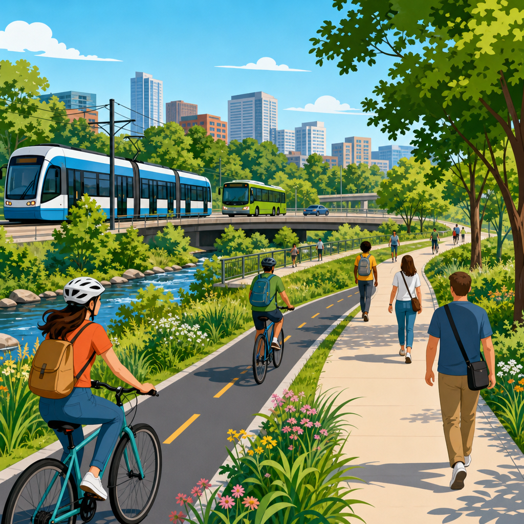
Greenways are often described as parks, trails, or scenic corridors, but that framing misses their most important urban function: they can operate as mobility infrastructure. When designed for daily trips instead of occasional leisure, greenways connect homes to jobs, schools, transit stations, shops, and public services with safe, low-stress routes. In transportation planning, mobility infrastructure means the physical network that moves people reliably and efficiently. That includes roads, sidewalks, rail lines, bus lanes, cycle tracks, bridges, and, increasingly, linear green corridors built for active travel. Treating greenways as mobility infrastructure changes how cities plan budgets, design standards, maintenance, and performance measurement.
The distinction matters because recreation space is usually funded, managed, and evaluated differently from transportation assets. A trail in a park may close at dusk, lack winter maintenance, or end abruptly at a major road. A mobility corridor cannot. It needs lighting where appropriate, year-round access, direct routing, wayfinding, safe crossings, universal design, and links to the wider transport network. I have worked on corridor audits where a path looked attractive on a map but failed commuters because crossings added ten minutes, entrances were hidden, and bike parking at destinations was absent. Those details determine whether a greenway serves Sunday outings or everyday travel.
Greenways also matter because they solve multiple city problems at once. They expand transport choice, reduce traffic pressure, support public health, lower household transportation costs, and add climate resilience through stormwater management and urban cooling. The best examples show that a greenway is not an amenity on the side of the transport system; it is part of the system. Cities from Copenhagen to Bogotá to Seoul have proved that when green corridors are connected, legible, and protected, people use them for commuting, school trips, and station access at meaningful scale. That is why urban leaders should classify, fund, and manage greenways as core mobility infrastructure.
What makes a greenway true mobility infrastructure
A greenway becomes mobility infrastructure when it meets the same practical standards users expect from any transport corridor. First, it must connect origins and destinations people reach regularly. A path that circles a lake may be pleasant, but a corridor linking dense neighborhoods to an employment center and a rail station has mobility value. Second, it must be direct. People walking or cycling tolerate only limited detours before shifting to more convenient routes. In network analysis, directness and connectivity are stronger predictors of use than landscape quality alone. Third, it must be safe, both from traffic conflicts and personal security risks. Protected intersections, clear sightlines, lighting policies matched to context, and passive surveillance from adjacent uses all shape whether riders and walkers choose the route daily.
Design width and surface quality matter as much as route alignment. Shared-use paths that are too narrow create conflict between pedestrians, runners, micromobility users, and cyclists traveling at different speeds. Guidance from AASHTO and NACTO makes clear that expected volumes, separation needs, and access points should drive dimensions. On commuter-heavy corridors, I have seen striping and centerlines fail once peak-hour bike traffic grows. In those cases, separate walking and cycling zones or parallel facilities become necessary. Surface continuity is equally important. Tree-root heave, ponding, debris, and poor drainage quickly reduce comfort and safety, especially for wheelchair users, parents pushing strollers, and older adults. If a city would not accept those conditions on a downtown sidewalk, it should not accept them on a transport greenway.
Operations are another defining feature. Mobility corridors require regular inspection, snow and ice clearance where relevant, pavement repair, vegetation management, emergency access protocols, and clear rules for delivery, maintenance, and event closures. This sounds mundane, but it is what separates a transport asset from a decorative one. The most successful cities assign ownership and service levels clearly across parks, transportation, and public works departments. Without that governance, greenways become everyone’s asset and no one’s responsibility.
Why the recreation-only model fails cities
When cities treat greenways primarily as leisure space, they underbuild the very features that make networks useful. Hours may be limited. Entrances may favor scenic overlooks instead of desire lines from nearby streets. Crossing design may prioritize vehicle flow over uninterrupted pedestrian and cycling movement. Signage may highlight heritage interpretation but omit travel times to schools, commercial districts, or transit hubs. These choices reduce practical utility even when the corridor itself is beautiful.
The recreation model also distorts funding. Park budgets often compete with playgrounds, sports facilities, and landscaping, while transport funds target congestion, safety, and mode shift. A greenway positioned only as open space may struggle to secure capital for grade-separated crossings, bridge retrofits, or protected approaches on city streets. Yet those expensive links are exactly what unlock network value. I have reviewed projects where ninety percent of the route was complete, but one hostile arterial crossing kept commuting volumes low. Once the crossing was rebuilt with signal priority, refuge islands, and protected geometry, counts rose sharply because the corridor finally functioned as a door-to-door route.
There is also an equity problem. Recreation framing tends to favor flagship projects in already advantaged districts where waterfronts, former rail lines, or high-visibility public spaces attract philanthropy and political support. Mobility framing pushes planners to ask different questions: Which neighborhoods lack safe access to jobs? Where do students walk along dangerous roads? Which transit stations have the largest bike catchment gaps? That shift often redirects investment toward communities where transport burden is highest and car ownership is lowest. In practice, this means greenways should be planned using accessibility analysis, crash data, and demographic indicators, not just land availability and scenic potential.
How greenways integrate with the wider transport network
A greenway works best as one link in an interconnected mobility system. It should feed into sidewalks, protected bike lanes, transit stops, plazas, and local streets designed for low vehicle speeds. The goal is not to create isolated ribbons of quality surrounded by hostile conditions, but a coherent network where users can complete entire trips. In transport terms, access and egress are as important as the main corridor. If reaching the greenway requires crossing a six-lane arterial without protection, many potential users will never start the trip.
Transit integration is especially important. Most rail and bus rapid transit stations have a larger potential catchment area for bikes than for walking alone. Safe greenway access can extend that reach without requiring more parking. The Dutch concept of the fietsstraat and the wider station-access model show how bike-friendly corridors support rail ridership. In North America, trails that connect directly to stations with secure parking, ramps instead of stairs, and fare gates designed for bikes consistently perform better than routes that terminate nearby but not at the station threshold. Small design decisions determine whether the transfer feels seamless or frustrating.
Intersections deserve special attention because they are where networks usually fail. A corridor may be continuous for miles, yet one multilane crossing with long signal waits destroys reliability. Best practice includes raised crossings on side streets, protected intersection geometry, median refuges, bicycle signal phases, and turning-radius reductions that slow vehicles. Wayfinding should use travel times and destination names, not just trail branding. For example, signs that say “Central Station 8 min by bike” or “Jefferson High 12 min walk” support everyday decision-making far better than purely recreational markers.
| Mobility criterion | Recreation-focused greenway | Mobility-focused greenway |
|---|---|---|
| Primary purpose | Leisure and scenic use | Daily access to destinations |
| Route design | May prioritize views and meanders | Prioritizes directness and continuity |
| Crossings | Basic or infrequent treatments | Protected, frequent, delay-minimizing |
| Operations | Seasonal or limited maintenance | Year-round service standards |
| Metrics | Visits and event activity | Trips, mode shift, safety, access |
| Network role | Standalone amenity | Integrated transport corridor |
Public health, climate, and economic benefits of mobility greenways
The strongest argument for greenways as infrastructure is that they deliver transport outcomes while producing co-benefits cities already need. On public health, they support routine physical activity embedded in daily life, which is more durable than exercise requiring extra time and money. Research published in journals such as The Lancet Public Health and guidance from the World Health Organization consistently link walking and cycling access to lower chronic disease risk, improved mental well-being, and better air quality outcomes when car trips are displaced. The key is routine use. A mobility greenway encourages five short weekday trips, not just a weekend ride.
Climate resilience is another major benefit. Linear green corridors can absorb stormwater through bioswales, permeable edges, restored riparian zones, and tree canopy that reduces heat exposure. This does not replace conventional drainage engineering, but it can reduce runoff volume and improve microclimate along travel routes. In hot weather, shade is not aesthetic icing; it is functional infrastructure that affects whether vulnerable users can walk or cycle safely. Cities like Melbourne and Barcelona increasingly treat shade access and surface temperature as mobility design issues, especially for school routes and aging populations.
Economic impacts are equally concrete. Households save money when safe non-car travel becomes realistic for short and medium trips. Cities benefit when road space pressure eases, local retail gains from higher footfall, and employers can draw from a larger labor pool without added parking demand. Property value effects often receive attention, but planners should be careful: rising values can improve the tax base while also increasing displacement risk. That is why mobility greenway policy should be paired with affordability tools, anti-displacement strategies, and equitable investment in surrounding neighborhoods.
Planning, measurement, and governance for successful corridors
To build greenways that function as infrastructure, cities need transport-grade planning methods. Start with origin-destination analysis, latent demand mapping, crash history, school travel patterns, and transit access gaps. Then test corridor options for directness, gradient, crossing complexity, and connection quality at both ends. This work is less glamorous than a rendering, but it determines performance. I have found that desire-line mapping and intercept surveys often reveal practical needs that standard park consultations miss, such as shift workers needing early access or caregivers requiring wider turns for cargo bikes and mobility devices.
Measurement should move beyond annual visitor counts. Useful indicators include commute share, percentage of residents within a safe access radius, average crossing delay, serious injury reduction, transit station bike access rates, and maintenance response times. Automated counters, before-and-after studies, and user surveys all have value, but they should be tied to clear goals. If the objective is school access, evaluate student trip changes. If the objective is transit connection, measure linked trips and parking demand at stations. What gets measured gets funded, and what gets funded gets maintained.
Governance must also be explicit. Transportation departments usually understand service levels, asset management, and safety auditing. Parks departments often lead on landscape stewardship and programming. Public works handles drainage, lighting, and repairs. Successful greenway programs define roles across all three. They also establish design standards, maintenance schedules, and closure protocols in writing. Without that coordination, one agency plants dense vegetation for habitat while another worries about sightlines, and users experience the result as inconsistency. Strong governance turns a corridor into a dependable public asset.
Greenways should no longer sit in the mental category of nice-to-have recreation space. They are transport corridors that can move large numbers of people safely and affordably when they are designed for direct trips, integrated with transit and street networks, and maintained to year-round standards. Cities that understand this shift unlock more than park value: they gain healthier travel options, lower transport costs, safer school routes, and infrastructure that supports climate adaptation at the same time.
The practical lesson is simple. Plan greenways using the same seriousness applied to roads, rail, and sidewalks. Fund crossings, not just landscaping. Measure trips, not just visits. Design entrances around where people actually live and go. Coordinate parks, transportation, and public works so service levels are clear. If a corridor cannot reliably carry someone to work, school, or a station, it is not yet fulfilling its potential.
For leaders working on sustainable urban development, this is the standard worth adopting now. Review your existing trail network as a mobility system, identify the missing links and unsafe crossings, and prioritize upgrades where daily access needs are greatest. When greenways are treated as essential infrastructure, cities become easier to move through, more resilient, and more equitable for everyone.
Frequently Asked Questions
What does it mean to treat greenways as mobility infrastructure instead of just recreation space?
Treating greenways as mobility infrastructure means designing and evaluating them as part of the everyday transportation network, not only as places for walking, jogging, or weekend cycling. In practical terms, a greenway should help people get from home to work, school, transit stops, grocery stores, health care, and other daily destinations safely and efficiently. That shifts the planning focus from scenery and leisure amenities alone to directness, continuity, accessibility, lighting, crossings, wayfinding, and reliable year-round use. A transportation-oriented greenway is expected to function like other pieces of infrastructure: it should connect important origins and destinations, reduce barriers to movement, and support predictable travel for people of different ages and abilities.
This distinction matters because many cities already have paths that are pleasant but not useful for daily trips. A route may be beautiful yet disconnected, indirect, poorly lit, or difficult to access from surrounding neighborhoods. When greenways are planned as mobility corridors, those weaknesses become design priorities to solve. The result is a low-stress network that expands transportation choice, especially for people who cannot or do not want to rely on a car. In that sense, greenways are not a secondary amenity. They can be a core part of urban mobility systems, complementing sidewalks, bike networks, bus routes, and rail service.
How can greenways improve everyday transportation in cities and suburbs?
Greenways improve everyday transportation by creating protected, comfortable routes that connect people to common destinations without requiring them to travel on high-speed or high-stress roads. For many potential walkers, cyclists, wheelchair users, and people using scooters or strollers, the biggest barrier is not distance alone but traffic danger and network gaps. A well-designed greenway addresses that problem by offering continuous corridors separated from fast vehicle traffic and by linking neighborhoods to schools, employment centers, commercial areas, parks, civic buildings, and transit hubs. That makes short and medium-length trips far more realistic without a car.
They also improve network efficiency by filling in missing connections where the street system is incomplete or hostile. In many places, rail lines, waterways, utility corridors, and underused rights-of-way can become direct paths that bypass circuitous street layouts. This can shorten trip times and make active travel more competitive for daily errands and commutes. Greenways can also extend the reach of public transportation by helping people get to bus stops and train stations safely. When that first-mile and last-mile access is comfortable and dependable, transit becomes more useful overall. In both urban and suburban contexts, greenways work best when they are integrated into broader transportation planning rather than treated as isolated trail projects.
What design features make a greenway useful for commuting and daily trips?
A greenway that supports commuting and everyday travel needs more than an attractive path. It needs continuous routing, direct connections, safe road crossings, and design standards that reflect frequent use at different times of day and in all seasons. Width matters, especially where people walking, cycling, rolling, and jogging share space. Surface quality matters too, because rough or inconsistent pavement can make a route uncomfortable or inaccessible for wheelchairs, mobility devices, cargo bikes, and families with strollers. Good drainage, maintenance, snow and debris removal, and clear markings are essential if the greenway is meant to function as dependable infrastructure rather than a fair-weather amenity.
Access and safety are equally important. Entry points should connect naturally to surrounding streets, sidewalks, bike lanes, bus stops, and neighborhood destinations. Intersections with roads should prioritize visibility and user protection through treatments such as raised crossings, signals, refuge islands, reduced turning speeds, and traffic calming where appropriate. Lighting, sightlines, and wayfinding help make a route usable early in the morning, at night, and by people unfamiliar with the area. Amenities like benches, shade, drinking water, and rest areas can still play a role, but the core question is whether the greenway supports reliable movement. If someone can confidently use it to reach work, school, or transit on a regular schedule, it is functioning as mobility infrastructure.
Why are greenways important for safety, equity, and transportation access?
Greenways can play a major role in improving safety because they offer lower-stress alternatives to dangerous road environments. Many streets were designed primarily around vehicle throughput, leaving little room for people walking or cycling comfortably. Protected greenway corridors reduce exposure to traffic, simplify route choice, and create space where users of different ages and confidence levels can travel with greater comfort. This is especially important for children going to school, older adults, new cyclists, and people using mobility devices who may be excluded by conventional roadway design.
From an equity perspective, greenways are most valuable when they expand real transportation access for communities that have historically faced mobility barriers. That includes households without reliable car access, lower-income residents with high transportation costs, people with disabilities, and neighborhoods that have been cut off by highways, industrial land, or unsafe arterial roads. A greenway can reduce those barriers if it is planned with equitable access in mind: multiple entry points, ADA-conscious design, connections to essential destinations, safe crossings, and investment that reaches underserved areas rather than only already advantaged districts. In that way, greenways are not just environmental or recreational projects. They can support more affordable, inclusive, and practical mobility for people whose daily transportation options are often limited.
How should cities measure whether a greenway is successful as transportation infrastructure?
Cities should measure greenway success using transportation outcomes, not just counts of leisure use or general public satisfaction. A strong evaluation framework looks at connectivity to key destinations, frequency of daily-trip use, access to transit, travel time benefits, safety performance, and year-round reliability. Planners should ask whether the greenway closes important network gaps, whether it increases the number of people who can reach jobs or schools without a car, and whether it improves first-mile and last-mile transit access. User counts remain useful, but they should be paired with origin-destination analysis, commute patterns, and data on who is using the corridor and for what purposes.
It is also important to assess equity and usability. Are surrounding neighborhoods able to access the greenway conveniently, or is it difficult to enter? Are crossings safe and legible? Is the route maintained consistently in rain, heat, snow, and darkness? Are people with disabilities able to use it comfortably? Cities should track crash reduction, perceived safety, mode shift, and maintenance response over time. Surveys can help identify whether users rely on the greenway for commuting, school trips, shopping, and transit connections, rather than only recreation. When a greenway measurably improves daily movement, broadens transportation choice, and functions as a trusted part of the network, it is succeeding as mobility infrastructure.