Urban mobility does more than move people from one address to another; it determines how cities look, how neighborhoods grow, how public space is shared, and how daily life feels at street level. In practice, urban mobility includes every system that enables movement within a city: sidewalks, bike lanes, buses, rail, taxis, delivery networks, ride-hailing, private cars, curb management, accessibility design, and increasingly the digital tools that coordinate all of them. Cityscapes, by contrast, are the visible and lived form of the city, from skyline and block pattern to street trees, plazas, storefronts, parking lots, and the width of a crossing. After years of working on transportation content and reviewing plans from transit agencies, metropolitan planning organizations, and municipal design departments, I have seen the same principle confirmed repeatedly: transportation decisions are land use decisions in disguise. When a city chooses where vehicles go, where people wait, how goods are delivered, and who gets priority at intersections, it is also choosing what gets built, what survives, and what kind of public realm residents inherit.
This matters because mobility systems create powerful incentives that shape development over decades. A rail station can support compact housing, offices, and retail within walking distance. A highway interchange can trigger low-density commercial strips, larger setbacks, and acres of surface parking. Frequent buses can keep a corridor economically active without requiring every visitor to drive. Safe sidewalks and protected cycling infrastructure can increase foot traffic, support small businesses, and reduce dependence on car storage. Accessibility standards such as the Americans with Disabilities Act, universal design principles, tactile paving, curb ramps, and audible crossing signals influence not only legal compliance but also the practical inclusiveness of streets and stations. As cities face climate targets, housing shortages, traffic congestion, freight growth, public health concerns, and budget constraints, the role of urban mobility in shaping cityscapes becomes impossible to treat as a niche planning topic. It is one of the central forces behind whether a city feels connected or fragmented, human-scaled or hostile, resilient or brittle.
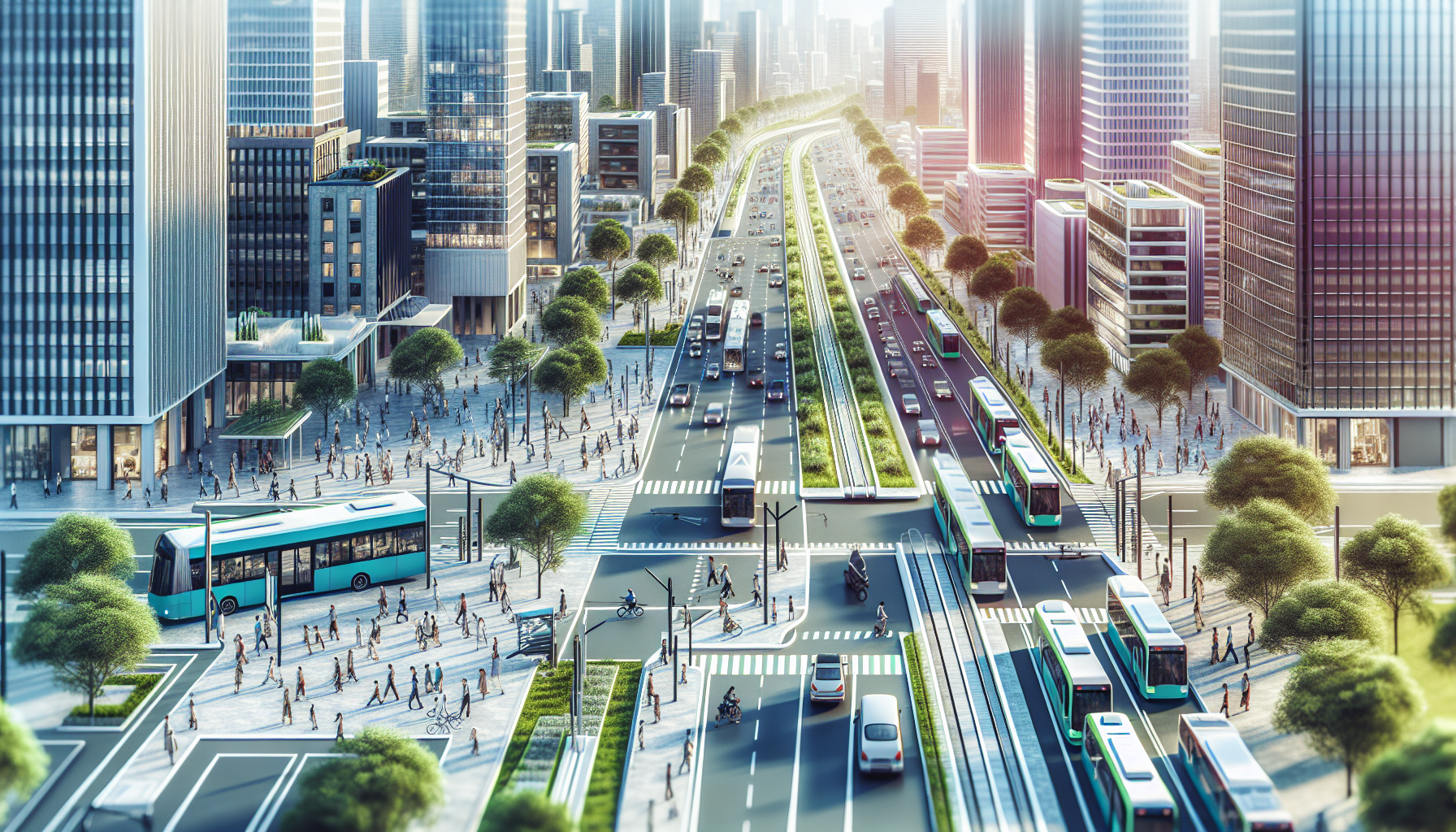
Mobility Networks as the Hidden Blueprint of Urban Form
The built environment typically follows the strongest transportation network available. Historically, streetcar lines guided growth along linear corridors, producing walkable districts with mixed uses clustered near stops. Later, widespread automobile access and road expansion supported suburbanization, superblocks, drive-through retail, and zoning patterns that separated homes from jobs and services. That historical shift is visible in countless cities. In Los Angeles, early transit corridors helped create dense commercial nodes long before freeway construction scattered growth across a larger urban footprint. In Copenhagen, sustained investment in cycling and transit reinforced compact development and active public space. In Curitiba, bus rapid transit was coordinated with land use policy so density rose along major transit axes rather than randomly across the urban area. These are not abstract planning stories; they are examples of mobility systems acting as a physical template for building type, parcel value, and street design.
Road geometry alone can change the character of a place. Wide lanes, high design speeds, and long signal cycles encourage through-traffic and suppress street life. Narrower lanes, shorter crossings, raised intersections, median refuges, bus bulbs, and curb extensions slow vehicles and make space legible for people. When engineers and planners use tools such as level of traffic stress for cycling, complete streets policies, transit signal priority, and road diets, they are not only improving safety metrics. They are changing storefront visibility, noise exposure, pedestrian dwell time, and the viability of outdoor seating, kiosks, and civic amenities. A corridor designed only for vehicle throughput often produces blank frontages and shallow social use. A corridor designed for multimodal access tends to support finer-grained activity and a more distinctive cityscape.
Transit, Density, and the Economic Logic of Place
High-capacity transit shapes cityscapes by concentrating value and activity around stations and frequent service corridors. The mechanism is straightforward: when many people can arrive without needing parking, land can be used for homes, offices, schools, and public amenities instead of vehicle storage. Transit-oriented development builds on this logic through moderate to high density, mixed uses, walkable blocks, and reduced parking requirements near reliable service. Cities such as Hong Kong, Tokyo, and parts of London demonstrate how rail access can support intense urban form with strong retail turnover and high pedestrian volumes. Even in North American contexts, station areas around systems such as Washington Metro or Vancouver SkyTrain show how transit access alters investment patterns, often increasing demand for apartments, neighborhood services, and public realm upgrades.
Transit quality matters as much as transit presence. In my review work, I have seen many corridors labeled transit rich that actually suffer from unreliable headways, poor shelter, weak wayfinding, or difficult transfers. Those weaknesses reduce the shaping power of the system. By contrast, when service is frequent enough that riders do not need to consult a timetable, and when stops are comfortable, safe, and integrated with sidewalks and bike access, urban form responds more strongly. Developers, retailers, and residents value certainty. This is why agencies measure not only route coverage but also frequency, span, reliability, and first-mile or last-mile connections. Transit that arrives every ten to fifteen minutes or better can materially change location decisions. Transit that is infrequent and uncomfortable rarely reshapes the city at the same scale.
| Mobility mode | Typical spatial effect | Common cityscape outcome |
|---|---|---|
| Heavy rail or metro | Concentrates high demand at stations | Dense mixed-use nodes, lower parking ratios, active ground floors |
| Bus rapid transit | Strengthens linear corridors | Mid-rise development, improved streetscape, faster redevelopment along avenues |
| Protected cycling network | Expands short-trip catchment area | More local retail visits, calmer streets, reduced curb pressure |
| Automobile-oriented arterial system | Prioritizes speed and vehicle storage | Setback buildings, large parking lots, fragmented pedestrian realm |
| Walkable street grid | Increases route choice and permeability | Fine-grained blocks, stronger street life, adaptable mixed-use fabric |
Street Design, Public Space, and Everyday Experience
The most immediate way urban mobility shapes cityscapes is through the design of streets themselves. In many cities, streets account for the largest share of public land, so their allocation has outsized visual and social consequences. A street dominated by moving and parked cars leaves little room for trees, seating, stormwater features, loading zones, protected bike lanes, or wider sidewalks. Reallocating even one lane can transform how a district functions. New York City’s redesign of Times Square and parts of Broadway showed that removing space from general traffic did not produce urban collapse; it created safer pedestrian areas, improved travel times on some avenues, and turned previously chaotic intersections into recognizable civic space. Similar lessons have emerged from superblock programs in Barcelona, low-traffic neighborhoods in London, and tactical urbanism pilots in cities from Bogotá to Melbourne.
Street design also affects public health and environmental performance. Vehicle-heavy corridors generate more local air pollution, traffic injury risk, and urban heat exposure, especially where pavement dominates and tree canopy is sparse. Multimodal design can counter these effects through lower speeds, fewer conflict points, more permeable surfaces, and shaded walking routes. The National Association of City Transportation Officials has popularized design guidance that many municipalities now use to implement transit lanes, protected intersections, bus boarding islands, and curbside management strategies. These interventions may appear technical, but their consequences are visible in façade activation, retail stability, and whether residents choose to spend time outdoors. When mobility planning is aligned with placemaking, the cityscape becomes not just more efficient but more livable.
Housing, Equity, and Access to Opportunity
Urban mobility shapes cityscapes unevenly, and that unevenness has deep social consequences. Transportation infrastructure has historically divided communities through highway construction, rail barriers, disinvestment, and zoning that privileged commuter access over neighborhood continuity. In many U.S. cities, mid-century freeway projects cut through Black and low-income neighborhoods, depressing property values locally while facilitating suburban commutes elsewhere. Today, the legacy remains visible in severed street grids, underused land, noise burdens, and weaker business districts. At the same time, improved mobility can create opportunity when it connects residents to jobs, schools, healthcare, and public services without imposing high travel costs. The cityscape that results is not neutral; it reflects who can reach essential destinations reliably and who cannot.
Equitable mobility planning therefore requires more than adding infrastructure. It requires affordability, accessibility, safety, and meaningful community input. Fare policy influences whether transit-oriented neighborhoods remain usable to the people who already live there. Sidewalk quality determines whether older adults, children, and people using wheelchairs can navigate daily routes independently. Lighting, maintenance, and stop placement influence personal security and actual usage. There is also a tradeoff planners must acknowledge honestly: better mobility and public realm improvements can raise land values and trigger displacement if housing protections are weak. Inclusionary zoning, anti-displacement funds, community land trusts, and parking reform paired with housing production can help preserve access. When cities integrate these policies, mobility investments are more likely to produce inclusive cityscapes rather than polished corridors that exclude long-term residents.
Freight, Logistics, and the Often Overlooked Layer of the City
Passenger travel gets most of the public attention, but freight mobility quietly shapes cityscapes every day. E-commerce growth, restaurant delivery, construction logistics, waste collection, and service vehicles all compete for curb space and street capacity. In dense districts, the absence of designated loading areas can turn travel lanes and bike lanes into ad hoc freight zones, degrading safety and reliability. Industrial land near ports, rail terminals, warehouses, and urban distribution centers influences surrounding building types, truck routes, noise patterns, and air quality. Cities that ignore freight planning often end up with disorderly curbs, blocked sidewalks, and rising conflict between deliveries and public space goals.
Better freight management can improve both function and form. Off-peak delivery programs, microhubs for cargo bikes, smart loading zones, and clearer curb regulations reduce street friction while supporting local business. European cities including Paris and Amsterdam have tested urban consolidation models that shift some last-mile deliveries to smaller, lower-emission vehicles. In North America, curb management platforms and digital permitting systems are helping cities allocate space dynamically rather than relying on static signs that no longer match demand. The visual result may seem subtle, but it matters: cleaner curbs, fewer double-parked vehicles, safer crossings, and more predictable use of limited street space. A well-managed logistics layer keeps the cityscape legible and functional.
Technology, Data, and the Next Generation of City Shaping
Digital technology increasingly mediates urban mobility, and this changes cityscapes in ways people often miss. Real-time arrival information influences whether transit feels dependable enough to anchor daily routines. Mobility-as-a-service platforms, integrated payment systems, and trip planning apps affect mode choice and therefore infrastructure demand. Shared bikes and scooters can expand access to transit, but if parking rules are weak they can clutter sidewalks and undermine accessibility. Automated traffic enforcement, adaptive signals, and curb sensors help cities manage scarce space with more precision. Data from sources such as General Transit Feed Specification, automatic passenger counters, connected vehicle pilots, and anonymized location analytics now informs everything from bus network redesigns to pedestrian safety programs.
Still, technology is not a substitute for sound street design or governance. I have seen cities invest heavily in apps while neglecting basics such as shelter, sidewalk continuity, or safe crossings. The physical city remains the decisive interface. Digital tools work best when they support clear policy goals: fewer serious injuries under Vision Zero frameworks, lower emissions through mode shift, more efficient curb use, or better access in underserved districts. Looking ahead, climate adaptation will make this integration even more important. Heat, flooding, and extreme weather will pressure cities to redesign streets with resilient materials, shade, drainage, and redundant transport options. The strongest cityscapes will be those built around mobility systems that are flexible, low-carbon, accessible, and designed for people first.
Urban mobility shapes cityscapes because movement systems determine where value concentrates, how public space is allocated, and which daily experiences a city makes easy or difficult. Transit supports density when service is frequent and reliable. Street design influences safety, commerce, comfort, and civic identity. Equity depends on whether infrastructure connects communities to opportunity without displacing them. Freight and digital coordination matter because curbs, deliveries, and real-time management affect how streets function block by block. Across all of these dimensions, the pattern is consistent: the city people see is the product of the mobility choices leaders make and residents accept.
For planners, developers, business owners, and residents, the practical lesson is simple. Evaluate transportation projects not only by travel speed but also by the kind of place they will create in five, ten, and twenty years. Ask what each lane, station, sidewalk, loading zone, and parking rule is teaching the city to become. If you are building an urban mobility and transportation strategy, use this hub as a starting point and explore the connected topics beneath it, from transit-oriented development and curb management to accessibility, cycling networks, street design, and freight planning. Better mobility does not just improve travel. It builds better cities.
Frequently Asked Questions
How does urban mobility influence the physical design of a city?
Urban mobility has a direct and lasting effect on the way a city is physically organized. The transportation choices a city prioritizes—whether private cars, public transit, walking, cycling, or shared mobility—shape street widths, block sizes, building placement, parking requirements, public plazas, and even the overall density of neighborhoods. When cities are designed primarily around cars, they often devote large amounts of land to roads, garages, surface parking, and wide intersections. That can create longer distances between destinations, reduce street-level activity, and make public space feel less inviting for pedestrians. By contrast, cities that invest in sidewalks, bike networks, reliable transit, and accessible street design typically produce more connected, human-scaled environments where homes, shops, schools, and workplaces are easier to reach without needing to drive everywhere.
Mobility also influences how public space is shared and perceived. A street is not just a traffic corridor; it is one of the city’s most visible and heavily used public spaces. Decisions about bus lanes, curb access, bike infrastructure, crosswalk design, street trees, benches, loading zones, and transit stops all affect how safe, comfortable, and attractive that space feels. In this way, urban mobility is a design tool as much as an engineering system. It can support lively, mixed-use streets with active storefronts and social interaction, or it can produce fragmented, vehicle-dominated corridors that are difficult to navigate and less welcoming. Over time, these choices influence everything from property values and development patterns to neighborhood identity and the everyday experience of being in the city.
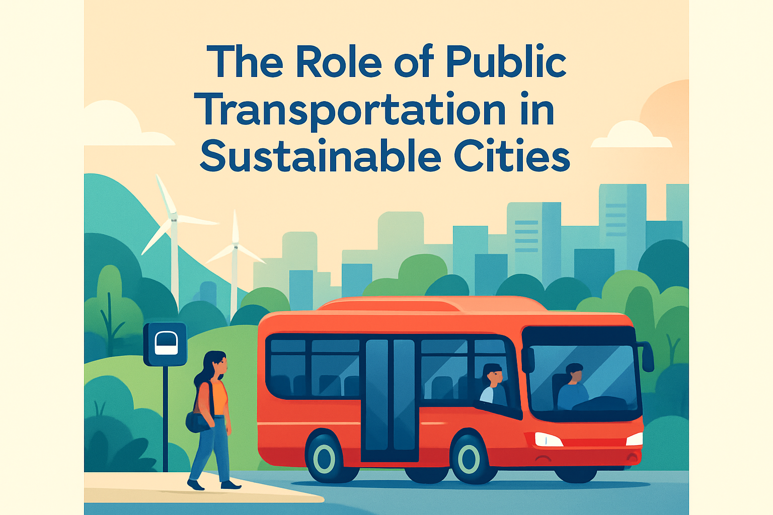
Why is public transportation so important in shaping cityscapes?
Public transportation plays a central role in shaping cityscapes because it allows cities to move large numbers of people efficiently without requiring as much space as private vehicles. A single rail line or high-capacity bus corridor can support dense clusters of housing, offices, retail, and civic uses, which often leads to more compact and walkable development. Transit stations become anchors for activity, and the areas around them frequently evolve into hubs of commerce, housing, and public life. This is why cities with strong transit systems often have more active streets, more visible pedestrian traffic, and more opportunities for mixed-use development than cities where most trips depend on cars.
Just as importantly, public transportation changes what a city needs to build. When residents can rely on buses, trams, subways, or commuter rail, cities can reduce pressure to add parking, widen roads, or spread development outward. That creates opportunities to use valuable land for parks, housing, public amenities, and local businesses instead of vehicle storage and road expansion. Transit also affects the visual rhythm of the city: station entrances, shelters, dedicated lanes, wayfinding systems, and transit plazas all become part of the built environment. Well-designed transit does more than improve movement; it helps create recognizable urban centers, supports more equitable access to opportunity, and encourages street life that gives neighborhoods character and vitality.
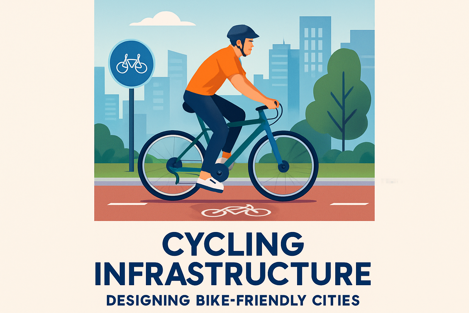
What role do walking and cycling play in creating better urban environments?
Walking and cycling are fundamental to healthy, appealing cityscapes because they operate at a human scale. Streets designed for pedestrians and cyclists tend to be safer, slower, more interactive, and more visually engaging than streets designed primarily for fast-moving traffic. Wide sidewalks, protected bike lanes, frequent crossings, shade, lighting, seating, and accessible curb ramps all contribute to a public realm where people feel comfortable spending time rather than simply passing through. That shift has major consequences for how neighborhoods function. It supports local businesses, encourages casual social interaction, improves safety through increased street presence, and makes urban areas feel more connected and alive.
These modes also influence land use and development patterns. When neighborhoods are walkable and bike-friendly, residents can reach daily needs within shorter distances, which supports mixed-use planning and reduces dependence on large parking facilities. This often results in finer-grained streetscapes with storefronts, housing, schools, and services woven more closely together. Walking and cycling infrastructure can also serve broader goals such as public health, environmental sustainability, and accessibility, especially when routes are continuous, intuitive, and inclusive for users of different ages and abilities. In practical terms, cities that take active mobility seriously often end up with more livable streets, stronger neighborhood identity, and public spaces that work better for everyone—not just for drivers.
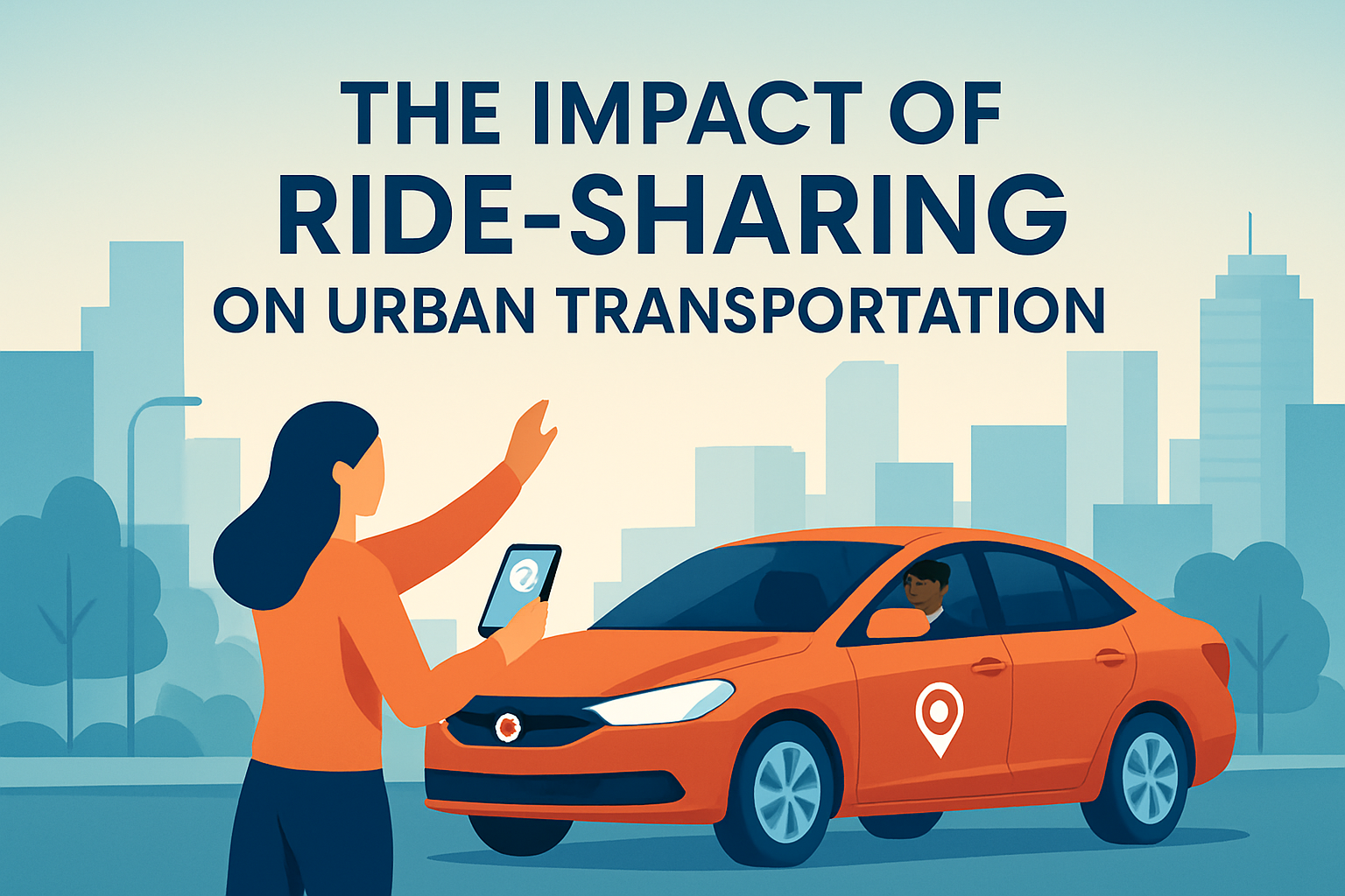
How do digital tools and new mobility services affect the modern cityscape?
Digital tools and new mobility services are increasingly shaping cityscapes by changing how movement is coordinated, managed, and experienced. Navigation apps, real-time transit information, ride-hailing platforms, shared bikes and scooters, digital ticketing, smart parking systems, and freight coordination tools all influence how people choose routes, modes, and travel times. These systems may seem invisible compared with roads or rail lines, but they have visible physical effects on city streets. For example, ride-hailing and delivery growth have intensified demand for curb space, prompting cities to rethink pickup zones, loading areas, parking rules, and street management. Likewise, micromobility services have created demand for protected lanes, parking corrals, charging systems, and clearer right-of-way design.
These technologies can improve convenience and flexibility, but they also introduce new planning challenges. Without careful regulation and integration, they can contribute to curb congestion, sidewalk clutter, uneven service distribution, and conflicts among users competing for limited street space. That is why digital mobility should be viewed as part of urban design and governance, not just as a consumer convenience. When cities integrate data, pricing, curb management, accessibility standards, and multimodal planning effectively, digital tools can support a more efficient and responsive urban environment. In that context, the modern cityscape is shaped not only by concrete infrastructure but also by the systems that organize movement in real time, influencing how space is allocated and how the street functions throughout the day.
Why is equitable and accessible mobility essential to the future of city development?
Equitable and accessible mobility is essential because a city’s transportation system determines who can participate fully in urban life. Access to jobs, education, healthcare, parks, retail, and social networks depends heavily on whether people can move safely, affordably, and conveniently through the city. If mobility systems are designed only for people who own cars or can navigate physically demanding, poorly connected infrastructure, the cityscape will reflect and reinforce inequality. Certain neighborhoods may become isolated, public spaces may exclude older adults and people with disabilities, and basic opportunities may remain out of reach for low-income residents. In contrast, when mobility planning includes accessible sidewalks, step-free transit, safe crossings, affordable fares, reliable service, and thoughtful connections across neighborhoods, the city becomes more inclusive in both function and form.
This has major implications for future development. Cities that prioritize equitable mobility are more likely to support balanced growth, reduce spatial segregation, and create public spaces that serve a wider range of users. Accessibility features such as tactile paving, audible signals, curb ramps, level boarding, and intuitive wayfinding are not minor additions; they are core design elements that influence how welcoming and usable the built environment is. Similarly, ensuring that underserved neighborhoods receive strong transit and safe street infrastructure can stimulate investment without making mobility a privilege reserved for a few. In the long term, equitable urban mobility helps shape cityscapes that are not only more efficient and sustainable, but also more just, resilient, and supportive of everyday life for all residents.