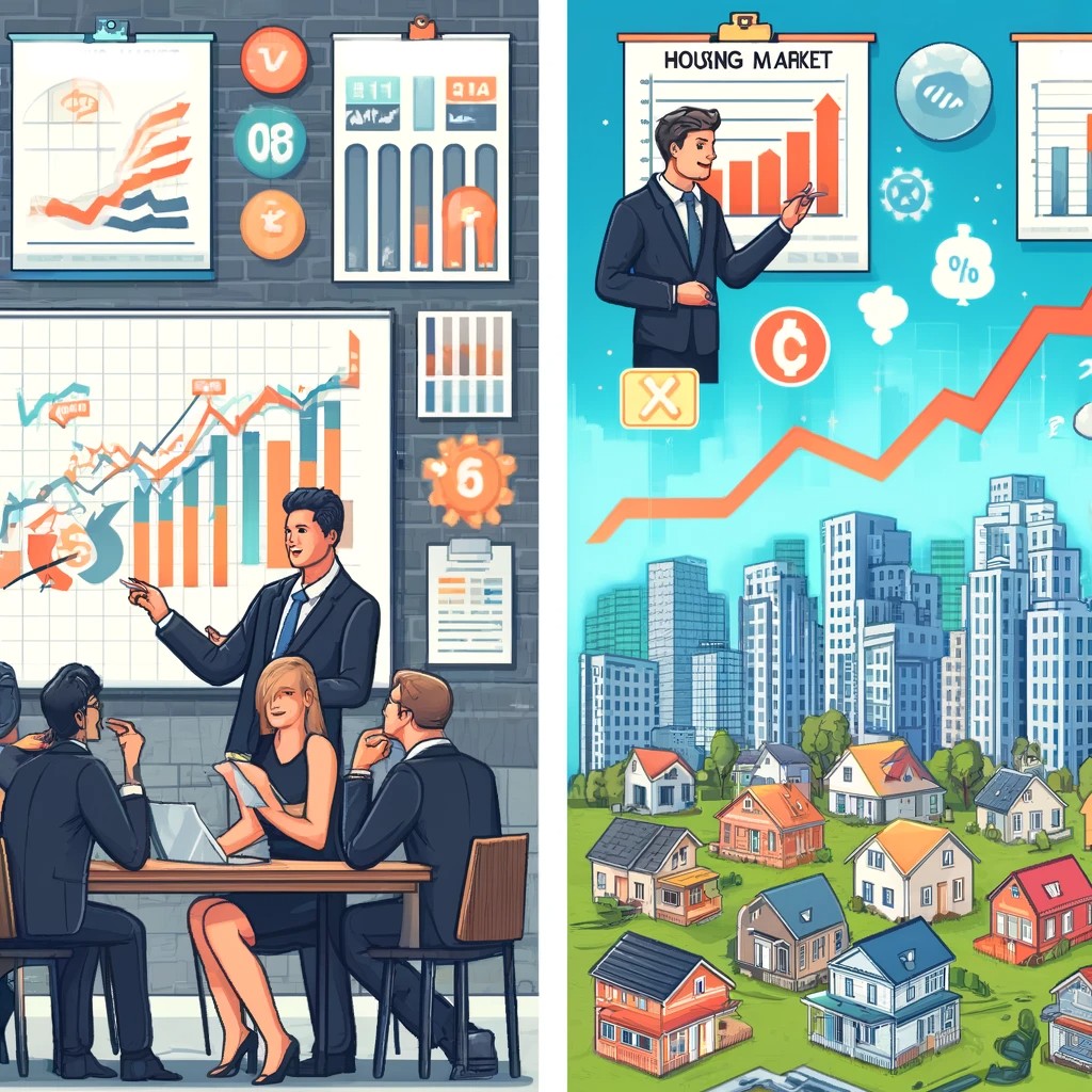
Urban heat is no longer a seasonal inconvenience; it is a measurable housing, health, and infrastructure risk that varies from one block to the next. When people ask how AI can help map urban heat risk block by block, they are really asking how cities, developers, landlords, insurers, and residents can identify where extreme heat is most dangerous and what to do about it. Urban heat risk combines land surface temperature, air temperature, humidity, building materials, tree cover, energy burden, and population vulnerability. A neighborhood with dark roofs, sparse shade, older housing stock, and many heat-sensitive residents can experience far worse outcomes than a nearby area with parks, reflective materials, and newer cooling systems.
I have worked with geospatial risk models used in property analysis, and the lesson is consistent: citywide averages hide the real problem. A metro may report a tolerable summer heat profile while specific corridors, apartment clusters, and industrial edges experience persistent nighttime heat, higher cooling costs, and elevated emergency calls. This matters for housing market trends because heat affects livability, insurance assumptions, renovation priorities, tenant demand, appraisal logic, and municipal capital planning. AI makes this work practical at scale by combining satellite imagery, street-level data, parcel records, utility signals, weather history, and demographic indicators into maps that show risk with far more precision than traditional heat studies alone.
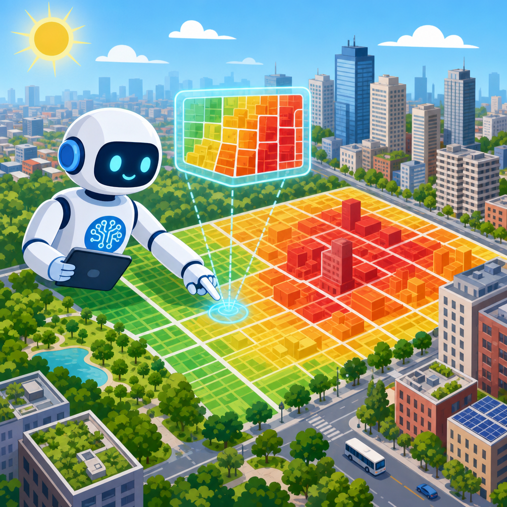
Block-by-block mapping does not mean guessing from a colorful map. It means using machine learning, computer vision, and spatial analytics to detect heat patterns, explain their causes, and forecast where exposure will worsen. The strongest systems integrate remote sensing data from Landsat, Sentinel, and ECOSTRESS, local weather station readings, lidar-derived canopy coverage, zoning and parcel data, and building characteristics such as roof type, height, age, and window-to-wall ratio. With those inputs, AI can classify hot spots, estimate exposure during daytime and overnight periods, and rank intervention options. For housing professionals, that turns abstract climate talk into site-specific decisions about acquisitions, retrofits, disclosures, and resilience planning.
What block-by-block urban heat mapping actually measures
Urban heat mapping measures more than temperature alone. In practice, useful models track heat exposure, heat retention, and vulnerability together. Exposure describes how hot a place gets during the day based on solar radiation, surface materials, shade, wind flow, and the surrounding built form. Retention describes how slowly that heat dissipates at night, which is critical because overnight recovery strongly affects health outcomes. Vulnerability captures who is exposed, including older adults, outdoor workers, renters in poorly insulated units, people without reliable air conditioning, and households already facing high energy bills.
AI improves this process because it can analyze many variables simultaneously and identify nonlinear relationships. For example, a block with moderate daytime temperatures may still rank as high risk because dense masonry buildings trap heat, tree canopy is low, and nighttime temperatures stay elevated. Another block near water may read cooler from a satellite but still expose residents because upper-floor apartments overheat and there is little indoor cooling. Traditional mapping often misses those distinctions. AI models can fuse thermal imagery, parcel boundaries, building permits, and socioeconomic data to estimate risk at the parcel, building, or street-segment level.
For housing market analysis, the distinction between surface temperature and lived heat matters. Asphalt parking lots and dark roofs may produce very high surface readings, but the real estate implications depend on how that heat affects interiors, HVAC loads, maintenance costs, and tenant satisfaction. A professionally built model therefore links outdoor heat indicators with building performance and occupancy patterns. That is how an analyst moves from “this block is hot” to “this multifamily asset faces elevated summer operating costs, lower comfort scores, and a stronger case for cool roof and shade investments.”
How AI builds a heat risk map from scattered data
The most effective urban heat models start with geospatial data engineering. Satellite thermal bands provide broad coverage, but they have tradeoffs in spatial and temporal resolution. Landsat offers established thermal data with moderate spatial detail, while Sentinel contributes land cover and vegetation metrics. ECOSTRESS, mounted on the International Space Station, can capture valuable thermal snapshots at varied times. AI systems combine those sources with local weather stations, mobile temperature sensors mounted on vehicles, building footprints, impervious surface layers, census indicators, and utility or assessor records where available.
Computer vision helps identify physical drivers of heat. Models can scan aerial imagery and street imagery to classify roof materials, detect tree canopy gaps, estimate shade coverage, and locate large paved surfaces. Natural language processing can add context by extracting cooling-related details from permit applications, inspection notes, or listing descriptions, such as references to window units, insulation upgrades, or roof replacements. Gradient boosting models, random forests, and convolutional neural networks are commonly used because they perform well with mixed structured and image-based data.
Prediction requires calibration. A reliable model does not rely on satellite data alone; it validates outputs against ground observations. In projects I have reviewed, the biggest quality gains came from correcting for time of day, seasonal differences, humidity, and canyon effects created by tall buildings. Analysts also need to normalize for cloud cover and understand that surface temperature is not identical to air temperature at pedestrian level. The best results come from ensemble approaches that estimate both. Once validated, the model can produce a heat risk score for each block and explain which factors are contributing most strongly, which is essential for policy and property decisions.
| Data source | What it adds | Example use in housing analysis |
|---|---|---|
| Landsat thermal imagery | Surface temperature patterns across the city | Find persistently hot roofing and pavement clusters near housing |
| Sentinel land cover data | Vegetation, impervious surfaces, and land classification | Compare tree-poor blocks with cooler shaded streets |
| Lidar canopy and height data | Tree cover, building height, and shade geometry | Estimate which facades and sidewalks receive afternoon shade |
| Parcel and assessor records | Building age, type, size, and use | Flag older multifamily stock likely to have weaker thermal performance |
| Utility and weather data | Cooling demand, peak load, humidity, and nighttime conditions | Connect heat exposure to energy burden and outage risk |
Why urban heat maps matter for housing market trends
Heat risk is becoming a market signal. Buyers and renters already respond to walkability, flood risk, school access, and transit. Heat is joining that list because it shapes comfort, monthly costs, and the reliability of a neighborhood during extreme weather. In hot periods, poorly shaded blocks can have markedly higher cooling demand, and older buildings without envelope upgrades can become difficult to occupy safely. That changes leasing velocity, turnover, and renovation priorities. In multifamily operations, summer complaints about hot units often reveal not just maintenance problems but locational heat stress around the asset.
For investors, block-level heat data supports sharper underwriting. Two apartment properties a half mile apart may appear similar in age and rent profile, yet one may sit in an area with higher nighttime heat, less canopy, more transformer strain, and more heat-vulnerable residents. That property may require earlier capital spending on roof coatings, insulation, window replacements, backup power, or common-area cooling. It may also face reputational risk if tenants experience repeated summer discomfort. AI-based mapping helps quantify those differences before acquisition rather than after a costly surprise.
Municipal planners and housing agencies also benefit because broad heat resilience funds can be misallocated without fine-grained targeting. A city may know that its west side runs hotter, but block-level maps can show which senior housing complexes, public housing sites, or low-income rental corridors should receive shade trees, cooling centers, reflective pavement, or home retrofit grants first. That is a better use of limited budgets. For homebuilders and developers, the same maps inform orientation, material choice, open-space design, and stormwater strategies that reduce future heat exposure instead of locking it in for decades.
What AI can reveal that standard heat studies often miss
Standard urban heat studies are valuable, but they are often episodic. A city may commission a heat survey during one hot week, publish a report, and update it years later. AI allows continuous refinement. Because models can ingest new weather events, permit data, tree loss, and redevelopment activity, the heat map becomes a living layer rather than a static document. That matters in fast-changing housing markets where infill development, demolition, and vegetation loss can alter local heat conditions quickly.
AI also uncovers interaction effects that are hard to see manually. For example, a block may not rank among the hottest in daytime imagery, but if it combines high rent burden, low AC penetration, older top-floor units, and poor nighttime cooling, its human risk is high. Conversely, a commercial district with extreme daytime pavement temperature may pose less housing risk if few residents are present overnight. Advanced models separate those cases. They can also estimate future conditions by simulating canopy decline, infill density, material changes, and hotter baseline summers.
Another advantage is explainability when done correctly. Good systems do not just output a red zone. They show drivers such as low normalized difference vegetation index, high impervious cover, dark roofing prevalence, building density, weak nocturnal cooling, or high social vulnerability. In practical terms, that means a property team can act on the finding. If roof albedo is a major factor, install a cool roof. If facade exposure and poor insulation are driving interior overheating, improve the envelope. If a block lacks shade, coordinate tree planting and pedestrian cooling measures rather than assuming every problem needs expensive mechanical intervention.
Best practices, limits, and responsible use
AI heat mapping is powerful, but it is not magic. The first limit is data quality. Satellite resolution may be too coarse for narrow alleys, small courtyards, or mixed-use parcels with varied surfaces. Ground sensors can be unevenly distributed. Assessor files may be outdated. If analysts ignore those issues, the map will look precise while hiding uncertainty. The responsible approach is to document data sources, confidence ranges, validation methods, and refresh schedules. In professional settings, I treat uncertainty as part of the product, not an inconvenience to conceal.
The second limit is fairness. Heat vulnerability is tightly linked to historical disinvestment, redlining patterns, aging housing, and unequal access to trees and cooling. A model that flags risk without context can accidentally reinforce stigma or depress investment in the very areas that need upgrades. The better use is targeted resilience investment, tenant protection, and transparent public communication. Cities should avoid using heat scores as a blunt zoning or enforcement tool without considering housing affordability and displacement risks.
Third, action matters more than mapping. A beautiful dashboard does not cool a single apartment. The best programs connect heat intelligence to building codes, retrofit incentives, canopy plans, emergency outreach, and capital budgeting. For property owners, practical steps include cool roofs, better attic insulation, exterior shading, high-performance windows, heat pumps, sealed ducts, reflective hardscape, and backup power for critical cooling spaces. For residents, outreach should explain where risk is highest, when nighttime heat is dangerous, and how to access assistance. AI is most valuable when it shortens the path from detection to intervention.
How to use block-level heat insights now
The main lesson is simple: urban heat risk is local, measurable, and increasingly relevant to housing decisions. AI makes it possible to see beyond city averages and identify which blocks, buildings, and populations face the greatest exposure. By combining satellite imagery, street-level observations, parcel data, weather records, and building characteristics, modern models can rank risk, explain causes, and support specific interventions. That helps investors underwrite more accurately, helps cities target resilience budgets, and helps housing providers prioritize retrofits that improve comfort and lower summer operating stress.
For anyone tracking housing market trends, heat should be treated as a core neighborhood variable rather than a side issue. It influences energy burden, tenant retention, renovation planning, public health exposure, and long-term asset performance. The strongest maps do not stop at showing hotter places. They connect heat to canopy loss, roof materials, building age, insulation quality, and social vulnerability, then translate those findings into actions that can be budgeted and measured. That is where AI delivers real value: not in automation for its own sake, but in turning complex environmental signals into decisions at the block level.
If you manage housing, invest in property, or shape local planning, start by adding heat risk to your site-selection and asset-review process. Ask what data feeds the model, how it was validated, and which interventions offer the highest return for the hottest blocks. Then use those answers to guide upgrades, disclosures, and resilience planning before the next extreme summer arrives. Cities that map heat block by block will be far better positioned to protect residents, preserve housing quality, and make smarter long-term market decisions.
Frequently Asked Questions
What does it mean to map urban heat risk block by block with AI?
Mapping urban heat risk block by block means identifying how heat exposure and heat vulnerability change across very small geographic areas rather than treating an entire neighborhood or city as if it experiences the same conditions. AI helps by combining many layers of information that influence heat risk, including land surface temperature, air temperature, humidity, tree canopy, pavement coverage, roof materials, building density, shade patterns, energy burden, housing quality, and local health or demographic vulnerability. Instead of producing a broad citywide average, AI can detect patterns that show why one street overheats in the afternoon while a nearby block stays relatively cooler because of mature trees, reflective materials, building orientation, or lower levels of impervious surface.
This matters because urban heat is not evenly distributed. Two blocks in the same ZIP code can have very different risk profiles due to differences in shade, insulation, access to cooling, and the surrounding built environment. AI models can process satellite imagery, sensor data, weather records, utility information, and property-level characteristics at a scale that would be difficult to analyze manually. The result is a more precise heat map that shows where residents, buildings, and infrastructure face the greatest danger. For cities and property stakeholders, that level of detail supports smarter decisions about tree planting, cool roofs, cooling centers, building retrofits, tenant protections, and emergency response planning.
What kinds of data does AI use to identify the hottest and most vulnerable blocks?
AI-based urban heat mapping relies on a wide mix of environmental, building, infrastructure, and social data. On the environmental side, common inputs include satellite-derived land surface temperature, localized weather observations, humidity, wind patterns, solar exposure, and seasonal climate trends. On the built environment side, AI can analyze roof color, roofing material, pavement extent, parking lots, building height, lot coverage, window area, insulation quality, tree canopy, green space, and stormwater features. Street-level imagery and aerial imagery can also help estimate shade, surface reflectivity, and the concentration of heat-absorbing materials such as asphalt and dark roofs.
Just as important, AI can incorporate vulnerability indicators that help explain where heat becomes a serious housing and health risk. These can include age of housing stock, prevalence of air conditioning, building maintenance conditions, household income, utility cost burden, rental status, population density, age and health vulnerabilities, and historic patterns of disinvestment. In practice, the strongest models do not only ask where it is hottest; they ask where high temperatures overlap with poor housing performance, limited cooling access, and populations most likely to experience heat stress. That combination gives cities, developers, landlords, insurers, and public health teams a much more realistic picture of risk than temperature alone ever could.
How is AI more useful than traditional heat maps or standard weather reports?
Traditional weather reports are valuable for regional forecasting, but they usually operate at a scale that is too broad to capture the realities of urban heat. A city may receive one official temperature reading even though different blocks can feel dramatically different because of shade, surface materials, building concentration, and airflow. Standard heat maps can also be limited if they show only one variable, such as land surface temperature, without accounting for indoor exposure, humidity, nighttime heat retention, or whether residents can actually afford to cool their homes. AI improves on this by integrating many variables at once and detecting relationships among them.
For example, AI can help reveal that a block with slightly lower surface temperature may still present greater risk because residents live in older buildings with poor insulation, high energy bills, and limited tree cover, causing indoor heat to linger overnight. It can also identify hidden hot spots that broad maps miss, such as large multifamily properties surrounded by dark pavement or industrial corridors where heat accumulates after sunset. This makes AI especially useful for prioritization. Instead of making decisions based on citywide averages, stakeholders can rank blocks by combined heat exposure, sensitivity, and adaptive capacity. That leads to more targeted interventions, better budgeting, and stronger justification for capital improvements, public health outreach, and resilience planning.
How can cities, landlords, developers, and insurers use block-level heat risk maps in practice?
Block-level heat risk maps are most useful when they support concrete action. Cities can use them to target tree planting, cooling centers, reflective pavement projects, zoning updates, emergency response outreach, and neighborhood resilience investments where they will have the greatest effect. Public agencies can also use AI-generated heat risk assessments to prioritize inspections, tenant support programs, school cooling upgrades, and infrastructure improvements in areas where exposure overlaps with vulnerable populations. That makes climate adaptation more strategic and more equitable.
Landlords and property managers can use these maps to identify buildings that may need cool roofs, better insulation, exterior shading, HVAC upgrades, ventilation improvements, or backup power planning. Developers can use the data during site selection, design, and due diligence to understand how building massing, materials, landscaping, and orientation may increase or reduce heat exposure. Insurers can use block-level analysis to better understand how repeated extreme heat affects property performance, tenant health claims, equipment failure, and long-term asset resilience. For all of these groups, AI heat mapping turns a general climate concern into an operational planning tool. It helps answer practical questions such as where to invest first, which buildings face the greatest risk, which residents may need support during heat waves, and how to document mitigation efforts over time.
Can AI heat maps also help show what to do next, not just where the risk is?
Yes. One of the biggest advantages of AI is that it can move beyond risk identification and support intervention planning. Once a model identifies high-risk blocks, it can help estimate which strategies are likely to reduce heat most effectively in each location. For one block, the best intervention may be tree canopy expansion and shaded bus stops. For another, it may be cool roofs, reflective surfaces, reduced pavement, or building envelope upgrades. In dense housing areas, the highest-value action may be improving indoor cooling efficiency, reducing energy burden, and protecting residents from utility shutoffs during extreme heat events. AI can compare local conditions and model which combinations of improvements are likely to deliver the greatest benefit.
It can also help track progress over time. By updating models with new imagery, sensor readings, utility data, and property improvements, stakeholders can measure whether mitigation efforts are actually reducing exposure and vulnerability. That is important for grant applications, resilience reporting, regulatory compliance, and capital planning. In other words, AI heat mapping is not only about producing a smarter map. It is about supporting better decisions before, during, and after extreme heat events. When used responsibly, it gives decision-makers a block-by-block roadmap for reducing heat risk in housing, public spaces, and infrastructure while directing resources to the places where they are needed most.