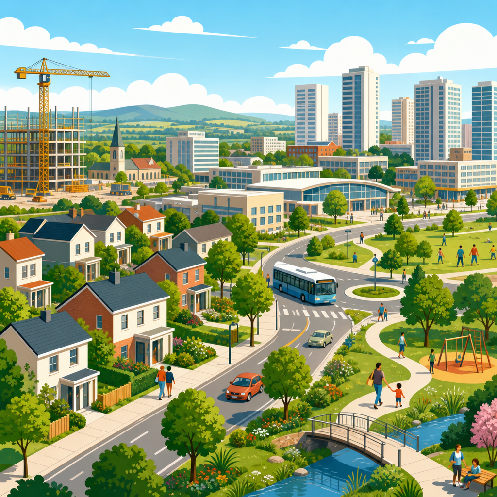
New towns, new cities, and planned growth shaped the twentieth century by turning urban expansion into a deliberate policy choice rather than a purely market-driven outcome. In planning terms, a new town is a purpose-built settlement designed to absorb population, jobs, and services according to a coordinated master plan, while a new city usually implies a larger, more autonomous urban center with broader economic and administrative functions. Planned growth refers to the wider toolkit behind both ideas: land assembly, infrastructure sequencing, zoning, housing delivery, transport design, and governance arrangements intended to guide where and how urbanization happens. These concepts matter because the twentieth century brought unprecedented industrialization, suburbanization, migration, and postwar reconstruction. Governments faced overcrowded cores, housing shortages, traffic congestion, and regional inequality, and many concluded that unmanaged growth would deepen each problem. I have worked with master plans and policy archives from Britain, France, India, and the United States, and the same lesson appears repeatedly: successful planned growth depends less on visionary drawings than on patient coordination between land, transport, finance, and institutions.
The century’s planned settlements were never all the same. Ebenezer Howard’s garden city model emphasized self-contained communities with greenbelts, mixed housing, and a balance between town and country. Later programs, especially after 1945, shifted toward state-led decentralization, large-scale public housing, industrial dispersal, and metropolitan restructuring. Some projects aimed to decongest capitals, such as Britain’s postwar new towns and South Korea’s satellite cities around Seoul. Others pursued national development goals, such as Brasília in Brazil, Chandigarh in India, and Islamabad in Pakistan, where a new capital symbolized political modernization and territorial integration. Still others addressed resource frontiers or strategic regional growth, from Soviet planned cities to company-backed settlements in mining and manufacturing zones. The record is mixed but instructive. Planned growth produced some of the century’s most influential urban experiments, proving that location, density, transit, and public space can be organized proactively. It also exposed recurring risks: mono-functional districts, social segregation, overreliance on automobiles, weak local economies, and underestimation of how residents adapt spaces over time.
As a hub within urban planning and policy, this article maps the main ideas, phases, and examples that define twentieth-century new towns and planned cities. It explains why governments built them, how planners translated policy into physical form, what tools made implementation possible, and why outcomes diverged so widely across countries. It also shows how this history still informs contemporary debates about housing delivery, climate resilience, infrastructure-led development, and metropolitan governance.
Why Governments Turned to New Towns and Planned Growth
The strongest driver was pressure in existing cities. By the early twentieth century, industrial capitals and port cities were struggling with overcrowded tenements, pollution, inadequate sanitation, and speculative land markets. Planning reformers argued that decentralization could relieve these conditions if growth were redirected into comprehensively planned settlements with jobs, schools, and open space. After the Second World War, the argument became more urgent. Bomb damage, housing deficits, baby booms, and renewed industrial expansion pushed many governments to adopt statutory planning and direct public development. In Britain, the New Towns Act of 1946 created development corporations empowered to acquire land, borrow capital, and build complete communities such as Stevenage, Harlow, and Milton Keynes. These were not mere housing estates. The intention was to create socially balanced settlements with employment areas, neighborhood units, civic centers, and green networks.
Regional policy also mattered. France’s villes nouvelles around Paris and other metropolitan areas sought to rebalance growth, reduce central congestion, and structure suburban expansion around transit and services. In the United States, federal policy did less to create classic new towns at scale, but planned communities such as Reston, Virginia, and Columbia, Maryland, showed how private and quasi-public actors could pursue mixed-use growth with neighborhood clustering, open space preservation, and community facilities. In newly independent states, planned capitals carried additional symbolic weight. Chandigarh represented a break from colonial urbanism and a statement of modern nationhood. Brasília embodied Brazil’s push to interiorize development and project administrative capacity into the national territory. In each case, planned growth was tied to a broader theory of social order: better urban form could support healthier living, more efficient administration, and more equitable access to opportunity.
Planning Models That Shaped Twentieth-Century New Settlements
Several models guided these projects, and most real examples combined more than one. The garden city tradition proposed limited size, permanent agricultural belts, cooperative or publicly influenced landholding, and the integration of housing, work, and recreation. Letchworth and Welwyn Garden City in England became the best-known early expressions. Their influence spread far beyond Britain because they offered a practical alternative to both congested industrial cities and low-density sprawl. The neighborhood unit, advanced by Clarence Perry in the United States, shaped street hierarchies, school catchments, and internal community layout. Modernist planning contributed superblocks, separation of pedestrian and vehicular movement, tower-and-slab housing formats, and strict land-use zoning. CIAM thinking, though often simplified in practice, reinforced confidence in rational spatial order.
By mid-century, the growth pole concept and regional planning frameworks added an economic layer. New settlements were expected not only to house people but also to channel investment into designated corridors and subregions. That is why many were linked to industrial estates, rail lines, highways, or administrative functions. Milton Keynes, designated in 1967, differed from earlier British new towns by embracing a larger scale, a flexible grid, distributed centers, and room for long-term expansion. Meanwhile, Soviet and Eastern Bloc planning often tied new cities directly to steel plants, hydroelectric projects, or mining complexes, creating urban form around production systems. In practice, the governing model mattered less than the fit between concept and implementation. A beautifully drawn master plan could fail if employment lagged behind housing, if transit was deferred, or if fiscal tools were too weak to capture land value gains.
How Planned Growth Was Implemented on the Ground
Implementation depended on four linked capacities: land control, infrastructure finance, development phasing, and governance continuity. Land assembly came first because fragmented ownership makes coherent urbanization difficult. Britain’s development corporations were effective partly because they could acquire land at near-existing use value, install roads and utilities, and recover costs as urban land values rose. This mechanism kept early public investment feasible. Similar logic informed many postwar state-led programs, though the legal basis varied. Infrastructure sequencing was equally important. Settlements that opened with roads but delayed schools, shops, clinics, and transit often struggled to retain residents or attract employers. In projects I have reviewed, the most resilient places staged growth by neighborhood, ensuring each phase had a minimum package of daily services before the next expanded.
Governance determined whether plans survived political cycles. A dedicated development authority can move faster than a conventional municipality during the buildout phase, but it also risks weak democratic accountability if residents have little voice. This tension appeared in multiple countries. The practical lesson is clear: new towns need strong delivery institutions early and stronger local representation later. Design standards also mattered. Street networks, plot subdivision, utility corridors, school locations, stormwater systems, and public transport rights-of-way all shape long-term adaptability. Places with finer-grained blocks and mixed-use allowances generally absorbed change better than rigidly separated districts. The table below summarizes common twentieth-century approaches and their typical outcomes.
| Approach | Core planning tool | Example | Typical strength | Typical risk |
|---|---|---|---|---|
| Garden city | Greenbelt and self-contained layout | Welwyn Garden City | Strong amenity and identity | Limited scale and affordability pressure |
| Postwar state new town | Development corporation | Harlow | Fast housing and infrastructure delivery | Employment imbalance if jobs lag |
| Modernist capital city | Monumental master plan | Brasília | Clear symbolic and administrative order | Social segregation and car dependence |
| Private planned community | Covenants and phased development | Columbia, Maryland | Market responsiveness with design control | Access shaped by income and pricing |
| Industrial new city | Factory-led settlement planning | Magnitogorsk | Rapid labor mobilization | Mono-economy vulnerability |
Major International Examples and What They Teach
Britain offers the most influential national program. The first generation of postwar new towns, including Stevenage and Harlow, pursued decentralization from London and other crowded cities. They integrated neighborhood units, employment zones, civic centers, and landscaped open space. Harlow’s network of footpaths and green wedges remains a reference point for humane urban design. Yet some towns struggled to diversify employment fast enough, causing commuting back toward major metropolitan cores. Milton Keynes later responded with a larger land budget and a road grid intended to support growth over decades, although critics argue that its low-density pattern normalized car use despite generous open space and a strong tree canopy.
France’s Cergy-Pontoise, Marne-la-Vallée, and other villes nouvelles show how planned growth can be tied to regional transit and polycentric metropolitan structure. Their success owed much to state coordination, commuter rail investment, and the deliberate siting of universities, offices, and shopping centers. Brasília demonstrates both the power and the limits of tabula rasa planning. Lucio Costa’s Plano Piloto and Oscar Niemeyer’s civic architecture produced one of the century’s most recognizable urban ensembles, but the city’s formal core relied heavily on automobiles and pushed lower-income workers into peripheral satellite settlements. Chandigarh is often praised for legibility, sector planning, and environmental responsiveness, yet its controlled geometry also had to accommodate later informality and metropolitan expansion beyond the original plan. Reston and Columbia illustrate a different path: planned communities using market mechanisms to deliver mixed uses, trails, schools, and village centers while still depending on the wider metropolitan economy for much of their success.
Successes, Failures, and the Lasting Policy Legacy
The biggest success of twentieth-century planned growth was proving that urban expansion does not have to be chaotic. New towns delivered housing at scale, protected open land through growth boundaries and greenbelts, and demonstrated the value of aligning infrastructure with land use. They also advanced planning practice in transport hierarchy, neighborhood design, public landscape systems, and long-range infrastructure reservation. Many residents of successful new towns gained better housing quality, more green access, and safer local circulation than they would have found in overcrowded inner-city districts or unserviced fringe sprawl. These gains were real and measurable.
The failures were equally instructive. Over-zoning and rigid functional separation often reduced street life and adaptability. Some projects underestimated the importance of mixed tenure, social diversity, and incremental change. Others relied too heavily on a single employer or administrative function, making them vulnerable to economic restructuring. Car dependence became a defining problem where densities, job distribution, and transit service were misaligned. Some planned capitals achieved visual coherence while reproducing inequality through peripheral informality and commuting burdens. The policy legacy is not that planners should abandon large-scale intervention; it is that physical planning must be integrated with economic development, fiscal realism, resident participation, and long-term governance. Today’s debates over transit-oriented development, land value capture, affordable housing mandates, and climate-resilient growth all draw directly from twentieth-century lessons. If you are exploring urban planning and policy, use this hub as your starting point and then examine each case in detail to see how planned growth succeeds, where it fails, and what it still offers future cities.
Frequently Asked Questions
What is the difference between a new town and a new city in twentieth-century planning?
In twentieth-century planning, the distinction usually comes down to scale, function, and degree of autonomy. A new town is typically a purpose-built settlement designed to receive population growth in a controlled way. It is often planned to relieve overcrowding in an existing metropolis, house workers near new industry, or provide balanced residential neighborhoods with schools, shops, open space, and transport laid out in advance. Its role is usually connected to a broader regional strategy, and in many cases it remains economically or administratively linked to a larger urban center.
A new city, by contrast, generally implies a larger and more self-sufficient urban entity. It is planned not just as a residential outlet but as a major center of employment, governance, commerce, and civic identity. New cities may be created to open up new regions, redistribute national population, anchor industrialization, or even serve as capitals. In practical terms, both new towns and new cities are products of intentional planning, but the term “new city” often suggests a wider urban mission and a stronger claim to long-term independence rather than satellite status.
That said, the boundary is not always rigid. Different countries used these terms differently, and political context mattered a great deal. What remains consistent is that both represented a twentieth-century belief that urban growth could be directed through public policy, land assembly, infrastructure investment, and master planning instead of being left entirely to piecemeal market forces.
Why did governments embrace planned growth and build new towns during the twentieth century?
Governments turned to planned growth because the twentieth century brought urban pressures on a scale that older patterns of development struggled to handle. Rapid industrialization, rural-to-urban migration, postwar housing shortages, and expanding metropolitan regions produced overcrowding, informal settlements, congestion, and uneven access to jobs and services. In many countries, policymakers concluded that simply reacting to growth was not enough. They wanted tools that could shape where people lived, where industry located, and how infrastructure was delivered.
New towns offered a practical answer to several problems at once. They could absorb overspill population from large cities, reduce pressure on central urban land, and provide housing in a more orderly form. Because they were planned in advance, they also allowed governments to coordinate roads, rail connections, utilities, schools, hospitals, commercial areas, and green space rather than adding them after the fact. This was especially attractive in the decades after major wars, when reconstruction and social welfare goals were closely tied to physical planning.
There was also an ideological dimension. Across much of the century, planners, architects, and public officials believed that better urban form could produce better social outcomes. Planned communities were seen as a way to improve public health, reduce class segregation, create access to sunlight and open space, and link housing to employment. In some countries, planned growth was also tied to national development strategies, including regional balance, industrial decentralization, frontier settlement, and state-led modernization. In short, governments embraced planned growth because it promised control, efficiency, and social improvement in an era of dramatic urban change.
How were new towns and planned communities typically designed and organized?
Most new towns were organized around a comprehensive master plan that aimed to integrate land use, transport, housing, employment, and community facilities from the beginning. Rather than allowing neighborhoods, industry, roads, and public services to emerge separately, planners sought to define their relationship in advance. This often meant dividing the settlement into distinct residential districts or neighborhood units, each with schools, local shops, parks, and community buildings, while concentrating higher-order retail, civic functions, and transport interchanges in a town center.
Transport planning was central. Many twentieth-century schemes separated fast-moving traffic from residential areas, used hierarchical road systems, and tried to reduce conflict between cars, pedestrians, and service routes. Rail links and bus networks were often built into the overall design, especially where the new town was meant to connect to a major city or employment corridor. Industrial estates or business zones were commonly placed at the edge of residential sectors or near major transport routes so that jobs and logistics could be accommodated without overwhelming neighborhood life.
Housing design reflected prevailing planning ideals of the period. Early and mid-century developments often drew on garden city ideas, emphasizing lower densities, green belts, landscaped open space, and a balance of homes and workplaces. Later schemes varied more widely, with some adopting modernist superblocks, high-rise housing, or highly segregated functional zones. Public amenities were treated as core infrastructure rather than optional additions, so schools, clinics, recreation grounds, and utility systems were usually embedded in the plan from the outset. The goal was not just to build houses, but to create a functioning urban environment with social, economic, and spatial coherence.
Were twentieth-century new towns successful, and what challenges did they face?
The record is mixed, which is exactly why new towns remain such an important subject in planning history. Many achieved significant successes. They delivered large volumes of housing, introduced infrastructure more systematically than speculative development often did, and demonstrated that urban expansion could be coordinated at the regional scale. Some helped relieve pressure on overcrowded cities, supported industrial decentralization, and created communities with better access to green space and public facilities than older urban districts could easily provide.
At the same time, many planned settlements faced serious limitations. A recurring challenge was economic balance. It was easier to build housing than to guarantee a stable long-term job base, and some places became overly dependent on commuting or on a narrow range of industries. Another issue was timing: if homes were built before services, residents could feel isolated; if transport links lagged behind population growth, congestion and dependence on private cars often followed. In some cases, town centers struggled to generate the vitality planners expected, particularly when retail patterns changed or when nearby metropolitan areas continued to dominate employment and culture.
Social and design critiques also emerged over time. Highly zoned plans could produce environments that felt orderly on paper but fragmented in everyday life. Some modernist layouts proved difficult to adapt, and certain large-scale housing forms became associated with maintenance problems or social stigma. Governance mattered too. Where public investment remained strong and long-term management was effective, outcomes were often better. Where funding declined or planning institutions weakened, the promise of balanced development was harder to sustain. So yes, many new towns were successful in important ways, but they also revealed how difficult it is to engineer urban life through design alone without continuous economic, social, and political support.
What is the lasting legacy of new towns, new cities, and planned growth in the twentieth century?
The lasting legacy is the normalization of the idea that urban growth can and should be shaped through policy. Twentieth-century experiments with new towns and new cities helped establish planning as a central tool of governance rather than a marginal technical exercise. They influenced how governments think about land assembly, zoning, infrastructure sequencing, regional development, housing provision, and the relationship between public investment and urban form. Even where specific projects were criticized, they expanded the policy imagination around what states and planning authorities could attempt.
These projects also left a physical legacy. Many planned settlements matured into substantial urban centers with distinct identities, established employment bases, and evolving town centers. Their street patterns, open-space systems, transport frameworks, and neighborhood structures continue to shape daily life for millions of residents. At the same time, their shortcomings provided equally important lessons. Planners learned that social diversity, adaptability, mixed uses, and long-term governance are just as important as initial physical design. The best contemporary planning approaches often build on these lessons by combining strategic coordination with flexibility and participation.
More broadly, the twentieth-century experience reframed debates about metropolitan expansion, regional inequality, and sustainability. Questions that were central then remain central now: how to accommodate growth without worsening congestion and sprawl, how to link housing to employment, how to provide infrastructure efficiently, and how to distribute development more fairly across regions. In that sense, the legacy of new towns, new cities, and planned growth is not confined to historical case studies. It continues to inform current discussions about housing shortages, transit-oriented development, climate resilience, and the future of planned urban expansion.


