
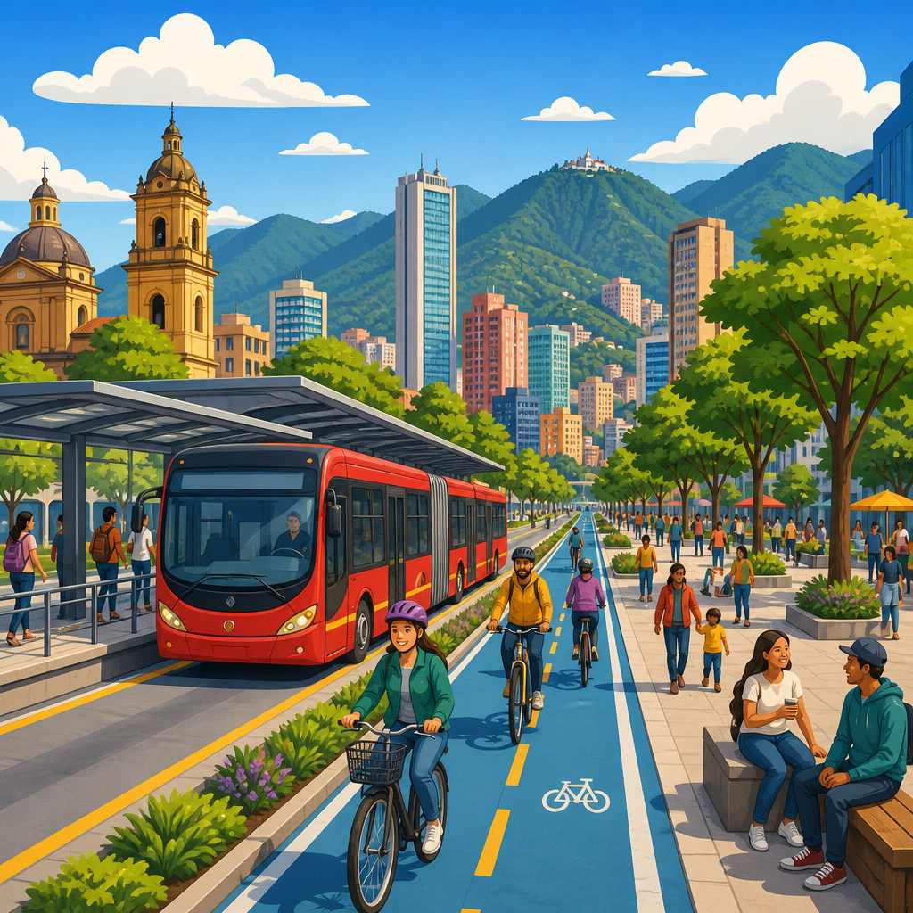
Bogotá reclaimed street space by treating roads not as corridors for cars alone but as public assets that should move people efficiently, support local life, and reduce inequality. That shift, pursued through bus rapid transit, protected cycling routes, car-free programs, sidewalk upgrades, and public space redesign, turned the Colombian capital into one of the most studied urban planning cases in the world. In practical terms, reclaiming street space means reallocating lanes, curbs, intersections, and plazas from low-capacity private vehicle use toward higher-capacity transit, safer walking and cycling, greener streets, and civic activity. I have worked on transport and land use stories for years, and Bogotá appears repeatedly because it shows how policy, design, and political will can alter daily life faster than megaprojects often do. The city matters because it faced problems common across growing metropolitan areas: congestion, long commutes, air pollution, unsafe roads, fragmented public space, and stark social divides. Rather than waiting for ideal funding or perfect consensus, leaders used the street network already in place. Their approach offers a hub for understanding modern urban planning and policy: who streets are for, how governments prioritize movement, what tradeoffs accompany reform, and why public life improves when access is measured by people moved and opportunities reached instead of cars accommodated.
Why street space became the central urban policy question
Street space is the largest share of public land in most cities, so changing its use has outsized effects on mobility, commerce, safety, health, and social inclusion. In Bogotá, pressure built during the late twentieth century as rapid urban growth met rising motorization and a road system that could not expand indefinitely. Traditional traffic engineering tends to answer congestion with more road capacity, but induced demand is well documented: when driving becomes easier, more trips shift to cars until delay returns. Bogotá’s reformers instead focused on person-throughput. A traffic lane filled with single-occupant cars may move 600 to 1,800 people per hour, while a dedicated busway can carry several times that number, especially with large articulated buses, prepaid boarding, and platform-level access. Sidewalks and cycle tracks also move people efficiently in dense districts while creating direct public health benefits.
The city’s leaders framed mobility as a matter of equity. Most residents did not own cars, yet a large share of prime urban land served a minority who drove. Rebalancing space therefore had a distributive logic: public rights-of-way should favor the modes most people use. That principle sounds simple, but it affects budget priorities, enforcement, design standards, and political messaging. Once a city accepts that streets are social infrastructure rather than vehicle pipelines, decisions about bus lanes, curb management, crossings, trees, and public plazas become linked parts of one policy agenda.
TransMilenio showed how bus rapid transit can restructure a city
The strongest symbol of Bogotá’s street reclamation is TransMilenio, the bus rapid transit system launched in 2000. Its importance lies not only in the buses themselves but in the street design and operating model around them. Instead of leaving buses mixed in traffic, Bogotá assigned central lanes on major corridors exclusively to high-capacity services. Stations were built in medians with off-board fare collection, controlled entry, level boarding, and passing lanes at key stops so express and local services could operate on the same trunk. This configuration, refined by planners drawing on Curitiba’s earlier example while adapting it to Bogotá’s scale, increased speed, reliability, and passenger capacity using a fraction of typical metro construction costs.
In policy terms, TransMilenio reclaimed road space from private vehicles and informal competition among buses. Before reform, fragmented bus operations often produced dangerous racing for passengers, inconsistent stopping patterns, and poor service quality. The new model organized routes, standardized stations, and made service legible. Commuters gained time savings because buses were no longer trapped in mixed traffic for much of their route. Businesses along corridors benefited from improved accessibility, even if loading and parking arrangements had to change. For many residents, the visible lesson was that a city could transform mobility with surface-level interventions rather than waiting decades for rail.
Results were significant, though not uniform. Dedicated trunk corridors improved travel times and increased network capacity, but overcrowding emerged as demand grew and system expansion lagged. That limitation is important. Reclaiming space works only when supply, operations, and maintenance keep pace with ridership. Even so, TransMilenio changed global practice by proving that bus systems, if given street priority and operational discipline, can function as true mass transit.
Cycling moved from recreation to everyday transport
Bogotá’s cycling story is equally influential because it treated bicycles as a practical transport mode, not a niche amenity. The city developed an extensive network of protected and separated routes known as ciclorutas, connecting residential areas to schools, parks, transit corridors, and employment centers. This mattered because network continuity is the threshold issue for mode shift. A short isolated bike lane may photograph well but does little for daily travel if riders must merge into fast traffic at every junction. Bogotá pursued enough length and connectivity to make regular trips possible for ordinary users, including students, service workers, and older adults.
The social impact was substantial. Cycling lowered travel costs for households, expanded access to jobs, and reduced dependence on crowded buses for short and medium trips. It also changed street culture. When more people cycle visibly and routinely, drivers, merchants, and policymakers begin to treat bike infrastructure as normal civic investment. I have seen this pattern elsewhere, but Bogotá demonstrated it early and at scale in Latin America. Importantly, the city linked bicycle planning to broader public space policy, adding greenways, better crossings, and park connections instead of painting lanes in isolation.
Challenges remain. Safety at intersections, route maintenance, theft prevention, and equitable distribution across peripheral districts all require constant attention. Yet the core policy lesson is settled: reallocating even a modest portion of road width can unlock large gains when the resulting network is coherent and protected.
Ciclovía turned car-free time into a permanent policy argument
Long before many cities embraced open streets programs, Bogotá institutionalized Ciclovía, the weekly closure of major roads to cars so residents could walk, cycle, skate, exercise, and socialize. On Sundays and holidays, extensive routes become temporary public space used by people from across the city. The program is often described as recreational, but its policy value runs deeper. It gives residents a direct, physical experience of streets operating under different priorities. That experience is politically powerful because it converts abstract planning debates into something people can feel underfoot.
Ciclovía also broadened the constituency for street reform. Families who might never attend a transport hearing encounter safer, cleaner, more convivial streets firsthand. Vendors and local businesses gain foot traffic. Public health agencies support activity gains. Transport departments learn how closures affect operations and emergency access. In many cities, demonstrations of this kind help normalize future bike lanes, bus lanes, school streets, and plaza projects. Bogotá’s version showed that temporary reallocation can change expectations permanently.
The program is not a substitute for everyday infrastructure. A city cannot rely on Sunday closures if weekday streets remain hostile. But Ciclovía strengthened public imagination and social legitimacy, which made harder, more permanent reallocations more defensible.
Walking and public life improved when sidewalks became infrastructure
Street reclamation is often discussed through transit and cycling, yet Bogotá’s most durable gains also came from recognizing walking as the base mode of urban mobility. Every transit trip begins and ends on foot. Every local shopping street depends on pedestrians. Sidewalk width, crossing frequency, curb ramps, lighting, shade, frontage activity, and enforcement against illegal parking all shape whether public space is usable. Bogotá invested in pedestrian corridors, park links, and sidewalks near major routes, while also using urban design to support social interaction rather than mere circulation.
That shift matters because cities frequently underestimate the economic value of walkability. Retail streets with slower traffic and safer crossings often support longer dwell time and more frequent visits. Children, older adults, and disabled residents gain disproportionate benefits from smoother surfaces and shorter crossing distances. Public seating and trees improve comfort in a city with variable weather and high-altitude sun exposure. In professional practice, I have found that sidewalk improvements are sometimes dismissed as cosmetic until crash rates fall, storefront occupancy stabilizes, and transit access improves. Bogotá helped prove that pedestrian infrastructure is transport infrastructure.
Policy tools that made street reallocation stick
Design alone never secures street transformation; policy and governance do. Bogotá paired physical projects with legal authority, institutional coordination, and public messaging. The city used corridor-based planning, stronger traffic management, parking control, and visible enforcement to protect the function of busways and pedestrian areas. Leadership mattered. Mayors such as Enrique Peñalosa made the moral case that a wealthy person in a car has no greater right to public road space than a bus rider or cyclist. That framing clarified why lane reallocation was not anti-car symbolism but pro-city governance.
Several recurring tools explain Bogotá’s influence:
| Policy tool | How Bogotá used it | Why it mattered |
|---|---|---|
| Dedicated lanes | Reserved central corridors for high-capacity buses | Improved speed, reliability, and person-throughput |
| Network planning | Connected cycle routes to destinations and transit | Enabled everyday trips, not isolated segments |
| Open streets programming | Closed roads regularly for public use | Built public support through direct experience |
| Public space upgrades | Improved sidewalks, crossings, and plazas | Made access safer and strengthened street life |
| Political narrative | Linked mobility reform to equity and citizenship | Helped justify difficult tradeoffs and enforcement |
These tools succeeded because they worked together. A bus lane without enforcement degrades. A cycle path without safe intersections underperforms. A plaza without access improvements can exclude nearby residents. Bogotá’s example is useful precisely because it was systemic rather than decorative.
What Bogotá got right, what it struggled with, and what other cities should copy
Bogotá got three big things right. First, it acted at the scale of the street network instead of relying on isolated flagship projects. Second, it prioritized people moved over vehicles moved, which is the correct metric in dense cities. Third, it linked mobility to dignity, health, and equal access, broadening support beyond transport specialists. Those strengths explain why planners from Mexico City to Jakarta, New York to Nairobi, continue to study Bogotá when debating bus priority, cycling systems, and open streets.
The city also struggled in ways worth stating clearly. High demand strained TransMilenio, and delays in expanding capacity reduced user satisfaction. Some corridors experienced conflict over parking, deliveries, and local access. Peripheral and lower-income areas did not always receive improvements at the same speed or quality. Maintenance, enforcement consistency, and long-term institutional continuity proved harder than launching visible projects. These are not reasons to dismiss the model; they are reminders that street reclamation is governance, not just ribbon cutting.
Other cities should copy Bogotá’s principles, not merely its visual forms. The right approach begins with corridor analysis, origin-destination data, crash mapping, curb-use studies, and public realm audits. From there, cities can identify where a bus lane carries more people than general traffic, where a protected bike network would close key gaps, and where sidewalks near schools or stations need immediate widening. Quick-build pilots using paint, posts, and temporary barriers can test concepts before permanent construction, but successful pilots must transition into durable materials, operations, and maintenance plans. The strategic goal is simple: use scarce street space to maximize access, safety, and public life.
Bogotá reclaimed street space by proving that ordinary roads can become extraordinary civic infrastructure when cities redesign them around people rather than vehicles. Its legacy is not a single bus system or a famous Sunday event, but a durable framework for urban planning and policy: prioritize high-capacity transit, build connected cycling networks, treat sidewalks as essential infrastructure, and use public space to strengthen social life. The city’s experience also shows that tradeoffs are real. Reallocation requires enforcement, operational discipline, funding continuity, and the political courage to withstand backlash from drivers who lose convenience. Yet the benefits are measurable and broad: faster commutes for more people, lower transport costs, safer streets, cleaner air, stronger local commerce, and more democratic access to the city.
For anyone working in urban planning and policy, Bogotá remains the reference point because it compressed decades of debate into visible, street-level change. It demonstrated that transportation policy is never only about movement; it is about fairness, health, climate resilience, economic inclusion, and the quality of everyday life between buildings. Cities do not need identical geography or institutions to learn from this case. They need the willingness to ask a basic question every time they redraw a curb or lane: who benefits from this space, and how many people can it serve well? Start there, study Bogotá carefully, and use its lessons to shape streets that move more people and welcome more life.
Frequently Asked Questions
What does it mean that Bogotá “reclaimed street space”?
In Bogotá, reclaiming street space meant rethinking streets as public assets rather than treating them mainly as channels for private cars. Instead of assuming that the primary purpose of a road was to maximize vehicle speed, city leaders began asking how the same space could move more people, improve safety, support everyday commerce, and make public life more inclusive. That led to practical changes such as dedicating lanes to high-capacity bus service, building protected bicycle routes, widening sidewalks, redesigning intersections, managing curb space more intentionally, and creating areas where pedestrians could gather more comfortably.
The deeper idea was about fairness as much as transportation. In a large, unequal city, most residents did not travel by private car, yet a disproportionate amount of street space had historically been organized around driving. By reallocating space toward buses, walking, and cycling, Bogotá aligned public infrastructure more closely with how people actually moved. This approach also recognized that streets are not just for movement; they are places where children walk to school, workers reach jobs, neighbors meet, and small businesses depend on foot traffic. In that sense, reclaiming street space was both a transport strategy and a social policy.
How did Bogotá use bus rapid transit to change the role of its streets?
Bogotá’s bus rapid transit system, TransMilenio, became one of the clearest examples of street reallocation at scale. Rather than continuing to give the most valuable road space to mixed traffic, the city set aside central lanes for high-capacity buses that could move large numbers of passengers quickly and predictably. Stations, pre-boarding fare payment, level boarding, and more organized operations helped create a service that functioned more like rail in terms of speed and efficiency, even though it ran on streets. The result was not simply a new bus system, but a new hierarchy of street use in which public transport received priority because it carried more people per lane.
This mattered because street space in dense cities is limited, and the question is not whether space will be allocated, but to whom and for what purpose. A general traffic lane may move relatively few people if most vehicles carry one or two occupants, while a dedicated transit lane can move many times more. Bogotá used that logic to justify giving buses priority on major corridors. The impact went beyond travel times: it sent a public message that mobility policy should favor efficiency, accessibility, and inclusion. Even critics of the system’s overcrowding or operational challenges often acknowledge that it fundamentally changed the conversation about what streets are for and who should benefit from them.
Why is Bogotá so closely associated with cycling and car-free street programs?
Bogotá is widely studied because it did not treat cycling and car-free events as niche amenities for a small group of enthusiasts. Instead, the city integrated them into a broader vision of urban mobility and public life. Protected cycling routes gave people a practical, lower-cost way to travel across the city, while the well-known Ciclovía program regularly opened major streets to people walking, biking, skating, and gathering by temporarily restricting motor vehicles. Together, these measures showed that streets can serve many functions beyond carrying car traffic.
The significance of these programs lies in how visible and democratic they are. A protected bike lane physically changes who feels safe using the street, often expanding access to children, older adults, and less confident riders. A recurring car-free event allows residents to experience streets at a human pace and imagine different long-term possibilities for the city. These initiatives also helped normalize the idea that reallocating street space is not an anti-car gesture for its own sake, but a pro-city strategy that can improve health, reduce barriers to mobility, and create stronger civic life. Bogotá’s example resonated globally because it demonstrated that even a large and congested city could prioritize active transportation and public space in highly visible ways.
How did sidewalk improvements and public space redesign support the city’s broader goals?
Sidewalk upgrades and public space redesign were essential because reclaiming street space is not only about moving people efficiently; it is also about making urban life safer, more dignified, and more accessible. In many cities, pedestrians are expected to navigate narrow, damaged, obstructed, or discontinuous sidewalks, even though nearly every trip begins or ends on foot. Bogotá’s efforts to improve sidewalks, crossings, medians, and adjacent public areas helped address that imbalance by investing in the most universal mode of travel: walking.
These changes had practical and social effects. Better sidewalks and intersections can reduce crashes, improve access to transit, assist people with disabilities, and support local businesses by making commercial corridors more inviting. Public space redesign can also strengthen neighborhood identity and increase the quality of daily life by creating room for seating, greenery, informal interaction, and safer movement. In Bogotá’s case, these interventions reinforced a larger planning philosophy: a successful street is not measured only by car throughput, but by whether it works well for the greatest number of people and supports the surrounding community. That perspective helped connect transportation policy with public health, equity, and urban design.
What lessons can other cities learn from Bogotá’s approach to street space?
One major lesson is that street design reflects political priorities, not just engineering formulas. Bogotá showed that if a city chooses to prioritize public transport, walking, cycling, and shared public life, it can reorganize even very constrained streets to better serve those goals. That does not mean copying every Bogotá policy exactly. Local geography, governance, street widths, travel patterns, and public expectations differ. But the underlying principle travels well: when space is scarce, cities should allocate it to the modes and activities that move the most people, broaden access, and create the greatest public benefit.
Another lesson is that symbolic and practical changes work best together. Large-scale transit investments matter, but so do everyday interventions like safer crossings, protected bike lanes, better sidewalks, and well-managed curb space. Bogotá also illustrates that visible demonstrations of alternative street use, such as car-free programs, can help the public understand and support more permanent redesigns. At the same time, other cities should note that reclaiming street space is not a one-time project. It requires maintenance, enforcement, institutional capacity, and continuous adaptation as demand changes. Bogotá’s experience is influential not because it solved every challenge perfectly, but because it proved that a city can fundamentally shift the purpose of its streets toward mobility, equity, and public life.


