
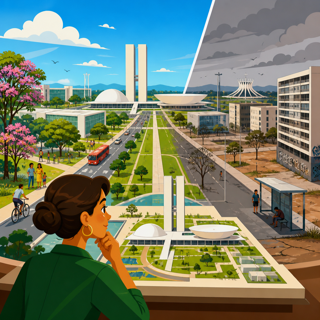
Brasília remains one of the most ambitious urban planning experiments of the twentieth century, a purpose-built national capital designed to embody modernity, territorial integration, and political renewal. The planning legacy of Brasília matters because it sits at the intersection of architecture, transport policy, housing, governance, and social equity, making it far more than a collection of iconic buildings. In urban planning terms, Brasília is a planned capital: a city conceived in advance, shaped by a formal master plan, and built rapidly to serve state objectives. Its core design, developed by Lúcio Costa and complemented by Oscar Niemeyer’s civic architecture, followed modernist principles such as functional zoning, monumentality, separation of traffic, and superquadra residential blocks. I have worked through Brasília’s planning documents, comparative capital city cases, and decades of post-occupancy critiques, and one conclusion is unavoidable: Brasília succeeded brilliantly as a symbol and administrative center while exposing the limits of top-down planning when daily urban life, inequality, and long-term metropolitan growth are underestimated.
That tension explains why Brasília is still studied in every serious discussion of planned cities. Supporters point to its clear geometry, protected skyline, strong civic identity, and role in shifting Brazil’s political center inland. Critics point to social segregation, car dependency, underdeveloped street life, and the disconnect between the planned core and the surrounding satellite cities where much of the workforce has long lived. Both sides are right in important ways. Brasília is neither a utopian triumph nor a planning failure in simple terms. It is a working capital city whose achievements are inseparable from its omissions. Understanding that duality is useful not only for historians but also for policymakers, planners, and citizens evaluating today’s large-scale urban projects, from new administrative districts to transit-oriented expansions and climate-resilient new towns.
Why Brasília Was Built and What Its Designers Intended
Brasília was inaugurated in 1960 after a remarkably compressed construction period under President Juscelino Kubitschek, whose development agenda framed the new capital as part of a broader national modernization drive. Moving the capital from coastal Rio de Janeiro to the country’s interior had deep historical roots in Brazilian statecraft, but Brasília finally transformed that ambition into concrete urban form. The decision was strategic as much as symbolic. Leaders wanted to encourage inland settlement, strengthen national integration, reduce the political weight of the coast, and create a seat of government less tied to colonial geography. Planned capitals often emerge from similar motives; Canberra, Ankara, and Abuja all reflect efforts to rebalance territory and project a new political identity.
Lúcio Costa’s Plano Piloto is often described as airplane-shaped, though Costa himself emphasized the crossing of two axes: the Monumental Axis for government and representation, and the Residential Axis for everyday living. This structure imposed order at a metropolitan scale. Government ministries lined the Esplanade, the National Congress anchored the civic composition, and residential life was organized into superquadras, or large housing superblocks intended to combine density, green space, schools, local commerce, and separation from fast traffic. Modernist planning strongly influenced these decisions. The Athens Charter, functional zoning, and faith in rational circulation all shaped the idea that a city could be made healthier and more efficient by clearly distinguishing where people live, work, govern, shop, and move.
In practice, Brasília’s original plan was highly disciplined. Building heights were controlled. Open space was preserved. Monumentality was intentional rather than accidental. The city’s central ensemble later earned UNESCO World Heritage status in 1987 because it represented an unusually intact modernist capital. That integrity matters. Many planned cities are compromised quickly by ad hoc development, but Brasília’s core retained its formal structure. Yet the very precision that gave Brasília coherence also limited flexibility. A city designed around idealized functions can struggle when actual urban life produces mixed uses, informal economies, nightlife demands, and uneven household incomes. Brasília’s intention was not to create the spontaneous complexity associated with older cities. Its intention was order, legibility, and a new civic stage for a new Brazil.
The Achievements: Design Clarity, National Identity, and Institutional Function
Brasília’s defenders are not relying on nostalgia. The city achieved several planning goals at an exceptionally high level. First, it created one of the clearest examples of a capital city expressing national identity through urban form. The Monumental Axis, the Praça dos Três Poderes, and Niemeyer’s major buildings provide a coherent visual language of statehood that few capitals match. This is not a minor accomplishment. Capitals perform constitutional theater. They must represent power, continuity, and public meaning. Brasília does that with extraordinary consistency.
Second, the city functioned as an administrative center. Ministries, federal institutions, and diplomatic functions were concentrated in a purpose-designed setting. Clear zoning reduced direct land-use conflicts in the planned core, and the reserved land structure helped public institutions operate without the congestion and fragmented parcel pattern common in older capitals. Third, Brasília advanced preservation of landscape and skyline. The strict planning controls of the Plano Piloto prevented the kind of speculative verticalization that can overwhelm civic centers elsewhere. In policy terms, this demonstrated that long-range urban controls can protect public form when they are politically defended.
Fourth, Brasília’s superquadra concept contained real strengths. In their best form, the superblocks offered generous tree cover, internal pedestrian areas, access to neighborhood schools, and a sense of residential calm unusual in fast-growing Latin American cities of the era. I have seen planners revisit these elements when discussing child-friendly neighborhoods and the value of open green common space. The problem is not that every idea in Brasília was wrong; several were decades ahead of mainstream sustainability conversations, especially the emphasis on daylight, ventilation, and landscaped residential environments. The lesson is that strong urban design can create enduring civic value, but design excellence alone does not guarantee social inclusion or walkable daily life across an entire metropolitan region.
The Critiques: Car Dependency, Segregation, and the Limits of Top-Down Planning
The sharpest criticisms of Brasília concern what happened when the ideal city met social reality. The Plano Piloto separated functions so decisively that routine trips often became long and inconvenient without a car. Wide roadways, grade-separated circulation, and large distances between destinations favored driving over walking. Even where residential areas were pleasant internally, the city often lacked the fine-grained street network, active frontages, and mixed uses that support vibrant urban life. This is why Brasília appears orderly from the air yet can feel discontinuous at ground level. Urban planners now describe this problem in terms of scale mismatch: a city can succeed as composition while underperforming as everyday public realm.
Social segregation intensified that critique. Construction workers and lower-income residents were never fully accommodated within the idealized core, and over time many lived in satellite cities outside the Plano Piloto. Taguatinga, Ceilândia, and other peripheral areas became essential parts of metropolitan Brasília, but they developed with different infrastructure quality, travel burdens, and access to opportunity. This pattern reveals a central planning failure. A capital designed for egalitarian modern citizenship reproduced a sharp center-periphery divide because affordable housing, labor geography, and migration were not integrated realistically into the original urban model.
| Planning Goal | What Brasília Delivered | What Emerged Over Time |
|---|---|---|
| National integration | Interior capital strengthened federal presence inland | Metropolitan growth spread beyond the planned core |
| Efficient circulation | Fast road movement across major axes | High car dependence and long trip distances |
| Orderly residential life | Superquadras with green space and services | Limited street vitality and uneven housing access |
| Social modernity | Symbol of a new, progressive Brazil | Persistent segregation between core and satellite cities |
| Protected civic form | Strong preservation of the central plan | Rigid structure made adaptation more difficult |
Another limitation was participatory deficit. Brasília was planned and executed by experts and the state at extraordinary speed, which is one reason it is visually coherent. But communities did not shape the city in the iterative, negotiated way common to successful urban districts that mature over time. That does not mean participatory planning solves everything; many democratic processes produce compromise without excellence. Still, Brasília demonstrates the risk of treating residents as abstract users rather than social actors with diverse routines, incomes, and preferences. A city can be meticulously planned and still miss how people actually inhabit space.
Brasília’s Metropolitan Reality and What It Teaches Urban Policy Today
To understand Brasília honestly, it is necessary to distinguish the celebrated Plano Piloto from the larger Federal District and metropolitan region. Most critiques that call Brasília inhuman are really critiques of the mismatch between the planned center and the broader urban system required to support it. Conversely, many glowing defenses focus too narrowly on the UNESCO-listed core. Serious policy analysis examines both. The metropolitan labor market, commuting patterns, housing production, and service distribution tell a fuller story than postcard views of the National Congress.
This wider lens makes Brasília highly relevant to current urban policy. First, planned capitals and master-planned districts must include realistic housing strategies from the beginning. If service workers, civil servants at different pay grades, teachers, retail employees, and construction laborers cannot live near jobs, segregation is not an accident; it is a design outcome. Second, transport planning must balance efficiency with human scale. Fast arterials move vehicles well, but they do not replace mixed-use streets, frequent transit, shaded sidewalks, and neighborhood destinations. Third, urban form must be adaptable. Cities change through demography, technology, climate pressures, and economic restructuring. Plans that protect key public assets should still allow incremental evolution.
Brasília also complicates simplistic debates about density. The Plano Piloto is neither conventionally dense nor purely suburban. Its superblocks place mid-rise residential buildings in open green landscapes, while metropolitan expansion beyond the core has generated other patterns entirely. The result shows that density is not enough by itself. What matters is the relationship between density, land-use mix, transit quality, and public space. A district can have enough residents to support local life and still feel empty if activities are segregated and blocks are too large. Planners working on new towns in the Gulf, administrative capitals in Africa, or redevelopment zones in Asia should read Brasília as a full systems case, not just an architectural icon. Its enduring lesson is that civic grandeur, housing inclusion, mobility choice, and metropolitan governance must be designed together or the city will split into separate realities.
Visionary Capital or Cautionary Tale? The Balanced Verdict
The most accurate verdict is that Brasília is both a visionary capital and a cautionary tale, and its legacy becomes clearer when those labels are treated as complementary rather than contradictory. It was visionary in its confidence, execution, and symbolic power. Few nations have built a capital so quickly, so coherently, or with such lasting formal distinction. Brasília gave Brazil a globally recognizable seat of government and helped redirect national attention toward the interior. It proved that long-range planning, when backed by political will and design discipline, can shape territory and identity on a historic scale.
It is also a cautionary tale because physical order did not automatically produce urban justice or everyday convenience. The city’s iconic spaces coexist with commuting burdens, dependence on automobiles, and a metropolitan structure that pushed many lower-income residents outward. Those outcomes were not incidental side effects. They emerged from planning assumptions that prioritized abstract function over social complexity. In my experience reviewing planned-city case studies, that is Brasília’s most important warning: when a city is designed primarily as an image of the future, it may neglect the ordinary patterns that make urban life inclusive, flexible, and resilient.
For today’s urban planning and policy debates, Brasília offers practical guidance. Preserve what is exceptional in civic design, but test every grand plan against household budgets, commute times, climate comfort, governance capacity, and the likely geography of labor. Build monuments if a nation wants monuments, but also build mixed-income neighborhoods, frequent transit, and streets people can actually use on foot. If you are assessing any planned district or new capital, use Brasília as your benchmark and your caution. Study its achievements closely, then plan for the human realities it teaches so clearly.
Frequently Asked Questions
What makes Brasília such an important case study in urban planning history?
Brasília matters because it is one of the clearest examples of a city planned almost entirely in advance to serve a national political purpose. Conceived in the mid-twentieth century as Brazil’s new inland capital, it was designed to symbolize modernization, territorial unity, and a break from older coastal power centers. That alone would make it historically significant, but its real importance lies in how many planning questions it brings together in one place: land use, transport systems, monumental civic design, housing distribution, state-led development, and the social consequences of large-scale urban vision.
Unlike cities that evolved gradually over centuries, Brasília was created from a master plan, allowing planners and architects to test modernist ideas at metropolitan scale. The city’s design prioritized order, functional zoning, broad road systems, and a strong visual hierarchy between government, residential, and commercial spaces. This makes Brasília invaluable for understanding both the ambition and the limits of top-down planning. It shows how powerful a planned capital can be as a national symbol, while also revealing how everyday urban life often resists neat design logic. For students of planning, it is not just an architectural landmark; it is a living laboratory of how ideals translate into daily reality over time.
Why is Brasília often described as both a visionary capital and a cautionary tale?
Brasília earns the label of visionary capital because it successfully achieved several of its founding goals. It established a new seat of government in Brazil’s interior, reinforced the idea of national integration, and created one of the most recognizable civic landscapes in the world. Its monumental core, modernist architecture, and carefully structured plan projected confidence in the future and helped define a powerful image of the modern state. For many observers, this was planning at its boldest: a city used as an instrument of national transformation.
At the same time, it is also seen as a cautionary tale because the qualities that made it visionary on paper created major tensions in practice. The separation of functions, dependence on automobiles, and emphasis on formal design over mixed-use street life contributed to urban experiences that many critics find rigid or socially fragmented. The planned city did not absorb all residents equally, and lower-income workers were often pushed into satellite settlements outside the original core. As a result, Brasília became not only a monument to planning ambition but also a case study in how spatial design can reproduce inequality. The caution is not that planning is futile, but that large-scale plans can overlook social complexity if they privilege order, symbolism, and efficiency over adaptability and inclusion.
How did Brasília’s design shape transportation and everyday mobility?
Transportation is central to Brasília’s legacy because the city was planned around modern circulation principles, especially the private automobile. Its broad avenues, superquadra residential blocks, and separated land uses were intended to make movement efficient and rational. In formal terms, this created a legible and highly organized urban structure. Government functions, housing, commerce, and recreation were arranged with a clarity that reflected modernist planning ideals. For drivers, parts of Brasília can feel efficient and direct, particularly when compared with older, congested cities that developed incrementally.
However, the same system created challenges for pedestrians, transit users, and people seeking a more fine-grained street-level urban experience. Long distances between functions, wide roads, and a landscape scaled to vehicles rather than foot traffic made everyday life more difficult without access to a car. Even where public transportation exists, the city’s spatial logic can make first- and last-mile connections less convenient than in denser, mixed-use urban environments. This is one reason Brasília is so frequently discussed in planning debates today: it anticipated a modern mobility model but also exposed its social and environmental costs. Its experience has encouraged later planners to think more carefully about multimodal transport, walkability, accessibility, and the importance of designing cities for diverse users rather than a single dominant mode.
What does Brasília reveal about housing, inequality, and social equity in planned cities?
Brasília reveals that even the most carefully planned cities can produce unequal outcomes if housing policy and social inclusion are not fully integrated into the urban model. The original vision included orderly residential sectors and a structured environment for modern urban life, but the city’s growth quickly exceeded the assumptions of its initial plan. Construction workers, service employees, and many lower-income residents were essential to the capital’s functioning, yet many were not accommodated within the most prestigious planned areas. Over time, this contributed to the expansion of satellite cities and peripheral settlements beyond the iconic central zone.
This pattern is one of the most important lessons of Brasília’s legacy. A city can be aesthetically coherent and administratively organized while still generating uneven access to jobs, services, public space, and opportunity. The central districts became associated with state power, formal design, and relative privilege, while many workers faced longer commutes and weaker infrastructure in outlying areas. For urban planners, the message is clear: housing cannot be treated as a secondary technical issue in a planned capital. It must be approached as a core question of justice, access, and belonging. Brasília shows that when social diversity is not fully embedded in the primary urban structure, segregation can emerge even within a city created to represent collective national progress.
What lessons can contemporary planners learn from Brasília today?
Contemporary planners can learn two equally important lessons from Brasília: first, that bold public vision can reshape national geography and produce enduring civic identity; and second, that visionary form is not enough on its own. Brasília demonstrates the power of coordinated planning, state investment, and design ambition. It proves that cities do not have to emerge only through incremental growth; they can be conceived strategically to meet political, administrative, and developmental goals. For countries considering new capitals, major urban extensions, or large-scale public projects, Brasília remains a powerful example of how planning can operate at national scale.
But its enduring relevance comes just as much from its shortcomings. The city teaches planners to pay closer attention to flexibility, mixed uses, affordable housing, human-scale public life, and the realities of informal growth. It also highlights the need to connect symbolic civic design with practical social infrastructure. A city may function impressively as a national image while still struggling as a daily environment for broad segments of its population. The best reading of Brasília, then, is neither simple celebration nor outright rejection. It is a reminder that great planning must balance clarity with complexity, vision with inclusion, and monumental purpose with ordinary urban life. That is why Brasília continues to shape discussions about planned capitals, modernist urbanism, and the future of equitable city-building.


