
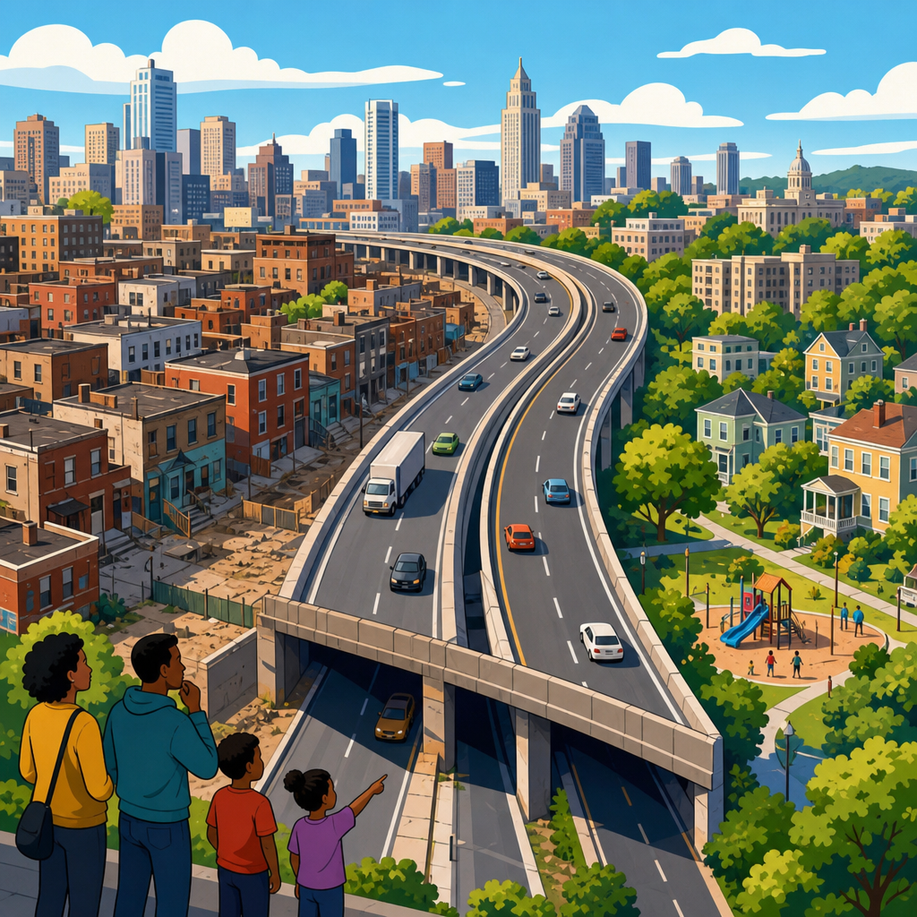
Urban expressways were routed through certain neighborhoods because transportation agencies, elected officials, and business coalitions consistently prioritized speed, land assembly, and political feasibility over neighborhood stability, public health, and local consent. In plain terms, roads went where they were cheapest to clear, easiest to justify, and least likely to trigger effective resistance. That pattern shaped cities across the United States and, with local variations, in Canada, the United Kingdom, and parts of Europe. Understanding why it happened matters because the same forces still influence transit expansions, freight corridors, rezoning decisions, and redevelopment plans today.
An urban expressway is a limited-access highway built within or immediately adjacent to a city. It is designed for fast vehicle movement, with interchanges instead of ordinary intersections, wider rights-of-way, and engineering standards that require substantial land. A neighborhood, in planning terms, is more than a collection of parcels. It includes residents, institutions, businesses, schools, churches, housing types, social networks, and the political capacity to defend them. When an expressway enters that setting, it changes access, noise levels, air quality, property values, and often the long-term direction of investment.
I have worked through environmental review files, historic planning maps, and condemnation records, and the pattern is remarkably consistent. Engineers often presented a route as a neutral technical solution, but the alignment reflected policy choices embedded in traffic modeling, right-of-way budgets, appraisal practices, and assumptions about whose displacement counted. The most affected areas were commonly Black neighborhoods, immigrant districts, industrial-adjacent communities, and lower-income working-class areas. In many cases, these neighborhoods had already been marked by redlining, urban renewal surveys, or labels such as “blighted” and “obsolete,” which made clearance easier to defend administratively.
The result was not random. It was a system in which legal authority, federal funding, and modernist planning ideas converged. The Federal-Aid Highway Act of 1956 provided money and urgency. Local redevelopment agencies assembled land. State highway departments controlled design. Downtown business groups wanted commuters and trucks to move efficiently. City leaders wanted visible infrastructure that signaled growth. Residents facing acquisition often had fewer lawyers, fewer media allies, and less access to decision-makers. To understand why urban expressways were routed through certain neighborhoods, you have to examine the economics of land, the politics of race and class, the engineering logic of route selection, and the institutional structure that rewarded demolition more than preservation.
Cheap land, clearance logic, and the economics of route selection
The first practical reason expressways were routed through certain neighborhoods was cost. Acquiring urban land is expensive, and highway departments were under pressure to minimize right-of-way budgets while still delivering direct routes. Neighborhoods with lower assessed property values, older housing stock, or mixed residential-industrial land uses were cheaper to condemn than affluent districts of newer homes or central business areas with high commercial values. On paper, that made these alignments look efficient. In practice, it shifted enormous social costs onto residents whose homes, storefronts, and community institutions were undervalued by appraisal systems.
Condemnation formulas amplified the bias. Agencies generally compensated owners based on market value, not on replacement cost within the same city, not on the loss of customer networks for small businesses, and not on the social value of staying near family, jobs, schools, and worship spaces. Renters, who made up a large share of residents in targeted neighborhoods, often received far less protection than owners. When I review midcentury project files, I repeatedly see officials describe a route as economical while ignoring overcrowding in receiving neighborhoods, school disruption, and long commutes forced by displacement. What looked inexpensive in a capital budget was often very expensive for households.
Corridor choice also followed existing scars on the urban landscape. Planners frequently routed expressways along rail lines, river edges, industrial belts, or areas already cleared by earlier renewal programs because these corridors seemed simpler to assemble. Yet these edges were often where marginalized communities had been pushed historically by zoning, lending discrimination, and exclusionary housing markets. So the argument that a highway merely used an existing transportation or industrial corridor was only partially true. Those corridors were socially produced, and they concentrated vulnerability long before the first road survey crew arrived.
Race, segregation, and unequal political power
Race was central, not incidental. In many American cities, expressways reinforced segregation by removing Black neighborhoods, erecting barriers between communities, or preserving white districts from through traffic by redirecting impacts elsewhere. Long before environmental justice became standard language, residents understood exactly what was happening. They testified that route maps mirrored racial boundaries and that officials treated some neighborhoods as disposable. Subsequent scholarship and local archival records have validated those claims in city after city.
Redlining by the Home Owners’ Loan Corporation did not directly determine every highway route, but its maps and the broader lending environment helped create the geography highways later exploited. Areas graded as risky or declining received less mortgage credit and less reinvestment. City officials then cited deteriorated conditions as evidence that clearance was appropriate. This circular logic mattered. Disinvestment made neighborhoods easier to target, and targeting justified further disinvestment. The result was a planning pipeline from discrimination to demolition.
Political power determined who could interrupt that pipeline. Affluent homeowners had stronger civic associations, better legal representation, and more influence with mayors, governors, and newspaper editorial boards. They could demand tunnels, caps, reroutes, or outright cancellation. Lower-income communities and communities of color often organized effectively as well, but they were fighting institutions that controlled information, hearings, and timelines. Even when residents proposed alternatives, agencies could dismiss them as unworkable because the official traffic model or design standard had already narrowed the acceptable options. That is why two neighborhoods with similar densities could face very different outcomes: one had leverage, and the other was treated as an obstacle.
Planning ideology, traffic forecasts, and institutional incentives
Midcentury planning culture favored separation of uses, high-speed mobility, and large-scale clearance. Engineers projected rising car ownership and assumed metropolitan prosperity depended on moving suburban commuters and freight quickly into and through the city. Those assumptions were embedded in trip generation rates, level-of-service targets, interchange spacing, and design speed criteria. Once a city accepted those premises, a broad expressway footprint became easier to justify than smaller street improvements or transit investment.
Institutional incentives reinforced that outlook. State highway departments were organized to build roads, not to preserve neighborhoods. Federal reimbursement formulas favored capital construction. Urban renewal agencies could clear land and coordinate with highway builders. Downtown business interests supported facilities that promised easier access to offices, department stores, and stadiums. No comparable institution had equal authority to defend residents from cumulative harms such as asthma exposure, severed local streets, or lost tax base from demolished housing.
The table below summarizes the main drivers that repeatedly appeared in route decisions.
| Driver | How officials described it | What it meant on the ground |
|---|---|---|
| Lower land cost | Economical right-of-way acquisition | More takings in lower-value neighborhoods |
| Traffic efficiency | Direct regional mobility and congestion relief | Wider roads, larger interchanges, neighborhood severance |
| Blight removal | Modernization and redevelopment opportunity | Displacement of residents and small businesses |
| Existing corridor use | Following rail, industrial, or river alignments | Impacts concentrated where marginalized communities already lived |
| Political feasibility | Practical route with manageable opposition | Avoidance of wealthier areas able to resist |
Traffic forecasts themselves were not neutral. Models typically counted vehicle throughput more carefully than local walking trips, neighborhood retail circulation, or the public health burden of added emissions. Benefits such as time savings were aggregated across thousands of drivers, while losses were concentrated on specific blocks. This asymmetry made harmful projects look rational. A commuter saving four minutes per trip appeared in spreadsheets as measurable progress; a neighborhood losing a church, a grocery store, and a trusted landlord rarely fit the same formula. The bias was methodological as much as political.
How route decisions played out in real cities
Specific cities show how these forces combined. In Detroit, construction of I-375 devastated Black Bottom and Paradise Valley, major centers of Black residence, business, and culture. Officials framed clearance as progress and traffic improvement, but the expressway also fit a broader pattern of removing Black neighborhoods deemed expendable near downtown. In New Orleans, Claiborne Avenue was transformed by the elevated Interstate 10, which cut through Tremé after the French Quarter route faced stronger resistance. The choice preserved a more politically protected district while damaging a historic Black community and its oak-lined boulevard economy.
In Miami, I-95 and related projects displaced residents in Overtown, a historically Black neighborhood already constrained by segregation. In St. Paul, the construction of I-94 destroyed hundreds of homes and businesses in Rondo, the center of the city’s Black community. In each case, agencies cited mobility, modernization, and clearance needs. In each case, residents bore losses that exceeded the narrow compensation frameworks of the time. Similar stories can be told about Syracuse’s 15th Ward, Nashville’s Jefferson Street corridor, and communities divided by the Cross Bronx Expressway in New York.
Not every city accepted the full buildout. San Francisco’s freeway revolts stopped several proposed routes. Boston eventually buried the Central Artery through the Big Dig, though only after decades of damage and enormous expense. These examples are instructive because they show that expressway routing was not inevitable. Where opposition was organized, politically connected, and able to exploit procedural openings, projects could be altered or defeated. The unequal geography of success tells you as much as the built roads do.
Lasting consequences and what current planners must learn
The long-term consequences of routing expressways through certain neighborhoods extend far beyond the initial demolition. Highways reduce street connectivity, making short local trips slower and less safe. They increase exposure to nitrogen dioxide, fine particulate matter, and noise, especially near ramps and freight routes. They depress adjacent property values in some blocks while stimulating speculative assembly in others. They can isolate commercial corridors from customers who once arrived on foot. They also weaken intergenerational wealth because displaced homeowners and business owners often lose appreciation potential, while renters face repeated instability.
Current planning practice is better in several respects, but the old pressures have not disappeared. Environmental review under the National Environmental Policy Act, civil rights obligations under Title VI, relocation standards, and public engagement requirements create more accountability than existed in the 1950s and 1960s. Public health analysis, traffic calming, complete streets, and community benefit frameworks have also changed the conversation. Still, if agencies begin with a fixed corridor and treat engagement as a formality, they can reproduce earlier harms under updated language.
The clearest lesson is that route choice is never purely technical. It reflects who is counted, what is measured, and which alternatives are honestly considered. Better decisions require cumulative impact analysis, transparent traffic assumptions, serious transit comparison, anti-displacement planning, and early community power in setting goals rather than merely reacting to maps. Some cities are now removing or capping urban freeways, as seen in Rochester’s Inner Loop transformation and discussions around I-81 in Syracuse, because they recognize that infrastructure can be repaired as well as built.
Why does this history matter for urban planning and policy now? Because every major infrastructure proposal still distributes benefits and burdens unevenly. If you understand why urban expressways were routed through certain neighborhoods, you can evaluate present-day claims about necessity, efficiency, and revitalization with sharper questions. Who gains time? Who loses homes? What alternatives were excluded? What assumptions define success? Those are not abstract concerns. They determine whether a project connects a city or cuts it apart.
The core takeaway is straightforward. Urban expressways were routed through certain neighborhoods because decision-makers valued low-cost land acquisition, regional vehicle movement, and political expediency more than the continuity of communities that had less power to defend themselves. Racial segregation, appraisal practices, redevelopment law, and engineering standards all contributed to that outcome. The built map of many cities is therefore also a record of unequal governance.
For planners, advocates, students, and residents, the practical benefit of knowing this history is better judgment. It helps you read route maps critically, recognize when a “neutral” alternative is carrying hidden assumptions, and demand evaluation methods that account for displacement, health, and community wealth. If you are working within urban planning and policy, use this history as a baseline: trace who is affected, ask what options were ruled out, and push for infrastructure choices that repair past damage instead of repeating it.
Frequently Asked Questions
Why were urban expressways so often routed through specific neighborhoods instead of wealthier areas?
In many cities, expressways were routed through neighborhoods that officials viewed as politically expendable rather than through areas with the most influence. Transportation agencies, mayors, planners, and business leaders often prioritized fast construction, low acquisition costs, and routes that would face the least organized resistance. That usually meant targeting places with lower land values, higher rates of renting, and populations that had less access to legal, financial, and political power. In practice, Black neighborhoods, immigrant communities, and working-class districts were frequently labeled as “blighted” or “obsolete,” making them easier to condemn and clear in the eyes of decision-makers.
Wealthier neighborhoods often had stronger tools to resist. Residents could hire attorneys, mobilize civic associations, pressure elected officials, and draw sympathetic media coverage. By contrast, neighborhoods already dealing with disinvestment or discrimination were less likely to receive the same protection. So while officials often described route choices as technical or neutral, those decisions were deeply shaped by local power. The result was a pattern repeated across the United States—and, with local variations, in Canada and the United Kingdom—in which the burdens of regional mobility were imposed disproportionately on communities with the least ability to stop them.
What factors did planners and public officials say they were considering when choosing expressway routes?
Officially, planners usually emphasized traffic flow, regional connectivity, safety, engineering practicality, and cost. They argued that expressways needed direct alignments, large rights-of-way, and access to central business districts, ports, industrial areas, or growing suburbs. Agencies also paid close attention to land assembly, meaning how easily they could acquire and clear enough property to build a wide, grade-separated roadway. From an administrative standpoint, a route that required fewer expensive takings, fewer major institutional relocations, and fewer prolonged legal fights looked more feasible and efficient.
But those stated criteria were never purely technical. What counted as “feasible” often reflected political judgment. A route through a stable, affluent neighborhood might be rejected not because it was impossible to engineer, but because the opposition would be fierce and costly. Meanwhile, a route through a disinvested neighborhood could be framed as practical because the land was cheaper and the residents had less influence. In many cases, planners also relied on urban renewal logic, treating older neighborhoods as redevelopment zones rather than as established communities with social networks, businesses, schools, churches, and cultural institutions worth preserving. So the route-selection process combined engineering with politics, economics, and unequal assumptions about whose homes and institutions mattered most.
How did race, class, and segregation influence where expressways were built?
Race and class were central to the story, not incidental details. In the mid-20th century, many North American cities were already shaped by segregation, redlining, exclusionary housing policies, and unequal public investment. That meant Black and low-income neighborhoods were often concentrated in areas where property values had been suppressed and public officials had long treated residents as marginal to future growth plans. When expressway routes were proposed, those same neighborhoods were frequently identified as suitable corridors because they were seen as easier to acquire and clear.
Segregation also narrowed people’s options after displacement. Families forced out by highway construction could not simply move anywhere; discriminatory lending, restrictive real estate practices, and informal barriers limited where they could go. That intensified overcrowding and instability in the areas still open to them. At the same time, expressways often reinforced existing racial boundaries, physically separating neighborhoods and entrenching patterns of inequality. Even when decision-makers did not always use explicitly racial language in public, the structure of the process favored outcomes that burdened communities of color and poorer residents far more heavily than others. Understanding expressway routing therefore requires seeing it as part of a broader system of unequal urban policy, not just a series of isolated transportation decisions.
Were expressways always placed in neighborhoods considered “blighted,” or was that label sometimes used to justify the decision after the fact?
The label “blighted” was often highly subjective and could function as a powerful political tool rather than an objective description. In many cases, neighborhoods targeted for expressways were indeed coping with overcrowding, aging housing stock, industrial pollution, or long-term neglect. But those conditions were frequently the result of prior public and private disinvestment, discriminatory lending, and weak city services—not evidence that the community lacked value. Once an area was marked as deteriorated, officials could present clearance as modernization and depict the expressway as a public improvement rather than a destructive intervention.
That label also erased what made these neighborhoods socially important. Places called blighted often contained strong family networks, local businesses, houses of worship, mutual aid systems, and cultural institutions that were not captured by property assessments or planning maps. By reducing neighborhoods to clearance zones, authorities made displacement seem rational and inevitable. In some instances, the language of blight helped justify route choices that had effectively already been shaped by cost and politics. So while physical conditions sometimes played a role, the term itself often worked less as neutral analysis and more as a legitimizing framework for decisions that placed efficiency and redevelopment ahead of resident stability and consent.
What were the long-term effects of routing expressways through these neighborhoods?
The long-term effects were profound and often intergenerational. The most immediate impact was displacement: families lost homes, renters lost affordable housing, businesses lost customer bases, and institutions such as schools and churches were uprooted or weakened. Even where residents remained nearby, the expressway could divide a neighborhood into disconnected fragments, making everyday life noisier, less walkable, and less cohesive. Traffic pollution, constant noise, and dangerous road environments contributed to poorer public health outcomes, while land near the highway often became less desirable for reinvestment.
Economically, these projects destroyed wealth that might otherwise have been passed between generations, especially in communities that already faced barriers to asset-building. Socially, they disrupted networks of care, commerce, and identity that had taken decades to form. Politically, they deepened distrust of planning institutions, especially where residents had objected and were ignored. At the metropolitan scale, expressways did improve automobile travel and suburban access, but those benefits were distributed unevenly while the costs were concentrated locally. That is why debates today about highway removal, capping, environmental justice, and reparative planning are so significant: they reflect a growing recognition that these roads were not merely infrastructure projects, but choices that reshaped opportunity, health, and belonging in lasting ways.


