
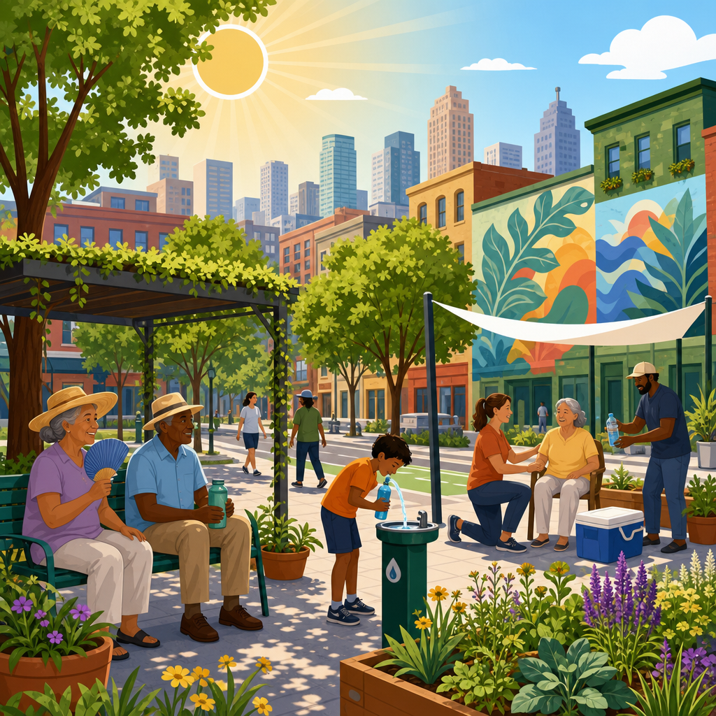
Extreme heat deaths are not distributed evenly across a city; they cluster block by block, shaped by pavement, tree cover, housing quality, age, income, health status, and whether people can cool down safely during the hottest hours. When planners talk about reducing extreme heat deaths at the neighborhood scale, they mean using local data and targeted interventions to lower illness and mortality in the places where risk is highest. This matters because heat is already the deadliest weather hazard in the United States in many years, and climate change is making heat waves longer, earlier, and more humid. In practice, I have seen two neighborhoods in the same metro area face sharply different outcomes during the same heat event simply because one had shade, insulated homes, and a trusted cooling center, while the other had dark roofs, unreliable transit, and residents afraid to open windows at night.
Neighborhood-scale heat policy starts with a clear definition of risk. Hazard is the temperature exposure itself, including air temperature, humidity, nighttime heat, and radiant heat from sun-baked surfaces. Vulnerability describes who is more likely to be harmed: older adults, infants, outdoor workers, people with cardiovascular or respiratory disease, residents taking certain medications, and households that cannot afford air conditioning. Exposure reflects the settings people move through each day, such as bus stops without shade, top-floor apartments, asphalt schoolyards, and industrial corridors. A city lowers deaths only when it addresses all three dimensions together. That means mapping hot spots, identifying sensitive populations, reducing heat at the street and building level, and making sure emergency response systems reach the people most likely to suffer heat stroke, dehydration, kidney stress, or cardiac events before they become fatal.
Public health agencies and climate scientists have established a strong foundation for this work. The Centers for Disease Control and Prevention tracks heat-related illness and recommends heat action plans, targeted outreach, hydration access, and household cooling support. The National Weather Service issues heat advisories and warnings, but city thresholds often need local adjustment because dangerous conditions in Phoenix differ from dangerous conditions in Boston or Atlanta. Many cities also use land surface temperature mapping, satellite imagery, and urban heat island models to locate the hottest census tracts. The key lesson is simple: a citywide average hides deadly variation. Saving lives requires neighborhood-level planning, because a single corridor with sparse trees, high asthma rates, and low car ownership may need different solutions than a leafy district with better housing and more private resources.
Another reason neighborhood action matters is timing. Most fatal heat emergencies unfold over hours or days, but the factors that decide who survives were usually built over decades. Zoning that allowed large expanses of parking, underinvestment in parks, aging public housing, and redlining that suppressed canopy growth all contribute to current risk. The good news is that cities are not starting from zero. They can combine immediate measures, such as cooling centers, utility shutoff protections, and door-to-door wellness checks, with capital investments in trees, roofs, transit shelters, and housing retrofits. When those actions are coordinated by neighborhood need rather than rolled out evenly everywhere, they save more lives per dollar and build resilience that residents can feel on the hottest day, not just on a planning document.
Find the blocks where heat becomes deadly
The first task is to identify where extreme heat is most likely to kill. Air temperature from a regional weather station is not enough. Cities need high-resolution heat maps that combine land surface temperature, tree canopy, impervious cover, building age, housing tenure, health indicators, and social isolation. Tools from NOAA, CDC heat health datasets, and local public health departments can support this work, but the strongest maps are built with local validation. In one project approach I have used, afternoon mobile temperature sensors mounted on vehicles revealed ten-degree Fahrenheit differences between neighborhoods less than three miles apart. Those differences aligned with warehouse districts, multilane arterials, and older apartment clusters with minimal insulation.
Good heat mapping also separates daytime and nighttime risk. Some neighborhoods are hottest under direct sun because they lack shade, while others remain dangerous after sunset because concrete and brick release stored heat slowly. Nighttime heat is especially lethal because the body loses its chance to recover. Public health teams should overlay emergency department visits, EMS calls, mortality records, utility burden, and language access needs to identify where outreach must be prioritized. This is the neighborhood-scale equivalent of precision medicine: treat the places with the strongest symptoms first. Cities that build a heat vulnerability index and update it annually are better able to justify budgets, target grants, and coordinate departments around the same geography.
Cool homes first, because housing determines survival
Housing quality is often the decisive factor in whether a heat wave becomes a medical crisis. Residents spend most of their time indoors, and poorly insulated buildings can trap heat well into the night. Top-floor units, west-facing apartments, manufactured housing, and older brick structures without adequate ventilation are frequent danger points. The fastest life-saving strategy is to ensure residents can run effective cooling equipment without fear of disconnection or unaffordable bills. Utility shutoff moratoriums during heat events, emergency air-conditioner distribution for medically vulnerable households, and bill assistance targeted by census tract can prevent deaths immediately.
Longer term, cities should treat heat resilience as a housing standard, not an optional upgrade. Weatherization, cool roofs, exterior shading, reflective window films, attic insulation, heat pumps, and better ventilation all reduce indoor heat exposure. Building codes can require solar reflectance and minimum insulation values for new construction, while rehabilitation programs can prioritize units occupied by seniors, people with disabilities, and renters in high-risk blocks. New York City’s clean heat and retrofit experience, though designed around broader building performance goals, shows that housing programs can be scaled through financing, standards, and enforcement. For neighborhood heat policy, the lesson is direct: every retrofit plan should ask how many degrees it lowers indoor temperatures and for whom.
Design streets and public spaces that lower radiant heat
People do not experience heat only at home. They wait for buses, walk to stores, supervise children on playgrounds, and work outdoors on streets that may function like heat traps. Urban design can significantly reduce radiant heat and make neighborhoods survivable during peak afternoon conditions. Street trees are one of the most effective interventions when they are planted in the right places and maintained long enough to reach meaningful canopy. Shade can reduce surface temperatures dramatically and lower the human-perceived heat burden by blocking direct solar radiation. But tree strategy must be specific. Sparse ornamental planting in already green districts does little for mortality. Priority should go to school routes, bus stops, senior housing, commercial corridors, and blocks with high pedestrian exposure.
Cool pavements and reflective coatings can help in selected settings, though they are not universal solutions. Some products reduce surface temperature yet increase reflected shortwave radiation, which can raise pedestrian heat exposure if shade is absent. That is why cities should test materials using mean radiant temperature, not just surface readings. Parks, pocket plazas, water access points, and shaded seating areas also matter because they provide places to recover. In arid cities, misting can be useful in controlled public locations, while in humid regions it may offer limited benefit. Good neighborhood heat design is therefore climate-specific, maintenance-aware, and centered on the ways people actually move through daily life.
Build response systems residents will use and trust
Cooling centers save lives only if people can reach them, feel safe in them, and know they exist before the heat emergency begins. Many cities have learned that opening a building is the easy part; building trust is harder. Residents may avoid centers because of distance, transit gaps, disability access problems, stigma, language barriers, fear of losing pets, or concern about immigration enforcement. Effective neighborhood-scale heat response solves these practical barriers. Libraries, schools, recreation centers, faith buildings, and malls can all serve as cooling sites if they offer accessible hours, water, seating, charging, restrooms, and clear wayfinding. Transportation departments should coordinate free rides or shuttle service on warning days.
Outreach works best through organizations residents already know. Community health workers, tenant associations, block captains, mutual aid groups, and senior service providers can check on vulnerable neighbors faster than a centralized hotline alone. Cities should maintain registries for residents who opt in to wellness calls, but they should also fund in-person canvassing in the highest-risk tracts. Messaging must be multilingual and direct: where to go, when to go, how to recognize heat exhaustion, and when to call emergency services. In my experience, the most effective heat plans treat communication as infrastructure. A polished website is useful, but a phone call from a trusted local partner can be what gets an isolated elder into a cool room before symptoms escalate.
Target investments where the return in lives saved is highest
City leaders often ask which interventions produce the greatest benefit for the budget available. The answer depends on local climate and housing conditions, but the highest-value plans usually combine immediate protection with structural upgrades in the same places. The table below shows how common neighborhood interventions compare when evaluated through a mortality-prevention lens.
| Intervention | Best use case | Main benefit | Key limitation |
|---|---|---|---|
| Cooling centers with transit support | Acute heat emergencies | Rapid protection for residents without home cooling | Limited if awareness and mobility are low |
| Home AC assistance and shutoff protection | Low-income, medically vulnerable households | Immediate indoor temperature reduction | Can raise energy costs without bill support |
| Weatherization and heat pump retrofits | Older housing stock | Durable resilience and lower utility burden | Higher upfront capital cost |
| Tree canopy and shade structures | Pedestrian corridors, schools, transit stops | Lower radiant heat and better walkability | Trees require years and maintenance |
| Cool roofs and reflective surfaces | Large roof areas and some streetscapes | Reduced heat gain and urban heat accumulation | Performance varies by context |
Neighborhood targeting is essential because equal spending everywhere is not equitable when heat risk is unequal. A district with high rates of chronic illness, low canopy, and old rental housing should receive more intensive intervention than an affluent area where most homes already have efficient cooling. This principle is consistent with public health practice and with climate adaptation finance increasingly used by federal and philanthropic programs. Cities should also measure results in health terms, not just project counts. Success metrics include lower heat-related EMS calls, reduced indoor overheating complaints, higher cooling center utilization from priority tracts, and improved canopy along high-exposure routes. When budgets are tight, these metrics help defend concentrated investment where it saves the most lives.
Govern heat through coordination, standards, and accountability
Reducing extreme heat deaths at the neighborhood scale is not a one-department task. Planning, public health, housing, emergency management, parks, transportation, utilities, school districts, and community organizations all control part of the solution. Cities need a heat governance structure with clear authority, defined triggers, and measurable responsibilities. Some places now appoint chief heat officers or establish interagency heat task forces. Titles matter less than operational clarity: who activates outreach, who opens sites, who contacts utilities, who updates maps, and who reports outcomes after each event.
Standards should guide both emergency operations and long-term planning. Comprehensive plans can set canopy and shade targets for vulnerable neighborhoods. Capital improvement programs can score projects partly on heat risk reduction. Building performance standards can address passive survivability, meaning whether a home remains safe for occupants during a power outage or mechanical failure. Schools should have heat-safe play and dismissal protocols. Labor agencies should align city contracting with OSHA heat protections and state outdoor worker rules where applicable. Accountability closes the loop. After each major heat event, cities should conduct an after-action review, compare neighborhood outcomes, and adjust interventions where gaps persist. Heat resilience becomes real when residents can see that the hottest blocks are not being studied repeatedly without change.
The most effective cities will treat extreme heat as a neighborhood health emergency and a design problem at the same time. They will map risk precisely, cool homes, shade streets, build trusted response networks, and direct money toward the blocks where mortality risk is greatest. That approach saves lives now and reduces future harm as heat waves intensify. It also delivers co-benefits residents notice immediately: lower electric bills, more comfortable walking routes, safer housing, better transit access, and greener public space.
The core takeaway is straightforward. Cities reduce extreme heat deaths when they stop relying on citywide averages and start acting at the neighborhood scale. Hazard, vulnerability, and exposure vary by block, so policy must vary by block as well. The best plans combine urgent measures like cooling access and wellness checks with durable investments in housing, shade, and public infrastructure. They use local data, trusted community partners, and clear accountability to make sure help reaches the people most at risk.
If you are shaping urban planning and policy, start with a neighborhood heat map, identify the residents least able to stay cool, and align your next budget cycle around those findings. A focused, block-level heat strategy is one of the clearest ways a city can save lives.
Frequently Asked Questions
Why do extreme heat deaths vary so much from one neighborhood to another?
Extreme heat deaths are highly uneven because heat risk is shaped by very local conditions, not just the citywide temperature reported at the airport. One block may have dark pavement, few trees, older buildings, and a high share of older adults living alone, while a nearby block may have more shade, better-insulated housing, and easier access to air-conditioned public spaces. Those differences change how much heat people are exposed to during the day, how well homes cool off at night, and whether residents can recover during dangerous heat events.
Neighborhood-scale heat vulnerability is usually driven by several factors working together. Built surfaces such as asphalt, rooftops, parking lots, and industrial land uses absorb and re-radiate heat, raising surrounding temperatures. Limited tree canopy reduces shade and evaporative cooling. Poor housing quality can trap heat indoors, especially in top-floor apartments, older homes with weak insulation, and units without effective ventilation or air conditioning. Social factors also matter: low-income households may avoid using air conditioning because of utility costs, people with chronic illness may be more sensitive to heat stress, and residents without reliable transportation may struggle to reach cooler places. That is why deaths often cluster block by block rather than spreading evenly across an entire city.
What does it mean to reduce heat deaths at the neighborhood scale?
Reducing heat deaths at the neighborhood scale means moving beyond one-size-fits-all citywide messaging and focusing resources where the danger is greatest. In practice, that means identifying specific neighborhoods, corridors, housing types, and even individual buildings where heat exposure and health vulnerability overlap. Cities use local temperature mapping, hospitalization and mortality data, housing information, utility burden data, tree canopy assessments, and demographic indicators to understand where residents are at the highest risk during heat waves.
Once those hotspots are identified, neighborhood-scale action involves targeted interventions designed to lower both exposure and vulnerability. Examples include planting and maintaining shade trees on blocks with little canopy, adding cool roofs and reflective pavements in areas with intense heat retention, upgrading public housing and older rental buildings so they stay cooler, expanding cooling center access in places where residents cannot safely cool at home, and tailoring outreach to people most likely to be harmed. The goal is not simply to make neighborhoods more comfortable; it is to reduce emergency illness, prevent avoidable deaths, and build local systems that protect people during the hottest hours and the hottest seasons.
Which interventions are most effective for preventing heat illness and deaths in high-risk neighborhoods?
The most effective strategies usually combine immediate life-saving measures with longer-term physical improvements to the neighborhood. In the short term, cities can reduce deaths by making sure people have safe places to cool down, especially during afternoons and nights when indoor heat can remain dangerous. That includes well-publicized cooling centers, extended hours at libraries and recreation centers, free transportation to cooling sites, emergency welfare checks for medically vulnerable residents, and utility assistance so households do not have to choose between paying a bill and running an air conditioner. These measures are especially important for older adults, outdoor workers, people with disabilities, and residents in buildings that trap heat.
Longer-term prevention depends on changing the physical environment that drives neighborhood heat risk. Expanding tree canopy can substantially lower surface and air temperatures while improving walkability and comfort. Cool roofs and better insulation reduce indoor overheating, which is critical because many heat deaths happen inside homes. Shade structures at bus stops, parks, schoolyards, and commercial corridors can protect people who must spend time outside or wait for transit. Reflective or permeable materials can help reduce heat absorbed by streets and sidewalks. Importantly, the strongest results usually come from layered approaches rather than single fixes. A neighborhood with cooler housing, more shade, reliable cooling access, and targeted public health outreach is far better protected than one that only adds a few trees or opens a cooling center without addressing housing conditions.
How can cities identify the neighborhoods and residents most at risk during extreme heat?
Cities can identify high-risk areas by combining environmental data with public health and social vulnerability information. Heat mapping is a common starting point because it reveals temperature differences across neighborhoods, often showing that some areas are dramatically hotter than others. But heat exposure alone does not tell the whole story. A neighborhood may be hot, yet have strong household air conditioning and well-resourced residents; another may be only slightly cooler but have many elderly residents, poor housing, and limited access to transportation or health care. To understand death risk, planners need to overlay temperature data with indicators such as age, preexisting health conditions, income, housing quality, disability status, language barriers, utility burden, and emergency response patterns.
Good neighborhood-scale planning also depends on granular, trusted local data. Hospitals and health departments can help identify heat-related emergency trends. Utilities may show where shutoffs or high energy burdens limit safe cooling. Housing agencies can flag older buildings known to overheat. Community organizations often know which residents are isolated, unhoused, undocumented, or otherwise less likely to seek help through formal systems. The most effective cities do not rely only on maps produced at a broad census-tract level; they validate those findings through resident input, building-level assessments, and on-the-ground observations. That combination helps officials target the right blocks, the right buildings, and the right populations before a heat emergency becomes deadly.
What role do equity and community engagement play in reducing neighborhood-scale heat deaths?
Equity is central because the neighborhoods facing the highest heat mortality risk are often the same places that have experienced long-term disinvestment, fewer trees, more pavement, lower-quality housing, and greater health burdens. Without an equity lens, cities can end up spreading resources thinly across all neighborhoods instead of concentrating protection where it is most urgently needed. An equitable heat strategy recognizes that some residents face multiple overlapping risks: they may work outdoors, live in a poorly cooled apartment, have chronic illness, and lack money for higher electricity bills. Reducing heat deaths means prioritizing those realities rather than assuming everyone can respond to heat alerts in the same way.
Community engagement matters because local residents understand barriers that top-down plans often miss. They know which apartment buildings become unbearable by evening, which parks have no usable shade, which cooling centers feel inaccessible, and which neighbors need check-ins during heat emergencies. Involving community-based organizations, tenant groups, health workers, faith leaders, and neighborhood advocates can improve program design, outreach, and trust. It also helps cities avoid unintended consequences, such as tree-planting or greening projects that improve comfort but contribute to rising rents and displacement if not paired with housing protections. The strongest neighborhood heat plans are built with communities, not simply delivered to them, and they treat heat resilience as both a public health issue and a matter of environmental justice.


