
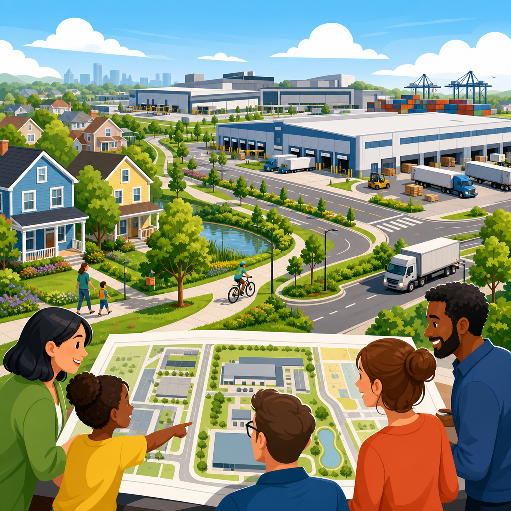
Planning for warehouse, industrial, and logistics growth near neighborhoods is one of the hardest jobs in urban planning because it requires cities to expand economic capacity without undermining health, safety, housing stability, or daily quality of life. In practice, this topic covers freight facilities, fulfillment centers, truck yards, light manufacturing, cold storage, rail-served industry, and the roads, utilities, buffers, and land-use rules that support them. It also covers the neighborhoods beside them: places where residents experience truck traffic, noise, diesel emissions, lighting glare, stormwater runoff, and rising land costs long before regional consumers notice faster delivery times. Getting this balance right matters because industrial land is essential civic infrastructure. It supports jobs, tax base, construction supply chains, food distribution, emergency response, and last-mile commerce, yet poorly planned growth can lock in conflicts that last for decades.
I have worked on industrial area plans where a single rezoning triggered disputes over school walking routes, nighttime truck staging, pavement failure, and cumulative air quality burdens that were invisible in a conventional traffic study. Those projects taught a simple lesson: warehouse and logistics growth near neighborhoods cannot be evaluated site by site alone. Cities need a corridor and district perspective that connects zoning, transportation engineering, environmental review, public health data, utility capacity, labor access, and enforcement. Key terms matter here. A warehouse stores goods; a distribution center moves goods rapidly; a logistics hub combines storage, sorting, and transportation connections; industrial growth includes production and repair uses that may have very different operational impacts. Compatibility means more than setbacks. It means whether operating hours, truck volumes, building scale, curb management, emissions controls, and worker access fit the surrounding urban fabric. A strong plan identifies where industrial uses should intensify, where transitions are required, and what standards make coexistence credible over time.
Why is pressure increasing now? E-commerce accelerated demand for near-market industrial space, while port activity, reshoring, cold-chain expansion, and same-day delivery pushed operators to seek sites close to population centers and freeway access. At the same time, many cities have lost industrial land to residential and mixed-use redevelopment, making the remaining parcels more valuable and more contested. The result is a planning challenge with high stakes: preserve enough employment land for regional resilience, but prevent environmental injustice and neighborhood decline. The most effective municipal response is not a blanket yes or no. It is a rules-based framework that defines suitable locations, protects sensitive uses, sets measurable performance standards, and ties approvals to infrastructure upgrades and operational accountability.
Why industrial land near neighborhoods remains necessary
Industrial and logistics facilities often need to be close to neighborhoods because neighborhoods are close to customers, workers, and existing infrastructure. A grocery distributor serving urban stores cannot function efficiently from a remote exurban site if delivery windows are narrow and refrigeration costs are high. Building suppliers, waste transfer operations, municipal fleet depots, and parcel carriers all depend on short travel times to dense service areas. In many metros, rail corridors, legacy industrial districts, and port-connected routes were established long before surrounding residential growth. That historical geography means separation is not always realistic. The planning question is therefore not whether adjacency exists, but under what conditions it can remain functional and fair.
Preserving industrial land also protects economic diversity. Warehouses and light industrial operations provide a range of jobs, from equipment maintenance and dispatch to inventory management and skilled trades, often without requiring a four-year degree. They broaden the tax base and support local business supply chains. When cities allow unrestricted conversion of industrial land to higher-rent uses, they may gain short-term property value but lose long-term economic resilience. The Brookings Institution, the Urban Land Institute, and many regional planning agencies have repeatedly noted that employment land shortages can raise logistics costs and push freight activity to less efficient locations, increasing truck miles traveled across the entire region. That inefficiency eventually returns to neighborhoods as more congestion on a larger network.
Choosing the right places and drawing firm boundaries
The foundation of a good plan is spatial clarity. Cities should map prime industrial areas, transition areas, and incompatible edges using parcel data, freight routes, crash history, topography, utility capacity, flood risk, and proximity to homes, schools, parks, clinics, and senior housing. Prime industrial areas are places with direct access to state highways, arterials designed for heavy vehicles, rail spurs, adequate power, and large parcels. These districts are where warehouse and logistics growth should be concentrated. Transition areas sit between heavy activity and homes. They are appropriate for lower-intensity industrial uses, flex space, maker space, offices tied to industrial operations, and buildings with stricter design and operating limits. Incompatible edges are locations where truck-intensive uses should not expand because the street network, environmental burden, or adjacent sensitive uses make coexistence unrealistic.
Firm boundaries are especially important. Without them, every exception becomes a precedent. I have seen cities approve one “temporary” truck yard on a marginal parcel, only to find neighboring sites quickly assembled for similar uses because the market reads permissive signals faster than the zoning text can react. A durable industrial land policy should include minimum district sizes, anti-fragmentation rules, and clear criteria for nonindustrial encroachment. It should also identify protected residential streets where truck access is prohibited except for direct local delivery. Mapping alone is not enough; the map must be paired with standards that are easy to enforce and difficult to evade through vague categories like storage, contractor yard, or transportation service.
Managing impacts that residents notice first
Neighborhood conflict usually starts with operations, not architecture. Residents notice truck backups at 5 a.m., trailer refrigeration units humming overnight, headlights crossing bedroom windows, diesel odors at school pickup, and mud tracked onto local streets. Because of that, impact management should be specific and measurable. Site plans should require all truck ingress and egress on designated freight streets, internal queuing so vehicles do not spill into the public right-of-way, and loading bay orientation away from homes wherever physically possible. Conditions of approval can set quiet hours for outdoor loading, require electric standby power for refrigerated trailers, and mandate shielded, downward-facing lighting with maximum pole heights near residential edges.
Air quality deserves equal precision. Diesel particulate matter, nitrogen oxides, and brake and tire wear are concentrated concerns around truck-heavy uses. Cities should require applicants to quantify expected truck trips, fleet composition, idling behavior, and proximity to sensitive receptors, then tie approval to mitigation such as no-idling enforcement, charging infrastructure, anti-tampering requirements for emissions systems, and preferential access programs for cleaner fleets. California’s air districts, the EPA’s freight planning guidance, and the Institute of Transportation Engineers all provide usable frameworks for this work. Noise, vibration, and stormwater should be treated the same way: measure baseline conditions, forecast operational impacts, then impose standards with monitoring and corrective actions rather than relying on general promises of good neighbor conduct.
| Planning issue | Typical neighborhood risk | Practical mitigation standard |
|---|---|---|
| Truck circulation | Cut-through traffic on local streets | Freight route designation, signed restrictions, geofenced dispatch instructions |
| Queuing and staging | Blocked intersections and curb lanes | On-site stacking analysis and minimum internal queue length |
| Noise | Sleep disruption from loading and backup alarms | Time limits, acoustic barriers, quieter equipment specifications |
| Air emissions | Exposure near homes and schools | Idle limits, fleet modernization, electric charging and hookups |
| Lighting | Glare into yards and windows | Shielded fixtures, lower pole heights, photometric compliance at property edge |
| Stormwater | Runoff and localized flooding | Detention, water quality treatment, permeable areas where feasible |
Street design, freight access, and worker mobility
Transportation planning often fails when it treats all vehicle trips as equivalent. A thousand passenger-car trips and a hundred heavy truck trips produce very different pavement wear, turning needs, signal timing demands, and safety risks. Industrial growth near neighborhoods requires a freight network plan that identifies truck routes by vehicle class, turning radii, bridge constraints, curb regulations, and conflict points with schools, bike routes, and transit stops. The ideal pattern is simple: trucks use a limited set of streets built for them, while neighborhood streets remain calm, legible, and protected. Achieving that pattern may require capital upgrades such as stronger pavement sections, dedicated turn lanes, signal retiming, tighter driveway spacing, and median treatments that prevent unsafe turning movements.
Worker mobility matters too. Many warehouse employees do not drive alone, and a site that is impossible to reach by transit or safe walking routes pushes more cars into nearby neighborhoods. Large industrial employers should be evaluated for shift timing, transit span, sidewalk continuity, crossing safety, bike parking, and shuttle needs. In one district plan I worked on, the most effective neighborhood traffic reduction did not come from a road widening. It came from a coordinated shift-change shuttle linking a commuter rail station to three logistics campuses, combined with staggered start times and managed parking. That kind of intervention improves labor access while reducing spillover on residential blocks. A complete plan therefore addresses freight and people together, not as separate afterthoughts.
Environmental justice, health, and cumulative burden
Not every neighborhood faces the same baseline conditions, and planning should acknowledge that directly. Communities already burdened by highways, rail lines, legacy contamination, heat islands, and underinvestment are less able to absorb additional logistics impacts. Looking only at the emissions or noise from one new project can miss the real issue, which is cumulative burden. Best practice is to screen neighborhoods using public health and environmental indicators, then apply stricter review where vulnerability is high. Tools such as CalEnviroScreen, local asthma hospitalization data, traffic injury maps, and urban heat assessments help planners identify where added truck activity would be inequitable even if it appears manageable on a single parcel.
Meaningful community engagement is part of this analysis, but it must happen early and in accessible formats. Residents can identify informal truck shortcuts, flooding patterns, school dismissal conflicts, and nighttime operations that are absent from engineering models. They also know when promised mitigations are not being enforced. Cities build trust when they publish complaint data, inspection outcomes, and compliance histories for industrial operators. They build more trust when approvals include community benefits tied to the actual impact profile, such as air filtration for nearby schools, street trees on truck corridors, home sound insulation, safer crossings, and local hiring pipelines. These measures do not erase harm, but they show that the city recognizes adjacency as a continuing governance responsibility, not a one-time permitting event.
Implementation, monitoring, and long-term governance
The difference between a thoughtful industrial policy and a symbolic one is implementation. Zoning must be supported by development review checklists, operational permits, capital improvement programming, and code enforcement capacity. Cities should require transportation management plans, construction logistics plans, and periodic compliance reporting for larger facilities. They should also coordinate across agencies. Planning, public works, fire, environmental health, and economic development often review the same project through different lenses; if their conditions conflict or leave gaps, neighborhoods feel the consequences. A single industrial review protocol can align truck routing, fire access, hazardous materials handling, drainage, and design standards before approvals are issued.
Monitoring needs to continue after opening day. Technology makes this easier than it was a decade ago. Cities can use pavement sensors, traffic counters, noise monitors, camera-based curb observation, and permit data to verify whether facilities are operating as approved. GPS-based geofencing can help keep contract drivers on designated freight routes. Repeated violations should trigger escalating responses, from warning notices to fines, permit modifications, or suspension of specific activities. Long-term governance also includes periodic plan updates. Consumer logistics changes quickly, and so do vehicle technologies. Electric trucks, microhubs, autonomous yard operations, and off-hour delivery programs will alter impact patterns over time. A good hub policy remains stable in principle while adapting its standards to new evidence and tools.
Planning for warehouse, industrial, and logistics growth near neighborhoods succeeds when cities stop treating land use, freight movement, and community health as separate conversations. Industrial land is necessary, but necessity does not justify weak standards or avoidable harm. The most durable approach is to preserve the right industrial districts, establish clear transition areas, route trucks onto streets designed for them, require measurable mitigation, and monitor operations with real enforcement. That framework protects jobs and supply chains while giving residents something they rarely get in contested growth debates: predictable rules.
For policymakers, the main benefit of this approach is better decision quality over time. Projects move faster when expectations are clear, infrastructure dollars are targeted, and community concerns are addressed with data instead of slogans. For residents, the benefit is practical: safer streets, lower exposure, quieter edges, and more accountability. For operators, the benefit is certainty. Facilities work best in places planned for them, with access, utilities, and operating conditions that fit the business model.
If you are building an urban planning and policy framework for this subtopic, start with a district map, a freight network map, and a neighborhood impact checklist. Then link every approval to enforceable standards and transparent monitoring. That is how cities can accommodate growth without sacrificing the people who live next door.
Frequently Asked Questions
Why is planning warehouse, industrial, and logistics growth near neighborhoods so challenging?
Planning for warehouse, industrial, and logistics growth near neighborhoods is difficult because local governments are trying to achieve two goals that often pull in opposite directions. On one hand, cities and counties need land for jobs, freight movement, manufacturing, delivery networks, food distribution, and regional economic resilience. On the other hand, the same communities must protect residents from truck traffic, noise, air pollution, unsafe street conditions, visual impacts, and pressure on nearby housing. The challenge is not simply whether industrial growth should happen, but where it should go, how it should be designed, and what rules should govern its operation.
These projects also create impacts that extend well beyond the property line. A new warehouse or truck yard can affect school routes, neighborhood intersections, curb space, stormwater systems, emergency response access, and even sleep quality for nearby households. Industrial users often depend on 24-hour operations, heavy vehicle circulation, outdoor equipment, and bright security lighting, all of which can create friction when residential areas are close by. In many regions, legacy zoning patterns place homes and industry side by side, so planners are not working with a blank slate. They are managing existing conflicts while trying to accommodate future growth.
Another reason this planning is so complex is that not all industrial development is the same. Light manufacturing, cold storage, rail-served facilities, last-mile fulfillment centers, and bulk logistics operations each have different traffic patterns, utility demands, building forms, and environmental risks. A one-size-fits-all zoning approach usually fails. Good planning requires detailed land-use analysis, freight network planning, public health consideration, infrastructure capacity review, and meaningful community engagement. The most successful jurisdictions treat industrial growth near neighborhoods as a long-term systems issue rather than a single project review question.
What are the biggest neighborhood impacts cities should evaluate before approving new industrial or logistics development?
Before approving warehouse, industrial, or logistics projects near neighborhoods, cities should carefully evaluate a wide range of direct and cumulative impacts. Truck traffic is usually one of the first concerns, and for good reason. Large facilities can increase heavy vehicle volumes on local streets, create turning conflicts at intersections, block driveways, accelerate pavement wear, and raise risks for pedestrians and cyclists. Reviewing average daily traffic is not enough; planners should also examine peak-hour truck activity, route compliance, curbside conflicts, queuing, and potential spillover into residential streets.
Air quality and noise are also major issues. Diesel exhaust from trucks, yard equipment, refrigeration units, and backup generators can create serious health concerns, especially for residents living nearby over many years. Noise can come from loading docks, trailer movements, alarms, compressors, idling vehicles, and overnight operations. Lighting, vibration, odor, stormwater runoff, and heat-island effects may also matter depending on the use. In addition, local governments should assess how a project may affect neighborhood character, property conditions, outdoor activity, and residents’ sense of safety and comfort.
Cities should also look at broader land-use and equity effects. If industrial expansion puts pressure on older rental housing, increases land speculation, or encourages incompatible redevelopment patterns, the result can be housing instability as well as environmental burden. It is especially important to study cumulative conditions in communities that already host multiple freight corridors, rail lines, ports, or industrial districts. A project that appears manageable on its own may become harmful when layered onto existing exposure. Strong review processes therefore combine site-specific analysis with area-wide planning, health-informed decision-making, and enforceable mitigation measures.
How can local governments support industrial and logistics growth without harming nearby residents?
Local governments can support economic growth while reducing neighborhood harm by being deliberate about location, design, infrastructure, and operations. The first step is to place the most intense industrial and logistics uses where they have the best access to highways, major arterials, rail, ports, and utility systems, while minimizing dependence on local residential streets. Jurisdictions should distinguish between low-impact employment uses and high-intensity freight operations rather than grouping everything under a broad industrial label. Clear zoning subcategories, performance standards, and freight-oriented land-use maps can help prevent conflicts before they begin.
Site and building design also matter. Cities can require truck access points away from homes, internal queuing so vehicles do not stack on public streets, loading docks oriented away from residential edges, landscaped setbacks, sound walls where appropriate, enclosed operations for certain activities, and lighting controls that reduce glare. Buffer areas should be designed as functional transitions, not token strips of landscaping. In some cases, step-down building height requirements, screening, fence standards, and limits on outdoor storage can significantly improve compatibility. Design expectations work best when they are written into codes and development agreements rather than negotiated inconsistently from project to project.
Just as important, local governments should pair land-use approvals with infrastructure and operational requirements. That can include designated truck routes, signal upgrades, sidewalk and crossing improvements, anti-idling rules, electrification readiness, stormwater controls, and limits on overnight activities near homes. Ongoing compliance is essential. Conditions of approval should be measurable, monitored, and enforceable, with clear consequences for violations. Many communities also benefit from freight advisory groups or neighborhood-industry liaison processes so concerns can be addressed after a facility opens. In short, good planning does not stop at entitlement; it continues through construction, operation, and long-term oversight.
What role do buffers, zoning, and truck route planning play in reducing conflicts between industry and neighborhoods?
Buffers, zoning, and truck route planning are three of the most important tools available to planners because they shape compatibility at both the site scale and the district scale. Zoning sets the baseline by determining which uses are allowed, where they can locate, and under what conditions they may operate. When zoning is too vague, highly impactful logistics uses can end up near homes, schools, or small commercial streets that were never designed for heavy freight activity. More precise zoning can separate low-impact industrial uses from large truck-intensive operations and can require conditional review for uses with greater neighborhood effects.
Buffers help manage the transition between different land uses. Effective buffers are not just visual screens; they can reduce noise, improve privacy, create spatial separation, and reinforce safer circulation patterns. Depending on context, a buffer might include wider setbacks, berms, dense landscaping, walls, transitional open space, office frontage, or lower-intensity employment uses placed between homes and heavy operations. The right approach depends on the type of industrial activity, topography, street network, and the sensitivity of adjacent uses. Buffers should be tailored to real impacts rather than treated as generic checklist items.
Truck route planning is equally critical because even a well-located facility can create neighborhood harm if freight vehicles use the wrong streets. Cities should establish designated truck routes connected to regional corridors, post them clearly, align them with pavement and turning capacity, and coordinate them with enforcement and navigation systems where possible. Route planning should also consider school zones, pedestrian corridors, transit stops, and residential bottlenecks. When truck circulation is left unresolved, residents often bear the burden through noise, safety concerns, and congestion. Together, zoning, buffers, and route planning create a framework that allows industrial land to function productively without exporting avoidable impacts into nearby neighborhoods.
How should communities engage residents when planning industrial expansion near existing homes?
Community engagement should begin early, before sites are effectively chosen and before residents feel that decisions have already been made. In planning for industrial expansion near homes, meaningful engagement means more than holding a single public hearing after technical studies are complete. Residents need clear information about the type of proposed use, likely truck activity, hours of operation, environmental controls, job expectations, and possible alternatives. They also need opportunities to identify local conditions that may not show up in standard reviews, such as informal walking routes, recurring traffic backups, flooding locations, noise patterns, or existing health concerns.
Effective engagement is specific, accessible, and ongoing. That may include small neighborhood meetings, translated materials, online and in-person options, visual simulations, map-based workshops, and plain-language explanations of zoning and review processes. Communities often respond best when planners present actual tradeoffs rather than abstract promises. For example, if a city needs more industrial land to support jobs and distribution, it should openly discuss what protections, infrastructure investments, and operational limits will accompany that growth. Transparency builds trust, especially in neighborhoods that have historically carried disproportionate environmental burdens.
Most importantly, engagement should influence outcomes. Residents are far more likely to participate constructively when they can see how their input changes truck access points, buffer widths, operating conditions, pedestrian improvements, monitoring requirements, or enforcement mechanisms. Some jurisdictions formalize this through community benefit agreements, advisory committees, good-neighbor policies, or post-occupancy reporting requirements. The goal is not to eliminate disagreement, because some tension is inevitable, but to make sure decisions are informed, fair, and accountable. When cities listen carefully and incorporate neighborhood knowledge into planning, they usually produce better industrial projects and more durable public support.


