
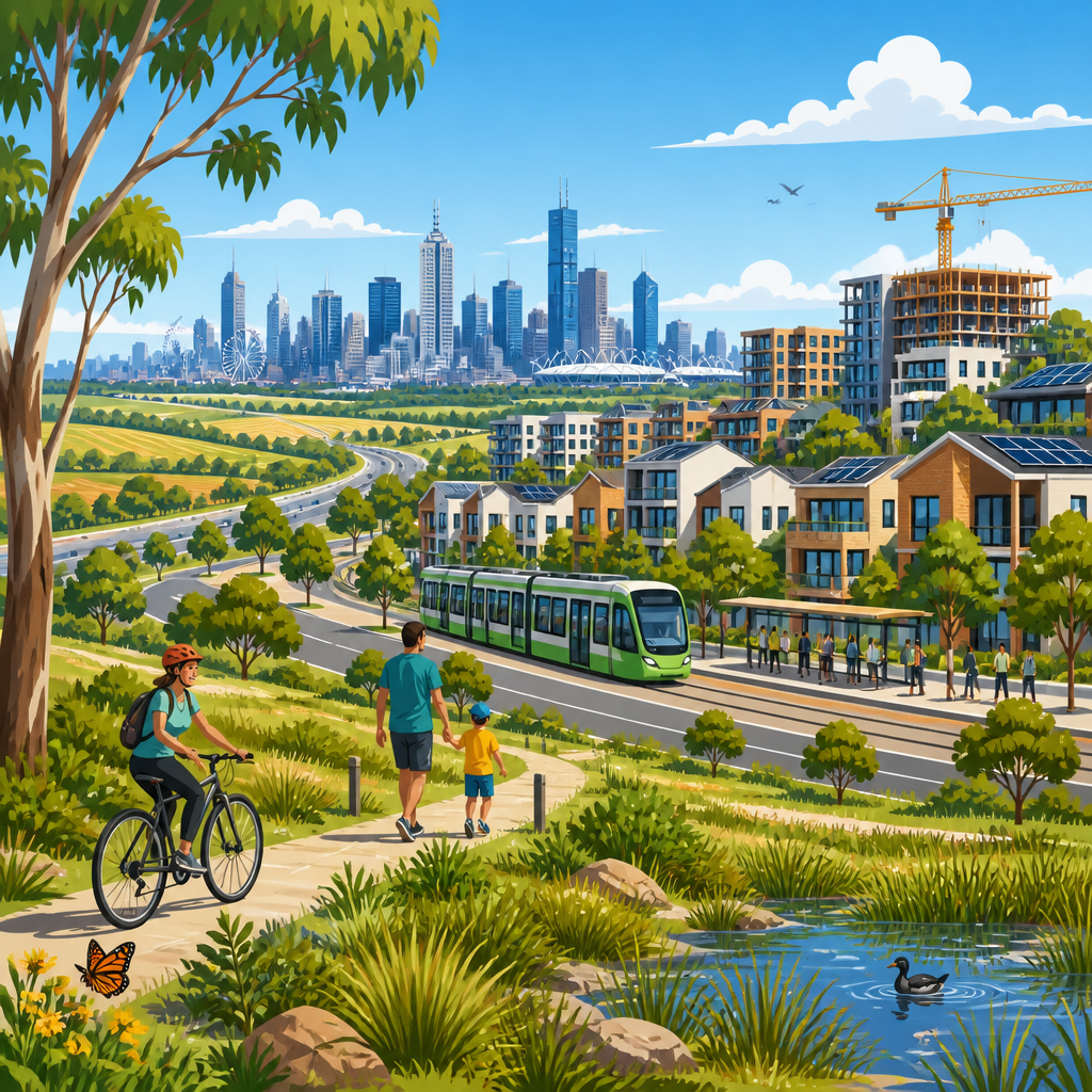
Melbourne’s urban fringe is where the city’s housing ambition, infrastructure limits, environmental constraints, and planning system all collide. In practice, the urban fringe refers to the outer suburban edge where metropolitan development meets rural land, conservation areas, industrial precincts, and productive landscapes. Managing growth there is not simply about releasing more land for new estates. It is about sequencing homes, transport, drainage, schools, jobs, open space, utilities, and community services so expanding suburbs function well from the start rather than spending decades catching up. For Melbourne, this matters because population growth has repeatedly pushed the city outward, and each new wave of development creates long-term fiscal, social, and environmental consequences that are difficult to reverse.
I have worked with fringe growth issues through planning strategy, precinct structure planning, development assessment, and infrastructure coordination, and the same lesson returns every time: the real challenge is not whether growth will happen, but whether it will be managed in a way that avoids locked-in inefficiency. Low-density sprawl without transport options increases car dependence. Delayed drainage and road upgrades raise flood risk and congestion. Poorly timed community facilities leave new residents in underserviced neighbourhoods. Conversely, well-managed growth areas can deliver a more coherent urban form, clearer investment pathways, and better value from public infrastructure spending.
Melbourne manages this pressure through a layered system that combines state planning policy, urban growth boundaries, growth area planning, infrastructure charging, developer obligations, transport investment, and environmental regulation. Key terms matter here. The Urban Growth Boundary sets the broad limit for metropolitan expansion. Growth corridors are the major outer areas identified for urban development, such as parts of Wyndham, Melton, Hume, Whittlesea, Casey, and Cardinia. Precinct Structure Plans, usually prepared by the Victorian Planning Authority, translate strategic direction into suburb-scale layouts that identify roads, schools, town centres, parks, drainage corridors, and employment land. Development Contributions Plans and Infrastructure Contributions Plans establish who pays for specific items. Together, these tools shape how growth moves from paddock to functioning suburb.
The reason this topic deserves close attention is that fringe planning influences affordability, household transport costs, infrastructure efficiency, climate resilience, biodiversity protection, and social equity all at once. A new house on cheaper land may look affordable upfront, but if it requires two cars, long commutes, and delayed services, the real cost to households rises quickly. Urban fringe policy therefore sits at the centre of Melbourne’s wider planning debate: how to accommodate growth while preserving liveability. Understanding how the system works helps explain why some outer areas mature successfully and why others struggle for years with congestion, service gaps, and fragmented development.
The planning framework that directs growth
Melbourne’s approach starts with metropolitan strategy and statutory controls. State policy establishes where growth should be concentrated and what outcomes new communities should achieve. The Urban Growth Boundary is the most visible tool because it creates a formal line between urban and non-urban land. That line has shifted over time, but its core purpose remains straightforward: provide certainty about where expansion will occur and protect other land uses from speculative, piecemeal conversion. Without that boundary, infrastructure agencies face a moving target, councils struggle to coordinate service planning, and agricultural or environmental land becomes vulnerable to incremental loss.
Inside the designated growth areas, the planning system becomes more detailed. Precinct Structure Plans are critical because they move beyond broad policy statements and map the actual skeleton of future suburbs. A strong plan identifies arterial roads, connector streets, local centres, government school sites, active open space, conservation reserves, drainage networks, community hubs, and employment precincts before subdivision begins. This sequencing matters. Once titles are created and houses are built, retrofitting land for a school, widening a road, or stitching together a fragmented creek corridor becomes slower and more expensive. In my experience, the quality of the precinct plan often predicts the quality of the suburb ten years later.
Growth planning in Melbourne also relies on cooperation between state departments, servicing authorities, councils, and developers. Water authorities assess sewer, recycled water, and drainage capacity. Transport agencies evaluate road networks and public transport interfaces. Education and health departments identify demand triggers for future facilities. Councils bring local knowledge about community needs, recreation patterns, and place-making priorities. Developers then deliver subdivisions within that structure. The system is imperfect, but its central premise is sound: fringe growth should be planned at precinct scale rather than lot by lot.
How growth corridors turn strategy into suburbs
Melbourne’s major growth fronts are not random. They follow corridors where large parcels of land, transport links, and servicing opportunities make urban expansion possible. The western corridor, including Wyndham and Melton, has absorbed substantial housing growth because of relatively broad land supply and access to existing transport spines such as the Princes Freeway and regional rail lines. The northern corridor, including Hume and Whittlesea, combines logistics advantages, industrial land, and major housing demand. The south-eastern corridor, especially Casey and Cardinia, has long been a release valve for family housing but also illustrates the tension between outward growth and transport lag.
What turns a corridor into a functioning suburb is not the land release itself but the assembly of urban structure. A growth area typically begins with a precinct plan, followed by subdivision permits, engineering plans, utility servicing, and staged land development. Early stages often deliver detached housing first because that is fastest for the market to absorb. The risk is that jobs, transit, and civic uses arrive later. Melbourne has tried to counter that pattern by planning principal and major town centres, employment land, and community facilities from the outset, though delivery timing still varies widely between precincts.
Real-world outcomes differ across locations. In parts of Wyndham Vale and Tarneit, rapid population growth has placed heavy pressure on road capacity, schools, and train services, showing what happens when demand accelerates faster than infrastructure expansion. In contrast, areas where arterial reservations, drainage corridors, and school sites were secured early have generally adapted better as housing rolled out. The lesson is clear: corridor planning succeeds when land use, infrastructure reservations, and funding mechanisms are aligned before market momentum takes over.
Infrastructure sequencing is the make-or-break issue
If there is one factor that determines whether urban fringe growth feels orderly or chaotic, it is infrastructure sequencing. New residents can tolerate temporary inconvenience, but they notice quickly when roads are unfinished, buses infrequent, schools overcrowded, or stormwater systems incomplete. Melbourne’s planning system attempts to avoid that outcome by identifying trunk infrastructure early and assigning costs through contributions frameworks. Even so, the timing gap between population arrival and infrastructure delivery remains the most common weakness in fringe development.
Roads and intersections are usually the first visible pressure point. Many new estates open through a limited number of access roads, which can create severe bottlenecks until arterial upgrades are complete. Public transport often lags because viable bus frequency depends on funding, route design, and a critical mass of riders. Rail projects take longer still. Utilities are less visible but equally important. Sewer pump stations, potable water mains, electricity capacity, drainage basins, and digital connectivity must all be delivered in a coordinated sequence. A delay in one network can stall development or undermine liveability.
| Infrastructure type | Why it matters at the fringe | Common delivery challenge | Typical planning response |
|---|---|---|---|
| Arterial roads | Connect new suburbs to jobs, freight routes, and services | Population often arrives before road duplication or signal upgrades | Reserve corridors early and fund works through staged capital programs |
| Public transport | Reduces car dependence and supports equitable access | Bus frequency and rail capacity frequently lag housing growth | Protect station precincts, design bus-ready street networks, advocate early service uplift |
| Schools and community facilities | Shape daily liveability and social cohesion | Land may be set aside, but construction can trail enrolment demand | Secure sites in precinct plans and trigger delivery using population thresholds |
| Drainage and waterways | Manage flood risk, water quality, and open space structure | Complex land assembly and approvals can delay basin delivery | Integrate drainage with open space corridors and catchment planning |
| Utilities | Enable occupation and long-term service reliability | Network augmentation can be expensive and technically constrained | Coordinate servicing strategies across agencies before subdivision stages proceed |
From practice, the most resilient projects are the ones that treat infrastructure as city-building, not as an afterthought to subdivision. That means designing collector roads that can carry buses, placing schools where children can walk safely, using drainage corridors as linear parks, and locating town centres on transport spines rather than buried within cul-de-sac estates. Fringe growth is easier to manage when physical infrastructure and urban design reinforce each other.
Housing supply, affordability, and density tradeoffs
Urban fringe expansion is often justified by one central argument: it adds housing supply at a scale that established areas rarely match. That argument has merit. Large greenfield precincts can deliver thousands of dwellings in a relatively short time, and detached homes remain attractive to many households, especially families seeking more internal space. In Melbourne, fringe supply has been a significant component of metropolitan housing production for decades. However, supply alone does not settle the affordability question.
Cheaper land on the edge can reduce purchase prices compared with inner and middle suburbs, but overall affordability depends on more than entry cost. Transport expenses, energy performance, access to jobs, and travel time all shape whether a location is genuinely affordable over the long term. A household saving on mortgage repayments may spend more on fuel, tolls, childcare logistics, or second-car ownership. That is why planners increasingly assess housing outcomes through both dwelling cost and location efficiency.
Density is the other key tradeoff. Fringe areas have historically skewed toward detached housing, yet low density makes frequent public transport, local retail viability, and diverse housing choice harder to sustain. Melbourne’s better recent precincts include a broader mix of lot sizes, townhouses, and medium-density housing near centres, schools, and future stations. Even modest increases in density around activity nodes can support better services without abandoning the suburban form many buyers want. The practical goal is not maximum density everywhere. It is enough diversity to create resilient communities across life stages, incomes, and household types.
Environmental limits shape where and how growth proceeds
Melbourne’s fringe is not vacant land in any meaningful planning sense. It includes grasslands, waterways, habitat corridors, floodplains, quarry buffers, agricultural land, and areas exposed to bushfire or heat stress. Growth management therefore depends on understanding environmental limits early, before urban expectations harden around unsuitable sites. This is one reason precinct planning must be evidence-led. Biodiversity assessments, hydrology studies, contamination reviews, cultural heritage investigations, and bushfire analysis all influence the developable footprint.
In Victoria, protections for matters such as native grasslands and threatened species have materially shaped corridor planning. Waterway setbacks and retarding basins affect subdivision layouts. Flood modelling can shift road alignments or require elevated building pads. Bushfire Management Overlay controls can limit development intensity or impose defendable space measures on fringe interfaces. These are not secondary considerations. They determine cost, timing, and feasibility.
Climate adaptation is also becoming more important. Outer suburbs with sparse tree canopy and expansive dark surfaces can experience pronounced urban heat. Long travel distances increase transport emissions. New precincts are now expected to address integrated water management, cooler streets, walkability, and more efficient building design. The strongest growth area outcomes come from using environmental systems as structuring elements rather than treating them as obstacles. Creek corridors can become recreation spines. Conservation reserves can define neighbourhood identity. Water-sensitive urban design can reduce runoff while improving amenity.
Governance, funding, and the politics of delivery
Managing Melbourne’s fringe is ultimately a governance exercise. Planning may identify the right land use pattern, but delivery depends on institutions, funding, and political timing. State government controls major strategic settings and much of the transport and school investment. Councils handle local roads, community facilities, maintenance obligations, and place-based advocacy. Developers deliver housing and a large share of local infrastructure. Utility providers run their own asset planning cycles. When these timelines do not align, residents feel the mismatch immediately.
Funding tools help but do not solve every problem. Development Contributions Plans and Infrastructure Contributions Plans can recover some costs for local and subregional items, yet they rarely cover the full burden of major transport projects or complex network upgrades. Governments still need to make large upfront investments, and those decisions compete with priorities across the whole state. This is why some growth areas experience a persistent lag between approved housing and delivered services.
Politics matters too. Boundary changes, infrastructure announcements, and land release decisions can all trigger strong debate because they affect land values, local amenity, and public spending commitments. Good fringe policy requires discipline: maintain credible settlement boundaries, release land where servicing is realistic, and avoid scattering growth into areas that cannot support efficient infrastructure. In professional terms, consistency is a public asset. It reduces speculation, supports infrastructure planning, and gives communities clearer expectations about where Melbourne will grow next.
Melbourne manages growth at the urban fringe best when it treats expansion as a long-term systems problem rather than a short-term land supply exercise. The essential tools are already visible: a defined growth boundary, corridor-based planning, precinct structure plans, infrastructure contributions, environmental assessment, and coordinated agency delivery. When these elements are aligned, new suburbs can open with clearer transport networks, protected community facility sites, functioning drainage, and a realistic path to jobs and services. When they are not aligned, residents inherit congestion, delayed infrastructure, and avoidable service gaps.
The main lesson is straightforward. Fringe growth is not inherently good or bad; its success depends on timing, structure, and discipline. Melbourne needs continued housing supply, but it also needs better sequencing, more housing diversity, stronger public transport commitment, and firmer protection of environmental assets. That balance is what turns outward growth from simple expansion into actual city-making.
For planners, policymakers, developers, and residents, the practical next step is to judge every fringe proposal by the same core question: will this create a complete community, or just more houses ahead of infrastructure? Keeping that standard in view is the clearest way to support growth that is more affordable, more liveable, and more sustainable for metropolitan Melbourne.
Frequently Asked Questions
1. What does Melbourne’s “urban fringe” actually mean, and why is it so important?
Melbourne’s urban fringe is the outer edge of the metropolitan area where new suburban development meets rural land, conservation areas, industrial precincts, waterways, and productive agricultural landscapes. It is not just a line on a map. It is a highly contested and carefully managed transition zone where major decisions are made about how the city will accommodate population growth, where new communities will live, and how public infrastructure will be delivered over time.
The reason it matters so much is that the urban fringe is one of the few places where Melbourne can still develop at a large scale. Entire new suburbs, town centres, schools, parks, road networks, and utility systems can be planned there. At the same time, these areas often contain significant environmental assets, flood-prone land, habitat corridors, farming operations, and transport constraints. That means growth at the fringe has consequences well beyond housing supply. It affects commuting patterns, household costs, biodiversity, water management, local employment, and the long-term shape of the city.
In practical terms, managing the fringe well is about more than releasing land for housing estates. Authorities must decide when land is rezoned, what infrastructure is needed first, how stormwater and drainage are handled, where schools and community facilities will go, and how to avoid creating car-dependent suburbs with limited access to jobs and services. The urban fringe is important because it is where Melbourne’s growth ambitions and its physical, environmental, and financial limits are most visible.
2. Why can’t Melbourne just keep releasing more land on the fringe to solve housing demand?
Releasing more land sounds simple, but in reality it is only one small part of the housing equation. New urban land does not automatically become a well-functioning community. Before homes can be built at scale, governments and service providers need to plan and fund roads, intersections, public transport, drainage systems, sewerage, water, electricity, telecommunications, schools, health services, sports fields, local parks, and in many cases major upgrades to regional infrastructure. If land is released faster than these systems can be delivered, the result is often long commutes, congested roads, pressure on existing services, and neighbourhoods that lack the facilities residents expect.
There are also strong planning and environmental reasons not to expand endlessly. Fringe areas may include grasslands, wetlands, waterways, biodiversity corridors, bushfire-prone land, floodplains, culturally significant sites, or highly productive farming land. Once these landscapes are urbanised, they are difficult or impossible to recover. Planning policy therefore has to weigh the need for housing against the need to protect environmental values, manage risk, and preserve strategically important non-urban land.
Another issue is sequencing. A large supply of rezoned land may exist on paper, but development can still be delayed by fragmented land ownership, infrastructure funding gaps, market timing, developer staging, or unresolved servicing constraints. In other words, more land release does not necessarily mean faster delivery of affordable, liveable housing. Melbourne’s planning system tries to manage this by coordinating growth areas, identifying precinct-level infrastructure, and prioritising development where the supporting framework is most realistic. The challenge is not simply how much land is available, but whether new communities can be created in a timely, connected, and sustainable way.
3. How does Melbourne plan infrastructure for fast-growing fringe suburbs?
Infrastructure planning on Melbourne’s urban fringe typically happens through a structured sequence rather than through ad hoc approvals. Broadly speaking, governments identify growth areas, prepare strategic plans for future urban development, and then move into more detailed precinct planning that sets out where housing, employment land, roads, community facilities, schools, parks, drainage reserves, and transport links should be located. This approach is designed to make sure development occurs in an orderly way rather than lot by lot without a larger framework.
A key part of this process is understanding that infrastructure comes in layers. There is local infrastructure such as neighbourhood roads, footpaths, open space, and community centres. There is also major trunk infrastructure such as arterial roads, rail connections, sewer mains, major drainage works, substations, and regional sporting facilities. Some items can be funded or delivered through development contributions and private investment, while others depend heavily on state agencies, utility providers, and long-term government capital programs. That is why infrastructure delivery on the fringe is often slower and more complex than residents expect.
Effective planning also depends on sequencing. Authorities aim to coordinate the timing of housing with the timing of infrastructure so that new residents are not left waiting years for schools, reliable transport, or basic services. In practice, this is difficult because population growth can move quickly while public funding cycles and construction timelines move more slowly. As a result, one of the biggest management tasks at the urban fringe is staging development in a way that reduces the mismatch between when people move in and when supporting infrastructure is fully operational.
Increasingly, Melbourne’s fringe planning also focuses on complete communities rather than dormitory suburbs. That means trying to provide not just homes, but also access to jobs, town centres, public transport, open space, and social infrastructure from the outset. While there is still a gap between policy ambition and on-the-ground delivery in some places, the direction of planning is clear: infrastructure is not meant to be an afterthought. It is central to how growth is managed.
4. What environmental and land-use constraints shape growth at the urban fringe?
Environmental and land-use constraints play a major role in determining where and how Melbourne can grow. Fringe areas often contain floodplains, creeks, wetlands, native grasslands, remnant vegetation, habitat corridors, and land exposed to bushfire or erosion risk. These features are not minor technicalities. They influence subdivision layouts, infrastructure costs, development timing, and in some cases whether certain land should be urbanised at all. Planning at the fringe therefore has to account for both environmental protection and hazard management from the earliest stages.
Drainage is one of the most practical examples. New housing estates generate large amounts of runoff, so stormwater systems, retarding basins, waterways protection measures, and regional drainage infrastructure have to be designed carefully. If these systems are overlooked or underfunded, downstream flooding and water quality problems can worsen quickly. Similarly, building near conservation areas often requires buffers, habitat protections, and long-term land management measures that affect how much developable land is actually available.
Land-use conflict is another major factor. The urban fringe is where suburban neighbourhoods come into contact with quarries, industrial operations, freight corridors, farming land, and waste or utility infrastructure. Poorly managed interfaces can create complaints, restrictions on existing industries, and pressure to convert strategically important land into more housing. That is why planning authorities often protect certain industrial and employment areas, maintain separation distances, and consider the long-term metropolitan role of non-residential land before approving new residential growth.
There is also an important food-production and landscape question. Some fringe land supports market gardening, grazing, or other productive uses that serve metropolitan supply chains and local economies. Expanding housing into these areas may provide short-term development opportunities but reduce long-term resilience and economic diversity. In that sense, environmental and land-use constraints are not simply obstacles to development. They are part of a broader planning judgment about what kind of metropolitan edge Melbourne wants to preserve and what trade-offs are acceptable as the city grows.
5. What does “managing growth well” look like for Melbourne’s urban fringe?
Managing growth well means creating suburbs that are liveable, connected, and resilient from the beginning, rather than allowing housing to outpace everything else. At a practical level, that includes sequencing development so roads, public transport, drainage, schools, utilities, and open space are delivered close to when residents arrive. It means planning neighbourhoods around town centres, community facilities, and local jobs instead of relying entirely on long-distance commuting. It also means protecting the environmental systems and strategic non-urban land that give the fringe its broader metropolitan value.
Good management is also about realism. Not every parcel of fringe land is equally suitable for urban development, and not every rezoning leads quickly to new homes. Strong planning requires governments to identify which areas can be serviced efficiently, where infrastructure investment should be concentrated, and how growth can be staged to avoid fragmented or isolated outcomes. In many cases, the best results come from coordinating housing supply with transport corridors, employment precincts, and social infrastructure rather than chasing expansion for its own sake.
From a resident’s perspective, successful fringe growth should feel less like moving into a construction zone at the edge of the city and more like joining a community with a clear long-term structure. That means access to schools, healthcare, parks, shopping, safer street networks, public transport choices, and nearby work opportunities. From a citywide perspective, it means balancing affordability and supply with infrastructure capacity, fiscal responsibility, environmental stewardship, and strategic land-use planning.
Ultimately, Melbourne manages growth at the urban fringe well when it treats these areas as complete urban extensions, not just as housing release fronts. The core test is whether new development supports both current residents and the future shape of the metropolis. If homes are delivered alongside the infrastructure, services, environmental protections, and employment foundations that communities need, then fringe growth becomes an asset to the city rather than a source of long-term strain


