
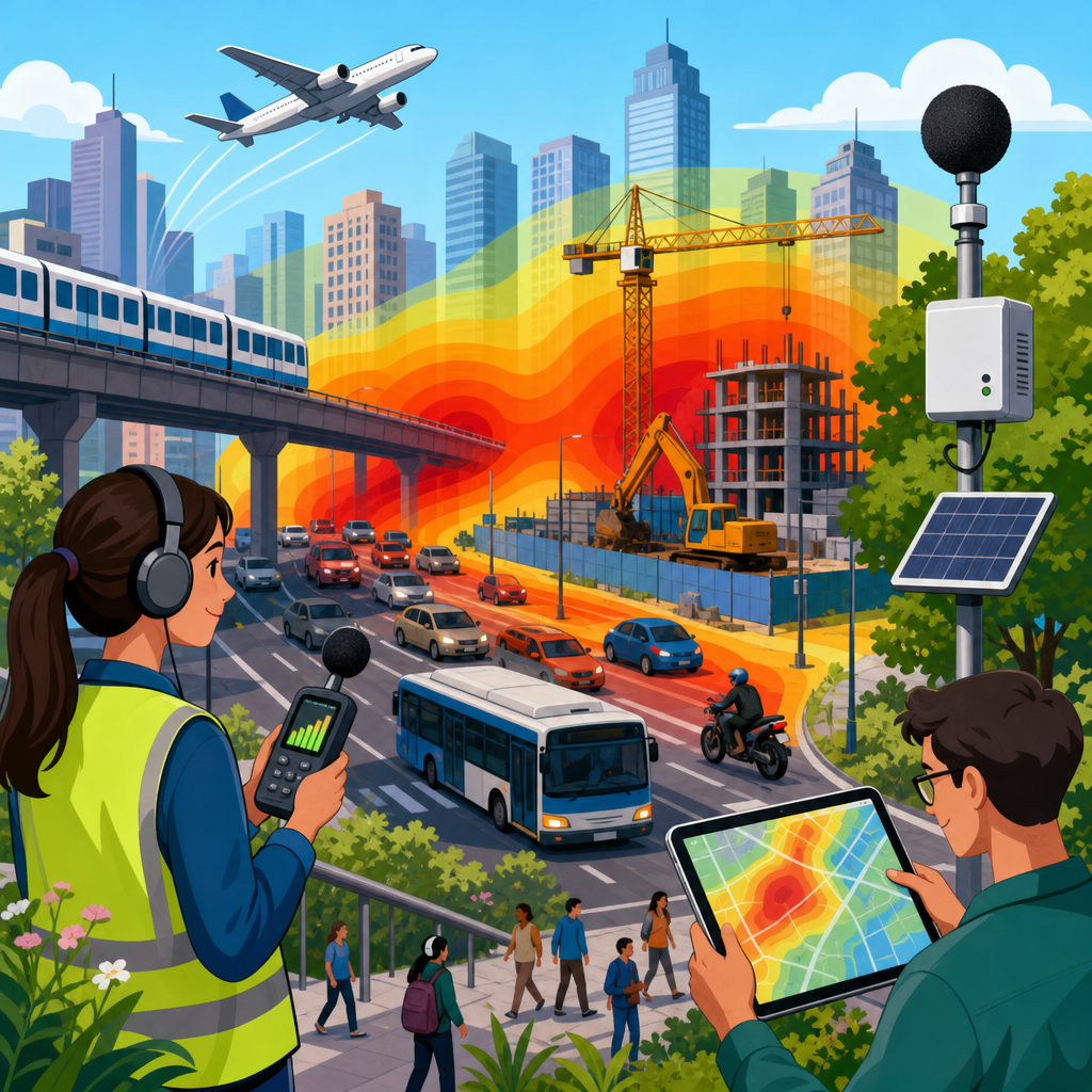
Urban noise hotspots are the streets, intersections, rail corridors, entertainment districts, and industrial edges where sound levels routinely exceed what residents, workers, and regulators consider acceptable. In city planning, “noise” means unwanted sound, typically measured in decibels, while a “hotspot” is a place where repeated monitoring, complaints, or modeled exposure show unusually high levels compared with nearby areas. I have worked on transportation and land-use projects where noise maps changed roadway design, delivery hours, and facade standards, and the lesson is consistent: unmanaged noise is not just an annoyance. It affects sleep, learning, cardiovascular health, real estate value, street vitality, and political trust in local government.
Cities measure noise because they need evidence before they can regulate it, invest in mitigation, or defend decisions in court. A single loud event rarely defines a hotspot. Planners look for patterns across time, land use, and population exposure. Common metrics include A-weighted decibels, written as dBA, which approximate how human hearing perceives sound; Leq, the equivalent continuous sound level over a period; Lden, a day-evening-night metric used widely in Europe with penalties for evening and night noise; and Lnight, which focuses on sleep disruption. In the United States, agencies often rely on FHWA traffic noise procedures, FAA airport noise contours, local noise ordinances, and environmental review thresholds under state or municipal law.
The topic matters because urban noise is inseparable from growth. Denser neighborhoods bring more people close to roads, loading docks, bars, transit, and construction sites. At the same time, compact urban form supports walking, transit use, and lower emissions, so the goal is rarely silence. The real task is management: identifying where harmful or disruptive sound concentrates, understanding which sources dominate, and choosing interventions that reduce exposure without undermining mobility, commerce, or public life. Effective noise management combines measurement, modeling, design, enforcement, and community engagement. Cities that do this well create clearer rules for development, more defensible infrastructure projects, and healthier neighborhoods.
How cities identify urban noise hotspots
Most cities start with three evidence streams: field measurements, predictive models, and public reports. Field measurements come from handheld sound level meters, permanent monitors mounted on poles or buildings, and mobile surveys conducted by staff or consultants. Good practice follows recognized methods such as IEC and ANSI standards for instrument performance and calibration. On a recent corridor study, we used Type 1 meters for baseline analysis near schools and Type 2 meters for broader screening, calibrating before and after each session. That distinction mattered because decisions about barriers and building upgrades required defensible data. Weather, microphone height, reflective surfaces, and sampling duration all affect results, so competent monitoring plans specify them in advance.
Predictive modeling expands beyond what a few monitors can capture. Transportation agencies model road traffic noise using vehicle counts, speeds, fleet mix, grade, pavement type, and receptor locations. Rail models account for horn use, wheel-rail interaction, switches, and braking. Airport studies use flight tracks, aircraft type, and operations by time of day. Strategic citywide maps combine multiple sources into exposure surfaces showing where people are likely to experience high levels. These maps are powerful because they connect noise not only to geography but also to population, schools, hospitals, parks, and housing stock. A hotspot is more actionable when the city can say both how loud it is and who is affected.
Complaint data fills gaps but must be interpreted carefully. A 311 dashboard may show clusters around nightlife districts, waste collection routes, or construction zones, yet complaint frequency often reflects awareness, language access, trust in government, and housing tenure as much as actual exposure. In practice, complaint patterns are best used as screening signals. If residents repeatedly report nighttime idling near a freight corridor, the city can verify with overnight monitoring, curbside observations, and operator interviews. The strongest hotspot assessments triangulate all three sources: measured sound levels, modeled exposure, and community-reported nuisance. That approach reduces false positives and helps distinguish one-off disturbances from chronic environmental noise.
What the numbers mean in real neighborhoods
Decibel figures are often misunderstood because the scale is logarithmic, not linear. An increase of 10 dBA is commonly perceived roughly as a doubling of loudness, while a 3 dBA increase represents a substantial rise in acoustic energy. For residents, the practical question is not only “How loud is it?” but “When, how often, and from what source?” A block that averages 68 dBA during the day may feel tolerable if the sound is mostly steady traffic and facades are well insulated. A quieter-looking block can feel worse if intermittent truck impacts, motorcycle acceleration, or rooftop equipment create sharp peaks at night. Hotspot analysis therefore tracks both averages and peak events.
Context changes interpretation. Around major arterials, cities often expect higher ambient sound, but they still evaluate sensitive receptors such as homes, clinics, schools, and libraries differently from commercial frontages. Near entertainment areas, officials may separate amplified music, crowd noise, and transportation spillover because each requires a different remedy. Construction is another common source of confusion. It is usually temporary, but repeated projects can make “temporary” noise effectively continuous for years in fast-growing districts. In those cases, construction management plans, approved work hours, equipment mufflers, and quieter methods such as drilled rather than impact piling can meaningfully reduce disruption.
Equity is central. Lower-income neighborhoods and communities of color have often been exposed to more traffic, freight, and industrial noise because of historic land-use decisions and highway placement. When cities map hotspots against health vulnerability, asthma prevalence, rent burden, age, and access to green space, they frequently find overlapping stressors. That does not mean every noisy area can be remade quickly, but it does change priorities. In my experience, the most credible programs rank projects not only by sound level but by exposure of vulnerable populations and by the feasibility of reduction. That produces a fairer pipeline for barriers, truck routing changes, signal timing, facade treatments, and code enforcement.
Major urban noise sources and how they are assessed
Road traffic is the dominant source in most cities, especially from tire-pavement interaction at higher speeds and engine, exhaust, and braking noise at lower speeds. Heavy trucks contribute disproportionately because of engine power, mass, and nighttime logistics patterns. Rail noise hotspots appear near at-grade crossings, curved tracks, yards, and maintenance facilities. Airports create broad exposure zones, with the most serious issues often tied to nighttime flights and concentrated departure paths. Construction hotspots shift block by block. Fixed mechanical sources include HVAC systems, generators, cooling towers, and restaurant exhaust fans. Social sources include nightlife, outdoor events, and informal gathering areas. Each source behaves differently across time and space, so one citywide threshold rarely solves management on its own.
Assessment methods vary by source. Traffic studies usually combine counts, classification, speed data, and receptor analysis at building facades or outdoor activity areas. Rail assessments examine train frequency, horn protocols, wheel condition, and track maintenance. Airport analysis relies heavily on long-term operations data and contour mapping. Mechanical noise investigations focus on tonality, vibration, and line-of-sight propagation between source and receiver. Entertainment districts often require late-night patrol measurements and source attribution, because the remedy for music escaping a venue is different from the remedy for rideshare pickup congestion. Good hotspot management begins by naming the source precisely. “Downtown is noisy” is politically useful but operationally weak.
| Source | Typical hotspot pattern | Primary metric or method | Common mitigation |
|---|---|---|---|
| Road traffic | Arterials, ramps, freight streets | Leq, traffic models, facade receptors | Speed management, low-noise pavement, barriers |
| Rail | Crossings, curves, yards | Event counts, peak levels, operational review | Track maintenance, quiet zones, wheel and brake controls |
| Aircraft | Flight paths, approach corridors | Lden or DNL contours, operations data | Operational changes, insulation programs, land-use controls |
| Construction | Redevelopment districts, infrastructure sites | Time-of-day monitoring, equipment inventory | Work-hour limits, quieter methods, acoustic shielding |
| Mechanical systems | Alleys, rooftops, service yards | Source-specific measurement, tonal analysis | Enclosures, silencers, relocation, maintenance |
Source assessment should also consider building form. Urban canyons can trap and reflect sound, making a narrow street louder than traffic volume alone would suggest. New towers may shield one block while reflecting noise toward another. Parks are not automatically quiet; a park beside an elevated highway can measure worse than a residential side street. Because of these effects, planners increasingly pair noise work with 3D urban design review. The result is more accurate siting of loading bays, mechanical equipment, podium walls, and active ground-floor uses. It also helps explain to residents why two blocks with similar traffic counts can have very different lived acoustic conditions.
How cities manage and reduce noise hotspots
Management tools fall into five broad categories: land-use controls, transportation operations, building design, source mitigation, and enforcement. Land-use controls include zoning buffers, performance standards, disclosure requirements, and compatibility rules that keep the most noise-sensitive uses away from the loudest edges unless mitigation is provided. Transportation operations can reduce sound quickly through lower nighttime speed limits, smoother traffic flow, truck route adjustments, anti-idling rules, and pavement maintenance. Building design measures include higher STC-rated windows, facade sealing, vestibules, courtyard orientation, and acoustic screens for balconies or rooftops. Source mitigation addresses the noise where it begins, often through mufflers, barriers, resilient mounts, quieter machinery, and maintenance practices.
Noise barriers are visible but not universal solutions. They can work well along highways where line of sight can be blocked, but they are less effective on dense urban grids with many openings, upper-story receptors, and multiple source directions. Low-noise pavement can reduce tire noise, though performance depends on speed, climate, and maintenance cycles. Signal coordination sometimes cuts repeated acceleration and braking, which residents often perceive as more irritating than steady flow. For freight corridors, consolidating loading times, electrifying delivery fleets, and redesigning curb management can reduce both sound and conflicts. Electric buses and cars help at low speeds, but above roughly 30 miles per hour tire noise dominates, so fleet electrification alone will not solve arterial hotspots.
Enforcement works only when rules are measurable and staffing is credible. Many local ordinances fail because they rely on vague nuisance language or because permitted exemptions swallow the rule. The most effective codes define receiving land uses, time-of-day standards, measurement protocols, tonal penalties, and responsibilities for recurring violations. They also recognize practical limits. A city cannot ticket its way out of airport or freeway noise; those require regional coordination, capital investment, and land-use policy. But a city can improve compliance for rooftop units, bars, amplified events, modified vehicle exhausts, and construction staging. In several downtown programs I have seen, the turning point was not stricter penalties alone but clearer procedures that let inspectors document source, distance, and duration consistently.
Governance, public communication, and long-term policy
Successful noise management is organizational as much as technical. Transportation departments, environmental health teams, police, permitting offices, transit agencies, and planning staff often hold different pieces of authority. Without coordination, residents get bounced between departments while no one owns the hotspot. Strong cities designate a lead office for strategy, maintain a shared complaint and monitoring database, and publish response standards. Public communication matters because residents want answers in plain language: what was measured, whether it violated a standard, what source caused it, and what action comes next. Dashboards and online maps help, but only if they explain uncertainty and update schedules clearly.
Long-term policy turns episodic fixes into a system. That includes strategic noise maps updated on a regular cycle, acoustic requirements in development review, procurement standards for quieter municipal equipment, and health-based prioritization for mitigation funding. Cities should also connect noise policy to broader goals. Safer street design can cut both crashes and acceleration noise. Better transit operations can reduce bus bunching and brake squeal. Urban forestry and park design may not block major noise on their own, but they improve perceived sound quality when paired with real source reduction. The most resilient programs treat the urban sound environment as a planning issue, not only an enforcement problem.
The core lesson is straightforward: urban noise hotspots can be measured reliably, explained clearly, and managed effectively when cities combine data, design, and governance. Sound level readings identify where trouble concentrates, exposure mapping shows who is affected, and source-specific analysis points to the right intervention. The best responses are rarely one-size-fits-all. A freight street may need curb reform and pavement treatment, a nightlife district may need venue controls and pickup management, and a rail corridor may need operational changes and targeted insulation. When officials match tools to source and context, they protect public health without freezing urban activity.
For planners, property owners, and residents, the main benefit of a serious noise program is predictability. People know what standards apply, what evidence counts, and what remedies are realistic. That makes development review fairer, infrastructure projects more defensible, and neighborhood conversations less adversarial. If your city is updating its comprehensive plan, transportation strategy, or code enforcement system, make urban noise hotspots part of the agenda. Start with a map, a monitoring plan, and clear accountability, then build policies that reduce exposure where it matters most.
Frequently Asked Questions
What is an urban noise hotspot, and how do cities decide whether an area qualifies as one?
An urban noise hotspot is a location where unwanted sound levels are consistently higher than what is typical, acceptable, or allowed under local standards. In practice, that usually includes busy streets, major intersections, rail corridors, airport approach paths, nightlife districts, loading zones, and industrial edges where people are repeatedly exposed to elevated sound. Cities do not define hotspots by intuition alone. They usually combine several sources of evidence, including short-term and long-term sound monitoring, complaint records, traffic volumes, land-use patterns, and predictive acoustic modeling. A location may be flagged because measured decibel levels repeatedly exceed a threshold, because it stands out sharply compared with surrounding blocks, or because residents and businesses report recurring disruption.
What makes the concept important in planning is that a hotspot is not just “a loud place.” It is a place where sound exposure is frequent enough, intense enough, or widespread enough to create real planning, health, or quality-of-life concerns. A commercial corridor that is loud only during a parade is different from a corridor with heavy truck traffic every day and nighttime deliveries every week. Cities also look at who is affected. Noise near homes, schools, hospitals, parks, and other sensitive uses often receives more attention than similar sound levels in purely industrial areas. In that sense, identifying a hotspot is both a technical exercise and a policy decision shaped by context, exposure duration, time of day, and the surrounding community.
How do cities measure noise in hotspots, and what role do decibels actually play?
Cities measure noise using sound level meters, fixed monitoring stations, mobile surveys, and computer models that estimate exposure across larger areas. The most familiar unit is the decibel, or dB, which expresses sound intensity on a logarithmic scale. Because the scale is logarithmic, relatively small numerical increases can represent meaningful changes in perceived loudness and energy. Urban noise work often relies on A-weighted decibels, written as dBA, because that weighting better reflects how the human ear responds to different frequencies. Planners and acoustical specialists also look beyond a single number. They may evaluate average levels over time, peak events, day-night averages, and the frequency of high-noise occurrences to understand how a place sounds in real life.
Measurement methods vary depending on the source. Traffic noise may be monitored along roadways during peak and off-peak periods. Rail noise may focus on pass-by events, wheel-rail interaction, horns, and vibration-related effects. Entertainment district noise may be sampled late at night when crowd activity and amplified music are highest. Industrial noise may be studied at property lines and at nearby residences to compare operational sound with code limits. In many cities, measurement is paired with modeling because it is impossible to place monitors everywhere. Models can estimate how roadway geometry, building form, traffic mix, topography, and surface materials influence sound propagation. When done well, the result is not just a loudness snapshot but a spatial picture of exposure that helps cities prioritize interventions and communicate clearly with the public.
Why are some places much noisier than nearby blocks, even within the same neighborhood?
Noise hotspots often form because sound is shaped by a combination of source strength, urban design, traffic patterns, and building configuration. A single arterial can be much louder than a side street simply because it carries more vehicles, more buses, more trucks, and more stop-and-go movement. Intersections can become especially noisy due to acceleration, braking, engine revving, horns, and turning movements. Rail corridors create concentrated exposure because train pass-bys generate powerful, intermittent sound energy over a narrow path. Entertainment districts behave differently, with noise coming not only from venues but also from outdoor queues, ride-hailing activity, idling vehicles, and late-night crowd dispersal.
The built environment also matters. Tall buildings can reflect and channel sound, creating a canyon effect that makes a corridor seem louder than a more open area with similar traffic counts. Hard surfaces such as concrete, glass, and metal tend to reflect sound rather than absorb it. Topography can either block or amplify exposure, and even small changes in street width, setbacks, vegetation, and wall placement can affect how sound travels. Time patterns are another major factor. A block may feel acceptable during the day but become a hotspot at night because background sound drops while freight deliveries, nightlife activity, or rail operations continue. This is why cities rarely rely on generalized neighborhood labels. Effective hotspot analysis has to be block-by-block and source-specific.
What strategies do cities use to manage urban noise hotspots once they have been identified?
Managing a noise hotspot usually works best when cities match the solution to the source. For roadway hotspots, common strategies include traffic calming, speed management, smoother pavement, truck routing changes, signal timing adjustments, limits on nighttime deliveries, transit fleet upgrades, and in some cases physical barriers or façade improvements. For rail-related hotspots, responses may involve track maintenance, wheel and rail treatments, operational changes, quieter crossing treatments where feasible, or building-level mitigation for nearby homes and institutions. In entertainment districts, cities often focus on licensing conditions, enforcement of amplified sound rules, queue management, curbside operations, sanitation timing, and better coordination between venue operators and neighboring residents.
Land-use planning is just as important as direct sound control. Cities can reduce future conflicts by guiding sensitive uses away from the loudest edges, requiring acoustic design in new development, setting setback standards, and using building orientation, courtyards, and shielding structures to create quieter interior spaces. Some cities adopt noise action plans that prioritize hotspots based on severity, population affected, and equity considerations. They may also create complaint response systems, public dashboards, and routine monitoring programs to see whether mitigation is working. The strongest approach is usually layered: reduce noise at the source where possible, interrupt its path where practical, protect receptors through design when necessary, and keep monitoring over time. That approach recognizes that urban sound can rarely be eliminated entirely, but it can often be managed far more effectively than people assume.
How do noise hotspots affect residents and city planning decisions over the long term?
Long-term exposure to elevated urban noise can influence comfort, sleep, concentration, communication, and overall quality of life. For residents, the issue is often cumulative rather than dramatic. Repeated nighttime disturbance, chronic traffic rumble, frequent train pass-bys, or constant late-evening activity can gradually make homes feel less livable, even when no single event seems extreme on its own. Workers, students, patients, and park users can also be affected, especially in places where speech intelligibility, rest, or attention matter. That is why city planners increasingly treat noise as more than a nuisance complaint. It is a livability, public health, and environmental justice issue that can shape how communities experience growth and infrastructure investment.
From a planning perspective, hotspot analysis influences project review, zoning, transportation policy, redevelopment strategy, and capital prioritization. A city may require a traffic or rail noise study before approving housing near a major corridor. It may revise freight routing, redesign intersections, or schedule infrastructure upgrades in response to persistent sound exposure. Noise mapping can also reveal inequities, showing that lower-income neighborhoods or historically burdened communities are more likely to live near multiple noise sources at once. That kind of evidence can change where cities direct mitigation funding and how they evaluate future development. In the long run, good noise management helps cities balance activity and growth with public well-being. It does not mean making cities silent; it means designing them so that the loudest places are understood, measured carefully, and managed responsibly.


