
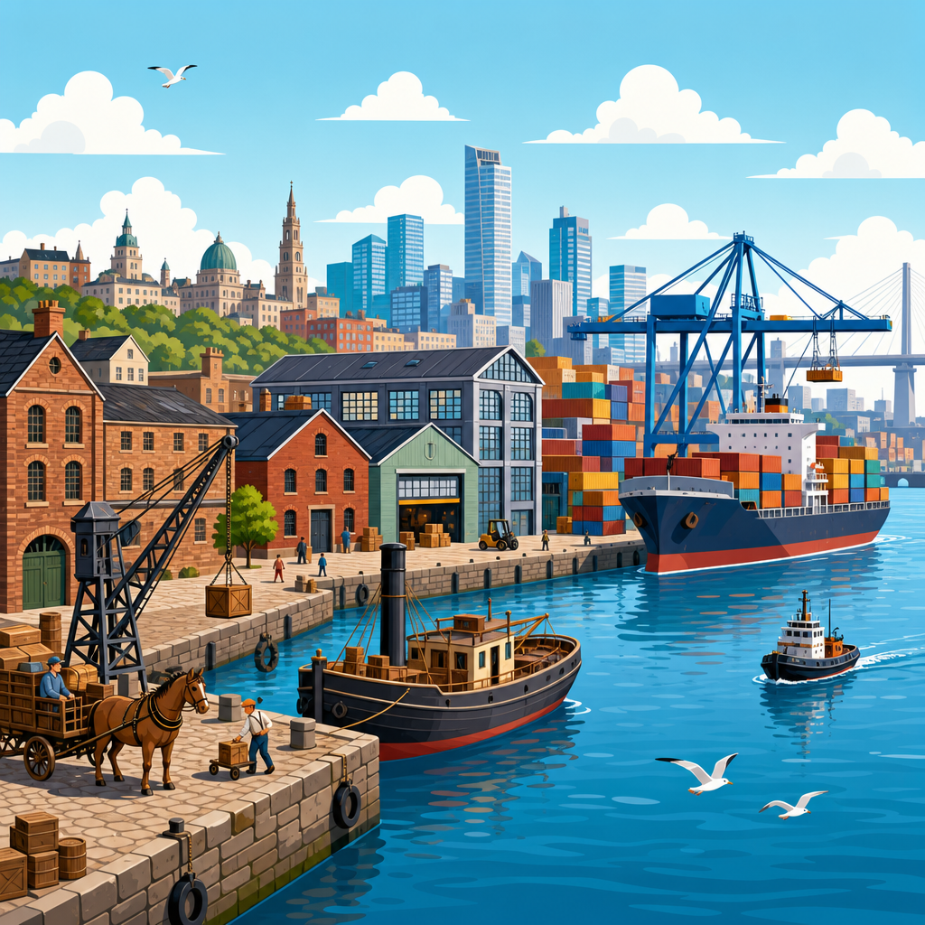
Port cities have long been the hinge between local economies and global trade, and industrial waterfronts are where that relationship becomes visible in concrete, steel, rail spurs, docks, and warehouses. A port city is more than a settlement beside navigable water; it is an urban system shaped by shipping channels, customs rules, labor markets, and infrastructure designed to move goods quickly from vessel to inland destination. An industrial waterfront is the working edge of that system, including piers, dry docks, freight yards, storage sheds, cold-chain facilities, bulk terminals, and the roads and rail lines that connect them. When planners, policymakers, and investors discuss revitalization, resilience, or land use conflict, they are usually talking about changes at this waterfront edge.
The subject matters because industrial waterfronts have repeatedly determined which cities prosper, which neighborhoods absorb pollution and truck traffic, and how nations secure supply chains. In my work reviewing redevelopment plans and freight studies, I have seen the same pattern from Baltimore to Rotterdam: once a waterfront is redesigned for a new era of trade, the city around it follows. Deep harbors supported break-bulk shipping, warehouses clustered near finger piers, and rail access drove nineteenth-century industrial growth. Containerization, automation, and larger vessels later pushed many traditional port functions outward, leaving behind obsolete structures, contaminated land, and contested redevelopment opportunities. Today, climate risk, e-commerce, and energy transition are again reshaping these districts.
Understanding this evolution requires a few key terms. Break-bulk cargo refers to goods loaded individually in boxes, bales, or barrels, usually handled by large dock labor forces. Containerization means transporting goods in standardized steel containers, most commonly twenty-foot equivalent units, which dramatically reduce handling time and loss. Intermodal transport links ship, rail, and truck movements through standardized equipment and terminals. Brownfield redevelopment describes the cleanup and reuse of land complicated by real or perceived contamination. These concepts explain why some historic waterfront warehouses become apartments or markets, while others remain essential logistics assets protected by industrial zoning. The history of industrial waterfronts is therefore not a niche design story; it is a practical guide to urban planning, economic policy, environmental justice, and infrastructure strategy in the twenty-first century.
From Natural Harbors to Engineered Trade Gateways
The earliest port cities grew where geography offered shelter, depth, and river access. London on the Thames, New York on its natural harbor, Hamburg on the Elbe, and Hong Kong on deep coastal waters all gained advantages from conditions that reduced navigational risk and connected maritime trade to inland markets. But geography alone never made a great industrial waterfront. Cities invested in dredging, quay walls, graving docks, bonded warehouses, customs houses, and later rail sidings to turn a shoreline into a reliable trade machine. By the nineteenth century, port competitiveness increasingly depended on engineered capacity rather than simple location.
Warehouses were central to this system. Before standardized containers, goods needed to be stored, sorted, inspected, taxed, and redistributed close to the dock. Cotton warehouses in Liverpool, tobacco warehouses in Baltimore, tea warehouses in London, and coffee warehouses in Santos were not generic storage boxes; they were specialized buildings with ventilation, hoists, thick walls, fireproofing measures, and direct relationships to brokers, insurers, and commodity exchanges. Their architecture reflected cargo requirements and risk management. In planning terms, they were part of a tightly integrated logistics landscape where shipping, finance, labor, and manufacturing converged within walking distance.
Industrial waterfronts also generated dense working-class districts. Dockworkers, carters, chandlers, shipwrights, warehouse clerks, and factory hands often lived nearby because labor demand was volatile and travel options were limited. This proximity created strong local economies but also entrenched social inequality. Waterfront neighborhoods usually carried the burdens of smoke, noise, dangerous work, and disease exposure, especially where slaughterhouses, tanneries, refineries, or coal depots lined the same shore. The modern planning debate over buffer zones, truck routes, and cumulative environmental impacts has roots in this earlier industrial geography. The conflict between economic productivity and neighborhood livability is not new; it has simply taken new forms.
Containerization and the Great Spatial Shift
No single innovation transformed industrial waterfronts more than containerization. In 1956, Malcom McLean’s converted tanker Ideal X demonstrated that standardized containers could slash loading costs and speed vessel turnaround. Over the following decades, ports that adapted to containers gained scale, while many traditional finger-pier districts declined. Container terminals need large flat yards, deep berths, powerful gantry cranes, secure gates, and highway or rail access capable of handling high throughput. Historic waterfronts built for break-bulk cargo rarely had enough contiguous land for this model, so port operations migrated to larger sites farther from old downtowns.
The spatial consequences were profound. In New York, activity shifted from Manhattan’s aging piers toward Newark and Elizabeth, where the Port Newark–Elizabeth Marine Terminal could accommodate containers and intermodal distribution. In London, the upstream docks lost relevance as global shipping patterns changed, eventually leading to extensive redevelopment at Docklands while newer port functions concentrated downstream at Tilbury and later London Gateway. Similar patterns appeared in Boston, San Francisco, and Sydney. Old warehouses became underused, vacant, or ripe for adaptive reuse, while new logistics districts emerged around larger terminals connected to regional highway systems.
This shift changed labor too. Container handling reduced the need for large gangs of longshore workers while increasing demand for crane operators, equipment mechanics, logistics planners, customs specialists, and software-supported scheduling. Productivity improved dramatically, but so did land intensity and capital intensity. A modern terminal can move astonishing volumes with far fewer workers on the quay than a break-bulk port of similar throughput. For urban policy, that means the economic value of marine industrial land can remain high even when visible employment falls, creating tension between waterfront redevelopment advocates and freight planners protecting scarce port-adjacent acreage.
| Era | Typical Waterfront Form | Key Infrastructure | Main Urban Effect |
|---|---|---|---|
| Break-bulk era | Finger piers and multi-story warehouses | Hoists, rail spurs, bonded storage | Dense dockside labor districts near downtown |
| Container era | Large flat terminals and storage yards | Gantry cranes, chassis yards, intermodal rail | Port functions move outward; older piers decline |
| E-commerce era | Regional distribution hubs and last-mile facilities | Warehouse management systems, cross-docks | New freight pressure on suburban and urban edges |
| Climate adaptation era | Elevated, hardened, and more resilient waterfront sites | Flood barriers, backup power, microgrids | Resilience costs shape land use and investment |
Warehouses as Industrial Infrastructure and Urban Memory
Warehouses deserve attention because they are often treated either as disposable logistics boxes or as romantic relics, when in fact they are both economic infrastructure and historical evidence. In active port districts, modern warehouses support transloading, customs inspection, refrigeration, bonded storage, and inventory buffering for just-in-time supply chains that are never truly just in time. During disruptions such as the COVID-19 pandemic, I saw warehouse vacancy become a strategic metric because low available space amplified congestion across ports and trucking networks. Storage capacity is not dead weight; it is shock absorption for the freight system.
Historic warehouses, meanwhile, reveal how industrial waterfronts once functioned. Load-bearing masonry, heavy timber framing, repetitive bay spacing, and narrow floor plates often tell you whether a building stored bagged commodities, manufactured goods, or high-value imports requiring careful handling. Adaptive reuse can preserve this history successfully, as seen in districts like Hamburg’s Speicherstadt or Toronto’s waterfront conversions, but not every warehouse should become offices or housing. Some remain well located for urban manufacturing, food distribution, film production, or maritime support services. Good planning starts with operational analysis rather than aesthetic assumption.
That analysis should ask direct questions. Is the building near an active marine terminal, freight rail, or truck route? Does it have clear heights, loading capacity, and access geometry suitable for contemporary uses? Is the district protected by industrial zoning, or is land speculation undermining long-term employment space? Can environmental remediation be phased without displacing functioning businesses? The strongest waterfront strategies avoid a false choice between total preservation and total reinvention. They map what logistics functions still matter, what structures can be upgraded, and where public access can be added without crippling essential freight movement.
Redevelopment, Public Access, and the Politics of Land Use
By the late twentieth century, many cities saw underused waterfront land as an opportunity for housing, offices, parks, museums, and tourism. Baltimore’s Inner Harbor, London Docklands, and Bilbao’s waterfront transformation became influential examples of postindustrial redevelopment. These projects often improved public access, expanded tax bases, and repaired damaged urban images. They also established a template that many cities tried to copy, sometimes without enough regard for local labor markets, maritime needs, or flood risk. Not every obsolete pier district should become an entertainment waterfront, and not every industrial shoreline is actually obsolete.
The hardest planning question is usually where to draw the line between protected working waterfront and convertible land. Cities such as New York use designations like Significant Maritime and Industrial Areas to preserve clusters needed for marine services, waste transfer, food distribution, and manufacturing. Rotterdam protects the port economy through long-range land reservation and close coordination between municipal planning and port authority strategy. In contrast, where zoning is weak or fragmented, industrial users are often priced out by speculative land values long before a city realizes it has lost crucial logistics capacity. Once marine industrial land is converted to residential use, conflicts over noise, odor, lighting, and truck traffic become nearly impossible to reverse.
Public access still matters, and the best projects do not treat it as incompatible with industry. Hamburg, Copenhagen, and parts of Brooklyn show that carefully designed esplanades, view corridors, and edge conditions can coexist with active maritime functions when safety and operations are respected. The key is precision. Public promenades belong where they do not interrupt gate operations or hazardous cargo handling. Mixed-use redevelopment belongs on truly surplus land, not on parcels that the freight network still needs. Waterfront planning succeeds when it recognizes that a city can value both civic access and industrial productivity, but only if each use is mapped honestly and regulated clearly.
Climate Risk, Resilience, and the Next Industrial Waterfront
Industrial waterfronts now face a defining challenge: they are indispensable to trade yet highly exposed to sea-level rise, storm surge, extreme rainfall, heat, and power disruption. Hurricane Sandy showed how quickly port operations, fuel supply, and regional distribution can fail when low-lying waterfront systems flood. Similar lessons came from typhoons affecting Asian ports and from repeated high-water events along major river ports. Because these districts handle food, energy, building materials, and medical supplies, their resilience is not a niche engineering concern. It is a metropolitan and national security issue.
Effective adaptation starts with asset-level understanding. Planners and operators need elevation data, flood recurrence modeling, utility dependency maps, and business continuity plans for terminals, warehouses, substations, access roads, and rail connectors. The best strategies combine hard protection and operational redesign: raising electrical equipment, floodproofing critical rooms, elevating loading areas, adding backup generation, diversifying gate access, and coordinating with regional emergency management. The PIANC and World Association for Waterborne Transport Infrastructure guidance, along with FEMA floodplain tools and port-specific resilience studies, gives a strong technical baseline. But standards alone are insufficient if capital budgets and land use plans remain disconnected.
The future industrial waterfront will also be shaped by decarbonization. Shore power can cut vessel emissions at berth. Electrified cargo-handling equipment reduces local air pollution, especially in neighborhoods already burdened by diesel exhaust. Green shipping corridors, low-carbon fuels, and better rail connections may change terminal design and warehouse energy demand. Yet tradeoffs are real. Electrification requires grid capacity, charging space, and reliable maintenance. Flood protection can raise project costs significantly. Some older sites will not be viable for long-term industrial use without expensive retrofits. That is why port city policy must integrate freight planning, climate adaptation, housing goals, and environmental justice rather than treating the waterfront as a blank slate. The smartest next step is a clear inventory of working waterfront assets, vulnerabilities, and redevelopment pressures, followed by rules that protect critical functions while guiding resilient public investment.
Frequently Asked Questions
What makes a port city different from other cities located near water?
A port city is not simply a place with a shoreline, riverbank, or harbor. It is an urban system organized around the movement of goods, people, and capital between maritime routes and inland markets. What distinguishes a true port city is the presence of specialized infrastructure and institutions built to support trade at scale. That includes docks, quays, piers, warehouses, customs facilities, rail connections, truck routes, cranes, ship repair yards, and administrative systems that regulate imports, exports, tariffs, and cargo handling.
In practical terms, port cities develop differently from resort towns, fishing villages, or waterfront residential districts because their land use patterns are shaped by logistics. Industrial areas cluster near berths and shipping channels. Warehouses and freight depots sit close to rail spurs and highways. Labor markets often reflect maritime and industrial needs, with workers employed in cargo handling, storage, processing, transportation, brokerage, and manufacturing. Over time, this creates a distinct urban identity in which the waterfront serves not only as a scenic edge but as a working interface between local economies and global trade networks.
Port cities also tend to be especially sensitive to changes in shipping technology, trade policy, and infrastructure investment. A deeper channel, a new terminal, or a shift in customs rules can transform land values, employment patterns, and industrial growth. That is why port cities have historically been engines of urban expansion and economic change. Their waterfronts are functional landscapes, where global commerce becomes visible in concrete, steel, cargo sheds, and circulation systems designed for speed and scale.
What role have warehouses played in the development of industrial waterfronts?
Warehouses have been central to the logic and growth of industrial waterfronts because they solve one of the most important problems in trade: timing. Ships, trains, carts, and trucks rarely arrive exactly when buyers, manufacturers, or distributors are ready for goods, so storage becomes essential. Warehouses allowed port cities to receive cargo in large volumes, sort it, protect it, document it, and release it in stages to inland markets. In that sense, the warehouse was never just a building for holding goods. It was a key piece of the circulation system that made trade reliable and scalable.
Historically, waterfront warehouses were often designed around the characteristics of specific commodities. Grain elevators, bonded warehouses, cold storage buildings, cotton sheds, timber yards, and general cargo depots each reflected different handling requirements. Their architecture responded directly to industrial need: thick walls for protection, large floor plates for bulk storage, hoists and loading doors for vertical transfer, rail sidings for distribution, and proximity to berths for efficient unloading. Many were positioned so cargo could move quickly from ship to storage and then to railcar or wagon with minimal delay and labor duplication.
Warehouses also played an administrative and financial role. They supported customs inspection, inventory control, insurance valuation, and trade documentation. In many port cities, control over warehouse space was closely tied to commercial power, because whoever controlled storage and handling capacity could influence the pace and cost of trade. As industrial waterfronts evolved, warehouses became larger, more specialized, and more integrated with mechanical systems such as conveyors, refrigeration, palletization, and eventually container logistics. Even when modern supply chains reduced the need for long dwell times, the warehouse remained vital, shifting from simple storage toward high-speed distribution and logistics coordination.
How did industrial waterfronts evolve from traditional docks to modern logistics hubs?
The evolution of industrial waterfronts has largely followed changes in shipping technology, cargo handling methods, and inland transportation systems. Early waterfronts often depended on labor-intensive break-bulk cargo operations, where goods arrived in sacks, barrels, crates, and bundles that had to be individually loaded, unloaded, counted, and stored. This required dense clusters of piers, transit sheds, warehouses, and large labor forces working close to the water’s edge. Industrial districts grew around these operations because manufacturers and merchants benefited from immediate access to imported materials and export channels.
As steam power, rail infrastructure, mechanized cranes, and larger ships changed maritime trade, waterfronts became more engineered and specialized. Channels were dredged, quays reinforced, docks expanded, and rail spurs threaded through port districts to speed transfer between vessel and hinterland. The most dramatic transformation came with containerization in the twentieth century. Standardized shipping containers reduced handling time, cut losses, improved security, and reshaped the spatial needs of ports. Instead of dense forests of small warehouses and finger piers, modern ports required vast container yards, heavy-lift equipment, intermodal terminals, and direct highway and rail access.
This shift pushed many working waterfronts outward from historic urban cores to larger, deeper, more flexible sites. Older industrial waterfronts sometimes declined when they could not accommodate container ships, modern cranes, or expanded truck circulation. In other cases, they adapted by specializing in niches such as bulk cargo, ferries, shipbuilding, cold chain logistics, or warehousing. Today, a modern industrial waterfront functions less as a simple docking edge and more as a logistics platform. It integrates maritime transport with data systems, customs processing, inland freight corridors, and supply chain management, turning the waterfront into a highly coordinated node within global distribution networks.
Why are industrial waterfronts so important to local and regional economies?
Industrial waterfronts matter because they compress transportation, storage, production, and exchange into a highly efficient geographic zone. By linking ships to rail lines, roads, warehouses, and nearby industrial land, they reduce the friction of moving goods from origin to destination. That efficiency lowers costs for importers, exporters, manufacturers, and distributors, making the wider region more competitive. In many cases, the waterfront is where raw materials enter, finished products leave, and value is added through processing, packaging, assembly, or redistribution.
The economic significance of these areas extends well beyond direct port activity. Industrial waterfronts support employment across multiple sectors, including terminal operations, trucking, rail freight, warehousing, customs brokerage, ship repair, equipment maintenance, construction, manufacturing, and logistics management. They also generate secondary economic effects through supplier networks, real estate demand, professional services, and tax revenues. A functioning port and waterfront can influence where factories locate, how retailers stock goods, and how regional businesses connect to international markets.
Just as importantly, industrial waterfronts often shape long-term urban development. Investment in channels, docks, and freight infrastructure can attract private capital and industrial clustering, while failures to modernize can contribute to economic decline or underused land. Their importance also becomes especially clear during disruptions. Supply chain bottlenecks, labor shortages, storms, or infrastructure failures at the waterfront can ripple quickly through regional and national economies. That is why planners, policymakers, and businesses treat industrial waterfronts as strategic assets. They are not peripheral zones at the edge of the city; they are operational landscapes that anchor trade, employment, and economic resilience.
What challenges and future trends are shaping the next generation of industrial waterfronts?
Industrial waterfronts today face a complex mix of operational, environmental, and urban pressures. One major challenge is balancing efficiency with land scarcity. Ports and logistics operators need space for container storage, truck staging, intermodal transfer, and security buffers, yet many waterfronts are located in densely developed cities where land is expensive and contested. Historic port districts may also struggle with obsolete layouts, aging piers, limited channel depth, and poor connections to modern highway or rail systems. Upgrading these areas often requires major capital investment, regulatory coordination, and careful planning around surrounding neighborhoods.
Climate risk is another defining issue. Because industrial waterfronts sit at the edge of land and water, they are directly exposed to sea-level rise, storm surge, flooding, corrosion, and extreme weather. Future-ready waterfronts increasingly require resilient design measures such as elevated infrastructure, stronger bulkheads, improved drainage, redundant power systems, and better emergency planning. Environmental regulation is also reshaping waterfront operations through cleaner fuels, shore power, electrified equipment, emissions controls, habitat restoration, and stricter oversight of runoff and contaminated sites. In many cities, there is growing pressure to reduce the environmental burden that port activity places on nearby communities.
Looking ahead, the next generation of industrial waterfronts will likely be more automated, data-driven, and intermodal. Digital tracking, terminal automation, predictive logistics, and real-time inventory systems are changing how cargo moves through port landscapes. At the same time, there is renewed interest in preserving some working waterfront functions even as former industrial areas are redeveloped for housing, culture, or mixed-use districts. The central question is not whether waterfronts will continue to evolve, but how cities will manage that evolution. The most successful industrial waterfronts will be the ones that combine trade efficiency, infrastructure resilience, environmental responsibility, and strong integration with regional transportation networks.


