Introduction
The history of urban planning is intrinsically linked to various socio-political forces, with colonialism being one of the most formidable influences shaping cities globally. As nations expanded their territories during the colonization era, they frequently imposed their own cultural, economic, and political ideologies on the lands they occupied, leaving an indelible mark on urban landscapes. This imposition led to the creation of infrastructure that reflected the needs and aspirations of the colonizers rather than the indigenous populations, resulting in cities that often represented colonial power, prestige, and control. The urban landscapes left behind by colonial powers continue to affect contemporary urban planning, even long after gaining independence. These influences are evident in the city’s organization, architecture, infrastructure, and demographic layout.
Understanding the influence of colonialism on urban planning provides valuable insights into the complexities of modern urban environments. It aids in recognizing both the challenges and opportunities in reimagining cities to be more inclusive and reflective of local identities and needs. Colonial urban planning was deliberate, serving as a tool to exert control over colonized spaces. This often included creating segregated zones, with Europeans residing in well-planned neighborhoods while indigenous populations lived in overcrowded and underdeveloped areas. Colonial ideologies informed infrastructure priorities, leading to developments geared towards economic exploitation and administrative efficiency, often sidelining indigenous welfare. As we delve deeper into the influence of colonialism on urban planning, we uncover its multifaceted nature, encompassing cultural imposition, racial segregation, economic restructuring, and infrastructural legacy. These aspects have left a complex and enduring imprint on cities around the world, shaping their evolution into the modern era.
The colonial era marked a period of significant transformations in urban planning, with colonial powers such as Britain, France, Spain, and Portugal exporting their ideologies and techniques to various parts of the world. These transformations were not merely about transposing European urban models onto foreign soils but were conveyed through policies and practices that fundamentally altered existing urban structures and social dynamics. The decisions made during this time have spanned through history to shape modern urban planning paradigms, marking a profound, enduring influence.
A critical aspect of colonial influence on urban planning was the implementation of zoning policies that served to physically and symbolically divide space. In many colonial cities, a clear spatial separation existed, distinguishing between the “European quarter” and areas for the indigenous populace. These zones were often accompanied by significant infrastructural imbalances that favored Europeans, featuring better services, road networks, healthcare, and more robust economic systems. In contrast, areas relegated to the indigenous peoples often suffered from overcrowding, inadequate sanitation, and limited resources.
Such separation was not solely functional; it was emblematic of the racial and social hierarchies that colonial powers maintained. By structuring cities this way, colonialists could exert greater control, monitoring and managing indigenous populations effectively while minimizing interaction with them. This segregation contributed to lasting socio-economic divisions that remain visible in many post-colonial cities today, presenting challenges for achieving social equality and urban integration.
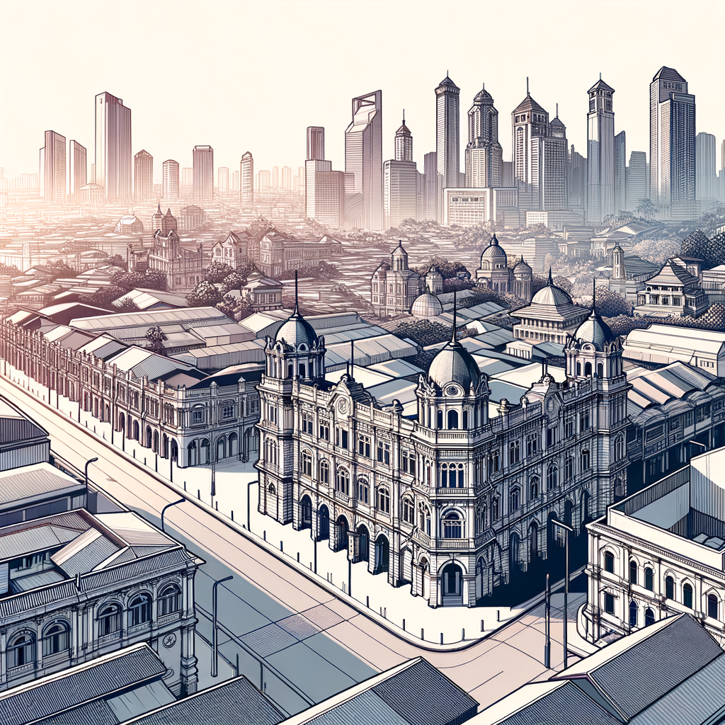
Architectural importation played a pivotal role in reinforcing colonial dominance, as colonizers sought to imprint their influence visually through grand buildings and structures. Colonial architecture often combined local styles with European aesthetics, creating a hybrid form of architecture that symbolized the power and presence of colonial authority. These structures frequently served administrative and commercial functions, manifesting as government buildings, churches, and trade centers, positioned strategically to project dominance and facilitate economic exploitation.
The road networks created during colonial times reflected the economic objectives of the colonizers, prioritizing extracts such as mining, plantations, and export industries over local needs. Colonial planners designed these networks to facilitate resource extraction and transportation of goods from the interior to ports, often overlooking the connectivity requirements of local communities. This has left an ongoing spatial legacy that privileges certain economic routes and nodes over others, affecting contemporary urban mobility and spatial development patterns.
Additionally, colonial powers often superimposed their own administrative frameworks upon cities, altering local governance structures to better serve their interests. These frameworks often ignored existing social and tribal structures, undermining local governance systems and creating new power dynamics that favored colonial objectives. This legacy of top-down governance became entrenched in urban planning and management practices, influencing the way urban policies are formulated and implemented in the present day.
The cultural ramifications of colonial urban planning can also be witnessed in modern cities. Many colonized regions were forced to adopt the language, religion, and culture of the colonizers, which was often reflected in the urban environment. Today, remnants of a colonial past can be seen through the prevalence of colonial languages in urban signage, place names, and other facets of daily life. Moreover, the education policies instituted by colonial rulers have been long-lasting, impacting generational knowledge of architecture, planning, and societal organization.
Post-independence, many cities continued to grapple with the structures imposed upon them by colonial powers, striving to mold them into spaces that reflect indigenous needs and identities. However, the pressures of modernization and globalization often necessitated the retention of certain colonial infrastructure, leading to dual urban realities: that of colonial relics alongside evolving modern elements. This juxtaposition often creates friction in urban planning, with cities needing to balance heritage preservation with the demands for modern infrastructure and increased urban capacity.
Moreover, public spaces designed during colonial times often had a different social function and cultural significance than they do today. As sites of authority and control, these spaces were instrumental in demonstrating colonial power and facilitating social order. In contemporary contexts, the challenge remains to transform these spaces into areas that foster inclusion, cultural expression, and community engagement.
To fully understand the influence of colonialism on urban planning, one must also consider the economic context of these cities. Colonial cities were primarily established as nodes of economic extraction and revenue generation for the colonizers, emphasizing industries that bolstered the colonial economy while keeping local economies subservient. This legacy of economic focus has resulted in irregular urban growth patterns, with particular emphasis on certain sectors that continue to shape urban economic strategies even today.
It is also critical to recognize the resilience and adaptability of the indigenous populations who, despite the oppressive structures of colonial urban planning, developed innovative ways to navigate and inhabit these altered landscapes. Informal settlements, communities, and economies sprang up as mechanisms of resistance and survival, demonstrating the tenacity and agency of local populations in the face of imposed systemic constraints.
The influence of colonial urban structures extends beyond simple remnant architecture or layout. The complexities of social segregation, economic exploitation, and administrative control implanted during colonial times require comprehensive strategies to untangle. Urban planners and policymakers today must contend with these historical legacies while striving to create equitable, inclusive, and sustainable urban environments.
Conclusion
In examining the influence of colonialism on urban planning, the enduring imprint of colonial powers becomes remarkably evident, providing both a historical context and a challenge for modern urban development. Colonial urban planning was a calculated endeavor aimed at reinforcing and maintaining power structures through spatial design, infrastructure development, and socio-economic policies that gratified colonial interests over indigenous needs. These imprints manifest in the organization of urban spaces, the architectural styles prevalent in cities, infrastructural development priorities, and often in the pervasive socio-economic disparities experienced today in many formerly colonized regions.
The legacy of colonialism in urban planning provides a lens through which we can analyze the intricacies of urban challenges currently faced by cities worldwide. Recognizing these colonial influences allows for a more nuanced understanding of urban dynamics, facilitating the development of strategies that prioritize inclusivity, cultural expression, and equitable resource distribution. Through acknowledging and addressing the colonial past embedded in urban environments, cities can embark on a transformative journey toward reimagining spaces that celebrate local identities and cater to the needs of all inhabitants.
This heritage demands thoughtful policy direction that seeks to dismantle remnants of colonial segregation, repurpose public spaces for communal benefit, and advocate for development paths that are consciously inclusive. As urban planners and decision-makers engage with these historical realities, there is an opportunity to reshape cities into environments of holistic growth where historical context informs future development with sensitivity and consideration for all community members.
The influence of colonialism on urban planning is thus both a vital historical inquiry and an imperative contemporary challenge. Addressing this legacy is essential for fostering environments where historical contexts are not only acknowledged but leveraged to guide meaningful urban development. By critically engaging with the past, cities can craft futures that are truly reflective and representative of their unique identities, complexities, and aspirations.
Frequently Asked Questions
1. How did colonial powers influence the urban planning of their colonies?
Colonial powers exerted an immense influence on the urban planning of their colonies, fundamentally altering the landscapes to suit their purposes. When colonial powers established control over a region, they often viewed the existing urban setup as inadequate for their ambitions. As a result, they introduced European-style urban planning, which emphasized hierarchical segregation, centralized authority structures, and monumental architecture to convey their dominance and prestige.
Colonizers often established new administrative and commercial hubs that mirrored their home country's city layouts. They prioritized infrastructure that facilitated resource extraction and exportation, such as railways, ports, and roads, designed expressly to connect resource-rich areas to global trade networks. This often led to the neglect or deliberate underdevelopment of other parts of the colony that did not serve immediate economic interests.
In addition to economic motivators, colonial urban planning also imposed cultural values through city designs. Public spaces, such as squares and parks, were modeled to reflect European aesthetics, often ignoring local contexts or indigenous urban traditions, thus eroding cultural heritage. European-style buildings often came up in colonies as symbols of modernity and superiority, increasing the cultural gap between the colonizers and the colonized.
2. What were the long-term effects of colonial urban planning on post-colonial cities?
The long-term impacts of colonial urban planning on post-colonial cities are profound and complex, often leaving a dual legacy of challenges and opportunities. One significant consequence is the socio-economic divide, where the infrastructure developed during colonial times continues to serve elite or central areas, leaving peripheral regions neglected. This has birthed urban inequality, with modern developments clustering in specific zones while others lag in terms of infrastructure and services.
Many post-colonial cities still face spatial and social fragmentation as colonial urban planning often had racial or ethnic segregation engrained in its structure, leading to the development of distinct neighborhoods based on these divisions. Such layouts have perpetuated social dynamics where marginalized communities remain cut off from economic opportunities situated in the city centers.
Nevertheless, the colonial legacy in urban planning also provides tangible frameworks that some cities have repurposed for redeveloping their urban cores and expanding into more integrated and inclusive urban environments. Revitalizing historical colonial infrastructure or repurposing public buildings has become a way to blend colonial heritage with contemporary needs, bridging the past with present-day urban functionality.
3. Can colonial urban planning be considered sustainable by modern standards?
By today's standards, colonial urban planning is often deemed unsustainable, both environmentally and socially. The plans primarily catered to rapid economic growth objectives and the symbolic assertion of power, often neglecting local environmental considerations and long-term sustainability. As a result, many colonial urban infrastructures were designed with little regard for natural landscapes or the ecological balance of territories, leading to challenges like deforestation, pollution, and resource depletion.
Moreover, colonial urban layouts often encouraged linear extensions and monocentric growth patterns, which are now counterproductive to achieving sustainable urban growth. These designs typically lack in provisions for green spaces that are integral to contemporary urban sustainability paradigms, failing to adopt eco-friendly transportation solutions or carbon-neutral initiatives that are now vital.
Nevertheless, one can argue that certain elements like structured zoning and urban governance frameworks initially instituted can be adapted and transformed to fit sustainable practices today with investments in modernizing these concepts to support green initiatives, urban resilience frameworks, and equality in urban development.
4. How did colonialism impact the cultural aspects of urban spaces in colonized regions?
Colonialism left an indelible mark on the cultural aspects of urban spaces by transforming the indigenous urbanity to reflect European ideals, often sidelining local customs, societal structures, and architectural traditions. The arrival of colonial powers often meant the introduction of foreign spatial organization principles that prioritized linearity and uniformity over the organic and multi-functional spaces found in traditional designs.
Colonial urban planning tended to impose rigid zoning laws and introduce public buildings that embodied colonial power dynamics, such as grand colonial governor's residences, military structures, and churches, which were infused with European architectural styles. This not only visualized the dominance of the colonizers but also displaced the native language of urban design, leading to a form of cultural erosion over generations.
Furthermore, the intent focused on instilling colonial cultural ideologies often excluded spaces of indigenous importance, resulting in their underdevelopment or demolition. However, it also spurred a cross-cultural exchange, and in some cases, new hybrid styles emerged as a fusion of indigenous and colonial elements, enriching the urban fabric in a multifaceted manner that is still discernible today within cities that celebrate their diverse history.
5. How have post-colonial countries tackled the colonial legacy in urban planning?
Post-colonial countries have been navigating the legacy of colonial urban planning through varied strategies, aiming to address inherited socio-economic disparities while respecting historical contexts. Some countries have adopted a path of decolonization by consciously renaming colonial-era places, or repurposing colonial infrastructure to signify a break from the past — creating modern landmarks within previously colonized areas to reinforce national identity.
Efforts have been made to address urban inequality by expanding essential services and infrastructure to areas previously neglected due to colonial biases. City planners in these regions often engage in creating integrated urban development plans that balance historic preservation with the dynamism of modern growth trends. The incorporation of participatory planning processes has also allowed diverse community voices to influence urban projects, countering the top-down methodologies typical of colonial planning.
There has also been a trend towards restoring and redeveloping historic neighborhoods or colonial districts to attract tourism, while cultural education initiatives cultivate a deeper understanding of both colonial impacts and local heritage among generations. This cooperative effort seeks to facilitate an inclusive, equitable, and culturally sensitive urban renaissance that mitigates the colonial legacy's imbalances, paving the path for sustainable and resilient urban futures.