
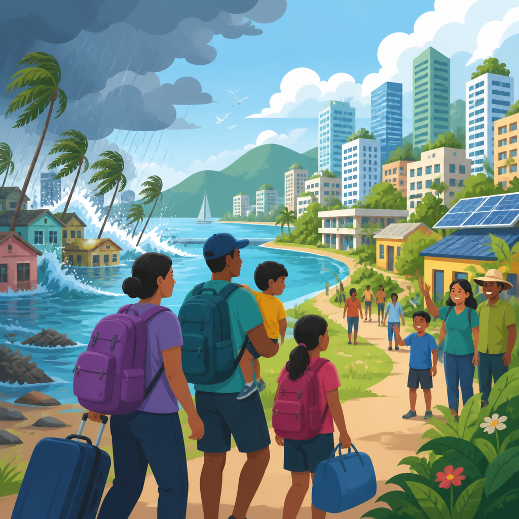
Climate migration in small island cities and coastal urban regions is no longer a future scenario; it is a planning reality shaping housing, infrastructure, public health, labor markets, and local governance. Climate migration refers to the movement of people influenced by climate-related hazards such as sea-level rise, storm surge, coastal erosion, saltwater intrusion, extreme rainfall, and heat. In small island cities, the pressure is often existential because land is limited and relocation options are constrained. In coastal urban regions, the challenge is scale: millions of residents, high-value infrastructure, ports, tourism districts, and informal settlements may all sit in exposed low-lying zones.
I have worked with urban adaptation teams that map flood exposure against census tracts, and one lesson is consistent: migration rarely happens in a single dramatic wave. More often, it unfolds as repeated displacement after storms, gradual household decisions to leave, shifts in insurance affordability, and public investment patterns that quietly redirect growth inland. That distinction matters. When leaders assume climate migration only means permanent evacuation, they miss the subtler but larger pressures already changing school enrollment, rental markets, transport demand, and social services.
Why does this topic matter within urban planning and policy? Because migration is not only a humanitarian issue; it is a land-use, fiscal, legal, and metropolitan governance issue. The World Bank’s Groundswell reports, the Intergovernmental Panel on Climate Change, and UN-Habitat all point to climate impacts as drivers of internal movement, especially where livelihoods, housing, and basic services are exposed. For island capitals and coastal metros, the central question is not whether mobility will occur, but whether it will be chaotic and unequal or planned and safer. Good planning can reduce forced displacement, support voluntary mobility, protect cultural continuity, and align infrastructure spending with realistic risk.
What climate migration means in island and coastal urban contexts
Climate migration in this context includes temporary evacuation, cyclical displacement, permanent relocation within the same city, movement to nearby towns, and cross-border migration where national territory is limited. Small island cities such as South Tarawa, Malé, Majuro, and Funafuti face a compressed geography. Government offices, hospitals, schools, ports, and housing may all be clustered near the shoreline. When king tides, erosion, and salinization intensify, relocation is not simply a household choice; it becomes a national urban development question.
Coastal urban regions such as Lagos, Miami, Alexandria, Jakarta, Manila, and Ho Chi Minh City face related but distinct dynamics. Their populations are larger, their economies more diversified, and their administrative boundaries more fragmented. One municipality may invest in seawalls while a neighboring district permits new development in floodplains. In practice, migration pressure often moves from the most exposed neighborhoods to peri-urban zones with cheaper land but weaker drainage, fewer jobs, and inadequate transport. That means climate migration can reproduce risk unless receiving areas are planned in advance.
It is also important to distinguish sudden-onset hazards from slow-onset change. A cyclone can displace households overnight. Saltwater intrusion into aquifers can push families out over several years by making drinking water expensive and agriculture less viable. Repeated nuisance flooding can lower property values, strain landlord maintenance, and make commuting unreliable. These slower processes often produce the largest cumulative movement because they steadily erode the practical basis for staying.
Key drivers pushing people to move
Sea-level rise is the headline driver, but urban migration decisions are usually shaped by interacting risks. Flood exposure, drainage failure, housing quality, income security, health services, and tenure status all matter. In informal coastal settlements, residents may face eviction pressure after disasters, even when they previously tolerated risk because jobs were nearby. In formal neighborhoods, rising insurance premiums, stricter building codes, and recurrent repair costs can trigger out-migration before water reaches doorstep height on a daily basis.
Heat is increasingly relevant in coastal regions, especially where wetlands have been paved over and tree cover is low. High nighttime temperatures can raise energy bills and worsen health outcomes, making low-income households more vulnerable. Livelihood disruption is another major factor. Fisheries, tourism, port operations, and coastal agriculture all depend on stable environmental conditions. When reef degradation reduces fish catch, beach erosion weakens tourism revenue, or repeated flooding interrupts logistics, residents may move not because homes are destroyed but because income becomes unreliable.
Public policy itself can drive migration. After major storms, governments sometimes designate no-build zones, buy out high-risk properties, or shift investment away from exposed districts. These steps may reduce future losses, but if they are poorly designed they can deepen inequality. I have seen relocation programs fail because they treated housing as the only variable. People need transport access, schools, clinics, legal tenure, and job continuity. Without that package, resettlement sites become socially and economically fragile, and some households return to danger.
| Driver | How it affects migration | Urban planning implication |
|---|---|---|
| Sea-level rise | Permanent inundation and chronic flooding reduce habitability | Update land-use maps and phase development inland |
| Storm surge | Sudden displacement after cyclones and coastal storms | Strengthen evacuation routes, shelters, and recovery housing |
| Saltwater intrusion | Water insecurity and agricultural loss push gradual movement | Protect aquifers and plan receiving neighborhoods |
| Erosion | Loss of land and damage to roads, homes, and tourism assets | Restrict building setbacks and manage retreat corridors |
| Insurance and finance stress | Rising costs make staying unaffordable for households and firms | Align risk disclosure, lending, and housing policy |
Who moves, who stays, and why equity is central
Not everyone can move, and not everyone wants to. The people at greatest physical risk are often not the first to leave. Low-income renters, elderly residents, people with disabilities, migrants without secure documentation, and households in informal settlements may be effectively trapped by cost, social ties, or legal barriers. At the same time, wealthier households may relocate earlier because they can absorb moving expenses, access credit, and buy homes in safer districts. This uneven mobility means climate migration is inseparable from equity.
Cultural identity is particularly important in small island settings. Land is not only an asset; it is ancestry, governance, and belonging. Planned relocation that ignores customary tenure, community decision-making, and spiritual ties will face resistance, and rightly so. Successful examples usually involve long consultations, local leadership, and options rather than mandates. Fiji’s planned relocation guidelines are frequently cited because they recognize that movement must protect livelihoods, social cohesion, and culture, not merely transfer people from one parcel to another.
Children and renters deserve special attention in urban policy. School continuity affects whether families accept relocation. Renters are often left out of compensation systems designed for owners, even though they make up large shares of urban populations. After disasters, temporary accommodation can stretch for months, then morph into permanent instability. Cities that track only damaged buildings miss the deeper social displacement visible in classroom turnover, overcrowded rentals, and commuting times from fringe settlements.
How cities should plan for movement instead of reacting to crisis
The first task is risk-informed spatial planning. Cities need parcel-level flood maps, elevation data, infrastructure interdependency analysis, and population vulnerability assessments. Tools such as FEMA flood insurance rate maps in the United States, LiDAR elevation datasets, and geospatial platforms like ArcGIS or QGIS help planners identify areas where protection is viable and areas where long-term retreat is more realistic. Good plans separate three strategies: protect, accommodate, and relocate. Mixing them without clear thresholds creates confusion and stranded investment.
Protection includes seawalls, surge barriers, mangrove restoration, raised roads, and upgraded drainage. Accommodation includes flood-resilient building codes, elevating structures, backup power, and amphibious or modular design in selected settings. Relocation includes buyouts, land swaps, public housing in safer districts, and incentives for new employment centers inland. In practice, the strongest urban strategies combine all three, but they assign each to specific zones based on cost, engineering limits, and social value. Dense central business districts may justify major defenses; scattered low-density settlements in erosion corridors often do not.
Receiving areas require as much planning as sending areas. This is where many policies fail. If households are encouraged inland but transit, water supply, drainage, schools, and clinics are missing, risk is simply redistributed. Metropolitan plans should prezone safe growth areas, assemble land, reserve rights-of-way for transport, and finance affordable housing before displacement accelerates. Inclusionary zoning, community land trusts, and public land banking can help prevent speculative price spikes that lock out vulnerable households from safer neighborhoods.
Policy tools that turn strategy into action
Urban leaders need legal and financial instruments, not only climate targets. Zoning updates can restrict new development in repeatedly flooded areas and require freeboard standards in transitional zones. Building codes can mandate elevation, floodproof materials, and critical equipment placement above projected flood levels. Capital improvement plans should rank projects using climate risk screens so that governments do not rebuild vulnerable facilities in the same exposed locations. Managed retreat, while politically difficult, becomes more feasible when it is framed as a phased public investment strategy rather than a sudden abandonment order.
Finance is decisive. Buyout programs work best when payments are timely, transparent, and linked to affordable rehousing. Insurance reform matters as well. Risk-based pricing can send clear signals, but without subsidies or public options for lower-income residents it can become regressive. Development banks and climate funds increasingly support resilience projects, yet cities often struggle to package migration-related investments because benefits cross sectors. A drainage upgrade, for example, may reduce displacement, protect transport, and preserve school access, but those gains sit in different budgets. Strong governance aligns them.
Data systems also need improvement. Many cities still do not track post-disaster mobility in real time. Mobile phone data, utility account changes, school enrollment records, and shelter management systems can reveal movement patterns if privacy safeguards are in place. I have seen planners make better decisions when they paired hazard maps with tenancy data and transit usage. That combination showed not just where flooding occurred, but which displaced households were likely to lose jobs if moved too far from bus corridors and industrial zones.
Real-world lessons from island cities and coastal metros
Jakarta illustrates the complexity of coastal urban risk. Land subsidence from groundwater extraction has worsened flood exposure alongside sea-level rise, making some northern areas sink far faster than the ocean rises. The policy lesson is clear: climate migration cannot be analyzed without local urban drivers such as groundwater governance and informal expansion. In Miami-Dade County, recurrent tidal flooding and insurance stress have intensified debates over resilient infrastructure, zoning, and social equity. Higher-elevation neighborhoods have experienced forms of climate gentrification as demand shifts away from the coast.
In Pacific island states, the challenge is often national in scope because capital cities concentrate people and services. Kiribati and Tuvalu are frequently discussed in international law because cross-border mobility may eventually become necessary if domestic relocation options narrow. Yet even there, most movement today is internal, incremental, and linked to housing, jobs, and family networks. That is why urban policy must focus on immediate realities: overcrowding, water security, sanitation, and safe expansion areas.
Rotterdam offers a different lesson. It shows that engineering, water governance, and spatial design can greatly reduce risk, but only where institutions are strong, funding is sustained, and adaptation begins early. Not every city can replicate Dutch infrastructure, yet the underlying principle applies broadly: treat water management, land use, and housing as one system. For small island cities and coastal urban regions, the most effective response to climate migration is not waiting for a crisis declaration. It is building fair, risk-aware urban policy now. City leaders, planners, and communities should start by mapping exposure, protecting vulnerable residents, and preparing safe places for people to move before choice disappears.
Frequently Asked Questions
What does climate migration mean in small island cities and coastal urban regions?
Climate migration refers to the movement of people that is influenced, accelerated, or made necessary by climate-related hazards and environmental change. In small island cities and coastal urban regions, this can include movement caused by sea-level rise, recurrent flooding, storm surge, coastal erosion, saltwater intrusion into freshwater supplies, extreme rainfall, and rising heat stress. Unlike sudden evacuation during a disaster, climate migration often unfolds gradually. Families may first move seasonally, then temporarily after storms, and eventually permanently when housing, livelihoods, schools, transport systems, or basic services become too unreliable or unsafe.
In small island settings, the issue is especially acute because there is often very limited land available for safer resettlement. That means migration may happen within a city, from outer settlements to denser urban cores, from one island to another, or across national borders. In larger coastal metropolitan areas, climate migration can occur from highly exposed waterfronts, river deltas, informal settlements, or low-lying neighborhoods toward higher-ground districts or inland secondary cities. In both contexts, climate migration is not just about physical exposure to hazards. It is also about whether people can still afford to live there, find work, access healthcare, keep children in school, insure property, and recover after repeated losses.
Importantly, climate migration is rarely driven by climate alone. Economic opportunity, social networks, land tenure, infrastructure quality, and public policy all shape who moves, when they move, and where they go. That is why planners increasingly treat climate migration as a governance and development issue, not only an environmental one. It affects housing demand, labor markets, transit systems, sanitation, health services, emergency management, and long-term urban growth.
Why are small island cities considered especially vulnerable to climate migration?
Small island cities face a unique combination of exposure, constraint, and limited flexibility. Many are located at or near sea level, with critical infrastructure concentrated along coastlines. Airports, ports, roads, hospitals, power systems, tourism districts, and dense residential areas are often all situated in the same exposed coastal zone. When sea levels rise and storm impacts intensify, the disruption is not isolated. It can affect the entire urban system at once, from water supply and transport to food imports and waste management.
Another major challenge is that small island cities usually have very limited land for retreat or expansion. In continental coastal regions, a city may be able to guide development inland over time. On a small island, there may be little or no higher ground available, and the land that does exist may already be occupied, environmentally sensitive, culturally important, or economically inaccessible. This turns adaptation into a far more complex problem. Relocation may require difficult decisions about land rights, community identity, public investment, and, in some cases, cross-border mobility.
Economic structure also increases vulnerability. Many small island economies depend heavily on tourism, fisheries, ports, and other climate-sensitive sectors. If coastlines erode, coral reefs degrade, freshwater becomes saline, or storm damage becomes recurrent, jobs can disappear even before homes are lost. That can trigger migration indirectly through declining incomes and rising living costs. Public finances may also be strained, limiting the government’s ability to invest in resilient housing, protective infrastructure, and social support. As a result, climate migration in small island cities is not simply a future risk. It is often a current pressure tied to repeated shocks, shrinking options, and the reality that staying in place may become increasingly difficult for many households.
How does climate migration affect housing, infrastructure, and public services in coastal urban regions?
Climate migration reshapes cities by changing where people live, how quickly neighborhoods grow, and what services are needed. One of the first impacts is on housing. As households move away from high-risk coastal areas or damaged communities, they often concentrate in safer districts that may already face shortages of affordable housing. This can increase rents, overcrowding, informal settlement growth, and pressure on land markets. In destination neighborhoods, cities may see rapid demand for new housing, schools, transit, drainage, and healthcare facilities. In origin areas, meanwhile, there may be property abandonment, declining tax revenue, and infrastructure networks that become harder to maintain efficiently.
Infrastructure systems are also deeply affected. Roads, water networks, sewage systems, electric grids, ports, and public transit are designed around assumptions about where people live and work. Climate migration changes those patterns. If population shifts are not anticipated, safer urban zones can become overloaded, while high-risk areas may continue receiving costly emergency repairs instead of planned transition strategies. Public health systems may face additional strain as displaced populations deal with trauma, disrupted care, heat exposure, waterborne disease risks, and sanitation problems after repeated flooding events.
Local governments must therefore plan for both adaptation in place and managed population movement. That includes updating land-use policy, strengthening building standards, expanding resilient affordable housing, protecting critical facilities, and investing in infrastructure that can serve changing population distributions. It also means using data better: cities need to understand not only hazard exposure, but also migration trends, tenant vulnerability, informal housing patterns, and service capacity. When climate migration is ignored, urban systems become reactive and inequitable. When it is incorporated into planning, cities are better able to reduce displacement harms and guide growth in safer, more sustainable ways.
What are the biggest social and economic challenges faced by people who migrate because of climate risks?
People affected by climate migration often face layered challenges that go well beyond the act of moving. Housing insecurity is one of the most immediate problems. Families may leave damaged or flood-prone areas only to find that safer neighborhoods are unaffordable or inaccessible. Rent burdens can rise quickly, and those without formal land titles, savings, or strong social networks may end up in informal or precarious housing. In small island cities, where land is scarce and social ties to place are strong, relocation can also mean profound cultural loss and emotional distress.
Livelihood disruption is another major concern. Many residents of coastal and island communities work in sectors directly tied to local ecosystems and waterfront economies, such as fishing, tourism, shipping, street commerce, and small-scale services. When they move, their skills may not transfer easily to new labor markets, or they may lose access to customers, equipment, and transportation networks. This can lead to underemployment, income instability, and deeper poverty. Children may experience interruptions to schooling, while older adults and people with disabilities may struggle to access healthcare and support systems during and after displacement.
There are also equity issues. Climate migration does not affect everyone equally. Low-income households, renters, informal settlers, migrants, women, Indigenous communities, and people without secure legal status often face the highest risks and the fewest options. Some cannot afford to move even when conditions are dangerous, while others are displaced repeatedly without long-term support. For this reason, effective responses must include social protection, legal assistance, tenant safeguards, access to public services, and community participation in relocation planning. The goal should not be simply moving people out of danger, but ensuring that migration, when it occurs, leads to safety, dignity, and real opportunity rather than new forms of vulnerability.
How can governments and city planners prepare for climate migration in a fair and effective way?
Fair and effective preparation starts with recognizing climate migration as a planning reality rather than an emergency exception. Governments and city planners need to integrate population movement into climate adaptation, urban development, housing policy, and infrastructure investment. That begins with risk mapping that combines physical hazards with social vulnerability, housing trends, service capacity, and likely migration corridors. Authorities should identify where people are most at risk of displacement, which neighborhoods may receive new residents, and what infrastructure upgrades are needed to support safer urban growth.
Housing policy is central. Cities need resilient, affordable housing strategies that reduce exposure and prevent displacement from becoming a pathway into homelessness or informal settlement. This may include land banking, inclusionary zoning, public housing investment, retrofitting programs, tenant protections, and relocation support for households in repeatedly flooded areas. Infrastructure planning should align with these efforts by expanding water, sanitation, drainage, transport, schools, clinics, and energy systems in lower-risk zones. At the same time, governments must make difficult but necessary decisions about where long-term protection is feasible and where managed retreat may be more realistic.
Equity and participation are what make these strategies durable. Communities must be involved early in decisions about adaptation, relocation, compensation, and land use. People are far more likely to support climate migration planning when it protects social networks, livelihoods, cultural identity, and access to services. For small island cities, regional cooperation and national support are especially important because local governments may not have enough land, finance, or administrative capacity to manage large-scale movement alone. Ultimately, the most effective approach combines hazard reduction, social protection, legal clarity, and inclusive governance. Climate migration cannot be solved by one project or one agency. It requires coordinated long-term planning that treats mobility as part of resilience, not as a policy failure.


